Share on Facebook
 Share on X
 Share by Email
 Share on Google Classroom
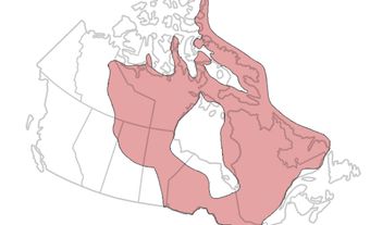
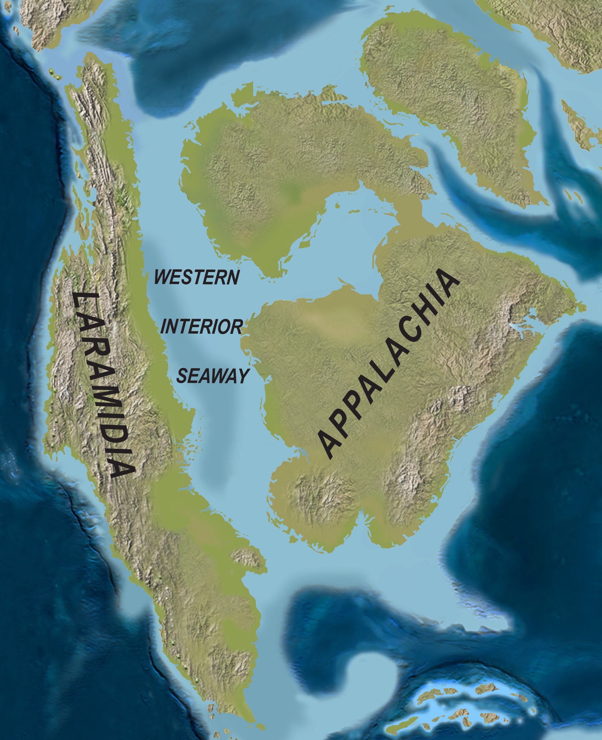
The Western Interior Seaway was an ancient sea that covered some of North America during the Cretaceous (145–66 million years ago). At its largest, the seaway stretched about 5,000 km. It connected the Arctic Ocean with the Gulf of Mexico. This divided North America into two landmasses, Laramidia and Appalachia. The Western Interior Seaway was home to many organisms, including algae, ammonites, squid, crabs, fish, sharks, seabirds, turtles, crocodiles, mosasaurs, and plesiosaurs. Many of the natural resources mined in the prairies result from the Western Interior Seaway.
Click here for definitions of key terms used in this article.
This article is a plain-language summary of the Western Interior Seaway. If you are interested in reading about this topic more in depth, please see our full-length entry, Western Interior Seaway.
How did the Western Interior Seaway form?
The Western Interior Seaway started forming 150 million years ago, during the Jurassic (201–145 million years ago). As mountains formed in the area, a basin appeared in western interior North America. This basin then filled with water.
Did you know?
Nothing today resembles the Western Interior Seaway. Several large inland seas exist today, like the Hudson Bay and the Baltic Sea. None are as big as the ancient Western Interior Seaway. The Western Interior Seaway was unique in connecting two different bodies of water: the Arctic Ocean and the Gulf of Mexico.
How Did the Western Interior Seaway Disappear?
The Western Interior Seaway began to disappear as more mountains formed and land surface uplifted. The Western Interior Seaway disappeared between 80 and 40 million years ago. It stopped connecting to the ocean 70 million years ago and then slowly disappeared.
Physical Features
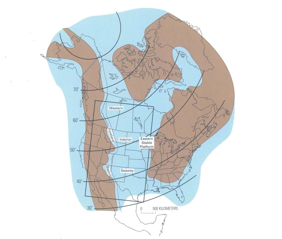
The Western Interior Seaway was around 5,000 km long and 1,500–2,000 km wide at its largest. Its deepest spot was 600 m, but the average depth was closer to 200 m.
During the late Cretaceous, the Earth was warm. The time around 97–90 million years ago is called the mid-Cretaceous Thermal Maximum (KTM) because it was so warm. Water in the Western Interior Seaway ranged from 25 °C to 34 °C, depending on depth. The water was also warmer in the southern part of the seaway.
Ecosystems
The Western Interior Seaway was home to many life forms. Some are still alive today. Others went extinct at the end of the Cretaceous.
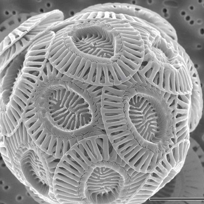
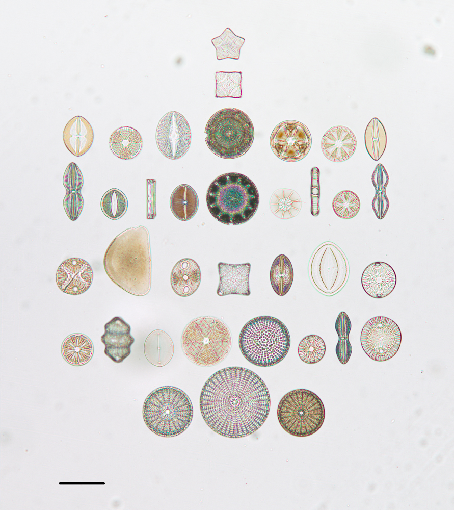
Plant life included tiny organisms like algae and diatoms. Another small organism, coccolithophores, made chalky shells. These coccolithophores are responsible for lots of the chalk deposits still found today.
Invertebrates like crustaceans and molluscs lived in the Western Interior Seaway.
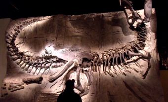
Vertebrates also lived in the Western Interior Seaway. Fish, sharks and turtles would have been common. The largest animals to live in the Western Interior Seaway were 5 m long fish, 12–17 m long mosasaurs, and 11 m long plesiosaurs.
Impact on Modern Geology and Geography
The rock that formed under the Western Interior Seaway has many natural resources. This rock can have coal, natural gas, crude oil, bitumen and bentonite. The location of these natural resources results from processes like mountain building, sea-level changes and climate.
Wetlands alongside the seaway grew peat, which over time turned to coal. This is how some large coal deposits in British Columbia, Alberta and Saskatchewan formed.
Some rock of the Western Interior Seaway has lots of organic carbon. These rock units can contain crude oil, bitumen and natural gas. These rock units occur across the United States.
Volcanic ash combined with seawater turns into clay. This is called Bentonite. Bentonite has many uses, like purifying oil and wine. Bentonite is mined in Canada and the United States from areas that were once the Western Interior Seaway.
The Canadian Prairies are mostly flat for two reasons. First, because of the Western Interior Seaway. Second, because ice sheets advanced and retreated during the Ice Age.
Rock from the Western Interior Seaway is visible in the Manitoba Escarpment. It also occurs in parts of Saskatchewan and the Northwest Territories.
Key Terms
Ammonite — An extinct squid-like animal with a spiral shell.
Bentonite — Clay made from volcanic ash combining with saltwater. It has many industrial uses.
Bitumen — A type of petroleum; it can be either liquid or solid.
Coccolithophore — A small organism that makes a chalk-like shell. They are plankton in the ocean.
Diatom — Tiny algae that live in water and soil. They make protective silica shells.
Mid-Cretaceous Thermal Maximum (KTM) — A very warm period of time 97–90 million years ago. Lots of carbon dioxide in the air created a greenhouse effect and heated the Earth (see Geological History of Canada).
Mosasaur — A type of extinct aquatic reptile. Mosasaurs swam using their tails and flippers.
Plesiosaur — A type of extinct aquatic reptile. Plesiosaurs swam using flippers. Some had long necks (see Albertonectes).