
Browse "Places"
-
Article
Maniwaki
The Oblate Fathers founded the mission Notre-Dame du Désert in 1849. Soon after, many settlers moved into the area, drawn by the forest's economic potential. A forest industry was established and provided the livelihood for the residents of the region. In 1851, Maniwaki was declared a parish.
"https://thecanadianencyclopedia.ca/images/tce_placeholder.jpg?v=e9dca980c9bdb3aa11e832e7ea94f5d9" // resources/views/front/categories/view.blade.php
https://thecanadianencyclopedia.ca/images/tce_placeholder.jpg?v=e9dca980c9bdb3aa11e832e7ea94f5d9
-
Article
Manning
Manning, Alta, incorporated as a village in 1951 and as a town in 1957, population 1164 (2011c), 1493 (2006c). The Town of Manning lies beside the Notikewin River, 73 km north of the town of PEACE RIVER.
"https://thecanadianencyclopedia.ca/images/tce_placeholder.jpg?v=e9dca980c9bdb3aa11e832e7ea94f5d9" // resources/views/front/categories/view.blade.php
https://thecanadianencyclopedia.ca/images/tce_placeholder.jpg?v=e9dca980c9bdb3aa11e832e7ea94f5d9
-
Article
Mansel Island
Mansel Island, 112 km long by 48 km wide, is the smallest of 3 islands lying across the entrance to HUDSON BAY. Its topography features a gently undulating limestone lowland with elevations not exceeding 100 m.
"https://thecanadianencyclopedia.ca/images/tce_placeholder.jpg?v=e9dca980c9bdb3aa11e832e7ea94f5d9" // resources/views/front/categories/view.blade.php
https://thecanadianencyclopedia.ca/images/tce_placeholder.jpg?v=e9dca980c9bdb3aa11e832e7ea94f5d9
-
Article
Maple Creek
Maple Creek, Saskatchewan, incorporated as a town in 1903, population 2,176 (2021 census), 2,084 (2016 census). Maple Creek is the name of both the town and the rural municipality (population 1,167, 2021 census) in which it is located. The town of Maple Creek is 383 km southwest of Regina, near the Cypress Hills.
"https://d3d0lqu00lnqvz.cloudfront.net/maplecreek/Maple_Creek_SK_main_street.jpg" // resources/views/front/categories/view.blade.php
https://d3d0lqu00lnqvz.cloudfront.net/maplecreek/Maple_Creek_SK_main_street.jpg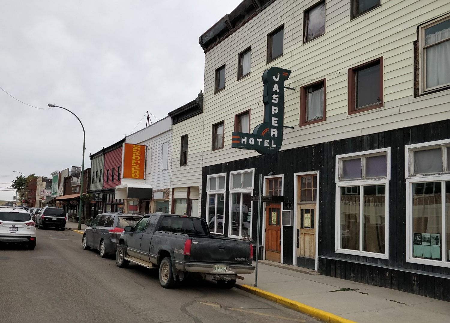
-
Article
Music at Maple Leaf Gardens
Maple Leaf Gardens. Downtown Toronto arena, home of the famed Maple Leaf hockey team and venue for other sports and entertainment activities. Designed by Ross & Macdonald with associates Jack Ryrie and Mackenzie Waters, it was built in 1931 at a cost of about $1.5 million on the northwest corner of Carlton and Church streets.
"https://d3d0lqu00lnqvz.cloudfront.net/media/media/49ad081c-8dc7-4f26-b772-628408048e22.jpg" // resources/views/front/categories/view.blade.php
https://d3d0lqu00lnqvz.cloudfront.net/media/media/49ad081c-8dc7-4f26-b772-628408048e22.jpg
-
Article
Maple Ridge
Maple Ridge, BC, incorporated as a district municipality in 1874, population 76 052 (2011c), 68 949 (2006c). The District of Maple Ridge is located 40 km east of VANCOUVER, bounded by the FRASER RIVER on the south and on the north by the Golden Ears Mountain.
"https://thecanadianencyclopedia.ca/images/tce_placeholder.jpg?v=e9dca980c9bdb3aa11e832e7ea94f5d9" // resources/views/front/categories/view.blade.php
https://thecanadianencyclopedia.ca/images/tce_placeholder.jpg?v=e9dca980c9bdb3aa11e832e7ea94f5d9
-
Article
Margaree River
The Margaree-Lake Ainslie system is the largest river system on Cape Breton Island, and one of the largest in Nova Scotia, with a total length of 120 km and a watershed of 1165 km2.
"https://thecanadianencyclopedia.ca/images/tce_placeholder.jpg?v=e9dca980c9bdb3aa11e832e7ea94f5d9" // resources/views/front/categories/view.blade.php
https://thecanadianencyclopedia.ca/images/tce_placeholder.jpg?v=e9dca980c9bdb3aa11e832e7ea94f5d9
-
Article
Marine Protected Areas of Canada
Canada’s marine protected areas (MPAs) aim to conserve marine ecosystems and their inhabitants in all three oceans surrounding Canada. Administered by the Department of Fisheries and Oceans, there are 16 Oceans Act marine protected areas in Canadian waters, covering 600,000 km2 or 10 per cent of maritime and coastal regions. The Government of Canada is currently committed to participating in protecting 30 per cent of the world’s oceans by 2030, after signing the Kunming-Montreal Global Biodiversity Framework and joining the Global Ocean Alliance and the High Ambition Coalition for Nature and People. Marine protected areas have various conservation goals, which are specific to each protected area. Not only do these protected areas strive to conserve the natural environment, but their management also aims to support the economic goals of the region and contribute to preserving and highlighting Canadian culture.
"https://d3d0lqu00lnqvz.cloudfront.net/media/media/d1263a8e-8f85-435e-bdc9-53067e86cf75.jpg" // resources/views/front/categories/view.blade.php
https://d3d0lqu00lnqvz.cloudfront.net/media/media/d1263a8e-8f85-435e-bdc9-53067e86cf75.jpg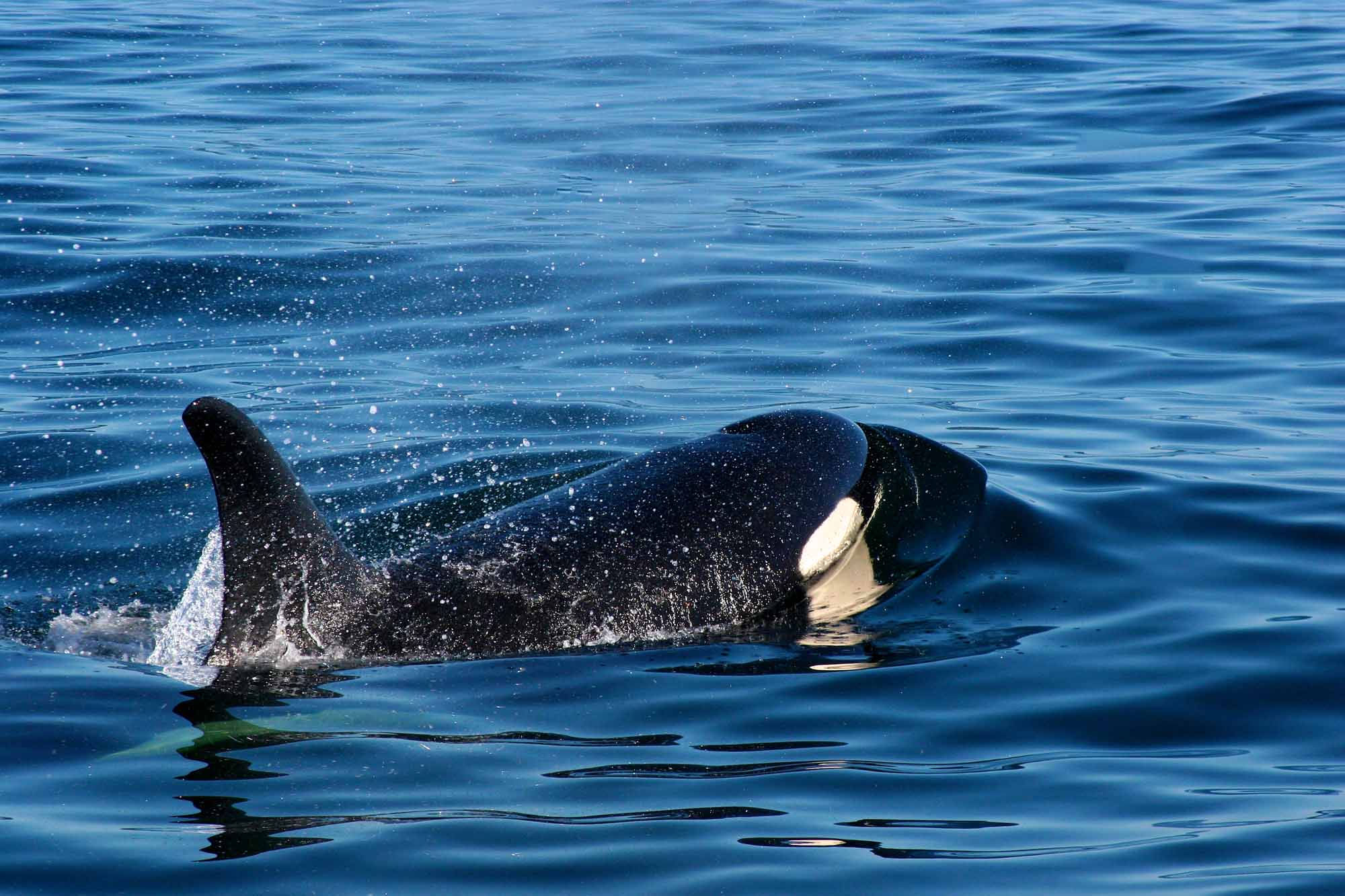
-
Article
Maritime Provinces
The word Maritimes is a regional designation for the Canadian provinces of Prince Edward Island, Nova Scotia and New Brunswick. These provinces constitute a cluster of peninsulas and islands that form the northeastern extension of the Appalachian Highlands and are also significantly affected by the Atlantic Ocean. Together, the Maritime provinces cover 133,850 km2 — or just a little more than 1 per cent of Canada's land surface.
"https://d3d0lqu00lnqvz.cloudfront.net/media/media/276c48ba-ecfb-4c4a-aec6-e7bba279abf9.jpg" // resources/views/front/categories/view.blade.php
https://d3d0lqu00lnqvz.cloudfront.net/media/media/276c48ba-ecfb-4c4a-aec6-e7bba279abf9.jpg
-
Article
Markham
Markham, Ontario, incorporated as a city in 1971, population 338,503 (2021 census), 328,966 (2016 census). Markham is located immediately northeast of Toronto. It is one of nine municipalities that make up the Regional Municipality of York. The Rouge River cuts through the municipality diagonally, connecting to Rouge National Urban Park. Initially an agricultural community, Markham is now known for its technology businesses and ethnocultural diversity. Throughout history, the Markham area has been home to different Indigenous groups, namely the Huron Wendat, Haudenosaunee and Anishinaabeg. The land is covered by Treaty 13 and the Williams Treaties.
"https://d3d0lqu00lnqvz.cloudfront.net/media/new_article_images/Markham/PacificMall.jpg" // resources/views/front/categories/view.blade.php
https://d3d0lqu00lnqvz.cloudfront.net/media/new_article_images/Markham/PacificMall.jpg
-
Article
Marshall
Marshall, Sask, incorporated as a village in 1914 and as a town in 2006, population 533 (2011c), 608 (2006c). The Town of Marshall is located on the Canadian National Railway line and the Yellowhead Highway between LLOYDMINSTER and NORTH BATTLEFORD, in the Rural Municipality of WILTON.
"https://thecanadianencyclopedia.ca/images/tce_placeholder.jpg?v=e9dca980c9bdb3aa11e832e7ea94f5d9" // resources/views/front/categories/view.blade.php
https://thecanadianencyclopedia.ca/images/tce_placeholder.jpg?v=e9dca980c9bdb3aa11e832e7ea94f5d9
-
Article
Martello Tower
Martello tower is a distinctive masonry fortification used in defence of British North America in the first half of the 19th century. Built from 1796 to 1848 during times of tension with the United States, there remains over a dozen Martello Towers between Halifax, Saint John, Quebec City and Kingston.
"https://d3d0lqu00lnqvz.cloudfront.net/media/media/97b0d919-cae9-420e-8e8f-399b7ffbb025.jpg" // resources/views/front/categories/view.blade.php
https://d3d0lqu00lnqvz.cloudfront.net/media/media/97b0d919-cae9-420e-8e8f-399b7ffbb025.jpg
-
Article
Martensville
Martensville, Sask, incorporated as a town in 1969 and a city in 2009, population 7716 (2011c), 4978 (2006c). The City of Martensville is located 9 km north of SASKATOON. In the late 1960s as Saskatoon's population underwent
"https://thecanadianencyclopedia.ca/images/tce_placeholder.jpg?v=e9dca980c9bdb3aa11e832e7ea94f5d9" // resources/views/front/categories/view.blade.php
https://thecanadianencyclopedia.ca/images/tce_placeholder.jpg?v=e9dca980c9bdb3aa11e832e7ea94f5d9
-
Article
Marystown
Marystown, NL, incorporated as a town in 1951, population 5506 (2011c), 5436 (2006c). The Town of Marystown is a shipbuilding and fish-processing centre, comprising the settlements of Marystown (formerly Mortier Bay), Creston, Creston North, Little Bay and Mooring Cove on the east side of the Burin Peninsula.
"https://thecanadianencyclopedia.ca/images/tce_placeholder.jpg?v=e9dca980c9bdb3aa11e832e7ea94f5d9" // resources/views/front/categories/view.blade.php
https://thecanadianencyclopedia.ca/images/tce_placeholder.jpg?v=e9dca980c9bdb3aa11e832e7ea94f5d9
-
Article
Mascouche
The history of Mascouche was closely linked to the roles played by Gabriel Christie and Peter and his son John Pangman, 3 of the last owners of the Seigneury de La Chesnaye.
"https://thecanadianencyclopedia.ca/images/tce_placeholder.jpg?v=e9dca980c9bdb3aa11e832e7ea94f5d9" // resources/views/front/categories/view.blade.php
https://thecanadianencyclopedia.ca/images/tce_placeholder.jpg?v=e9dca980c9bdb3aa11e832e7ea94f5d9