
Browse "Places"
-
Article
Kennedy House
Kennedy House is a provincial HISTORIC SITE located just north of Winnipeg on River Road, the old highway that connected the RED RIVER COLONY between LOWER FORT GARRY and UPPER FORT GARRY.
"https://thecanadianencyclopedia.ca/images/tce_placeholder.jpg?v=e9dca980c9bdb3aa11e832e7ea94f5d9" // resources/views/front/categories/view.blade.php
https://thecanadianencyclopedia.ca/images/tce_placeholder.jpg?v=e9dca980c9bdb3aa11e832e7ea94f5d9
-
Article
Keno Hill
Keno Hill (or Keno City), Yukon, settlement, population 20 (2021 census), 20 (2016 census). Keno Hill is located 122 km northwest of the Klondike Highway, 466 km by road north from Whitehorse.
"https://thecanadianencyclopedia.ca/images/tce_placeholder.jpg?v=e9dca980c9bdb3aa11e832e7ea94f5d9" // resources/views/front/categories/view.blade.php
https://thecanadianencyclopedia.ca/images/tce_placeholder.jpg?v=e9dca980c9bdb3aa11e832e7ea94f5d9
-
Article
Kenora
Kenora, Ontario, incorporated as a city in 2000, population 14,967 (2021 census), 15,096 (2016 census). The city of Kenora is located on Lake of the Woods, 50 km east of the Manitoba border. The city is the result of the amalgamation of three former towns, Kenora (incorporated 1892), Jaffray Melick (incorporated 1988) and Keewatin (incorporated 1908).
"https://thecanadianencyclopedia.ca/images/tce_placeholder.jpg?v=e9dca980c9bdb3aa11e832e7ea94f5d9" // resources/views/front/categories/view.blade.php
https://thecanadianencyclopedia.ca/images/tce_placeholder.jpg?v=e9dca980c9bdb3aa11e832e7ea94f5d9
-
Article
Kenosewun Visitor Centre and Museum
Kenosewun Visitor Centre and Museum was a provincially-operated archaeological facility and museum 21 kilometres north of Winnipeg. The archaeological site interprets Indigenous cultures in the Red River area. In particular, the site explores the significance of archaeological finds at St Andrew's Rapids, including material culture and land use. The centre was built to house archaeological research, and a portion of it served as a museum. In 2010, the Kenosewun Centre was permanently shut down.
"https://thecanadianencyclopedia.ca/images/tce_placeholder.jpg?v=e9dca980c9bdb3aa11e832e7ea94f5d9" // resources/views/front/categories/view.blade.php
https://thecanadianencyclopedia.ca/images/tce_placeholder.jpg?v=e9dca980c9bdb3aa11e832e7ea94f5d9
-
Article
Kensington
Owing to its crossroads location, the town received a station when the PEI Railway was constructed in 1873. Today Kensington is still a commercial centre, although it competes with the larger port town of Summerside.
"https://thecanadianencyclopedia.ca/images/tce_placeholder.jpg?v=e9dca980c9bdb3aa11e832e7ea94f5d9" // resources/views/front/categories/view.blade.php
https://thecanadianencyclopedia.ca/images/tce_placeholder.jpg?v=e9dca980c9bdb3aa11e832e7ea94f5d9
-
Article
Kensington Market
Kensington Market is an open-air food and clothing market in downtown Toronto. This multicultural marketplace is known for its independent spirit, colourful shop fronts, vibrant murals, charismatic locals and people-friendly Pedestrian Sundays events. The eclectic businesses located here sell fresh produce, cheese, meats, bread and desserts, bulk spices, nuts, flowers, marijuana and vintage clothing. The area also teems with a variety of restaurants, cafés and bars. The shops in Kensington Market spill out onto the sidewalk, giving the area a vibrant street culture unique to the city of Toronto. It is bordered by Spadina Avenue in the east, Bathurst Street in the west, Dundas Street in the south and College Street in the north.
"https://d3d0lqu00lnqvz.cloudfront.net/TCEImages/4ad543ac-841f-46aa-9c58-1dd27027f689.png" // resources/views/front/categories/view.blade.php
https://d3d0lqu00lnqvz.cloudfront.net/TCEImages/4ad543ac-841f-46aa-9c58-1dd27027f689.png
-
Article
Kent
Kent, BC, incorporated as a district municipality in 1895, population 5664 (2011c), 4738 (2006c). The District of Kent was named after the county of Kent in England. It is located in the upper portion of the FRASER RIVER LOWLAND of southwestern British Columbia about 117 km east of VANCOUVER.
"https://thecanadianencyclopedia.ca/images/tce_placeholder.jpg?v=e9dca980c9bdb3aa11e832e7ea94f5d9" // resources/views/front/categories/view.blade.php
https://thecanadianencyclopedia.ca/images/tce_placeholder.jpg?v=e9dca980c9bdb3aa11e832e7ea94f5d9
-
Article
Kentville
Kentville, Nova Scotia, incorporated as a town in 1886, population 6,630 (2021 census), 6,271 (2016 census). The Town of Kentville is located on the Cornwallis River, 110 km northwest of Halifax.
"https://d3d0lqu00lnqvz.cloudfront.net/kentville/Atlantic_Food_and_Horticulture_Research_Centre.jpg" // resources/views/front/categories/view.blade.php
https://d3d0lqu00lnqvz.cloudfront.net/kentville/Atlantic_Food_and_Horticulture_Research_Centre.jpg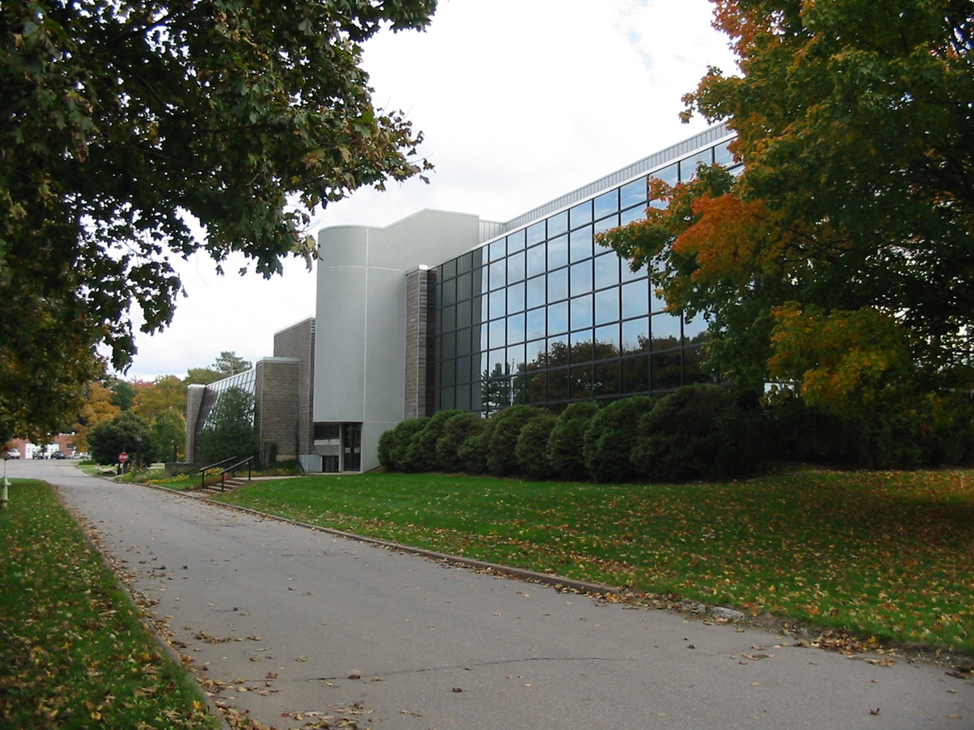
-
Article
Keremeos
Keremeos, BC, incorporated as a village in 1956, population 1330 (2011c), 1289 (2006c). The Village of Keremeos is located in the fertile bench beside the Similkameen River, 45 km south of PENTICTON. Its name likely derives from a Salish phrase meaning "wind channel in the mountain.
"https://thecanadianencyclopedia.ca/images/tce_placeholder.jpg?v=e9dca980c9bdb3aa11e832e7ea94f5d9" // resources/views/front/categories/view.blade.php
https://thecanadianencyclopedia.ca/images/tce_placeholder.jpg?v=e9dca980c9bdb3aa11e832e7ea94f5d9
-
Article
Kettle Valley
Kettle Valley is a dry, forested area in the Okanagan Highland of southern BC. The name relates either to rock formations in the waterfalls at the confluence of the Kettle and COLUMBIA rivers in Washington state or to the shape of baskets woven by Salish people there.
"https://thecanadianencyclopedia.ca/images/tce_placeholder.jpg?v=e9dca980c9bdb3aa11e832e7ea94f5d9" // resources/views/front/categories/view.blade.php
https://thecanadianencyclopedia.ca/images/tce_placeholder.jpg?v=e9dca980c9bdb3aa11e832e7ea94f5d9
-
Article
Key Biodiversity Areas of Canada
Key Biodiversity Areas (KBAs) are sites that play an outsized role in supporting the survival of species and ecosystems around the world. They are identified through rigorous scientific assessment using internationally standardized criteria developed by the International Union for Conservation of Nature (IUCN). Canada has about 800 KBAs, including candidate sites. They are found across marine, freshwater, terrestrial and subterranean environments, spotlighting key sites for iconic species like polar bears and puffins, and for lesser-known Canadian biodiversity, like slugs, lichens and rare dune ecosystems. KBAs recognize the diversity and significance of Canada’s nature, helping governments, Indigenous communities, conservation organizations, researchers and others prioritize areas for conservation.
"https://d3d0lqu00lnqvz.cloudfront.net/media/media/c0640ae1-86d9-41e2-9a94-5f392651fc8e.jpg" // resources/views/front/categories/view.blade.php
https://d3d0lqu00lnqvz.cloudfront.net/media/media/c0640ae1-86d9-41e2-9a94-5f392651fc8e.jpg
-
Article
Kicking Horse Pass
Kicking Horse Pass is a route through the Rocky Mountains. At an elevation of 1,627 m, Kicking Horse Pass straddles the Continental Divide on the border between Alberta and British Columbia in Yoho National Park. In 1971, Kicking Horse Pass was designated a National Historic Site for its importance as a transportation corridor in Western Canada, first for Indigenous peoples, then the Canadian Pacific Railway, and finally the Trans-Canada Highway.
"https://d3d0lqu00lnqvz.cloudfront.net/media/media/c2e8193c-32fb-430e-b2c8-7399eee67818.jpg" // resources/views/front/categories/view.blade.php
https://d3d0lqu00lnqvz.cloudfront.net/media/media/c2e8193c-32fb-430e-b2c8-7399eee67818.jpg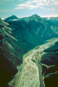
-
Article
Kicking Horse River
The Kicking Horse River begins as glacial meltwater streams flowing down the west slope of the Rocky Mountains.
"https://thecanadianencyclopedia.ca/images/tce_placeholder.jpg?v=e9dca980c9bdb3aa11e832e7ea94f5d9" // resources/views/front/categories/view.blade.php
https://thecanadianencyclopedia.ca/images/tce_placeholder.jpg?v=e9dca980c9bdb3aa11e832e7ea94f5d9
-
Article
Killarney
Killarney, Ont, incorporated as a municipality in 1999, population 505 (2011c), 459 (2006c). The Municipality of Killarney is located along Killarney Channel on the north shore of Georgian Bay. Nearby is Killarney Provincial Park.
"https://d3d0lqu00lnqvz.cloudfront.net/media/media/df178a0c-97df-4585-9da1-6e879749b6ef.jpg" // resources/views/front/categories/view.blade.php
https://d3d0lqu00lnqvz.cloudfront.net/media/media/df178a0c-97df-4585-9da1-6e879749b6ef.jpg
-
Article
Killarney (Man)
Killarney, Manitoba, population centre, population 2197 (2011c), 2273 (2006c). Killarney was incorporated as a village in 1903, as a town in 1907 and merged with the Rural Municipality of Turtle Mountain to form the Municipality of Killarney-Turtle Mountain in 2007.
"https://thecanadianencyclopedia.ca/images/tce_placeholder.jpg?v=e9dca980c9bdb3aa11e832e7ea94f5d9" // resources/views/front/categories/view.blade.php
https://thecanadianencyclopedia.ca/images/tce_placeholder.jpg?v=e9dca980c9bdb3aa11e832e7ea94f5d9