
Browse "Places"
-
Timelines
British Columbia
British Columbia is Canada's most westerly province, and is a mountainous area whose population is mainly clustered in its southwestern corner. BC is Canada’s third-largest province after Québec and Ontario, making up 10 per cent of Canada’s land surface.
"https://d3d0lqu00lnqvz.cloudfront.net/media/media/08691466-f851-405a-aed3-4dae6f6e6024.jpg" // resources/views/front/categories/view.blade.php
https://d3d0lqu00lnqvz.cloudfront.net/media/media/08691466-f851-405a-aed3-4dae6f6e6024.jpg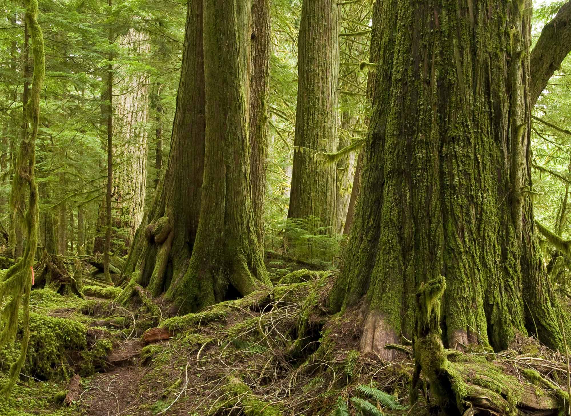
-
Article
British Columbia and Confederation
The colony of British Columbia was founded in 1858 in response to the Fraser River Gold Rush. (See also The Fraser River Gold Rush and the Founding of British Columbia.) The colony established representative government in 1864 and merged with the colony of Vancouver Island in 1866. In May 1868, Amor De Cosmos formed the Confederation League to bring responsible government to BC and to join Confederation. In September 1868, the Confederation League passed 37 resolutions outlining the terms for a union with the Dominion of Canada. The terms were passed by both the BC assembly and the federal Parliament in 1871. The colony joined Canada as the country’s sixth province on 20 July 1871. The threat of American annexation, embodied by the Alaska purchase of 1867, and the promise of a railway linking BC to the rest of Canada, were decisive factors.
"https://d3d0lqu00lnqvz.cloudfront.net/media/media/1f3712f0-f1ac-4fba-a093-ff4c7cfec856.jpg" // resources/views/front/categories/view.blade.php
https://d3d0lqu00lnqvz.cloudfront.net/media/media/1f3712f0-f1ac-4fba-a093-ff4c7cfec856.jpg
-
Article
British Columbia Railway
The British Columbia Railway was incorporated as the Pacific Great Eastern Railway in 1912 to build a line from North Vancouver to Prince George, where it was to link up with the Grand Trunk Pacific Railway.
"https://thecanadianencyclopedia.ca/images/tce_placeholder.jpg?v=e9dca980c9bdb3aa11e832e7ea94f5d9" // resources/views/front/categories/view.blade.php
https://thecanadianencyclopedia.ca/images/tce_placeholder.jpg?v=e9dca980c9bdb3aa11e832e7ea94f5d9
-
Article
British North America
British North America refers to the British colonies and territories in North America after the US became independent in 1783 (see also American Revolution) and until Confederation in 1867. The British North America Act (BNA Act), which came into effect on 1 July 1867, united three of the five British North American colonies. The Act (renamed the Constitution Act, 1867, in 1982) is the foundational document of Canada’s Constitution.
"https://d3d0lqu00lnqvz.cloudfront.net/media/media/38e5f8ee-b0d4-46c9-99d7-11bdda3004ce.jpg" // resources/views/front/categories/view.blade.php
https://d3d0lqu00lnqvz.cloudfront.net/media/media/38e5f8ee-b0d4-46c9-99d7-11bdda3004ce.jpg
-
Article
Brockinton Archaeological Site
The Brockinton archaeological site, also known as the Brockinton Indian Sites National Historic Site of Canada, is located along the valley wall of the Souris River of southwestern Manitoba.
"https://d3d0lqu00lnqvz.cloudfront.net/media/media/d2ad36fd-b155-4505-9f15-70cbe491cc21.jpg" // resources/views/front/categories/view.blade.php
https://d3d0lqu00lnqvz.cloudfront.net/media/media/d2ad36fd-b155-4505-9f15-70cbe491cc21.jpg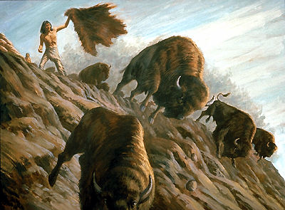
-
Article
Brock's Monument, Queenston Heights
The monument to Sir Isaac Brock stands atop Ontario’s Niagara Escarpment at Queenston Heights, overlooking the lower Niagara River. The current monument is the second erected in Canada to honour Brock, a military commander who died during the Battle of Queenston Heights in the War of 1812.
"https://d3d0lqu00lnqvz.cloudfront.net/media/media/da5bc151-a17e-4794-9d5d-fd6eb47e06f9.jpg" // resources/views/front/categories/view.blade.php
https://d3d0lqu00lnqvz.cloudfront.net/media/media/da5bc151-a17e-4794-9d5d-fd6eb47e06f9.jpg
-
Article
Brockville
Brockville, Ont, incorporated as a city in 1962, population 21 870 (2011c), 21 957 (2006c). The City of Brockville is located on the St Lawrence River, 80 km east of Kingston.
"https://d3d0lqu00lnqvz.cloudfront.net/media/media/22f08ba6-1b15-4ad2-8735-6081fd45a518.jpg" // resources/views/front/categories/view.blade.php
https://d3d0lqu00lnqvz.cloudfront.net/media/media/22f08ba6-1b15-4ad2-8735-6081fd45a518.jpg
-
Article
Brooks
Brooks, Alta, incorporated as a city in 2005, population 13 676 (2011c), 12 508 (2006c). The City of Brooks is located 185 km southeast of Calgary on the Trans-Canada Highway.
"https://thecanadianencyclopedia.ca/images/tce_placeholder.jpg?v=e9dca980c9bdb3aa11e832e7ea94f5d9" // resources/views/front/categories/view.blade.php
https://thecanadianencyclopedia.ca/images/tce_placeholder.jpg?v=e9dca980c9bdb3aa11e832e7ea94f5d9
-
Article
Brooman Point Village
Brooman Point Village is an archaeological site located at the tip of a long peninsula that extends from the eastern coast of Bathurst Island in the High Arctic.
"https://thecanadianencyclopedia.ca/images/tce_placeholder.jpg?v=e9dca980c9bdb3aa11e832e7ea94f5d9" // resources/views/front/categories/view.blade.php
https://thecanadianencyclopedia.ca/images/tce_placeholder.jpg?v=e9dca980c9bdb3aa11e832e7ea94f5d9
-
Article
Brossard
Brossard, Quebec, incorporated as a city in 1978, population 91,525 (2021 census), 85,721 (2016 census). From 2002 to 2006, Brossard was a borough of the new city of Longueuil, which was created from the amalgamation of eight distinct municipalities, including Brossard. In a 2004 referendum, Brossard residents voted to reconstitute their city, and on 1 January 2006, Brossard again became its own municipality. Brossard is located on the South Shore of the St. Lawrence River, and is linked to Montreal via the Samuel-De Champlain Bridge since 2019.
"https://thecanadianencyclopedia.ca/images/tce_placeholder.jpg?v=e9dca980c9bdb3aa11e832e7ea94f5d9" // resources/views/front/categories/view.blade.php
https://thecanadianencyclopedia.ca/images/tce_placeholder.jpg?v=e9dca980c9bdb3aa11e832e7ea94f5d9
-
Article
Bruce Peninsula
Owen Sound and Colpoys Bay form fjordlike harbours on Georgian Bay. Cape Croker, projecting 10 km into the bay, is an Ojibwa reserve. Adjacent Hope Bay is famous for its sheer limestone cliffs and sandy beach. At Lion's Head a jagged rock formation 51 m high gives the site its name.
"https://d3d0lqu00lnqvz.cloudfront.net/media/media/7351df64-b09f-4230-9054-90446369698f.jpg" // resources/views/front/categories/view.blade.php
https://d3d0lqu00lnqvz.cloudfront.net/media/media/7351df64-b09f-4230-9054-90446369698f.jpg
-
Article
Bruce Peninsula National Park
Bruce Peninsula National Park (established 1987, 156 km2) consists of a former provincial park and private lands acquired on a "willing buyer-willing seller" basis.
"https://d3d0lqu00lnqvz.cloudfront.net/escarpment/niagara-escarpment-bruce-peninsula.jpg" // resources/views/front/categories/view.blade.php
https://d3d0lqu00lnqvz.cloudfront.net/escarpment/niagara-escarpment-bruce-peninsula.jpg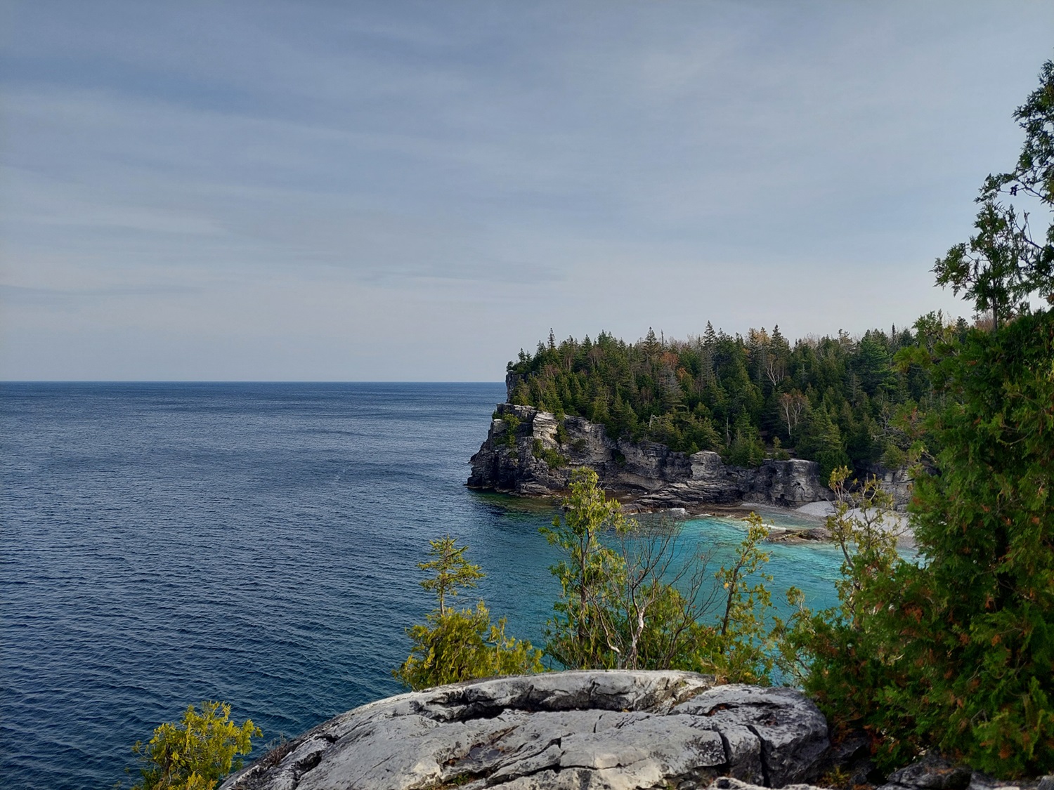
-
Article
Bruce Trail
The Bruce Trail is a continuous, 740 km footpath on the Niagara Escarpment connecting Queenston, near Niagara Falls, with the village of Tobermory in the Bruce Peninsula, Ontario. The trail follows the escarpment cliff through the fruit lands of Niagara and the city of Hamilton, across the Dundas Valley, north through the Caledon Hills to the Blue Mountains, then northwest across the Beaver Valley to Owen Sound and onward, seldom out of sight of Lake Huron's Georgian Bay, to Tobermory.
"https://d3d0lqu00lnqvz.cloudfront.net/media/media/ca0f5c71-ef4f-4fe0-bbd9-69e1452afbbe.jpg" // resources/views/front/categories/view.blade.php
https://d3d0lqu00lnqvz.cloudfront.net/media/media/ca0f5c71-ef4f-4fe0-bbd9-69e1452afbbe.jpg
-
Article
Brunette Island
Brunette Island, 20 km2, is situated at the mouth of Fortune B on Newfoundland's S coast, 18 km S of Connaigre Head. The island, roughly triangular, measures 11 km E-W and 6 km N-S. A steep ridge backs the NW shore, at one point rising to 160 m.
"https://thecanadianencyclopedia.ca/images/tce_placeholder.jpg?v=e9dca980c9bdb3aa11e832e7ea94f5d9" // resources/views/front/categories/view.blade.php
https://thecanadianencyclopedia.ca/images/tce_placeholder.jpg?v=e9dca980c9bdb3aa11e832e7ea94f5d9
-
Article
Buckingham
Originally incorporated as a village in 1855 and as a city in 1890, it adopted the name of the township in which it is situated. The name is a historical reminder of the role played in 19th-century British politics by George Nugent Temple Grenville, 1st Marquis of Buckingham (1753-1813).
"https://thecanadianencyclopedia.ca/images/tce_placeholder.jpg?v=e9dca980c9bdb3aa11e832e7ea94f5d9" // resources/views/front/categories/view.blade.php
https://thecanadianencyclopedia.ca/images/tce_placeholder.jpg?v=e9dca980c9bdb3aa11e832e7ea94f5d9