
Browse "Places"
-
Article
Boissevain
The first homesteaders took up land in the area in the late 1870s and early 1880s, and in 1885 the CPR reached the townsite. By the early 1890s Boissevain was a thriving community with hotels, stores, farm implement dealers and a lumber yard.
"https://d3d0lqu00lnqvz.cloudfront.net/media/media/a2793534-9aca-4f3f-a8a3-00f3d75ac298.jpg" // resources/views/front/categories/view.blade.php
https://d3d0lqu00lnqvz.cloudfront.net/media/media/a2793534-9aca-4f3f-a8a3-00f3d75ac298.jpg
-
Article
Boîtes à chansons
Boîtes à chansons. Name given to the intimate rooms which sprang up in the mid-1950s outside the normal entertainment circuits and in which most young Quebec chansonniers made their start.
"https://thecanadianencyclopedia.ca/images/tce_placeholder.jpg?v=e9dca980c9bdb3aa11e832e7ea94f5d9" // resources/views/front/categories/view.blade.php
https://thecanadianencyclopedia.ca/images/tce_placeholder.jpg?v=e9dca980c9bdb3aa11e832e7ea94f5d9
-
Article
Bonar Law Historic Site
Bonar Law is a provincial historic site near Rexton, NB. The Right Honourable Andrew Bonar Law served briefly as Prime Minister of Great Britain in 1922-23.
"https://thecanadianencyclopedia.ca/images/tce_placeholder.jpg?v=e9dca980c9bdb3aa11e832e7ea94f5d9" // resources/views/front/categories/view.blade.php
https://thecanadianencyclopedia.ca/images/tce_placeholder.jpg?v=e9dca980c9bdb3aa11e832e7ea94f5d9
-
Article
Bonavista
Bonavista, NL, incorporated as a town in 1964, population 3589 (2011c), 3764 (2006c). The Town of Bonavista is located near Cape Bonavista on Newfoundland's northeast coast.
"https://thecanadianencyclopedia.ca/images/tce_placeholder.jpg?v=e9dca980c9bdb3aa11e832e7ea94f5d9" // resources/views/front/categories/view.blade.php
https://thecanadianencyclopedia.ca/images/tce_placeholder.jpg?v=e9dca980c9bdb3aa11e832e7ea94f5d9
-
Article
Bonavista Bay
Bonavista Bay is an inlet on the Atlantic coast of Newfoundland between Cape Freels and Cape Bonavista. Roughly 65 km wide, it contains a large number of densely forested islands that shelter the mainland from northeasterly winds and create hundreds of kilometres of virtually landlocked waters.
"https://thecanadianencyclopedia.ca/images/tce_placeholder.jpg?v=e9dca980c9bdb3aa11e832e7ea94f5d9" // resources/views/front/categories/view.blade.php
https://thecanadianencyclopedia.ca/images/tce_placeholder.jpg?v=e9dca980c9bdb3aa11e832e7ea94f5d9
-
Article
Bonnet Plume River
The Bonnet Plume River begins its journey in the Mackenzie Mountains on the Yukon and NWT border.
"https://thecanadianencyclopedia.ca/images/tce_placeholder.jpg?v=e9dca980c9bdb3aa11e832e7ea94f5d9" // resources/views/front/categories/view.blade.php
https://thecanadianencyclopedia.ca/images/tce_placeholder.jpg?v=e9dca980c9bdb3aa11e832e7ea94f5d9
-
Article
Bonnyville
Bonnyville, Alberta, incorporated as a town in 1948, population 6,404 (2021 census), 5,975 (2016 census). The town of Bonnyville is located 240 km northeast of Edmonton in Alberta’s lake district and prairie parkland.
"https://thecanadianencyclopedia.ca/images/tce_placeholder.jpg?v=e9dca980c9bdb3aa11e832e7ea94f5d9" // resources/views/front/categories/view.blade.php
https://thecanadianencyclopedia.ca/images/tce_placeholder.jpg?v=e9dca980c9bdb3aa11e832e7ea94f5d9
-
Article
Borden
Borden, Sask, incorporated as a village in 1909, population 245 (2011c), 223 (2006c). The Village of Borden is located about 65 km northwest of Saskatoon. The village was originally named Baltimore but was renamed by the Canadian Northern Railway after Sir Frederick Borden.
"https://thecanadianencyclopedia.ca/images/tce_placeholder.jpg?v=e9dca980c9bdb3aa11e832e7ea94f5d9" // resources/views/front/categories/view.blade.php
https://thecanadianencyclopedia.ca/images/tce_placeholder.jpg?v=e9dca980c9bdb3aa11e832e7ea94f5d9
-
Article
Borden-Carleton
Borden-Carleton, PEI, incorporated as a community in 1983, population 750 (2011c), 786 (2006c). The Community of Borden-Carleton was created in 1995 with the amalgamation of the town of Borden (incorporated in 1919) and the
"https://d3d0lqu00lnqvz.cloudfront.net/media/media/688109dd-2a6e-48ea-ba63-58250b720b39.jpg" // resources/views/front/categories/view.blade.php
https://d3d0lqu00lnqvz.cloudfront.net/media/media/688109dd-2a6e-48ea-ba63-58250b720b39.jpg
-
Article
Borden Island
Borden Island, 2794 km2, is one of the Queen Elizabeth group of islands in the High Arctic. Most of the island is part of the Northwest Territories; the easternmost part of the island is part of Nunavut.
"https://thecanadianencyclopedia.ca/images/tce_placeholder.jpg?v=e9dca980c9bdb3aa11e832e7ea94f5d9" // resources/views/front/categories/view.blade.php
https://thecanadianencyclopedia.ca/images/tce_placeholder.jpg?v=e9dca980c9bdb3aa11e832e7ea94f5d9
-
Article
Border Towns in Canada
The Canada-United States border is the longest international border in the world, spanning almost 9,000 kilometres across eight Canadian provinces and territories. Because of the strong economic, social and cultural ties between Canada and the United States, many towns were established right along this border. Some towns even rely on their neighbouring country for municipal services or cultural connections. Below are some notable examples of such towns. All populations listed are from the 2021 Canadian census.
"https://d3d0lqu00lnqvz.cloudfront.net/bordertowns/Hyder_AK.jpg" // resources/views/front/categories/view.blade.php
https://d3d0lqu00lnqvz.cloudfront.net/bordertowns/Hyder_AK.jpg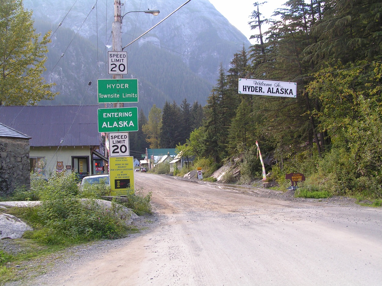
-
Article
Botwood
Botwood, NL, incorporated as a town in 1960, population 3008 (2011c), 3052 (2006c). The Town of Botwood is located in the Bay of Exploits, a long arm of Notre Dame Bay on the north coast of Newfoundland.
"https://thecanadianencyclopedia.ca/images/tce_placeholder.jpg?v=e9dca980c9bdb3aa11e832e7ea94f5d9" // resources/views/front/categories/view.blade.php
https://thecanadianencyclopedia.ca/images/tce_placeholder.jpg?v=e9dca980c9bdb3aa11e832e7ea94f5d9
-
Article
Boucherville
Boucherville, Quebec, incorporated as a city in 1957, population 41,743 (2021 census), 41,671 (2016 census). From 2002 to 2006, Boucherville was a borough of the new city of Longueuil, which was created from the amalgamation of eight distinct municipalities, including Boucherville. In a 2004 referendum, its residents voted to reconstitute their city, and on 1 January 2006, Boucherville again became its own municipality. Boucherville stretches for 7 km along the South Shore of the St. Lawrence River. It is connected to Montreal via the tunnel-bridge Louis-Hippolyte-Lafontaine (1967).
"https://thecanadianencyclopedia.ca/images/tce_placeholder.jpg?v=e9dca980c9bdb3aa11e832e7ea94f5d9" // resources/views/front/categories/view.blade.php
https://thecanadianencyclopedia.ca/images/tce_placeholder.jpg?v=e9dca980c9bdb3aa11e832e7ea94f5d9
-
Article
Bouctouche
Bouctouche, NB, incorporated as a town in 1985, population 2423 (2011c), 2383 (2006c).
"https://thecanadianencyclopedia.ca/images/tce_placeholder.jpg?v=e9dca980c9bdb3aa11e832e7ea94f5d9" // resources/views/front/categories/view.blade.php
https://thecanadianencyclopedia.ca/images/tce_placeholder.jpg?v=e9dca980c9bdb3aa11e832e7ea94f5d9
-
Article
Boundary Waters-Voyageur Waterway
The Boundary Waters-Voyageur Waterway extends 250 km along the international boundary extending from the western tip of Lake Superior to Lac La Croix in Ontario's Quetico Provincial Park.
"https://thecanadianencyclopedia.ca/images/tce_placeholder.jpg?v=e9dca980c9bdb3aa11e832e7ea94f5d9" // resources/views/front/categories/view.blade.php
https://thecanadianencyclopedia.ca/images/tce_placeholder.jpg?v=e9dca980c9bdb3aa11e832e7ea94f5d9