
Browse "Places"
-
List
Ten Mountains in Canada Named After Women
While the majority of geographic features in Canada are named after men, there are examples from coast to coast of places named for women. These place names reflect the story of Canada and were chosen for a variety of reasons. Some celebrate trailblazers and their accomplishments. Others are named for locals, or the friends and family of the person naming them. They can honour individuals lost during wars and women who made their mark on history. Here are 10 mountains in Canada that bear the names of women.
"https://d3d0lqu00lnqvz.cloudfront.net/TenMountainsNamedForWomen/MountCaubvick.jpg" // resources/views/front/categories/view.blade.php
https://d3d0lqu00lnqvz.cloudfront.net/TenMountainsNamedForWomen/MountCaubvick.jpg
-
Article
Terra Nova National Park
Terra Nova National Park (est 1957, 399.9 km2), Canada's most easterly national park, is located on Bonavista Bay, Nfld. Terra Nova is the Latin form of the name of the island, Newfoundland.
"https://d3d0lqu00lnqvz.cloudfront.net/media/media/47baa2cc-e48f-4b39-bfd5-4383b6cdfaa9.jpg" // resources/views/front/categories/view.blade.php
https://d3d0lqu00lnqvz.cloudfront.net/media/media/47baa2cc-e48f-4b39-bfd5-4383b6cdfaa9.jpg
-
Article
Terrace
Terrace, BC, incorporated as a city in 1987, population 11 486 (2011c), 11 320 (2006c).
"https://thecanadianencyclopedia.ca/images/tce_placeholder.jpg?v=e9dca980c9bdb3aa11e832e7ea94f5d9" // resources/views/front/categories/view.blade.php
https://thecanadianencyclopedia.ca/images/tce_placeholder.jpg?v=e9dca980c9bdb3aa11e832e7ea94f5d9
-
Article
Terrebonne
Vieux Terrebonne is a veritable heritage storehouse. The historic buildings and landmarks of the old village centre recall the role played by the NORTH WEST COMPANY in the history of Terrebonne.
"https://thecanadianencyclopedia.ca/images/tce_placeholder.jpg?v=e9dca980c9bdb3aa11e832e7ea94f5d9" // resources/views/front/categories/view.blade.php
https://thecanadianencyclopedia.ca/images/tce_placeholder.jpg?v=e9dca980c9bdb3aa11e832e7ea94f5d9
-
Article
Historical Boundaries of Canada
The boundaries of Canada — and the provinces and territories within it — have shifted and changed throughout the country’s history. Key shifts coincided with the Treaty of Paris in 1763, the establishment of the 49th parallel with the Convention of 1818 and the Oregon Treaty in 1846, and the gradual establishment of provincial and territorial boundaries from Confederation onward.
"https://d3d0lqu00lnqvz.cloudfront.net/media/media/3edd647c-4511-440e-b532-cc817f6c95fd.jpg" // resources/views/front/categories/view.blade.php
https://d3d0lqu00lnqvz.cloudfront.net/media/media/3edd647c-4511-440e-b532-cc817f6c95fd.jpg
-
Article
Teslin
Teslin, Yukon, incorporated as a village in 1984, population 124 (2016 census), 122 (2011 census). The village of Teslin is located on Teslin Lake at the mouth of the Nisutlin River. It is on the Alaska Highway, 183 km by road southeast of Whitehorse.
"https://thecanadianencyclopedia.ca/images/tce_placeholder.jpg?v=e9dca980c9bdb3aa11e832e7ea94f5d9" // resources/views/front/categories/view.blade.php
https://thecanadianencyclopedia.ca/images/tce_placeholder.jpg?v=e9dca980c9bdb3aa11e832e7ea94f5d9
-
Article
Texada Island
Texada Island, BC, 301 km2, pop 1089 (1991c) lies in the Strait of Georgia near Powell River.
"https://thecanadianencyclopedia.ca/images/tce_placeholder.jpg?v=e9dca980c9bdb3aa11e832e7ea94f5d9" // resources/views/front/categories/view.blade.php
https://thecanadianencyclopedia.ca/images/tce_placeholder.jpg?v=e9dca980c9bdb3aa11e832e7ea94f5d9
-
Article
Thai Buddhist Temple - Wat Yanviriya
Wat Yanviriya was the first Thai BUDDHIST temple in Canada (wat means temple-monastery). In 1992 Lord Abbot Luang Phor Viriyang Sirintharo established Wat Yanviriya in a converted Christian church in East Vancouver.
"https://thecanadianencyclopedia.ca/images/tce_placeholder.jpg?v=e9dca980c9bdb3aa11e832e7ea94f5d9" // resources/views/front/categories/view.blade.php
https://thecanadianencyclopedia.ca/images/tce_placeholder.jpg?v=e9dca980c9bdb3aa11e832e7ea94f5d9
-
Article
Thaıdene Nëné National Park Reserve
Branching off from the east arm of Great Slave Lake in the Northwest Territories, Thaidene Nëné National Park Reserve is rich with Indigenous historical and cultural significance. It spans more than 14,000 km² and lies in the heart of the Thaidene Nëné Indigenous Protected Area. From boreal forest and spanning lakes to subarctic tundra and rushing rivers, this park’s wide array of ecosystems demonstrates the diverse beauty this province has to offer. The land was designated as a national park reserve in August 2019, making it the 49th national park in Canada.
"https://d3d0lqu00lnqvz.cloudfront.net/nationalparkstimeline/Thaidene-Nene-National-Park-Reserve.jpg" // resources/views/front/categories/view.blade.php
https://d3d0lqu00lnqvz.cloudfront.net/nationalparkstimeline/Thaidene-Nene-National-Park-Reserve.jpg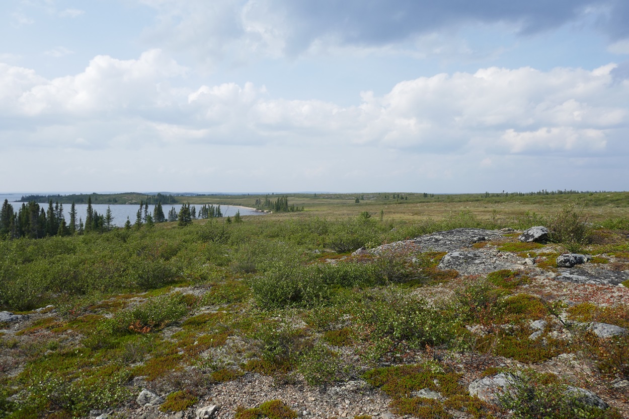
-
Article
Thames River
The Thames River begins in a swampy area of southwestern Ontario and meanders quietly for 273 km past the cities of Woodstock, London and Chatham-Kent to empty into Lake St. Clair.
"https://thecanadianencyclopedia.ca/images/tce_placeholder.jpg?v=e9dca980c9bdb3aa11e832e7ea94f5d9" // resources/views/front/categories/view.blade.php
https://thecanadianencyclopedia.ca/images/tce_placeholder.jpg?v=e9dca980c9bdb3aa11e832e7ea94f5d9
-
Article
The 519
The 519 — formerly called The 519 Church Street Community Centre — is located at 519 Church Street in Toronto’s gay village. It has evolved from a neighbourhood-led preservation effort into one of Canada’s most significant 2SLGBTQ+ community centres. Community-controlled from its founding in 1975, it quickly grew into a major hub for social services, activism and grassroots organizing after opening its doors in 1976. The 519 helped to establish Toronto’s Church and Wellesley neighbourhood as a centre of 2SLGBTQ+ community life. It is one of four 2SLGBTQ+ spaces featured in Canada Post's 2026 Places of Pride stamp collection, issued on 9 June 2026.
"https://d3d0lqu00lnqvz.cloudfront.net/The519ChurchStreetCommunityCentre.jpg" // resources/views/front/categories/view.blade.php
https://d3d0lqu00lnqvz.cloudfront.net/The519ChurchStreetCommunityCentre.jpg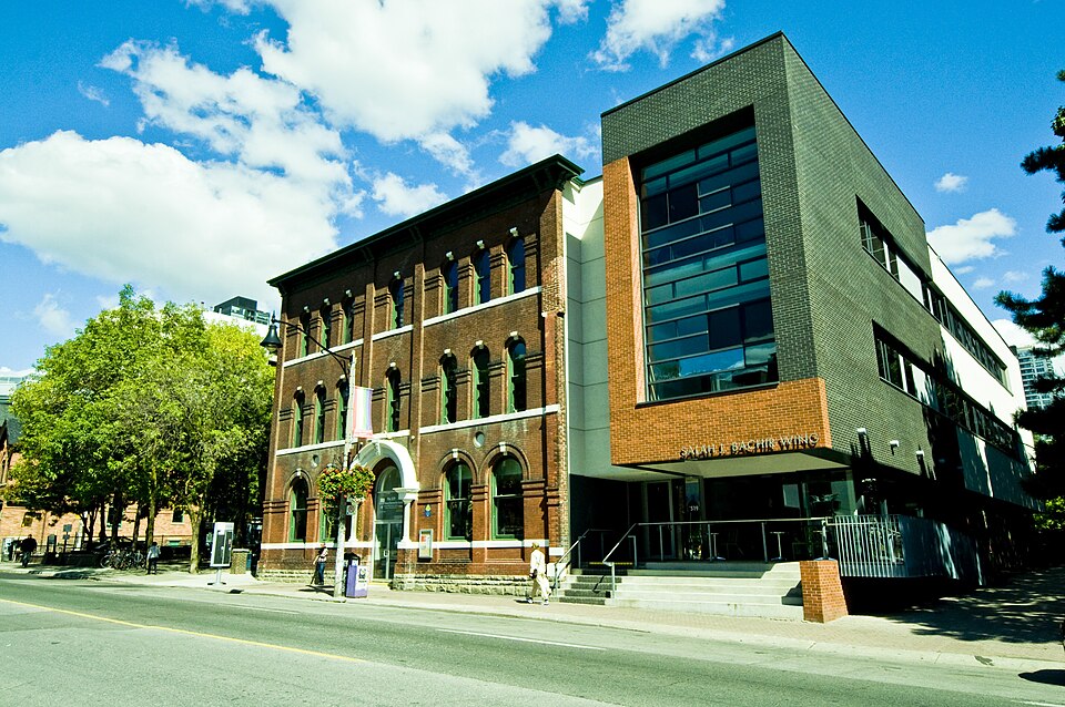
-
Article
The Bog
The Bog was Charlottetown, Prince Edward Island’s historically Black neighbourhood. For over 200 years, Black residents have lived on the island in small communities, but from about 1810 to 1900, Black people were concentrated in this small district. The Bog was located in the town’s west end on marshy, undesirable land. It ran from Government Pond and Black Sam’s Bridge in the northwest to Richmond and Rochford streets in the southeast. Black, white and mixed-race people lived there. At its peak, approximately 100 Black Islanders called it home. Today, there is no trace of the neighbourhood as modern government buildings stand where the historic neighbourhood once stood. However, descendants of the Bog still live on the island and many people are pushing for the neighbourhood’s history to be officially commemorated.
"https://d3d0lqu00lnqvz.cloudfront.net/TheBog/TheBogSchoolResized.jpg" // resources/views/front/categories/view.blade.php
https://d3d0lqu00lnqvz.cloudfront.net/TheBog/TheBogSchoolResized.jpg
-
Article
The Carlu
The Carlu (Eaton Auditorium 1931-76). Concert hall and special events facility located on the top (seventh) floor of the former Eaton's College Street store in Toronto.
"https://thecanadianencyclopedia.ca/images/tce_placeholder.jpg?v=e9dca980c9bdb3aa11e832e7ea94f5d9" // resources/views/front/categories/view.blade.php
https://thecanadianencyclopedia.ca/images/tce_placeholder.jpg?v=e9dca980c9bdb3aa11e832e7ea94f5d9
-
Article
The Crest Theatre
The Crest Theatre was founded in 1953 by Donald and Murray DAVIS with the support of their sister, Barbara CHILCOTT. As students, in the late 1940s, Donald and Murray had studied theatre under Robert Gill at the University of Toronto's Hart House Theatre.
"https://thecanadianencyclopedia.ca/images/tce_placeholder.jpg?v=e9dca980c9bdb3aa11e832e7ea94f5d9" // resources/views/front/categories/view.blade.php
https://thecanadianencyclopedia.ca/images/tce_placeholder.jpg?v=e9dca980c9bdb3aa11e832e7ea94f5d9
-
Article
The Ed Mirvish Theatre
The Toronto theatre at 244 Victoria Street was renamed The Ed Mirvish Theatre in December 2011.
"https://thecanadianencyclopedia.ca/images/tce_placeholder.jpg?v=e9dca980c9bdb3aa11e832e7ea94f5d9" // resources/views/front/categories/view.blade.php
https://thecanadianencyclopedia.ca/images/tce_placeholder.jpg?v=e9dca980c9bdb3aa11e832e7ea94f5d9