Browse "Cities & Populated Places"
-
Article
Urban Sprawl in Canada
Urban sprawl is the overexpansion of urban areas, far from existing city cores, into previously undeveloped land. Often, the land being replaced was previously used for agriculture. Sprawl is characterized by low-density housing and an urban design that prioritizes or requires driving to get to routine destinations. As of 2021, two-thirds of Canadians live in suburban areas, though some suburbs are less sprawl-like than others. Despite immense condominium construction in Toronto and Vancouver, these cities saw 3.4 and 2.4 times as much population growth at their edges as in their cores.
"https://d3d0lqu00lnqvz.cloudfront.net/urbansprawl/markham-suburb.jpg" // resources/views/front/categories/view.blade.php
https://d3d0lqu00lnqvz.cloudfront.net/urbansprawl/markham-suburb.jpg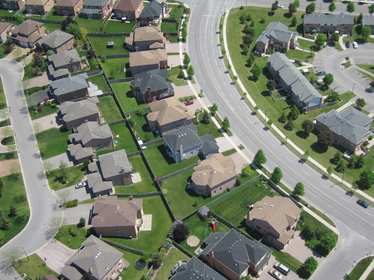
-
Article
Uummannarjuaq (Blacklead Island)
Uummannarjuaq, which means "like a big sea mammal's heart," had long been an Inuit seasonal campsite. The island attracted whalers because of its strategic location close to the floe edge--the boundary between shore ice and open water where the spring whale hunt took place.
"https://d3d0lqu00lnqvz.cloudfront.net/media/media/a5369db6-95c2-4ab9-8742-29a706a34177.jpg" // resources/views/front/categories/view.blade.php
https://d3d0lqu00lnqvz.cloudfront.net/media/media/a5369db6-95c2-4ab9-8742-29a706a34177.jpg
-
Article
Uxbridge
Uxbridge, Ontario, incorporated as a township in 1974, population 21,176 (2016 census), 20,623 (2011 census). The township of Uxbridge is located 68 km northeast of Toronto on Highway 47. The town of Uxbridge was amalgamated in 1974 with the townships of Scott and Uxbridge to form a new township in the Regional Municipality of Durham.
"https://thecanadianencyclopedia.ca/images/tce_placeholder.jpg?v=e9dca980c9bdb3aa11e832e7ea94f5d9" // resources/views/front/categories/view.blade.php
https://thecanadianencyclopedia.ca/images/tce_placeholder.jpg?v=e9dca980c9bdb3aa11e832e7ea94f5d9
-
Article
Val-Bélair
The name Bélair stems back to the original seigneury granted to Guillaume Bonhomme in 1682 by Governor Joseph-Antoine Le Febvre de La Barre and Intendant Jacques de Meulles. In a 1733 census the seigneury was designated as "the fief commonly referred to as Bélair or Bonhomme.
"https://thecanadianencyclopedia.ca/images/tce_placeholder.jpg?v=e9dca980c9bdb3aa11e832e7ea94f5d9" // resources/views/front/categories/view.blade.php
https://thecanadianencyclopedia.ca/images/tce_placeholder.jpg?v=e9dca980c9bdb3aa11e832e7ea94f5d9
-
Article
Val-des-Monts
Val-des-Monts, Qué, Municipality, pop 7842 (2001c), 7231 (1996c), 5551 (1991c), area 435.57 km2, inc 1975 following the legislative amalgamation of the municipalities of Wakefield-Partie-Est, Portland-Ouest and Perkins, is located about 20 km northeast of HULL on the north bank of the OTTAWA RIVER.
"https://thecanadianencyclopedia.ca/images/tce_placeholder.jpg?v=e9dca980c9bdb3aa11e832e7ea94f5d9" // resources/views/front/categories/view.blade.php
https://thecanadianencyclopedia.ca/images/tce_placeholder.jpg?v=e9dca980c9bdb3aa11e832e7ea94f5d9
-
Article
Val-d'Or
Val-d'Or, Quebec, incorporated as a city in 1968, population 32,752 (2021 census), 32,491 (2016 census). Val-d'Or is located 95 km southeast of Rouyn-Noranda in northwestern Quebec's Abitibi-Témiscamingue region. The town is near the source of the Harricana River, one of the major rivers flowing north to James Bay. Val-d’Or’s name is linked to the gold rush, second in scale only to the Klondike, which took the area by storm in the mid-1930s. (See Gold Rushes in Canada.)
"https://thecanadianencyclopedia.ca/images/tce_placeholder.jpg?v=e9dca980c9bdb3aa11e832e7ea94f5d9" // resources/views/front/categories/view.blade.php
https://thecanadianencyclopedia.ca/images/tce_placeholder.jpg?v=e9dca980c9bdb3aa11e832e7ea94f5d9
-
Article
Valley East
Valley East was formed by the amalgamation of 3 agricultural and rural townships: Hanmer (founded in 1904), Capreol and Blezard (both founded in 1906). Capreol was annexed to Hanmer in 1967 and Hanmer and Blezard amalgamated in 1969 to form the township of Valley East.
"https://thecanadianencyclopedia.ca/images/tce_placeholder.jpg?v=e9dca980c9bdb3aa11e832e7ea94f5d9" // resources/views/front/categories/view.blade.php
https://thecanadianencyclopedia.ca/images/tce_placeholder.jpg?v=e9dca980c9bdb3aa11e832e7ea94f5d9
-
Article
Valleyview
Valleyview, Alta, incorporated as a village in 1954 and as a town in 1957, population 1761 (2011c), 1725 (2006c). The Town of Valleyview is located 105 km east of GRANDE PRAIRIE. The first homesteaders took up land in the area in the late 1910s and the district was called Red Willow.
"https://thecanadianencyclopedia.ca/images/tce_placeholder.jpg?v=e9dca980c9bdb3aa11e832e7ea94f5d9" // resources/views/front/categories/view.blade.php
https://thecanadianencyclopedia.ca/images/tce_placeholder.jpg?v=e9dca980c9bdb3aa11e832e7ea94f5d9
-
Article
Vancouver
Vancouver, British Columbia, incorporated as a city in 1886, population 662,248 (2021 census), 631,486 (2016 census). Vancouver is the largest city in British Columbia and the eighth largest in Canada (see also Largest Cities in Canada by Population). The City of Vancouver lies on a peninsula in the southwest corner of the province's mainland. Two surrounding waterways — Burrard Inlet and the Strait of Georgia — provide a sheltered deep-sea port and convenient access to the Pacific Ocean, while the Fraser River offers an easy route to the rich agricultural lands of the Fraser River Lowland and the interior. Railways and highways give easy access to the interior.
"https://d3d0lqu00lnqvz.cloudfront.net/media/media/f2be1fdb-d1a8-4882-ba4b-0616d8cbfdd6.jpg" // resources/views/front/categories/view.blade.php
https://d3d0lqu00lnqvz.cloudfront.net/media/media/f2be1fdb-d1a8-4882-ba4b-0616d8cbfdd6.jpg
-
Editorial
Vancouver Feature: “China-town” Develops on Old Dupont
The following article is a feature from our Vancouver Feature series. Past features are not updated. In 1887, a Vancouver newsman noted the concentration of Chinese residences and businesses at the south end of Carrall Street at Dupont — now Pender Street — near the edge of False Creek. The development of “China-town,” as he called it, was recent, but Chinese had been Vancouver pioneers from the start.
"https://d3d0lqu00lnqvz.cloudfront.net/Vancouver's Chinatown.jpg" // resources/views/front/categories/view.blade.php
https://d3d0lqu00lnqvz.cloudfront.net/Vancouver's Chinatown.jpg
-
Article
Vanier
Too small for industry, the city was the location of a number of federal office buildings. The retail and service sectors were also important to the economy. A significant portion of the population remains French-speaking.
"https://d3d0lqu00lnqvz.cloudfront.net/media/media/57baa1d8-07ed-4239-83ea-be42e863df3e.jpg" // resources/views/front/categories/view.blade.php
https://d3d0lqu00lnqvz.cloudfront.net/media/media/57baa1d8-07ed-4239-83ea-be42e863df3e.jpg
-
Article
Vanier (Qué)
Vanier, Qué, City, pop 11 054 (2001c), 11 174 (1996c), 10 833(1991c), area 4.59 km2, inc 1916, was originally named Québec-Ouest until 1966, when it was changed to Vanier in honour of Governor-General Georges-Philéas VANIER.
"https://thecanadianencyclopedia.ca/images/tce_placeholder.jpg?v=e9dca980c9bdb3aa11e832e7ea94f5d9" // resources/views/front/categories/view.blade.php
https://thecanadianencyclopedia.ca/images/tce_placeholder.jpg?v=e9dca980c9bdb3aa11e832e7ea94f5d9
-
Article
Vanscoy
Vanscoy, Sask, incorporated as a rural municipality in 1909, population 2714 (2011c), 2629 (2006c). The Rural Municipality of Vanscoy is located about 30 km southwest of SASKATOON. The original name for this rural municipality was Logantown.
"https://thecanadianencyclopedia.ca/images/tce_placeholder.jpg?v=e9dca980c9bdb3aa11e832e7ea94f5d9" // resources/views/front/categories/view.blade.php
https://thecanadianencyclopedia.ca/images/tce_placeholder.jpg?v=e9dca980c9bdb3aa11e832e7ea94f5d9
-
Article
Varennes
Varennes, Quebec, incorporated as a town in 1972, population 20,591 (2021 census), 20,585 (2016 census). Varennes is located on the south shore of the St. Lawrence River across from Pointe-aux-Trembles. Less than one kilometre from the shore, the Varennes Islands (Île au Beurre, Île aux Fermiers, Île de Varennes, La Grande Île, Île aux Cabanes, Île Masta, and Île Saint-Patrice) are administratively part of the town.
"https://d3d0lqu00lnqvz.cloudfront.net/media/media/1a704adb-dfed-40f4-bbe4-bb40c5cf3113.jpg" // resources/views/front/categories/view.blade.php
https://d3d0lqu00lnqvz.cloudfront.net/media/media/1a704adb-dfed-40f4-bbe4-bb40c5cf3113.jpg
-
Article
Vaughan
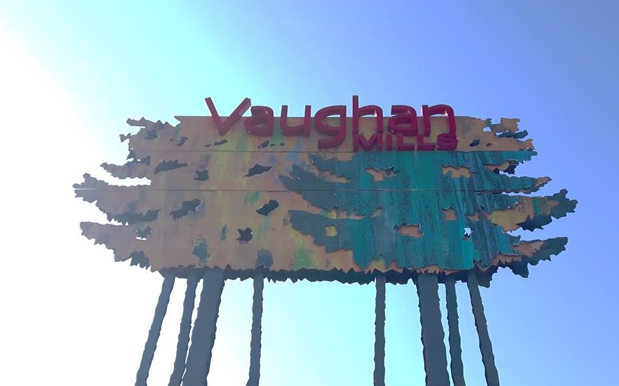
Vaughan, ON, incorporated as a city in 1991, population 323,103 (2021 census), 306,233 (2016 census). The City of Vaughan — which includes the five constituent communities of Maple, Kleinburg, Concord, Woodbridge and part of Thornhill — is located in the York regional municipality, next to the northwest boundary of metropolitan Toronto. Traditionally an agricultural and milling community, Vaughan’s economy diversified over the latter half of the 20th century as immigration increased and the township developed into a city. Today, Vaughan is a multicultural community with a growing metropolitan core.
"https://d3d0lqu00lnqvz.cloudfront.net/media/media/c51ebfa2-7e27-4826-aad3-bcb5814f2ad4.jpg" // resources/views/front/categories/view.blade.php
https://d3d0lqu00lnqvz.cloudfront.net/media/media/c51ebfa2-7e27-4826-aad3-bcb5814f2ad4.jpg