
Browse "Cities & Populated Places"
-
Article
Sainte-Anne-des-Plaines
The serene country atmosphere that surrounds Sainte-Anne-des-Plaines is complemented by the rich architectural heritage that is to be found in the city centre.
"https://thecanadianencyclopedia.ca/images/tce_placeholder.jpg?v=e9dca980c9bdb3aa11e832e7ea94f5d9" // resources/views/front/categories/view.blade.php
https://thecanadianencyclopedia.ca/images/tce_placeholder.jpg?v=e9dca980c9bdb3aa11e832e7ea94f5d9
-
Article
Sainte-Julie
Sainte-Julie is mainly a residential city that prides itself on being "the city in the country.
"https://thecanadianencyclopedia.ca/images/tce_placeholder.jpg?v=e9dca980c9bdb3aa11e832e7ea94f5d9" // resources/views/front/categories/view.blade.php
https://thecanadianencyclopedia.ca/images/tce_placeholder.jpg?v=e9dca980c9bdb3aa11e832e7ea94f5d9
-
Article
Salaberry-de-Valleyfield
Salaberry-de-Valleyfield draws its labour force from the local population and its history is marked by often violent labour disputes (see COMPANY TOWNS). Originally (1874) it was called Salaberry, in honour of Charles d'Irumberry de SALABERRY.
"https://thecanadianencyclopedia.ca/images/tce_placeholder.jpg?v=e9dca980c9bdb3aa11e832e7ea94f5d9" // resources/views/front/categories/view.blade.php
https://thecanadianencyclopedia.ca/images/tce_placeholder.jpg?v=e9dca980c9bdb3aa11e832e7ea94f5d9
-
Article
Salmo
Salmo, BC, incorporated as a village in 1946, population 1139 (2011c), 1007 (2006c). The Village of Salmo is located in the Selkirk Mountains on the Salmo River at its junction with Erie Creek, 24 km north of the United States border.
"https://thecanadianencyclopedia.ca/images/tce_placeholder.jpg?v=e9dca980c9bdb3aa11e832e7ea94f5d9" // resources/views/front/categories/view.blade.php
https://thecanadianencyclopedia.ca/images/tce_placeholder.jpg?v=e9dca980c9bdb3aa11e832e7ea94f5d9
-
Article
Salmon Arm
Salmon Arm, British Columbia, incorporated as a city in 2005, population 17,706 (2016 census), 17,464 (2011 census). The city of Salmon Arm is located at the head of the southwestern arm of Shuswap Lake, also called Salmon Arm, 110 km east of Kamloops.
"https://d3d0lqu00lnqvz.cloudfront.net/media/media/13d5ba26-c992-4341-99fa-c71c6fe1dc4f.jpg" // resources/views/front/categories/view.blade.php
https://d3d0lqu00lnqvz.cloudfront.net/media/media/13d5ba26-c992-4341-99fa-c71c6fe1dc4f.jpg
-
Article
Samson Cree Nation
Samson Cree Nation (nîpisîhkopâhk or “at willow grove” in Cree) is one of four bands that make up the area of Maskwacis (meaning Bear Hills in Cree), Alberta, along with Louis Bull Tribe, Montana First Nation and the Ermineskin Cree Nation. The nation is located in Treaty 6 territory and is the second largest band in Alberta. As of February 2026, the registered population was 9,596, with 6,521 members living on Samson Cree Nation’s reserve and 2,463 members living off-reserve. The nation is made up of Plains Cree people with Plains Cree being the dominant language.
"https://thecanadianencyclopedia.ca/images/tce_placeholder.jpg?v=e9dca980c9bdb3aa11e832e7ea94f5d9" // resources/views/front/categories/view.blade.php
https://thecanadianencyclopedia.ca/images/tce_placeholder.jpg?v=e9dca980c9bdb3aa11e832e7ea94f5d9
-
Article
Sandon
Silver was found in 1891 and a rush followed, with thousands of prospectors staking the silver-bearing slopes. By 1895 Sandon was a thriving town and the terminus of 2 railways.
"https://thecanadianencyclopedia.ca/images/tce_placeholder.jpg?v=e9dca980c9bdb3aa11e832e7ea94f5d9" // resources/views/front/categories/view.blade.php
https://thecanadianencyclopedia.ca/images/tce_placeholder.jpg?v=e9dca980c9bdb3aa11e832e7ea94f5d9
-
Article
Sanikiluaq
Sanikiluaq, Nunavut, incorporated as a hamlet in 1976, population 812 (2011c), 744 (2006c).
"https://thecanadianencyclopedia.ca/images/tce_placeholder.jpg?v=e9dca980c9bdb3aa11e832e7ea94f5d9" // resources/views/front/categories/view.blade.php
https://thecanadianencyclopedia.ca/images/tce_placeholder.jpg?v=e9dca980c9bdb3aa11e832e7ea94f5d9
-
Article
Sarnia
Sarnia, Ontario, incorporated as a city in 1914, population 71,594 (2016 c), 72,366 (2011 c). The City of Sarnia is located at the convergence of the St. Clair River and Lake Huron, 100 km west of London. A railway tunnel beneath the St. Clair and a highway bridge from nearby Point Edward connect Sarnia with Port Huron, Michigan. Sarnia is a major centre for the petrochemical industry and the southern terminus of an oil pipeline from Alberta. It was also the home of Alexander Mackenzie, first Liberal prime minister of Canada.
"https://d3d0lqu00lnqvz.cloudfront.net/media/media/35d2cb6f-0ea1-4258-9795-68b7ab247e24.jpg" // resources/views/front/categories/view.blade.php
https://d3d0lqu00lnqvz.cloudfront.net/media/media/35d2cb6f-0ea1-4258-9795-68b7ab247e24.jpg
-
Article
Saskatoon
Saskatoon, Saskatchewan, incorporated as a city in 1906, population 266,141 (2021 census), 247,201 (2016 census). The City of Saskatoon, the largest city in Saskatchewan, is situated in rolling parklands on the banks of the northward-flowing South Saskatchewan River, 352 km northwest of Regina. It serves as regional centre for the northern prairies and for central and northern Saskatchewan. It is noted for its extensive riverbank parks and trails, wide tree-lined streets and attractive University of Saskatchewan campus.
"https://d3d0lqu00lnqvz.cloudfront.net/media/media/c4ed4d03-e017-484f-b344-935c8f3295e8.jpg" // resources/views/front/categories/view.blade.php
https://d3d0lqu00lnqvz.cloudfront.net/media/media/c4ed4d03-e017-484f-b344-935c8f3295e8.jpg
-
Article
Scarborough
Scarborough, Ontario, former municipality, now a part of the city of Toronto. Scarborough is located on Lake Ontario and makes up the eastern part of the city. It was incorporated as a township in 1850 and as a city in 1983. In 1998, the provincial government, under the leadership of Premier Mike Harris, amalgamated six municipalities — Etobicoke, York, East York, North York, Scarborough and Toronto — to form the City of Toronto, a single municipality.
"https://d3d0lqu00lnqvz.cloudfront.net/media/media/f108614c-795e-4be6-a573-a66025a1a7e8.jpg" // resources/views/front/categories/view.blade.php
https://d3d0lqu00lnqvz.cloudfront.net/media/media/f108614c-795e-4be6-a573-a66025a1a7e8.jpg
-
Article
Schefferville
Schefferville, Quebec, incorporated as a town in 1955, population 155 (2016 census), 213 (2011 census). Schefferville is located between Knob and Pearce Lakes, on Quebec’s border with Labrador, 510 km north of Sept-Îles.
"https://d3d0lqu00lnqvz.cloudfront.net/media/new_article_images/Schefferville/Schefferville_2013.jpg" // resources/views/front/categories/view.blade.php
https://d3d0lqu00lnqvz.cloudfront.net/media/new_article_images/Schefferville/Schefferville_2013.jpg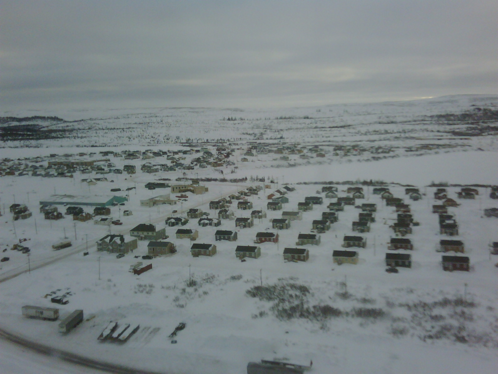
-
Article
Sechelt
Sechelt, BC, incorporated as a district municipality in 1986, population 9291 (2011c), 8454 (2006c). The District of Sechelt is located on the Sunshine Coast of British Columbia north of Vancouver on the Strait of GEORGIA. The community is named for the Sechelt who inhabit the area.
"https://d3d0lqu00lnqvz.cloudfront.net/media/media/d6cba941-1fb0-4c1a-98b3-2eb3969ed279.jpg" // resources/views/front/categories/view.blade.php
https://d3d0lqu00lnqvz.cloudfront.net/media/media/d6cba941-1fb0-4c1a-98b3-2eb3969ed279.jpg
-
Article
Sechelt Peninsula
The Sechelt Peninsula, approximately 350 km2, is part of a popular cottage area and yachting centre in British Columbia known as the "Sunshine Coast." Isolated from nearby Vancouver, BC, by Howe Sound and the Coast Mountains, its coast is linked by ferries with Vancouver via Horseshoe Bay and with Powell River via Saltery Bay.
"https://d3d0lqu00lnqvz.cloudfront.net/media/media/4a729b12-6f87-42d2-914e-96163d8c8ce3.jpg" // resources/views/front/categories/view.blade.php
https://d3d0lqu00lnqvz.cloudfront.net/media/media/4a729b12-6f87-42d2-914e-96163d8c8ce3.jpg
-
Article
Selkirk
Selkirk, Manitoba, incorporated as a town in 1882 and as a city in 1998, population 10,504 (2021 census), 10,278 (2016 census). The City of Selkirk is located on the west bank of the Red River, 29 km north of Winnipeg. The city was named after Thomas Douglas, Fifth Earl of Selkirk.
"https://thecanadianencyclopedia.ca/images/tce_placeholder.jpg?v=e9dca980c9bdb3aa11e832e7ea94f5d9" // resources/views/front/categories/view.blade.php
https://thecanadianencyclopedia.ca/images/tce_placeholder.jpg?v=e9dca980c9bdb3aa11e832e7ea94f5d9