Share on Facebook
 Share on X
 Share by Email
 Share on Google Classroom
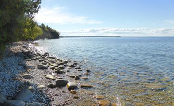
Lake of the Woods, 4,350 km2 (of which 3,149 km2 are in Canada), elevation 323 m. The surroundings of the lake were originally inhabited by Cree, Ojibwe and Sioux.
Description
Lake of the Woods is fed by Rainy River from the south and drained to the northwest by the Winnipeg River; it is a remnant of former glacial Lake Agassiz. Its south shore is regular, low and sandy, contrasting with the granite edge, myriad channels, peninsulas and 14,632 islands of the north shore. The lake's islands are wooded, but the name is likely a mistranslation of the Ojibwe name Pikwedina Sagainan, meaning "inland lake of the sand hills" (see Anishinaabemowin: Ojibwe Language).
The Canada-United States border runs north-northwest from the mouth of Rainy River across the lake, leaving a small peninsula of US territory above the 49th parallel.
History
The French explorer Jacques de Noyon reached the lake in 1688, and Jean-Baptiste Gaultier de La Vérendrye built Fort Saint-Charles on the north shore in 1732. Thrust into the lake from the east is Aulneau Peninsula, named for the Jesuit priest Jean-Pierre Aulneau (1705–36) who, along with La Vérendrye and 19 others, was killed on an island in the lake by Sioux warriors.
The lake was part of the main fur-trade route, and voyageurs frequently lost their way among its islands. Cree, Ojibwe and Sioux lived in the area first, and rock paintings have been found at several sites. About 2,000 Indigenous peoples still live around the lake in numerous reserves.
Today, this scenic lake attracts a thriving tourist trade. In early August, sailboats from Canada, Britain and the United States take part in the LOWISA Regatta (Lake of the Woods International Sailing Association), a 7-day race from Kenora around the lake.