
Browse "Places"
-
Article
Parliament Hill
Parliament Hill is a nine-hectare (0.09 km2) site in downtown Ottawa. It is home to Canada’s Parliament Buildings, the seat of the country’s federal government. Parliament Hill’s open grounds — a rarity among national parliaments — provide a place to gather for celebration or protest and are a National Historic Site. An excellent example of the gothic revival architecture style, the Parliament Buildings — Parliament (Centre Block) and two office buildings (East and West blocks) — officially opened on 6 June 1866. The Library of Parliament is the only part of the original Centre Block to have survived a fire in 1916. A Memorial Chamber and Peace Tower were added to the rebuilt Centre Block in honour of fallen First World War soldiers. The Centennial Flame was added to the grounds to mark Canada’s centennial in 1967. A $4.5–5 billion project to restore the Parliament Buildings began in 2002 and is due to be finished by 2031.
"https://d3d0lqu00lnqvz.cloudfront.net/media/media/dbd84edd-1c5c-4e10-ba3f-8b0c546b08c7.jpg" // resources/views/front/categories/view.blade.php
https://d3d0lqu00lnqvz.cloudfront.net/media/media/dbd84edd-1c5c-4e10-ba3f-8b0c546b08c7.jpg
-
Article
Parrsboro
Parrsboro, NS, incorporated as a town in 1889, population 1305 (2011c), 1401 (2006c). The Town of Parrsboro, located where the Parrsboro River meets the MINAS BASIN.
"https://thecanadianencyclopedia.ca/images/tce_placeholder.jpg?v=e9dca980c9bdb3aa11e832e7ea94f5d9" // resources/views/front/categories/view.blade.php
https://thecanadianencyclopedia.ca/images/tce_placeholder.jpg?v=e9dca980c9bdb3aa11e832e7ea94f5d9
-
Article
Parry Channel
Parry Channel is a sea passage running east to west through the arctic islands.
"https://thecanadianencyclopedia.ca/images/tce_placeholder.jpg?v=e9dca980c9bdb3aa11e832e7ea94f5d9" // resources/views/front/categories/view.blade.php
https://thecanadianencyclopedia.ca/images/tce_placeholder.jpg?v=e9dca980c9bdb3aa11e832e7ea94f5d9
-
Article
Parry Islands
The Parry Islands are a group of high arctic islands comprising Melville, Bathurst and Cornwallis islands, as well as a number of smaller ones. Melville is the largest of the 3 main islands and is also the highest, exceeding 1000 m in places.
"https://thecanadianencyclopedia.ca/images/tce_placeholder.jpg?v=e9dca980c9bdb3aa11e832e7ea94f5d9" // resources/views/front/categories/view.blade.php
https://thecanadianencyclopedia.ca/images/tce_placeholder.jpg?v=e9dca980c9bdb3aa11e832e7ea94f5d9
-
Article
Parry Sound
Parry Sound, Ont, incorporated as a town in 1887, population 6191 (2011c), 5818 (2006c). The Town of Parry Sound is located on the eastern side of GEORGIAN BAY, 225 km north of Toronto. The name honours British explorer Sir
"https://thecanadianencyclopedia.ca/images/tce_placeholder.jpg?v=e9dca980c9bdb3aa11e832e7ea94f5d9" // resources/views/front/categories/view.blade.php
https://thecanadianencyclopedia.ca/images/tce_placeholder.jpg?v=e9dca980c9bdb3aa11e832e7ea94f5d9
-
Article
Partridge Island
Partridge Island is located in the Bay of Fundy, about 1 km from the shoreline and the city of Saint John, New Brunswick. The island was set aside as a quarantine station in 1785 and operated as such between 1830 and 1941. Many immigrants arriving to Canada by ship, including thousands of Irish in 1847, were isolated on the island before being allowed to enter the country. This was done in an effort to prevent the spread of infectious diseases common on overcrowded vessels. In 1974, the Partridge Island quarantine station was designated a national historic site. Other important events are associated with the island, including the installation of the world’s first steam-operated fog alarm in 1859 (see also Robert Foulis).
"https://d3d0lqu00lnqvz.cloudfront.net/media/media/0332fe7a-6266-457b-b839-06a558ff5047.jpg" // resources/views/front/categories/view.blade.php
https://d3d0lqu00lnqvz.cloudfront.net/media/media/0332fe7a-6266-457b-b839-06a558ff5047.jpg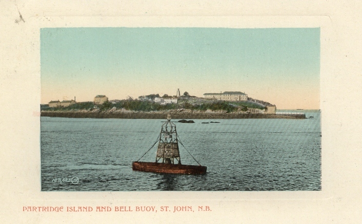
-
Article
Pasadena
Pasadena, NL, incorporated as a town in 1955, population 3352 (2011c), 3180 (2006c). The Town of Pasadena is situated on the shores of Deer Lake in the Humber Valley region of western Newfoundland, 25 km from the seaport and paper-milling centre of Corner Brook.
"https://thecanadianencyclopedia.ca/images/tce_placeholder.jpg?v=e9dca980c9bdb3aa11e832e7ea94f5d9" // resources/views/front/categories/view.blade.php
https://thecanadianencyclopedia.ca/images/tce_placeholder.jpg?v=e9dca980c9bdb3aa11e832e7ea94f5d9
-
Article
Passamaquoddy Bay
Passamaquoddy Bay is a small inlet near the mouth of the Bay of Fundy. Its mouth is restricted by a chain of islands, including Deer and Campobello, and strong tides (range 8.3 m) prevail in the region.
"https://thecanadianencyclopedia.ca/images/tce_placeholder.jpg?v=e9dca980c9bdb3aa11e832e7ea94f5d9" // resources/views/front/categories/view.blade.php
https://thecanadianencyclopedia.ca/images/tce_placeholder.jpg?v=e9dca980c9bdb3aa11e832e7ea94f5d9
-
Article
Paulatuk
Paulatuk, NWT, incorporated as a hamlet in 1987, population 298 (2021 census), 265 (2016 census). The Hamlet of Paulatuk, also known as Paulatuuq, dates back to the early 1920s when several Inuit settled at this site on Darnley Bay. The name Paulatuk means "place of coal" or "soot of coal" in Inuvialuktun and refers to the coal early settlers found nearby and used for heating. Paulatuk is known as the Southwind Capital of the Arctic.
"https://d3d0lqu00lnqvz.cloudfront.net/paulatuk/Paulatuk.jpg" // resources/views/front/categories/view.blade.php
https://d3d0lqu00lnqvz.cloudfront.net/paulatuk/Paulatuk.jpg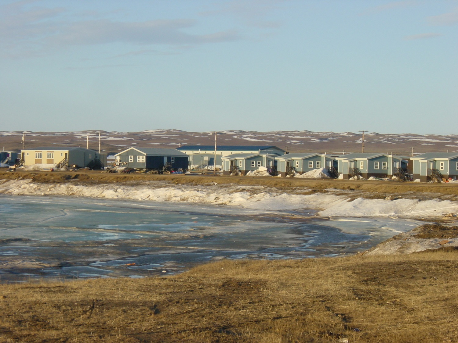
-
Article
Peace River
Peace River, 1,923 km long, is one of the principal tributaries of the Mackenzie River system. The name of the river refers to a settlement between Cree and Dane-Zaa (Beaver) warring parties around 1781 at Peace Point at the lower portion of the river. The Dane-Zaa word for the river is unchaga, meaning “big river”; the Cree word for the settlement there is sâkitawâhk.
"https://d3d0lqu00lnqvz.cloudfront.net/media/media/1086px-Sagitawa_Lookout,_Peace_River,_Alberta.jpg" // resources/views/front/categories/view.blade.php
https://d3d0lqu00lnqvz.cloudfront.net/media/media/1086px-Sagitawa_Lookout,_Peace_River,_Alberta.jpg
-
Article
Peace River (Alberta)
Peace River, Alta, incorporated as a town in 1919, population 6744 (2011c), 6315 (2006c). The Town of Peace River is located near the confluence of the Peace and Smoky rivers. It was next to this confluence that Alexander Mackenzie and his party wintered at a site they called Fort Fork during their famous journey to the Pacific Ocean of 1792-93.
"https://d3d0lqu00lnqvz.cloudfront.net/media/media/1086px-Sagitawa_Lookout,_Peace_River,_Alberta.jpg" // resources/views/front/categories/view.blade.php
https://d3d0lqu00lnqvz.cloudfront.net/media/media/1086px-Sagitawa_Lookout,_Peace_River,_Alberta.jpg
-
Article
Peace River Lowland
The Peace River Lowland is a gently rolling lowland without clearly defined outer boundaries, extending east of the Rocky Mountains on both sides of the Peace River, sloping downward to the north and east.
"https://d3d0lqu00lnqvz.cloudfront.net/media/media/13c13382-db21-45b1-a110-45d06d282f6e.jpg" // resources/views/front/categories/view.blade.php
https://d3d0lqu00lnqvz.cloudfront.net/media/media/13c13382-db21-45b1-a110-45d06d282f6e.jpg
-
Article
Peachland
Peachland, BC, incorporated as a district municipality in 1909, population 5200 (2011c), 4883 (2006c). The District of Peachland is located on the west shore of OKANAGAN LAKE, 25 km south of KELOWNA.
"https://d3d0lqu00lnqvz.cloudfront.net/media/media/ee63257d-2328-4e59-914e-6e496c640a51.jpg" // resources/views/front/categories/view.blade.php
https://d3d0lqu00lnqvz.cloudfront.net/media/media/ee63257d-2328-4e59-914e-6e496c640a51.jpg
-
Article
Peggy's Cove
Peggy's Cove, Nova Scotia, Unincorporated Place. Peggy's Cove is a small, picturesque fishing community located 43 km south of Halifax, on eastern St. Margarets Bay. It is known for its iconic lighthouse and massive granite boulders.
"https://d3d0lqu00lnqvz.cloudfront.net/peggyscove/peggy-s-cove-1.jpg" // resources/views/front/categories/view.blade.php
https://d3d0lqu00lnqvz.cloudfront.net/peggyscove/peggy-s-cove-1.jpg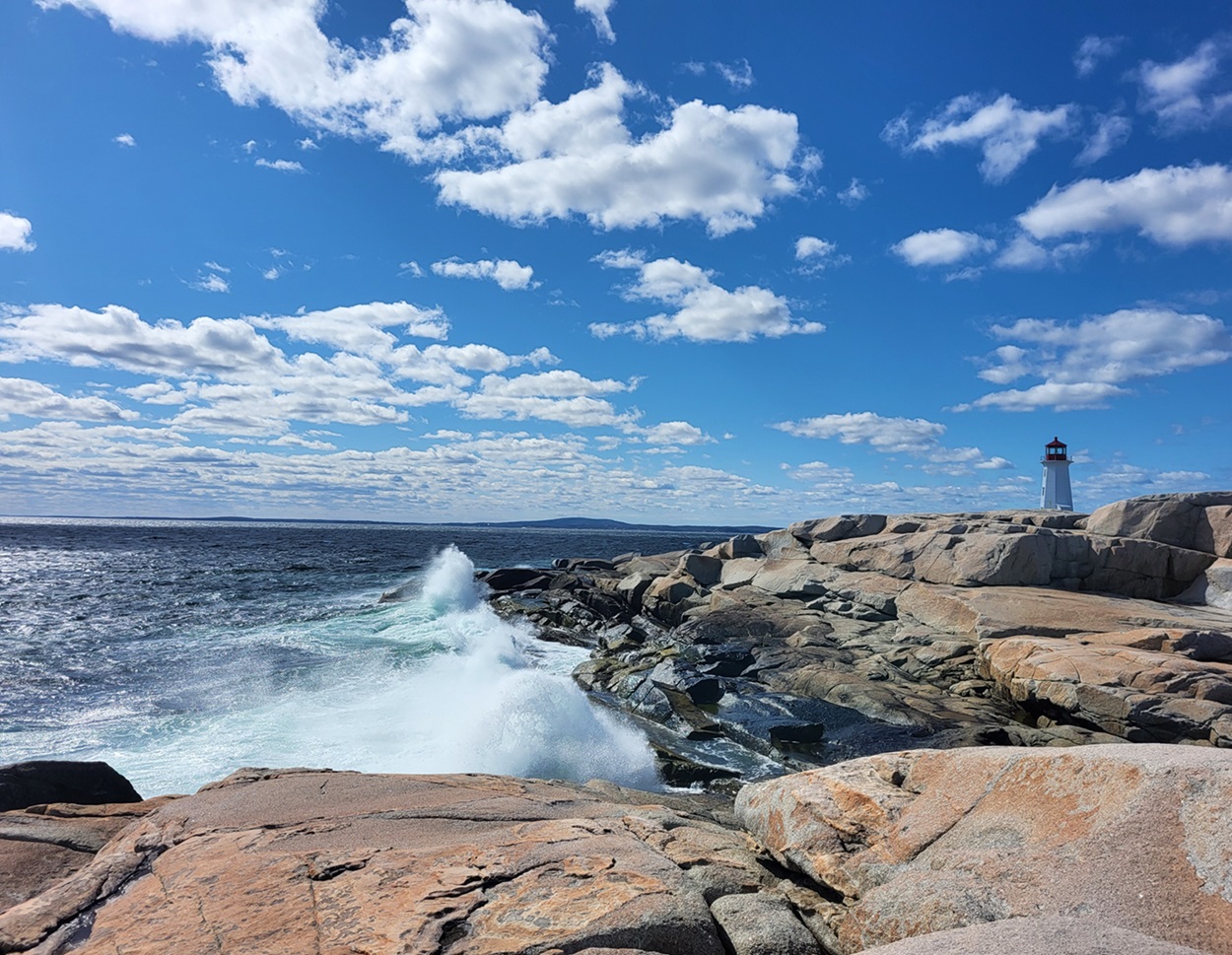
-
Article
Pelham
The rural-agricultural environment includes the Short Hills, vineyards, orchards and Canada's oldest sugar maple tree. There are sand quarries on the Fonthill Kame.
"https://thecanadianencyclopedia.ca/images/tce_placeholder.jpg?v=e9dca980c9bdb3aa11e832e7ea94f5d9" // resources/views/front/categories/view.blade.php
https://thecanadianencyclopedia.ca/images/tce_placeholder.jpg?v=e9dca980c9bdb3aa11e832e7ea94f5d9