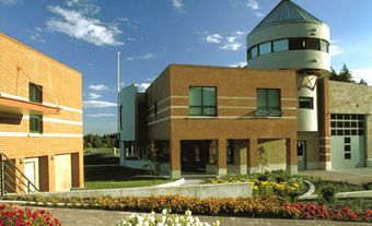
Peachland, BC, incorporated as a district municipality in 1909, population 5200 (2011c), 4883 (2006c). The District of Peachland is located on the west shore of Okanagan Lake, 25 km south of Kelowna. Peachland was named by John M. Robinson, a land developer, after he tasted the peaches grown in the area. In 1889, he purchased and subdivided land for a townsite and fruit lots. He later founded 2 other Okanagan Valley communities, Summerland and Naramata.
Peachland's early economy was based on the fruit industry, logging and sawmills, and the mining of copper and silver. Each of these industries has experienced a decline. The logging and sawmilling industry declined as the sawmills were sold to larger companies and then relocated to Kelowna. In 1970 the Brenda Mine, an open-pit copper mine, was opened and operated for 20 years. The closure of the mine caused economic hardship for the town. The fruit industry, although still a significant economic activity, is also declining as production costs rise and available land decreases. Several vineyards and wineries are located in the area.
Peachland is now primarily a retirement and bedroom community sustained by tourism and local services. It is thought that the lake creature Ogopogo lives across the lake from Peachland.

 Share on Facebook
 Share on X
 Share by Email
 Share on Google Classroom

