
Browse "Places"
-
Article
Fort Erie National Historic Site of Canada
Fort Erie National Historic Site recognizes a particularly strategic site during the War of 1812 at the entrance to the Niagara River from Lake Erie at the southeast corner of the Niagara Peninsula.
"https://thecanadianencyclopedia.ca/images/tce_placeholder.jpg?v=e9dca980c9bdb3aa11e832e7ea94f5d9" // resources/views/front/categories/view.blade.php
https://thecanadianencyclopedia.ca/images/tce_placeholder.jpg?v=e9dca980c9bdb3aa11e832e7ea94f5d9
-
Article
Fort Frances
Fort Frances, Ontario, incorporated as a town in 1903, population 7952 (2011c), 8103 (2006c). The Town of Fort Frances is located in northwestern Ontario at the west end of RAINY LAKE, where it drains into Rainy River.
"https://thecanadianencyclopedia.ca/images/tce_placeholder.jpg?v=e9dca980c9bdb3aa11e832e7ea94f5d9" // resources/views/front/categories/view.blade.php
https://thecanadianencyclopedia.ca/images/tce_placeholder.jpg?v=e9dca980c9bdb3aa11e832e7ea94f5d9
-
Article
Fort Frontenac
Frontenac reoccupied the site, rebuilding the fort in 1695, and the post became known as Fort Frontenac. Reinforced by troops under François-Charles de Bourlamaque and later the Marquis de MONTCALM, it nevertheless fell to the British under John Bradstreet in August 1758.
"https://d3d0lqu00lnqvz.cloudfront.net/media/media/224b2211-a1a9-4b89-888f-fab9972af144.jpg" // resources/views/front/categories/view.blade.php
https://d3d0lqu00lnqvz.cloudfront.net/media/media/224b2211-a1a9-4b89-888f-fab9972af144.jpg
-
Article
Fort George and Buckingham House
Fort George and Buckingham House, located 13 km southeast of Elk Point, Alta, were competing trading posts operated by the North West Company and the Hudson's Bay Company, respectively.
"https://thecanadianencyclopedia.ca/images/tce_placeholder.jpg?v=e9dca980c9bdb3aa11e832e7ea94f5d9" // resources/views/front/categories/view.blade.php
https://thecanadianencyclopedia.ca/images/tce_placeholder.jpg?v=e9dca980c9bdb3aa11e832e7ea94f5d9
-
Article
Fort George National Historic Site of Canada
Fort George National Historic Site and Battlefield of Fort George National Historic Site in the town of Niagara-on-the-Lake, Ont, were designated in 1921 by the Historic Sites and Monuments Board of Canada.
"https://thecanadianencyclopedia.ca/images/tce_placeholder.jpg?v=e9dca980c9bdb3aa11e832e7ea94f5d9" // resources/views/front/categories/view.blade.php
https://thecanadianencyclopedia.ca/images/tce_placeholder.jpg?v=e9dca980c9bdb3aa11e832e7ea94f5d9
-
Article
Fort Good Hope
Fort Good Hope, NWT, incorporated as a charter community in 1995, population 515 (2011c), 557 (2006c).
"https://d3d0lqu00lnqvz.cloudfront.net/media/media/1f4ae5ba-ddad-4d14-bd8f-f108e98c30af.jpg" // resources/views/front/categories/view.blade.php
https://d3d0lqu00lnqvz.cloudfront.net/media/media/1f4ae5ba-ddad-4d14-bd8f-f108e98c30af.jpg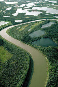
-
Article
Fort Haldimand
Fort Haldimand, located on the west promontory of Carleton Island at the east end of Lake Ontario, about 16 km offshore from Kingston, Ontario, was built by the British in 1778 during the American Revolution.
"https://thecanadianencyclopedia.ca/images/tce_placeholder.jpg?v=e9dca980c9bdb3aa11e832e7ea94f5d9" // resources/views/front/categories/view.blade.php
https://thecanadianencyclopedia.ca/images/tce_placeholder.jpg?v=e9dca980c9bdb3aa11e832e7ea94f5d9
-
Article
Fort Henry
Fort Henry, KINGSTON, Ont, was originally built during the WAR OF 1812 on Point Henry, beside Lake Ontario, to guard the outlet to the St Lawrence River and the Kingston Navy Yards.
"https://d3d0lqu00lnqvz.cloudfront.net/media/media/c4427c9c-96dd-4f5c-bb92-6c22ac423cb3.jpg" // resources/views/front/categories/view.blade.php
https://d3d0lqu00lnqvz.cloudfront.net/media/media/c4427c9c-96dd-4f5c-bb92-6c22ac423cb3.jpg
-
Article
Fort la Reine
Fort la Reine is the name used for a series of early French fur-trade posts located west of Winnipeg on the Assiniboine River. The original fort was established in 1738 by Pierre Gaultier de Varennes et de La Vérendrye and his sons, independent fur traders and explorers.
"https://thecanadianencyclopedia.ca/images/tce_placeholder.jpg?v=e9dca980c9bdb3aa11e832e7ea94f5d9" // resources/views/front/categories/view.blade.php
https://thecanadianencyclopedia.ca/images/tce_placeholder.jpg?v=e9dca980c9bdb3aa11e832e7ea94f5d9
-
Article
Fort Langley
Fort Langley, established 1827 on the FRASER RIVER, 32 km east of VANCOUVER near present-day LANGLEY, BC, was important in the province's development until the post's abandonment in 1886. Part of a network of trading posts
"https://d3d0lqu00lnqvz.cloudfront.net/media/media/6525ecf2-03d1-4023-828e-a5e946d649f7.jpg" // resources/views/front/categories/view.blade.php
https://d3d0lqu00lnqvz.cloudfront.net/media/media/6525ecf2-03d1-4023-828e-a5e946d649f7.jpg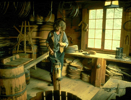
-
Article
Fort Liard
Fort Liard, NWT, incorporated as a hamlet in 1987, population 536 (2011c), 583 (2006c). The Hamlet of Fort Liard is located on the south bank of the Liard River, 544 km by air southwest of Yellowknife and about 25 km north of the BC border.
"https://thecanadianencyclopedia.ca/images/tce_placeholder.jpg?v=e9dca980c9bdb3aa11e832e7ea94f5d9" // resources/views/front/categories/view.blade.php
https://thecanadianencyclopedia.ca/images/tce_placeholder.jpg?v=e9dca980c9bdb3aa11e832e7ea94f5d9
-
Article
Fort Mackinac
Fort Mackinac, located on Mackinac Island, is the third fort to guard the Straits of Mackinac. It was a strategic centre in the Upper Great Lakes from 1780 to 1895. The British constructed the fort from 1780 to 1781 during the American Revolution. Fort Mackinac’s position on the island’s bluffs was designed to offer a strong defensive position as well as defend the village of Mackinac and anchorage of Haldimand Bay. It was transferred to American control in 1796, captured by the British during the War of 1812, and returned to the US in 1814. It remained a military post until 1895.
"https://d3d0lqu00lnqvz.cloudfront.net/MichilimackinacIslandTreaty/Fort_Mackinac2_web.jpg" // resources/views/front/categories/view.blade.php
https://d3d0lqu00lnqvz.cloudfront.net/MichilimackinacIslandTreaty/Fort_Mackinac2_web.jpg
-
Article
Fort Macleod
Fort Macleod, Alberta, incorporated as a town in 1892, population 3,297 (2021 census), 2,967 (2016 census). The town of Fort Macleod is located on the Oldman River, 165 km south of Calgary.
"https://d3d0lqu00lnqvz.cloudfront.net/media/media/f9dc98d5-ab5b-4c22-a263-d93badedcc89.jpg" // resources/views/front/categories/view.blade.php
https://d3d0lqu00lnqvz.cloudfront.net/media/media/f9dc98d5-ab5b-4c22-a263-d93badedcc89.jpg
-
Article
Fort Malden National Historic Site of Canada
Fort Malden National Historic Site in Amherstburg, Ont, commemorates 2 forts constructed on the same site by the British on the eastern bank of the Detroit River: Fort Amherstburg, constructed from 1796-99, and Fort Malden, built between 1815 and 1842.
"https://thecanadianencyclopedia.ca/images/tce_placeholder.jpg?v=e9dca980c9bdb3aa11e832e7ea94f5d9" // resources/views/front/categories/view.blade.php
https://thecanadianencyclopedia.ca/images/tce_placeholder.jpg?v=e9dca980c9bdb3aa11e832e7ea94f5d9
-
Article
Fort McMurray
Fort McMurray, Alberta, unincorporated population centre, population 61,374 (2011c), 47,705 (2006c). Fort McMurray is the largest community in the Regional Municipality of Wood Buffalo (RMWB). It is technically known as the municipality’s “Urban Service Area” and colloquially known as “Fort Mac.” The community located near the confluence of the Athabasca and Clearwater rivers in northeastern Alberta, near the centre of the vast Athabasca oil sands deposit. Originally incorporated as a city in 1980, in 1995 Fort McMurray merged with much of the surrounding area — collectively known as Improvement District No. 143 — to create the RMWB. At 63,783 km2, the municipality is the largest in North America in terms of size, accounting for nearly 10 per cent of the province’s total area. In May 2016, Fort McMurray experienced one of the worst forest fires in Canadian history. More than 80,000 residents were evacuated and approximately 2,400 structures — about 10 per cent of the city — were destroyed.
"https://d3d0lqu00lnqvz.cloudfront.net/media/media/c51a0711-1d24-48e1-9267-7117eaa2eb47.jpg" // resources/views/front/categories/view.blade.php
https://d3d0lqu00lnqvz.cloudfront.net/media/media/c51a0711-1d24-48e1-9267-7117eaa2eb47.jpg