
Browse "Places"
-
Article
Windsor (NS)
Windsor, NS, incorporated as a town in 1878, population 3785 (2011c), 3709 (2006c). The Town of Windsor is located in central Nova Scotia, at the mouth of the Avon and St Croix rivers.
"https://d3d0lqu00lnqvz.cloudfront.net/media/media/e2f6b892-e47d-4981-9656-0c2e345b41db.jpg" // resources/views/front/categories/view.blade.php
https://d3d0lqu00lnqvz.cloudfront.net/media/media/e2f6b892-e47d-4981-9656-0c2e345b41db.jpg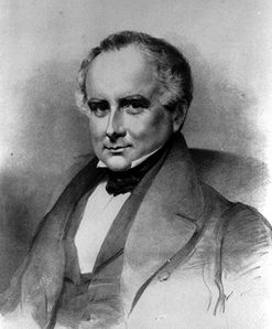
-
Article
Windsor (Ont)
Windsor, Ontario, incorporated as a city in 1892, population 217,188 (2016 census), 210,891 (2011 census). The city of Windsor is Canada’s southernmost city. It is located on the Detroit River in the extreme southwest corner of the province. Lying directly south of Detroit on the rich agricultural peninsula nestled between Lakes Erie and St. Clair, Windsor is an international gateway through which millions of foreign visitors enter the country each year.
"https://d3d0lqu00lnqvz.cloudfront.net/media/media/2979e12e-b21b-4a11-985a-0ef5de6ba61c.jpg" // resources/views/front/categories/view.blade.php
https://d3d0lqu00lnqvz.cloudfront.net/media/media/2979e12e-b21b-4a11-985a-0ef5de6ba61c.jpg
-
Article
Music in Windsor
Southern Ontario city across the Detroit River from Detroit, Mich. First settled in 1834, it was established as the western terminus of the Great Western Railway in 1854 and was incorporated as a town in 1858 and as a city in 1892.
"https://thecanadianencyclopedia.ca/images/tce_placeholder.jpg?v=e9dca980c9bdb3aa11e832e7ea94f5d9" // resources/views/front/categories/view.blade.php
https://thecanadianencyclopedia.ca/images/tce_placeholder.jpg?v=e9dca980c9bdb3aa11e832e7ea94f5d9
-
Article
Winisk River
Winisk River, 475 km long, rises in Wunnummin Lake in the Kenora District of northern Ontario.
"https://thecanadianencyclopedia.ca/images/tce_placeholder.jpg?v=e9dca980c9bdb3aa11e832e7ea94f5d9" // resources/views/front/categories/view.blade.php
https://thecanadianencyclopedia.ca/images/tce_placeholder.jpg?v=e9dca980c9bdb3aa11e832e7ea94f5d9
-
Article
Winkler
Winkler, Manitoba, incorporated as a city in 2002, population 10 670 (2011c), 9106 (2006c). The City of Winkler is located in the Pembina Valley region, 115 km southwest of Winnipeg and 22 km north of the US international boundary.
"https://thecanadianencyclopedia.ca/images/tce_placeholder.jpg?v=e9dca980c9bdb3aa11e832e7ea94f5d9" // resources/views/front/categories/view.blade.php
https://thecanadianencyclopedia.ca/images/tce_placeholder.jpg?v=e9dca980c9bdb3aa11e832e7ea94f5d9
-
Article
Winnipeg
Winnipeg, Manitoba, incorporated as a city in 1873, population 749,607 (2021 census), 705,244 (2016 census). The city of Winnipeg is the capital and largest city of Manitoba, and is located at the confluence of the Red River and Assiniboine River 100 km north of the Minnesota border. The name is derived from the Cree name for Lake Winnipeg, 65 km north, win-nipi, meaning "murky water." Winnipeg is an important economic and cultural centre for the Prairies. Lying midway between the Atlantic and Pacific Oceans, it has been called "Bull's Eye of the Dominion," and because of its location between the Canadian Shield and the prairie, "Gateway to the West."
"https://d3d0lqu00lnqvz.cloudfront.net/media/media/13f6cecb-3eb8-4e49-bb41-138036eb158b.jpg" // resources/views/front/categories/view.blade.php
https://d3d0lqu00lnqvz.cloudfront.net/media/media/13f6cecb-3eb8-4e49-bb41-138036eb158b.jpg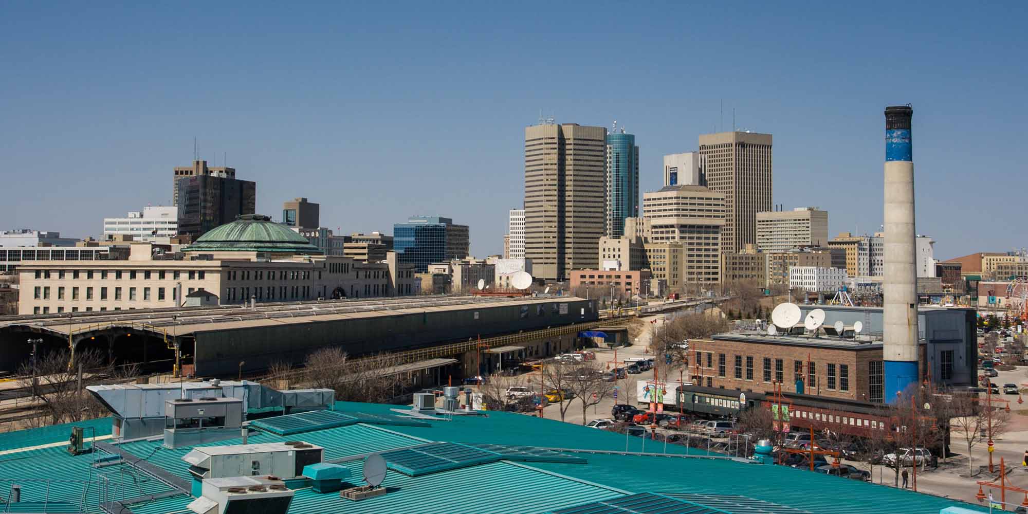
-
Article
Winnipeg Auditorium
Winnipeg Auditorium. Winnipeg's main concert hall complex from 1932, when it opened, until 1968, when it was supplanted in that function by the Manitoba Centennial Concert Hall. It was designed jointly by three architectural firms - Northwood & Chivers, Pratt & Ross, and J.N.
"https://thecanadianencyclopedia.ca/images/tce_placeholder.jpg?v=e9dca980c9bdb3aa11e832e7ea94f5d9" // resources/views/front/categories/view.blade.php
https://thecanadianencyclopedia.ca/images/tce_placeholder.jpg?v=e9dca980c9bdb3aa11e832e7ea94f5d9
-
Article
Music in Winnipeg
Manitoba's capital city, Winnipeg is located at the junction of the Red and Assiniboine rivers on a site once known to the Cree as “Murky Water.” Fort Rouge was established there in 1738 by Pierre de La Vérendrye, a fur trader and explorer.
"https://d3d0lqu00lnqvz.cloudfront.net/TCE_placeholder.png" // resources/views/front/categories/view.blade.php
https://d3d0lqu00lnqvz.cloudfront.net/TCE_placeholder.png
-
Article
Winnipeg River
Winnipeg River, 813 km long (to head of Firesteel River), issues from the north end of Lake of the Woods and flows northwest to Lake Winnipeg.
"https://thecanadianencyclopedia.ca/images/tce_placeholder.jpg?v=e9dca980c9bdb3aa11e832e7ea94f5d9" // resources/views/front/categories/view.blade.php
https://thecanadianencyclopedia.ca/images/tce_placeholder.jpg?v=e9dca980c9bdb3aa11e832e7ea94f5d9
-
Article
Wolfville
Wolfville, NS, incorporated as a town in 1893, population 4269 (2011c), 3772 (2006c). The Town of Wolfville is located on Minas Basin, 75 km northwest of Halifax.
"https://thecanadianencyclopedia.ca/images/tce_placeholder.jpg?v=e9dca980c9bdb3aa11e832e7ea94f5d9" // resources/views/front/categories/view.blade.php
https://thecanadianencyclopedia.ca/images/tce_placeholder.jpg?v=e9dca980c9bdb3aa11e832e7ea94f5d9
-
Article
Wollaston Lake
Wollaston Lake, 2681 km2, elev 398 m, lies in the wooded Shield country of NE Saskatchewan.
"https://thecanadianencyclopedia.ca/images/tce_placeholder.jpg?v=e9dca980c9bdb3aa11e832e7ea94f5d9" // resources/views/front/categories/view.blade.php
https://thecanadianencyclopedia.ca/images/tce_placeholder.jpg?v=e9dca980c9bdb3aa11e832e7ea94f5d9
-
Article
Wood Buffalo National Park
Wood Buffalo National Park (established in 1922, 44 802 km2) was established to protect the last herd of wood bison. Canada's largest national park straddles the Alberta/NWT border. It was declared a World Heritage Site in 1983.
"https://d3d0lqu00lnqvz.cloudfront.net/media/media/dad4c55e-b36d-4cf2-8e66-7da2b6cc188a.jpg" // resources/views/front/categories/view.blade.php
https://d3d0lqu00lnqvz.cloudfront.net/media/media/dad4c55e-b36d-4cf2-8e66-7da2b6cc188a.jpg
-
Article
Wood Mountain
Wood Mountain, elev 1000 m, is located about 135 km southwest of Moose Jaw, Sask, near the Forty-Ninth Parallel.
"https://thecanadianencyclopedia.ca/images/tce_placeholder.jpg?v=e9dca980c9bdb3aa11e832e7ea94f5d9" // resources/views/front/categories/view.blade.php
https://thecanadianencyclopedia.ca/images/tce_placeholder.jpg?v=e9dca980c9bdb3aa11e832e7ea94f5d9
-
Article
Woodland Cultural Centre
The Association of Iroquois and Allied Indians (AIAI), a provincial/territorial First Nations organization in Ontario, founded the Woodland Indian Cultural Education Centre (now Woodland Cultural Centre [WCC]) in 1972. The WCC works “to preserve, promote and strengthen Indigenous language, culture, art and history; bringing the story of the Hodinohsho:ni people of the Eastern Woodlands to life through innovative exhibitions and programs.” The WCC’s board of directors includes community members from the Six Nations of the Grand River First Nation, Mohawks of the Bay of Quinte (Tyendinaga Mohawk Territory) and Wahta Mohawks. The WCC was established by repurposing the Mohawk Institute, Canada’s first Indian residential school, following its closure. In 2014, the WCC launched its Save the Evidence campaign to restore the Mohawk Institute. This effort culminated in the substantial renovation and unveiling of the Mohawk Institute on 30 September 2025, Canada’s National Day for Truth and Reconciliation.
"https://d3d0lqu00lnqvz.cloudfront.net/WoodlandCulturalCentre/Woodland-Cultural-Centre_resized.jpg" // resources/views/front/categories/view.blade.php
https://d3d0lqu00lnqvz.cloudfront.net/WoodlandCulturalCentre/Woodland-Cultural-Centre_resized.jpg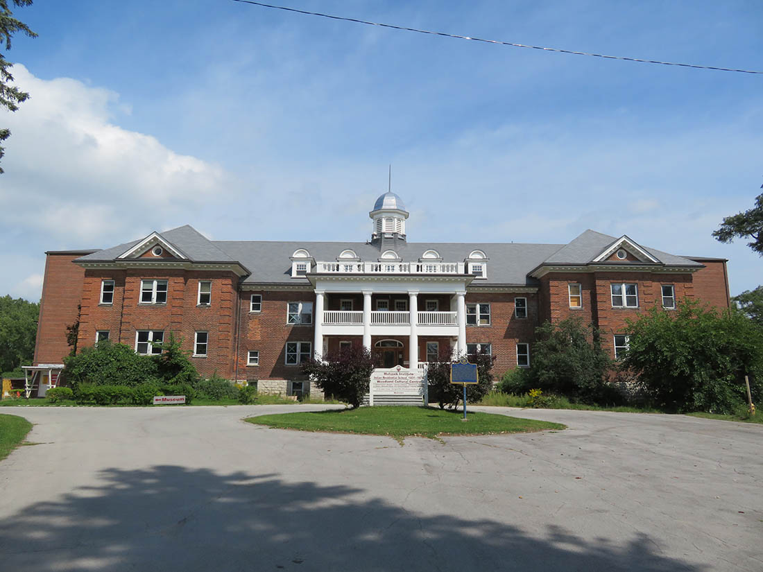
-
Article
Woodstock (NB)
Woodstock, NB, incorporated as a town in 1856, population 5254 (2011c), 5113 (2006c). The Town of Woodstock, the shire town of Carleton County, is located 103 km up the Saint John River from Fredericton, at the mouth of the Meduxnekeag River.
"https://thecanadianencyclopedia.ca/images/tce_placeholder.jpg?v=e9dca980c9bdb3aa11e832e7ea94f5d9" // resources/views/front/categories/view.blade.php
https://thecanadianencyclopedia.ca/images/tce_placeholder.jpg?v=e9dca980c9bdb3aa11e832e7ea94f5d9