
Browse "Places"
-
Article
White Pass & Yukon Route
The White Pass & Yukon Route railway was built to meet the demand for transportation to the gold fields of the Yukon River basin during the Klondike Gold Rush. Completed in 1900, it was a feat of engineering and one of the steepest railways in North America. It ran 177 km from Skagway, Alaska, to Whitehorse, Yukon. Today, tourist rail excursions run on a portion of the original line.
"https://d3d0lqu00lnqvz.cloudfront.net/media/new_article_images/WhitePassYukonRoute/WPYR_Cantilever_Bridge.jpg" // resources/views/front/categories/view.blade.php
https://d3d0lqu00lnqvz.cloudfront.net/media/new_article_images/WhitePassYukonRoute/WPYR_Cantilever_Bridge.jpg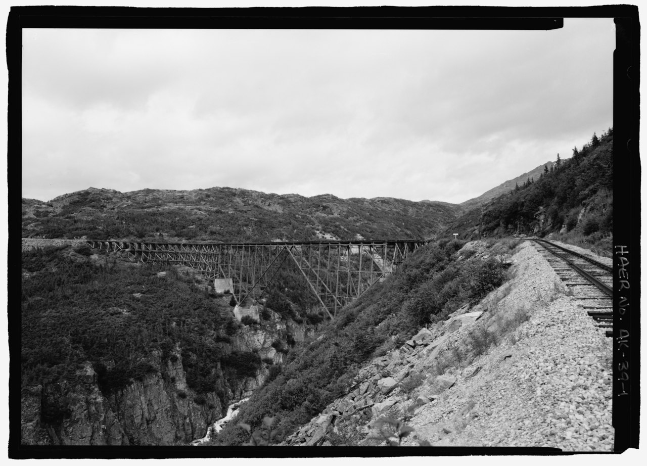
-
Article
White Rock
White Rock, BC, incorporated as a city in 1957, population 19 339 (2011c), 18 755 (2006c). The City of White Rock is 48 km by road southeast of Vancouver and is bounded on the north, east and west by Surrey. It began as a recreational resort on the shores of Semiahmoo Bay in SURREY.
"https://thecanadianencyclopedia.ca/images/tce_placeholder.jpg?v=e9dca980c9bdb3aa11e832e7ea94f5d9" // resources/views/front/categories/view.blade.php
https://thecanadianencyclopedia.ca/images/tce_placeholder.jpg?v=e9dca980c9bdb3aa11e832e7ea94f5d9
-
Article
Whitecourt
Whitecourt, Alta, incorporated as a town in 1971, population 9605 (2011c), 8971 (2006c). The Town of Whitecourt is located near the confluence of the McLeod and ATHABASCA rivers, 177 km northwest of Edmonton.
"https://thecanadianencyclopedia.ca/images/tce_placeholder.jpg?v=e9dca980c9bdb3aa11e832e7ea94f5d9" // resources/views/front/categories/view.blade.php
https://thecanadianencyclopedia.ca/images/tce_placeholder.jpg?v=e9dca980c9bdb3aa11e832e7ea94f5d9
-
Article
Whitehorse
Whitehorse, Yukon, incorporated as a city in 1950, population 28,201 (2021 census), 25,085 (2016 census). The City of Whitehorse, the capital of Yukon, is located about 87 km north of the British Columbia border.
"https://d3d0lqu00lnqvz.cloudfront.net/media/media/b714baa3-b8d8-4657-a436-7f27a8b1c819.jpg" // resources/views/front/categories/view.blade.php
https://d3d0lqu00lnqvz.cloudfront.net/media/media/b714baa3-b8d8-4657-a436-7f27a8b1c819.jpg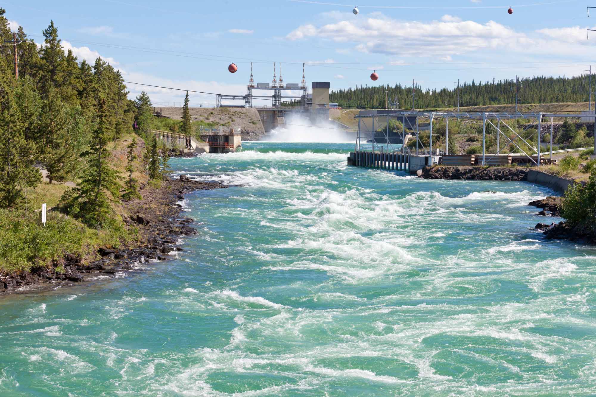
-
Article
Whiteshell Provincial Park
Whiteshell Provincial Park (established 1961, 2,737.15 km2), 105 km east of Winnipeg, Manitoba, by the Trans-Canada Highway, is Precambrian Shield country. Whiteshell is connected to Nopiming Provincial Park to the north.
"https://d3d0lqu00lnqvz.cloudfront.net/media/media/a5b2bc47-c5be-4499-b2a0-f516d71e6330.jpg" // resources/views/front/categories/view.blade.php
https://d3d0lqu00lnqvz.cloudfront.net/media/media/a5b2bc47-c5be-4499-b2a0-f516d71e6330.jpg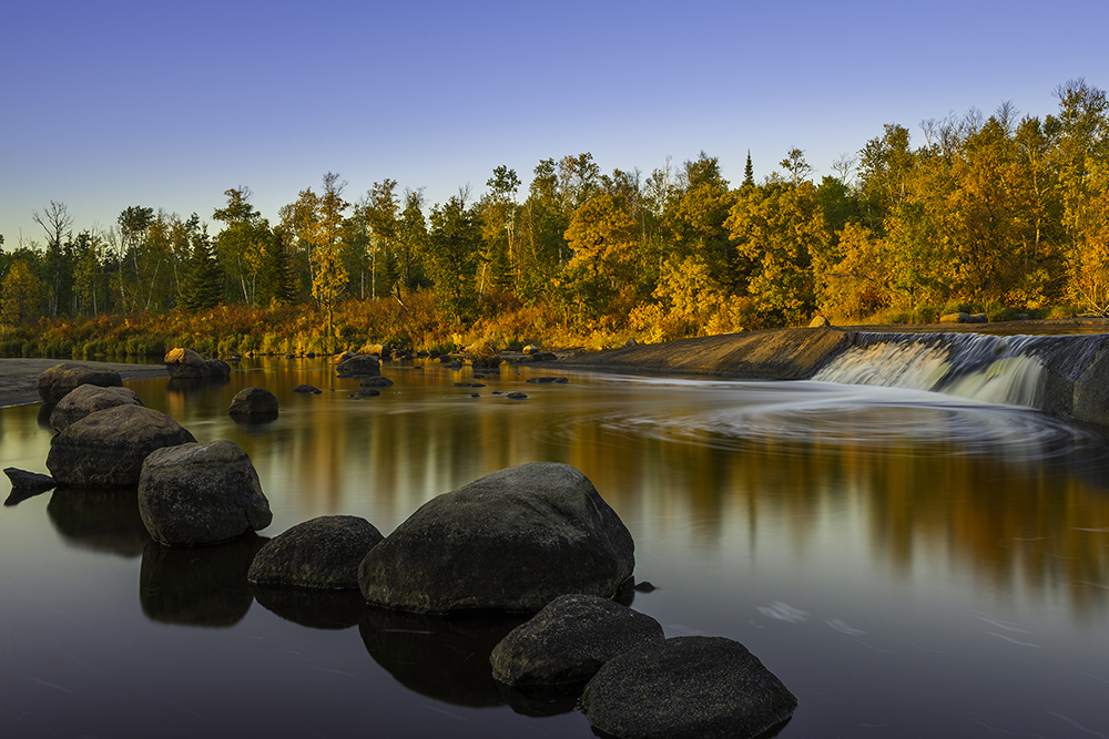
-
Article
Wiarton
Wiarton, Ont, urban area, population 2291 (2011c), 2322 (2006c). Wiarton was a town (1894-1998) until it was merged into the new town of South Bruce Peninsula (incorporated 1999) along with the townships of Albemarle and Amabel
"https://d3d0lqu00lnqvz.cloudfront.net/media/media/5ff0e2de-fcda-40e4-9cbe-b84c86365415.jpg" // resources/views/front/categories/view.blade.php
https://d3d0lqu00lnqvz.cloudfront.net/media/media/5ff0e2de-fcda-40e4-9cbe-b84c86365415.jpg
-
Article
Wiikwemkoong Unceded Territory
Wiikwemkoong Unceded Territory is a reserve located on the eastern peninsula of Manitoulin Island in Ontario. The reserve is held by the Wiikwemkoong First Nation, which is composed of Ojibwe, Odawa and Potawatomi peoples. Together, these nations form the Three Fires Confederacy. As an unceded reserve, Wiikwemkoong has not relinquished its land through treaty or other means. (See also Reserves in Ontario.) As of April 2026, the Wiikwemkoong First Nation had a registered population of 9,416, with an on-reserve population of 3,213. Formerly known as Manitoulin Island Unceded Indian Reserve, the reserve changed its name to Wiikwemkong Unceded Indian Reserve in 1968 when it amalgamated with Point Grondine First Nation and South Bay First Nation. The name was changed again, in 2014, to its current name, though the federal government still refers to the reserve as the Wikwemikong Unceded Reserve.
"https://d3d0lqu00lnqvz.cloudfront.net/media/new_article_images/Wiikwemkong/Wiikwemkong.jpg" // resources/views/front/categories/view.blade.php
https://d3d0lqu00lnqvz.cloudfront.net/media/new_article_images/Wiikwemkong/Wiikwemkong.jpg
-
Article
Wilcox
Wilcox, Sask, incorporated as a village in 1907, population 339 (2011c), 222 (2006c). The Village of Wilcox is located 42 km south of REGINA and situated midway between MOOSE JAW and WEYBURN on the Soo Line Railway.
"https://thecanadianencyclopedia.ca/images/tce_placeholder.jpg?v=e9dca980c9bdb3aa11e832e7ea94f5d9" // resources/views/front/categories/view.blade.php
https://thecanadianencyclopedia.ca/images/tce_placeholder.jpg?v=e9dca980c9bdb3aa11e832e7ea94f5d9
-
Article
Wile Carding Mill
Wile Carding Mill was established in BRIDGEWATER, NS, in 1860 and operated for over a century. In the 19th century the area around Bridgewater was an important sheep-rearing district and area farmers used the mill for carding and batting their wool. The wool was then spun or woven by farm families.
"https://thecanadianencyclopedia.ca/images/tce_placeholder.jpg?v=e9dca980c9bdb3aa11e832e7ea94f5d9" // resources/views/front/categories/view.blade.php
https://thecanadianencyclopedia.ca/images/tce_placeholder.jpg?v=e9dca980c9bdb3aa11e832e7ea94f5d9
-
Article
Wilfrid Laurier House National Historic Site of Canada
Built in 1876 in Arthabaska, Québec, this Victorian Italianate house was the personal residence of Sir Wilfrid Laurier (1841–1919). A leading national figure of his time, Laurier was the first French Canadian to become prime minister of Canada (1896 to 1911). Recognized as a National Historic Site of Canada in 1999, the house is now a museum dedicated to his memory.
"https://d3d0lqu00lnqvz.cloudfront.net/media/media/bfaa8646-486c-430f-9b6e-784a5a0488df.jpg" // resources/views/front/categories/view.blade.php
https://d3d0lqu00lnqvz.cloudfront.net/media/media/bfaa8646-486c-430f-9b6e-784a5a0488df.jpg
-
Article
Wilkie
Wilkie, Sask, incorporated as a town in 1911, population 1301 (2011c), 1222 (2006c). The Town of Wilkie is located in east-central Saskatchewan 160 km west of Saskatoon. Wilkie developed as a stopping place on the Medicine Hat
"https://d3d0lqu00lnqvz.cloudfront.net/media/media/3396144b-3b37-4b9b-891f-44674a7eaea6.jpg" // resources/views/front/categories/view.blade.php
https://d3d0lqu00lnqvz.cloudfront.net/media/media/3396144b-3b37-4b9b-891f-44674a7eaea6.jpg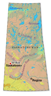
-
Article
Williams Lake
Williams Lake, BC, incorporated as a city in 1929, population 10 832 (2011c), 10 744 (2006c). The City of Williams Lake is located in the Cariboo country of central British Columbia, 545 km northeast of Vancouver.
"https://thecanadianencyclopedia.ca/images/tce_placeholder.jpg?v=e9dca980c9bdb3aa11e832e7ea94f5d9" // resources/views/front/categories/view.blade.php
https://thecanadianencyclopedia.ca/images/tce_placeholder.jpg?v=e9dca980c9bdb3aa11e832e7ea94f5d9
-
Article
Williston Lake
Williston Lake, 1761 km2, is the largest freshwater body in BC. Created in 1968 as the reservoir of the W.A.C.
"https://thecanadianencyclopedia.ca/images/tce_placeholder.jpg?v=e9dca980c9bdb3aa11e832e7ea94f5d9" // resources/views/front/categories/view.blade.php
https://thecanadianencyclopedia.ca/images/tce_placeholder.jpg?v=e9dca980c9bdb3aa11e832e7ea94f5d9
-
Article
Wilton
Wilton, Saskatchewan, incorporated as a rural municipality in 1909, population 1,629 (2016census), 1,494 (2011 census). The Rural Municipality of Wilton is located just east of Lloydminsteron the Saskatchewan-Alberta border. The main communities in the rural municipality are the town of Lashburn and the village of Marshall.
"https://thecanadianencyclopedia.ca/images/tce_placeholder.jpg?v=e9dca980c9bdb3aa11e832e7ea94f5d9" // resources/views/front/categories/view.blade.php
https://thecanadianencyclopedia.ca/images/tce_placeholder.jpg?v=e9dca980c9bdb3aa11e832e7ea94f5d9
-
Article
Windsor Hall/Salle Windsor
Later, concerts were given in the hotel's ballroom, which also bore the name Windsor Hall. Among concerts held in the ballroom known as the Ladies Ordinary of the Windsor were those by the Dubois String Quartet, who played there regularly from 1915 until 1927.
"https://d3d0lqu00lnqvz.cloudfront.net/media/media/44536990-4119-4245-a4f1-59275f935d4a.jpg" // resources/views/front/categories/view.blade.php
https://d3d0lqu00lnqvz.cloudfront.net/media/media/44536990-4119-4245-a4f1-59275f935d4a.jpg