
Browse "Places"
-
Article
Bow River
The Bow River runs through the most populated region of Alberta, intersecting cities such as Banff, Canmore, Cochrane and Calgary. It is also one of the most managed rivers in the province, with numerous dams and reservoirs located along the river, supplying water for hydroelectricity, irrigation and municipal and industrial uses. The river, as well as its tributaries and reservoirs, is also used for numerous recreational activities including world-class sport fishing. Winter snowfall at the Rocky Mountain headwaters supplies the majority of annual flow on the Bow River; however, streamflow can vary considerably from year to year and is subject to frequent periods of drought.
"https://d3d0lqu00lnqvz.cloudfront.net/media/media/38ad9246-0434-49ee-a02f-27fbdf53b780.jpg" // resources/views/front/categories/view.blade.php
https://d3d0lqu00lnqvz.cloudfront.net/media/media/38ad9246-0434-49ee-a02f-27fbdf53b780.jpg
-
Article
Bowmanville
Bowmanville, Ontario, population centre, population 39,371 (2016 census), 35,168 (2011 census). Bowmanville is located 25 km east of Toronto on Highway 401. Originally called Darlington Mills, it was renamed in the 1830s after Charles Bowman, the principal landowner. Bowmanville was incorporated as a village in 1852 and as a town in 1857. In January 1974, Bowmanville became part of the town of Newcastle (now Clarington) in the new Regional Municipality of Durham. Home of diverse manufacturers in the 19th century, Bowmanville now serves as a dormitory for Toronto and Oshawa.
"https://d3d0lqu00lnqvz.cloudfront.net/media/new_article_images/Bowmanville/POWcampBowmanville.jpg" // resources/views/front/categories/view.blade.php
https://d3d0lqu00lnqvz.cloudfront.net/media/new_article_images/Bowmanville/POWcampBowmanville.jpg
-
Article
Boyd's Cove
Boyd's Cove, in eastern Notre Dame Bay, Newfoundland, has been occupied intermittently for about 2,000 years. Beothuk pit houses dating from the late 17th or the early 18th century have yielded stone tools lying nearby European artifacts.
"https://thecanadianencyclopedia.ca/images/tce_placeholder.jpg?v=e9dca980c9bdb3aa11e832e7ea94f5d9" // resources/views/front/categories/view.blade.php
https://thecanadianencyclopedia.ca/images/tce_placeholder.jpg?v=e9dca980c9bdb3aa11e832e7ea94f5d9
-
Article
Bracebridge
Bracebridge, Ontario, incorporated as a town in 1889, population 17,305 (2021 census), 16,010 (2016 census). The Town of Bracebridge is located in the District Municipality of Muskoka, on the north branch of the Muskoka River.
"https://d3d0lqu00lnqvz.cloudfront.net/bracebridge/DENT-1881-_1.079_BRACEBRIDGE-_MUSKOKA.jpg" // resources/views/front/categories/view.blade.php
https://d3d0lqu00lnqvz.cloudfront.net/bracebridge/DENT-1881-_1.079_BRACEBRIDGE-_MUSKOKA.jpg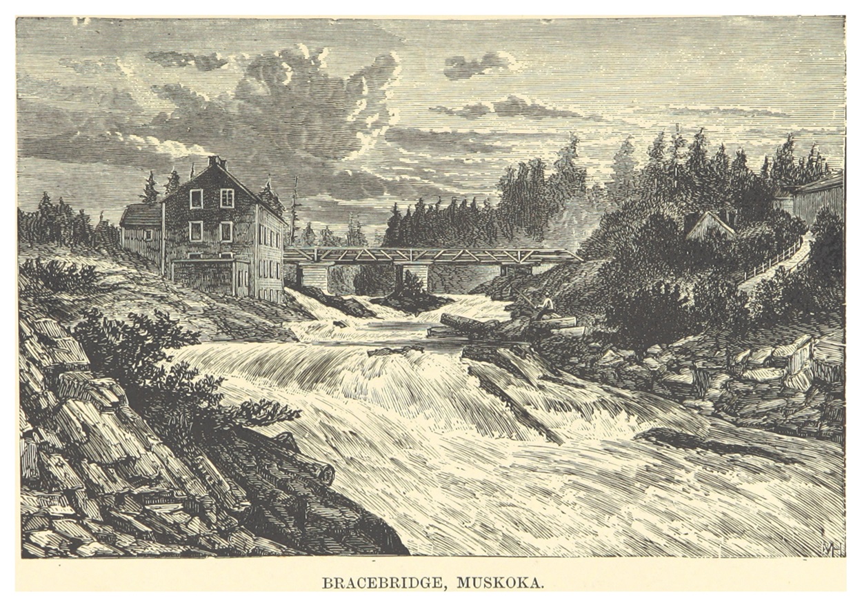
-
Article
Bradford West Gwillimbury
Bradford West Gwillimbury, Ontario, incorporated as a town in 1991, population 42,880 (2021 census), 35,325 (2016 census). The town of Bradford West Gwillimbury consists of the former town of Bradford (incorporated in 1960), most of the lands of the former township of West Gwillimbury, and a small portion of land from the township of Tecumseth. The town is located about 60 km north of downtown Toronto.
"https://d3d0lqu00lnqvz.cloudfront.net/media/media/dad4572f-2b1a-4403-8b17-6072735c63c9.jpg" // resources/views/front/categories/view.blade.php
https://d3d0lqu00lnqvz.cloudfront.net/media/media/dad4572f-2b1a-4403-8b17-6072735c63c9.jpg
-
Article
Brampton
Brampton, Ontario, incorporated as a city in 1974, population 656,480 (2021 census), 593,638 (2016 census). The city of Brampton was created by the amalgamation of the Town of Brampton, the southern half of Chinguacousy Township, and portions of the Town of Mississauga and Toronto Gore Township. Located northwest of Toronto, Brampton is part of the Regional Municipality of Peel. It is located within the Credit and Humber River watersheds. The city of Brampton is known for its ethnocultural diversity: 80.6% of the population identifies as a visible minority. Throughout history, the Brampton area has been home to different Indigenous groups, namely the Wendat (Huron), Haudenosaunee and Anishinaabeg, including the Mississaugas of the Credit. The land is covered by the Ajetance Purchase (1818).
"https://d3d0lqu00lnqvz.cloudfront.net/media/new_article_images/Brampton/1BramptonPicture.jpg" // resources/views/front/categories/view.blade.php
https://d3d0lqu00lnqvz.cloudfront.net/media/new_article_images/Brampton/1BramptonPicture.jpg
-
Article
Brandon
Brandon, Manitoba, incorporated as a city in 1882, population 51,313 (2021 census), 48,883 (2016 census). The City of Brandon, the province's second-largest city and economic hub of its southwestern region, is located on the Assiniboine River, 197 km west of Winnipeg.
"https://d3d0lqu00lnqvz.cloudfront.net/media/media/4112eb2b-9753-45c6-b355-904d9a519a46.jpg" // resources/views/front/categories/view.blade.php
https://d3d0lqu00lnqvz.cloudfront.net/media/media/4112eb2b-9753-45c6-b355-904d9a519a46.jpg
-
Article
Music in Brandon
Manitoba city on the Assiniboine River, 200 km west of Winnipeg. The first settlers arrived in 1878. Named after Brandon House, a one-time Hudson's Bay Co depot, the settlement received railway service (CPR) in 1881 and was incorporated as a city in 1882.
"https://thecanadianencyclopedia.ca/images/tce_placeholder.jpg?v=e9dca980c9bdb3aa11e832e7ea94f5d9" // resources/views/front/categories/view.blade.php
https://thecanadianencyclopedia.ca/images/tce_placeholder.jpg?v=e9dca980c9bdb3aa11e832e7ea94f5d9
-
Article
Brantford
Brantford, ON, incorporated as a city in 1877, population 97,496 (2016 census), 93,650 (2011 census). The City of Brantford is located on the Grand River, 104 km southwest of Toronto. It is home to several manufacturing industries, educational institutions and heritage sites.
"https://d3d0lqu00lnqvz.cloudfront.net/media/media/4e9bdb40-6a17-4aed-8166-559a7b871ae7.jpg" // resources/views/front/categories/view.blade.php
https://d3d0lqu00lnqvz.cloudfront.net/media/media/4e9bdb40-6a17-4aed-8166-559a7b871ae7.jpg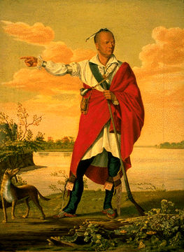
-
Article
Music in Brantford
Brantford, Ont. Ontario settlement established in 1805 on the Grand River. It was named in 1827 in honour of the Mohawk chief Joseph Brant, and incorporated as a city in 1877. The population, under 10,000 in 1867, had increased to over 66,000 by 1975.
"https://thecanadianencyclopedia.ca/images/tce_placeholder.jpg?v=e9dca980c9bdb3aa11e832e7ea94f5d9" // resources/views/front/categories/view.blade.php
https://thecanadianencyclopedia.ca/images/tce_placeholder.jpg?v=e9dca980c9bdb3aa11e832e7ea94f5d9
-
Article
Bras d'Or Lake
Bras d'Or Lake, 1099 km2, is an arm of the Atlantic Ocean occupying the centre of Cape Breton Island that nearly divides the island in two. On the north it is linked to the ocean by a narrow channel down the west side of Boularderie Island.
"https://thecanadianencyclopedia.ca/images/tce_placeholder.jpg?v=e9dca980c9bdb3aa11e832e7ea94f5d9" // resources/views/front/categories/view.blade.php
https://thecanadianencyclopedia.ca/images/tce_placeholder.jpg?v=e9dca980c9bdb3aa11e832e7ea94f5d9
-
Article
Bridgewater
Bridgewater, NS, incorporated as a town in 1899, population 8,790 (2021 census), 8,532 (2016 census). The town of Bridgewater is located at the head of navigation on the LaHave River, 16 km from its mouth. Bisected by the river, the town includes several bridges. Bridgewater is the largest town in the South Shore region of Nova Scotia — a region which also includes the nearby towns of Lunenburg, Mahone Bay, LaHave and Petite Rivière.
"https://d3d0lqu00lnqvz.cloudfront.net/bridgewater/Church-bridgewater.jpg" // resources/views/front/categories/view.blade.php
https://d3d0lqu00lnqvz.cloudfront.net/bridgewater/Church-bridgewater.jpg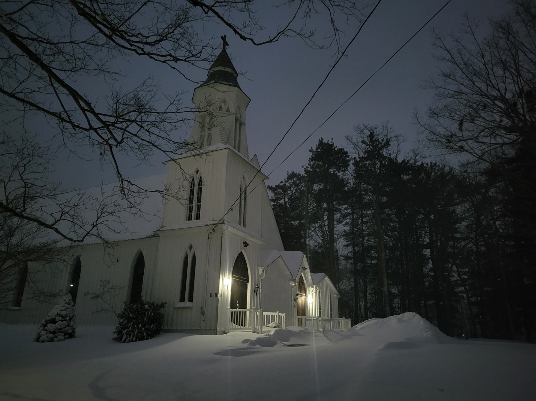
-
Article
Brighton
Brighton, Ont, incorporated as a municipality in 2001, population 10 928 (2011c), 10 253 (2006c). The Municipality of Brighton is located 12 km west of Trenton, near Lake Ontario.
"https://thecanadianencyclopedia.ca/images/tce_placeholder.jpg?v=e9dca980c9bdb3aa11e832e7ea94f5d9" // resources/views/front/categories/view.blade.php
https://thecanadianencyclopedia.ca/images/tce_placeholder.jpg?v=e9dca980c9bdb3aa11e832e7ea94f5d9
-
Article
British Block Medicine Wheel and Tipi Ring Campsite
Medicine Wheels are a broad category that include different kinds of stone structures. The medicine wheel at British Block is only one example. Its size and structure suggest that ritual activities were conducted by relatively large groups.
"https://d3d0lqu00lnqvz.cloudfront.net/media/media/fb3f18a1-9701-4838-bb63-a53b8d323911.jpg" // resources/views/front/categories/view.blade.php
https://d3d0lqu00lnqvz.cloudfront.net/media/media/fb3f18a1-9701-4838-bb63-a53b8d323911.jpg
-
Article
British Columbia
British Columbia is Canada's most westerly province, and is a mountainous area whose population is mainly clustered in its southwestern corner. BC is Canada’s third-largest province after Québec and Ontario, making up 10 per cent of Canada’s land surface. British Columbia is a land of diversity and contrast within small areas. Coastal landscapes, characterized by high, snow-covered mountains rising above narrow fjords and inlets, contrast with the broad forested upland of the central interior and the plains of the northeast. The intense "Britishness" of earlier times is referred to in the province's name, which originated with Queen Victoria and was officially proclaimed in 1858.
"https://d3d0lqu00lnqvz.cloudfront.net/media/media/449cfbc9-a5ff-4a70-b1e2-58f5ab29ffa5.jpg" // resources/views/front/categories/view.blade.php
https://d3d0lqu00lnqvz.cloudfront.net/media/media/449cfbc9-a5ff-4a70-b1e2-58f5ab29ffa5.jpg