
Browse "Places"
-
Article
Saskatchewan Legislative Building
Saskatchewan Legislative Building, Regina, was built 1908-12, following the plans of Montréal architects Edward and William Maxwell.
"https://thecanadianencyclopedia.ca/images/tce_placeholder.jpg?v=e9dca980c9bdb3aa11e832e7ea94f5d9" // resources/views/front/categories/view.blade.php
https://thecanadianencyclopedia.ca/images/tce_placeholder.jpg?v=e9dca980c9bdb3aa11e832e7ea94f5d9
-
Article
Saskatchewan River
The Saskatchewan River is 1,939 km long from the Rocky Mountains headwaters to Cedar Lake in central Manitoba. When including its longest tributary, the South Saskatchewan River, the Saskatchewan River is the fourth-longest river in Canada. It’s a major tributary to the Nelson River, ultimately draining into Hudson Bay. Its name is derived from the Cree word kisiskâciwanisîpiy meaning swift-flowing river. The Saskatchewan River was a major transportation route for First Nations for thousands of years and was an instrumental transportation and resource corridor during the fur trade and early European exploration.
"https://d3d0lqu00lnqvz.cloudfront.net/media/media/98d61a99-4200-4393-92c7-61a42587d6cf.jpg" // resources/views/front/categories/view.blade.php
https://d3d0lqu00lnqvz.cloudfront.net/media/media/98d61a99-4200-4393-92c7-61a42587d6cf.jpg
-
Article
Saskatoon
Saskatoon, Saskatchewan, incorporated as a city in 1906, population 266,141 (2021 census), 247,201 (2016 census). The City of Saskatoon, the largest city in Saskatchewan, is situated in rolling parklands on the banks of the northward-flowing South Saskatchewan River, 352 km northwest of Regina. It serves as regional centre for the northern prairies and for central and northern Saskatchewan. It is noted for its extensive riverbank parks and trails, wide tree-lined streets and attractive University of Saskatchewan campus.
"https://d3d0lqu00lnqvz.cloudfront.net/media/media/c4ed4d03-e017-484f-b344-935c8f3295e8.jpg" // resources/views/front/categories/view.blade.php
https://d3d0lqu00lnqvz.cloudfront.net/media/media/c4ed4d03-e017-484f-b344-935c8f3295e8.jpg
-
Article
Saskatoon Centennial Auditorium
Saskatoon Centennial Auditorium. Home of the Saskatoon Symphony Orchestra.
"https://thecanadianencyclopedia.ca/images/tce_placeholder.jpg?v=e9dca980c9bdb3aa11e832e7ea94f5d9" // resources/views/front/categories/view.blade.php
https://thecanadianencyclopedia.ca/images/tce_placeholder.jpg?v=e9dca980c9bdb3aa11e832e7ea94f5d9
-
Article
Music in Saskatoon
Saskatchewan city founded in 1882 as a temperance colony by pioneers from Ontario. It was incorporated as a town, with a population of 544, in 1903, and as a city, with five times that number, in 1906.
"https://thecanadianencyclopedia.ca/images/tce_placeholder.jpg?v=e9dca980c9bdb3aa11e832e7ea94f5d9" // resources/views/front/categories/view.blade.php
https://thecanadianencyclopedia.ca/images/tce_placeholder.jpg?v=e9dca980c9bdb3aa11e832e7ea94f5d9
-
Article
Sault Ste. Marie
Sault Ste. Marie, Ontario, incorporated as a town in 1887, as a city in 1912, population 72,051 (2021 census), 73,368 (2016 census). The city of Sault Ste. Marie is located adjacent to the rapids of the St. Marys River between lakes Superior and Huron. Across the river is the American city of the same name. Sault Ste. Marie sits on the traditional territory of the Ojibwe, who called the site Bawating (“place of the rapids”) and valued it for its access to the upper Great Lakes and as a source of abundant whitefish and maple sugar. It is popularly called “the Sault,” or “Soo.”
"https://d3d0lqu00lnqvz.cloudfront.net/media/media/a1557c26-bfa4-48ad-aef1-724137f63990.jpg" // resources/views/front/categories/view.blade.php
https://d3d0lqu00lnqvz.cloudfront.net/media/media/a1557c26-bfa4-48ad-aef1-724137f63990.jpg
-
Article
Music in Sault Ste Marie
Ontario city across the St Mary's River from Sault Ste Marie, Mich. As early as 1668 there was a small settlement of fur traders on the site. The permanent settlement was established in 1792. Sault Ste Marie was incorporated as a town in 1887 and as a city in 1912.
"https://thecanadianencyclopedia.ca/images/tce_placeholder.jpg?v=e9dca980c9bdb3aa11e832e7ea94f5d9" // resources/views/front/categories/view.blade.php
https://thecanadianencyclopedia.ca/images/tce_placeholder.jpg?v=e9dca980c9bdb3aa11e832e7ea94f5d9
-
Article
Scarborough
Scarborough, Ontario, former municipality, now a part of the city of Toronto. Scarborough is located on Lake Ontario and makes up the eastern part of the city. It was incorporated as a township in 1850 and as a city in 1983. In 1998, the provincial government, under the leadership of Premier Mike Harris, amalgamated six municipalities — Etobicoke, York, East York, North York, Scarborough and Toronto — to form the City of Toronto, a single municipality.
"https://d3d0lqu00lnqvz.cloudfront.net/media/media/f108614c-795e-4be6-a573-a66025a1a7e8.jpg" // resources/views/front/categories/view.blade.php
https://d3d0lqu00lnqvz.cloudfront.net/media/media/f108614c-795e-4be6-a573-a66025a1a7e8.jpg
-
Article
Scenic Places in Canada
Canada is full of stunning places. From mountains to lakes, forests and coastlines, the country’s landscapes are as wild as they are beautiful. Below are 13 scenic places across Canada, each selected for their unique ecological landscape, wildlife and culture.
"https://d3d0lqu00lnqvz.cloudfront.net/media/media/9b601dc6-d3d2-482c-8164-e3f8d453a78b.jpg" // resources/views/front/categories/view.blade.php
https://d3d0lqu00lnqvz.cloudfront.net/media/media/9b601dc6-d3d2-482c-8164-e3f8d453a78b.jpg
-
Article
Schefferville
Schefferville, Quebec, incorporated as a town in 1955, population 155 (2016 census), 213 (2011 census). Schefferville is located between Knob and Pearce Lakes, on Quebec’s border with Labrador, 510 km north of Sept-Îles.
"https://d3d0lqu00lnqvz.cloudfront.net/media/new_article_images/Schefferville/Schefferville_2013.jpg" // resources/views/front/categories/view.blade.php
https://d3d0lqu00lnqvz.cloudfront.net/media/new_article_images/Schefferville/Schefferville_2013.jpg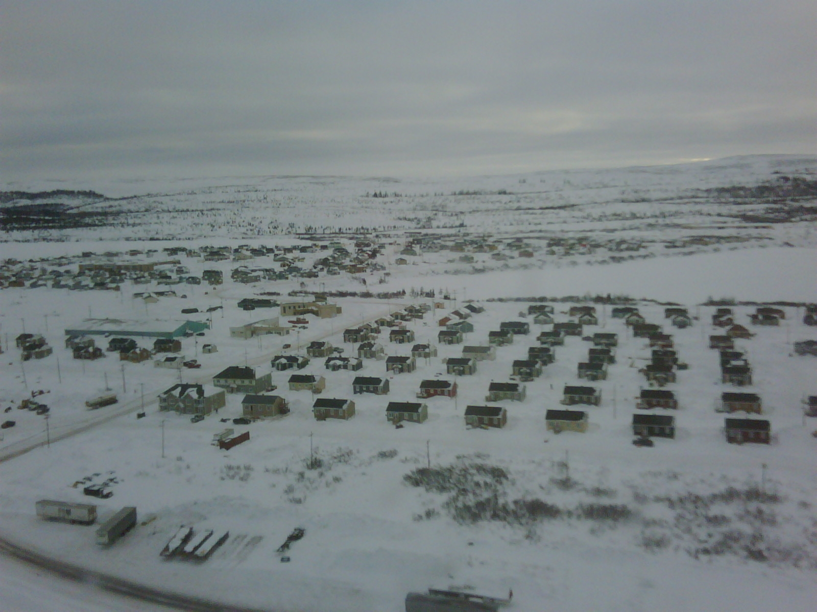
-
Article
Schola cantorum
Schola cantorum. Founded in Montreal 19 Mar 1915 by Jean-Noël Charbonneau. It was inaugurated 15 September as the Diocesan School of Sacred Music by Archbishop Georges Gauthier of Montreal. Its first individual and group lessons were attended by 84 students.
"https://thecanadianencyclopedia.ca/images/tce_placeholder.jpg?v=e9dca980c9bdb3aa11e832e7ea94f5d9" // resources/views/front/categories/view.blade.php
https://thecanadianencyclopedia.ca/images/tce_placeholder.jpg?v=e9dca980c9bdb3aa11e832e7ea94f5d9
-
Article
Science Centres in Canada
Canada is home to more than 40 science centres, planetariums, children's museums and related institutions that have been established to advance scientific literacy by making science learning fun and accessible.
"https://d3d0lqu00lnqvz.cloudfront.net/media/media/4407655a-832b-4a6c-a328-3e6f5d28fec0.jpg" // resources/views/front/categories/view.blade.php
https://d3d0lqu00lnqvz.cloudfront.net/media/media/4407655a-832b-4a6c-a328-3e6f5d28fec0.jpg
-
Article
Seal River
Named for the harbour seals (normally marine creatures) that are found up to 200 km upstream from Hudson Bay, Manitoba's Seal River is formed by the confluence of the North Seal (about 200 km long) and the South Seal (about 240 km long) rivers at Shethanei Lake.
"https://thecanadianencyclopedia.ca/images/tce_placeholder.jpg?v=e9dca980c9bdb3aa11e832e7ea94f5d9" // resources/views/front/categories/view.blade.php
https://thecanadianencyclopedia.ca/images/tce_placeholder.jpg?v=e9dca980c9bdb3aa11e832e7ea94f5d9
-
Article
Sechelt
Sechelt, BC, incorporated as a district municipality in 1986, population 9291 (2011c), 8454 (2006c). The District of Sechelt is located on the Sunshine Coast of British Columbia north of Vancouver on the Strait of GEORGIA. The community is named for the Sechelt who inhabit the area.
"https://d3d0lqu00lnqvz.cloudfront.net/media/media/d6cba941-1fb0-4c1a-98b3-2eb3969ed279.jpg" // resources/views/front/categories/view.blade.php
https://d3d0lqu00lnqvz.cloudfront.net/media/media/d6cba941-1fb0-4c1a-98b3-2eb3969ed279.jpg
-
Article
Sechelt Peninsula
The Sechelt Peninsula, approximately 350 km2, is part of a popular cottage area and yachting centre in British Columbia known as the "Sunshine Coast." Isolated from nearby Vancouver, BC, by Howe Sound and the Coast Mountains, its coast is linked by ferries with Vancouver via Horseshoe Bay and with Powell River via Saltery Bay.
"https://d3d0lqu00lnqvz.cloudfront.net/media/media/4a729b12-6f87-42d2-914e-96163d8c8ce3.jpg" // resources/views/front/categories/view.blade.php
https://d3d0lqu00lnqvz.cloudfront.net/media/media/4a729b12-6f87-42d2-914e-96163d8c8ce3.jpg