
Browse "Places"
-
Article
Queen Elizabeth Islands
The Queen Elizabeth Islands, named after Queen Elizabeth II in 1953, are a group of islands in the Canadian Arctic Archipelago in the Northwest Territories and Nunavut. On Ellesmere Island sits Barbeau Peak (2,616 m), which is the tallest point in eastern North America. The archipelago covers an area of roughly 419,000 km2.
"https://d3d0lqu00lnqvz.cloudfront.net/49143125132_fab8ed5308_o.jpg" // resources/views/front/categories/view.blade.php
https://d3d0lqu00lnqvz.cloudfront.net/49143125132_fab8ed5308_o.jpg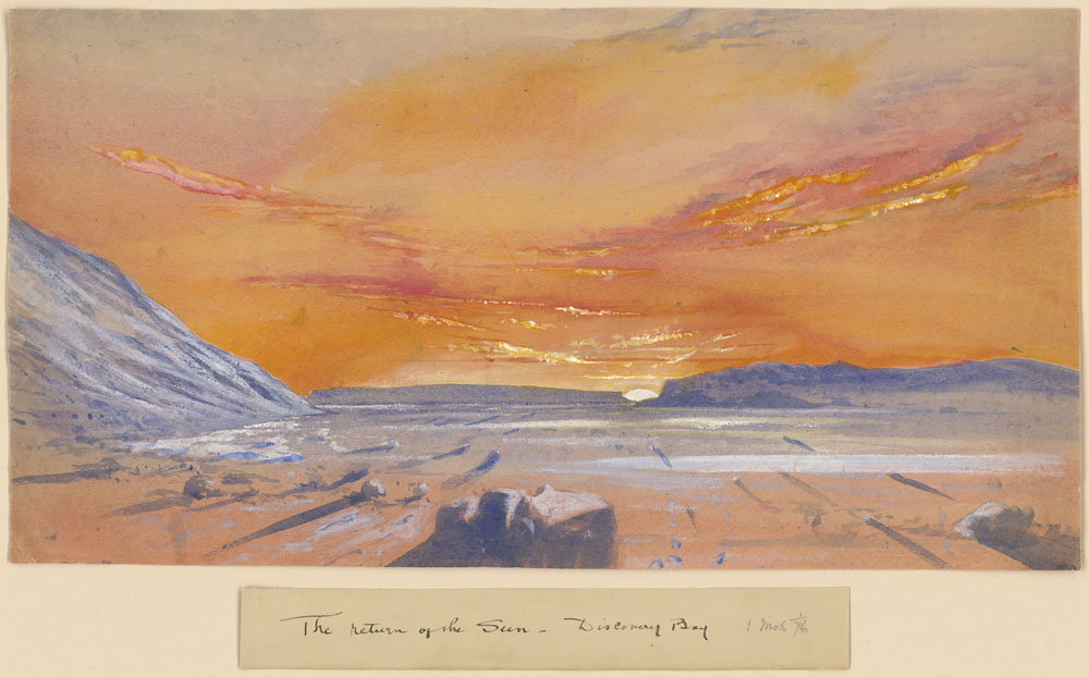
-
Article
Queen Elizabeth Theatre
Queen Elizabeth Theatre. 2,575-seat theatre, home of the Vancouver Opera, the Vancouver Symphony Orchestra (1960-77), and Ballet British Columbia, and administered by the City of Vancouver.
"https://thecanadianencyclopedia.ca/images/tce_placeholder.jpg?v=e9dca980c9bdb3aa11e832e7ea94f5d9" // resources/views/front/categories/view.blade.php
https://thecanadianencyclopedia.ca/images/tce_placeholder.jpg?v=e9dca980c9bdb3aa11e832e7ea94f5d9
-
Article
Queen Elizabeth Way
Queen Elizabeth Way, connecting Toronto with Niagara Falls and Fort Erie, Ont, was Canada's first 4-lane, controlled-access superhighway.
"https://thecanadianencyclopedia.ca/images/tce_placeholder.jpg?v=e9dca980c9bdb3aa11e832e7ea94f5d9" // resources/views/front/categories/view.blade.php
https://thecanadianencyclopedia.ca/images/tce_placeholder.jpg?v=e9dca980c9bdb3aa11e832e7ea94f5d9
-
Article
Queens
Queens, NS, incorporated as a regional municipality in 1996, population 10 917 (2011c), 11 177 (2006c). The Region of Queens Municipality is located approximately 150 km southwest of Halifax.
"https://d3d0lqu00lnqvz.cloudfront.net/media/media/22724662-cbf7-461d-9649-5a5c6a3a3b7f.jpg" // resources/views/front/categories/view.blade.php
https://d3d0lqu00lnqvz.cloudfront.net/media/media/22724662-cbf7-461d-9649-5a5c6a3a3b7f.jpg
-
Article
Quesnel
Quesnel, British Columbia, incorporated as a city in 1928, population 23,113 (2021 census), 23,146 (2016 census). The city of Quesnel is located at the junction of the Quesnel and Fraser rivers in central British Columbia, 625 km northeast of Vancouver.
"https://d3d0lqu00lnqvz.cloudfront.net/4422669791_185f781876_h.jpg" // resources/views/front/categories/view.blade.php
https://d3d0lqu00lnqvz.cloudfront.net/4422669791_185f781876_h.jpg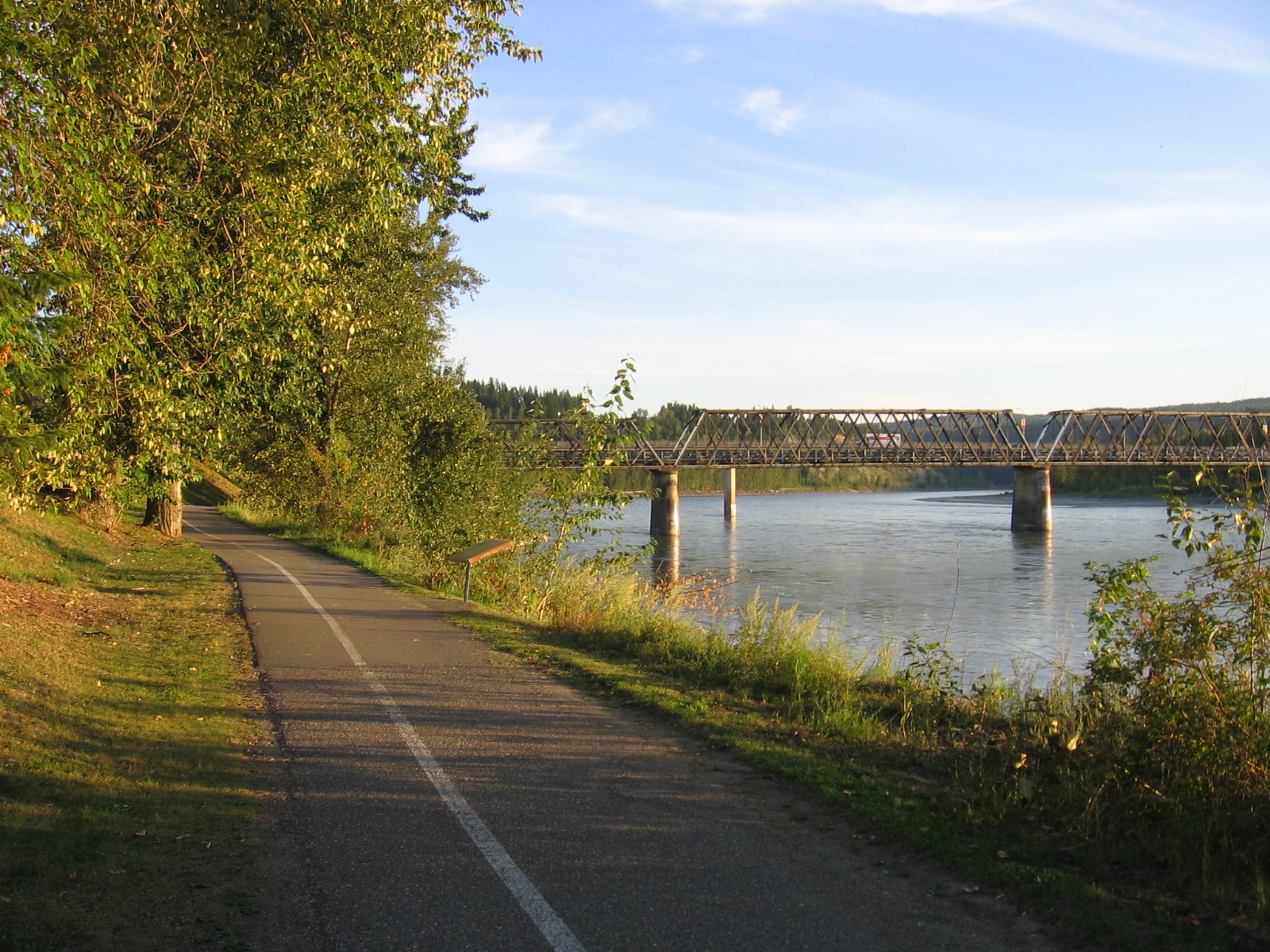
-
Article
Quidi Vidi Battery
The Quidi Vidi Battery was built in 1762 by the French. The French attacked the ST JOHN'S, Nfld, area in one of the last campaigns of the SEVEN YEARS' WAR, capturing and burning many settlements around Trinity and Conception bays. They then erected the battery to defend their newly won territory.
"https://thecanadianencyclopedia.ca/images/tce_placeholder.jpg?v=e9dca980c9bdb3aa11e832e7ea94f5d9" // resources/views/front/categories/view.blade.php
https://thecanadianencyclopedia.ca/images/tce_placeholder.jpg?v=e9dca980c9bdb3aa11e832e7ea94f5d9
-
Article
Quill Lakes
The Quill Lakes are three connected saline lakes in southeastern Saskatchewan. They are located 150 km north of Regina and 152 km east of Saskatoon. From west to east the lakes are named Big Quill, Middle Quill (also known as Mud Lake) and Little Quill. Despite its name, at 181 km2 Little Quill is the second largest of the three lakes. Big Quill is the largest at 307 km2. The Quill Lakes’ elevation is 516 m.
"https://thecanadianencyclopedia.ca/images/tce_placeholder.jpg?v=e9dca980c9bdb3aa11e832e7ea94f5d9" // resources/views/front/categories/view.blade.php
https://thecanadianencyclopedia.ca/images/tce_placeholder.jpg?v=e9dca980c9bdb3aa11e832e7ea94f5d9
-
Article
Quinte West
Long occupied by Indigenous peoples, at the time of first European contact, the Mississauga (Ojibwa) occupied the region.
"https://d3d0lqu00lnqvz.cloudfront.net/media/media/ee432d3b-83bf-4fa4-acd0-c86635530374.jpg" // resources/views/front/categories/view.blade.php
https://d3d0lqu00lnqvz.cloudfront.net/media/media/ee432d3b-83bf-4fa4-acd0-c86635530374.jpg
-
Article
Quispamsis
Quispamsis, NB, incorporated as a town in 1998, population 17 886 (2011c), 15 239 (2006c). The Town of Quispamsis is located 22 km northeast of SAINT JOHN along the Kennebecasis River.
"https://thecanadianencyclopedia.ca/images/tce_placeholder.jpg?v=e9dca980c9bdb3aa11e832e7ea94f5d9" // resources/views/front/categories/view.blade.php
https://thecanadianencyclopedia.ca/images/tce_placeholder.jpg?v=e9dca980c9bdb3aa11e832e7ea94f5d9
-
Article
Quttinirpaaq National Park
Quttinirpaaq National Park (established 1988, 37 775 km2) is Canada's second-largest national park (after Wood Buffalo National Park). First known as Ellesmere Island National Park, Quttinirpaaq is Canada's most northerly national park and the most northerly land in North America. Its Inuit name, taken in 1999, reflects it location, "top of the world." Access is by air from Resolute, Nunavut.
"https://d3d0lqu00lnqvz.cloudfront.net/media/media/5176d9ce-bf5f-4fdf-9453-c0f71b3128e6.jpg" // resources/views/front/categories/view.blade.php
https://d3d0lqu00lnqvz.cloudfront.net/media/media/5176d9ce-bf5f-4fdf-9453-c0f71b3128e6.jpg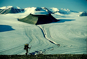
-
Article
Railway Station
More familiar are the "road stations" built between 1855 and 1857 for the Grand Trunk Railway's line from Montréal to Toronto and Sarnia.
"https://d3d0lqu00lnqvz.cloudfront.net/media/media/10107a9f-701b-469d-83d4-c13b79c50b3e.jpg" // resources/views/front/categories/view.blade.php
https://d3d0lqu00lnqvz.cloudfront.net/media/media/10107a9f-701b-469d-83d4-c13b79c50b3e.jpg
-
Article
Railways, Track and Yards
Railways, Track and Yards Railway track is the assembly of the 5 basic components - rail, ties, fastenings, ballasts and subgrade - over which trains run. Rails are rolled steel lengths bolted or welded together to form the running surface for trains.
"https://thecanadianencyclopedia.ca/images/tce_placeholder.jpg?v=e9dca980c9bdb3aa11e832e7ea94f5d9" // resources/views/front/categories/view.blade.php
https://thecanadianencyclopedia.ca/images/tce_placeholder.jpg?v=e9dca980c9bdb3aa11e832e7ea94f5d9
-
Article
Rainbow Stage
Rainbow Stage, named for its rainbow-shaped proscenium arch, opened with a variety show directed by Duncan on 7 July 1954. In September 1955 Duncan directed the first musical comedy performed there, Brigadoon, which marked the beginning of a tradition.
"https://d3d0lqu00lnqvz.cloudfront.net/media/media/9654eb74-30b7-4494-8deb-089276f161cf.jpg" // resources/views/front/categories/view.blade.php
https://d3d0lqu00lnqvz.cloudfront.net/media/media/9654eb74-30b7-4494-8deb-089276f161cf.jpg
-
Article
Rainbow Stage
After several seasons of poor weather a triodetic dome was constructed over the theatre in 1970.
"https://d3d0lqu00lnqvz.cloudfront.net/media/media/9654eb74-30b7-4494-8deb-089276f161cf.jpg" // resources/views/front/categories/view.blade.php
https://d3d0lqu00lnqvz.cloudfront.net/media/media/9654eb74-30b7-4494-8deb-089276f161cf.jpg
-
Article
Rainy Lake
Rainy Lake, 932 km2 (741 km2 in Canada), elev 338 m, is located in rough woodlands astride the Ont-Minn border, 240 km W of Lk Superior. It discharges into the Rainy R, which flows W along the border to LK OF THE WOODS.
"https://thecanadianencyclopedia.ca/images/tce_placeholder.jpg?v=e9dca980c9bdb3aa11e832e7ea94f5d9" // resources/views/front/categories/view.blade.php
https://thecanadianencyclopedia.ca/images/tce_placeholder.jpg?v=e9dca980c9bdb3aa11e832e7ea94f5d9