
Browse "Parks & Nature Reserves"
-
Article
National Parks of Canada (Plain-Language Summary)
Canada has 48 national parks and one national urban park. They were created and are run by the federal government. The national parks cover a vast amount of land — about 340,000 km2. This is about 3 per cent of Canada’s landmass. National parks serve two purposes. The first purpose is to preserve and protect nature. The second purpose is to give Canadians the chance to enjoy some of the country’s most beautiful and important natural settings. Millions of Canadians visit national parks every year. This article is a plain-language summary of the national parks of Canada. If you are interested in reading about this topic more in depth, please see our full-length entry, National Parks of Canada.
"https://d3d0lqu00lnqvz.cloudfront.net/media/media/27f9bb3e-3454-4b12-9aca-ded0299bfe8c.jpg" // resources/views/front/categories/view.blade.php
https://d3d0lqu00lnqvz.cloudfront.net/media/media/27f9bb3e-3454-4b12-9aca-ded0299bfe8c.jpg
-
Article
Notikewin Provincial Park
Interest from local residents led to the establishment of Notikewin Provincial Park (established 1979, 97 km2). Here is preserved a small piece of the quintessential natural landscape of northern Alberta, the once endless poplar and spruce forests deeply dissected by moody rivers.
"https://thecanadianencyclopedia.ca/images/tce_placeholder.jpg?v=e9dca980c9bdb3aa11e832e7ea94f5d9" // resources/views/front/categories/view.blade.php
https://thecanadianencyclopedia.ca/images/tce_placeholder.jpg?v=e9dca980c9bdb3aa11e832e7ea94f5d9
-
Article
Notre Dame Provincial Park
Nestled in the lush forests of central Newfoundland, Notre Dame Provincial Park (established 1959, 113 ha) borders on the serene waters of Junction Pond.
"https://thecanadianencyclopedia.ca/images/tce_placeholder.jpg?v=e9dca980c9bdb3aa11e832e7ea94f5d9" // resources/views/front/categories/view.blade.php
https://thecanadianencyclopedia.ca/images/tce_placeholder.jpg?v=e9dca980c9bdb3aa11e832e7ea94f5d9
-
Article
Ontario's Greenbelt
Ontario’s Greenbelt, also known as the Greater Golden Horseshoe Greenbelt, is about 800,000 hectares of permanently protected green space and farmland in Ontario. It is one of many prominent greenbelts worldwide, including the British Columbia Agricultural Land Reserve in Canada and greenbelts in Copenhagen, Brazil, London, England and elsewhere. The Greenbelt forms a “belt” around the Greater Golden Horseshoe, Canada’s most densely populated area. The region includes municipalities such as Toronto, Oakville, Pickering, Hamilton, and Mississauga and stretches from Rice Lake in the east to the Niagara River in the west. The Greenbelt was created in 2005 to protect high-quality farmland and environmentally sensitive features like forests, lakes and sensitive species from urban sprawl and development.
"https://d3d0lqu00lnqvz.cloudfront.net/greenbelt/oak-ridges-moraine.jpg" // resources/views/front/categories/view.blade.php
https://d3d0lqu00lnqvz.cloudfront.net/greenbelt/oak-ridges-moraine.jpg
-
Article
Ouimet Canyon Provincial Park
A spectacular, steep-sided gorge cut into volcanic rock of Lake Superior's northern shore is protected in Ouimet Canyon Provincial Park (established 1972, 777 ha), 65 km northeast of Thunder Bay, Ontario.
"https://d3d0lqu00lnqvz.cloudfront.net/media/media/fe2420b7-d26b-483e-b339-46a75ac65e13.jpg" // resources/views/front/categories/view.blade.php
https://d3d0lqu00lnqvz.cloudfront.net/media/media/fe2420b7-d26b-483e-b339-46a75ac65e13.jpg
-
Article
Pacific Rim National Park Reserve
Pacific Rim National Park Reserve (285.8 km2) stretches for 105 km along the rugged west coast of Vancouver Island. Established in 1970, the Pacific Rim National Park Reserve comprises three sections: the Long Beach unit, the West Coast Trail unit and the Broken Group islands. Nestled along the southwestern coast of Vancouver Island, the National Park Reserve boasts sandy beaches and temperate rainforests. Pacific Rim National Park Reserve lies in the traditional territories of the Nuu-chah-nulth First Nations and was symbolically twinned with the Hallyo Haesang Sea National Park of Korea in 1997.
"https://d3d0lqu00lnqvz.cloudfront.net/pacificrimnationalparkreserve/Long-Beach_-_Pacific_Rim_National_Park_Reserve.jpg" // resources/views/front/categories/view.blade.php
https://d3d0lqu00lnqvz.cloudfront.net/pacificrimnationalparkreserve/Long-Beach_-_Pacific_Rim_National_Park_Reserve.jpg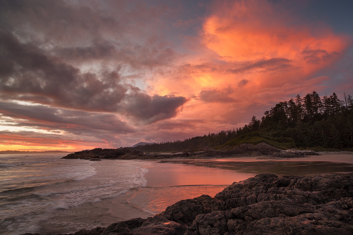
-
Article
Parc national de la Gaspésie
In the heart of the Gaspé Peninsula, 196 km east of Rimouski, is Parc national de la Gaspésie (established 1981, 802 km2). First established in 1937 by means of special legislation, the park has in the past bowed to mining and forestry pressures. It is now completely protected through the park's Act.
"https://thecanadianencyclopedia.ca/images/tce_placeholder.jpg?v=e9dca980c9bdb3aa11e832e7ea94f5d9" // resources/views/front/categories/view.blade.php
https://thecanadianencyclopedia.ca/images/tce_placeholder.jpg?v=e9dca980c9bdb3aa11e832e7ea94f5d9
-
Article
Petroglyphs Provincial Park
Petroglyphs Provincial Park (established 1976, 1643 ha) is the site of one of Canada's archaeological and cultural treasures. On a flat expanse of rock are some 900 carvings or petroglyphs of symbolic shapes and figures, likely carved by Algonquian-speaking people. Established as a historic-class park, Petroglyphs Provincial Park is located 55 km northeast of Peterborough, Ontario. It is located on the southern edge of the Canadian Shield and in a transition zone between the Shield and the Great Lakes-St Lawrence Lowland area. Rocky ridges covered with thin soil are interspersed with low-lying wetlands.
"https://thecanadianencyclopedia.ca/images/tce_placeholder.jpg?v=e9dca980c9bdb3aa11e832e7ea94f5d9" // resources/views/front/categories/view.blade.php
https://thecanadianencyclopedia.ca/images/tce_placeholder.jpg?v=e9dca980c9bdb3aa11e832e7ea94f5d9
-
Article
Prince Albert National Park
Prince Albert National Park (est 1927, 3874.3 km2) is located 200 km north of Saskatoon. The cabin and grave of Grey Owl (Archibald Belaney) are located in the park beside Ajawaan Lake, where he spent the last 7 years of his life.
"https://d3d0lqu00lnqvz.cloudfront.net/media/media/f507b630-0ecd-47f8-b3a8-7ef49ed586c9.jpg" // resources/views/front/categories/view.blade.php
https://d3d0lqu00lnqvz.cloudfront.net/media/media/f507b630-0ecd-47f8-b3a8-7ef49ed586c9.jpg
-
Article
Prince Edward Island National Park
Prince Edward Island National Park (est 1937, 21.5 km2) is a narrow strip of coastline stretching over 40 km along the north shore of PEI.
"https://d3d0lqu00lnqvz.cloudfront.net/media/media/43c98966-afd6-46ad-88a3-937937a88fff.jpg" // resources/views/front/categories/view.blade.php
https://d3d0lqu00lnqvz.cloudfront.net/media/media/43c98966-afd6-46ad-88a3-937937a88fff.jpg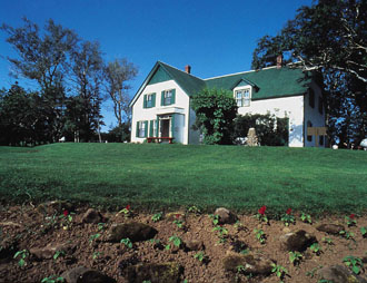
-
Article
Provincial Parks in Canada
Provincial parks are areas of land and water, large or small, natural or human-modified, designated by any of the provincial governments for the purposes of nature protection, recreation, tourism, historic preservation and education. They range in character from Polar Bear Provincial Park on Hudson Bay, a 24,087 km2 wilderness park visited by less than 500 people each year, to Bronte Creek Provincial Park, a 6.4 km2 recreation park near Toronto , which received 302,327 visitors in 1994.
"https://d3d0lqu00lnqvz.cloudfront.net/algonquinprovincialpark/Kayak-and-Canoe-Rivers.jpg" // resources/views/front/categories/view.blade.php
https://d3d0lqu00lnqvz.cloudfront.net/algonquinprovincialpark/Kayak-and-Canoe-Rivers.jpg
-
Article
Riding Mountain National Park
Riding Mountain National Park (est 1929, 2,973.1 km2) is located 265 km northwest of Winnipeg, perched almost 500 m above the prairie on the Manitoba Escarpment. The park is the "core protected area" of Riding Mountain Biosphere Reserve.
"https://d3d0lqu00lnqvz.cloudfront.net/media/media/c9679ffa-5ed0-4a59-995b-e07de3516e05.jpg" // resources/views/front/categories/view.blade.php
https://d3d0lqu00lnqvz.cloudfront.net/media/media/c9679ffa-5ed0-4a59-995b-e07de3516e05.jpg
-
Article
Rondeau Provincial Park
Rondeau Provincial Park (established 1894, 33 km2) provides environmental protection and recreation on one of 3 peninsulas jutting south into Lake ERIE. It lies 120 km east of Windsor and 115 km southwest of London.
"https://thecanadianencyclopedia.ca/images/tce_placeholder.jpg?v=e9dca980c9bdb3aa11e832e7ea94f5d9" // resources/views/front/categories/view.blade.php
https://thecanadianencyclopedia.ca/images/tce_placeholder.jpg?v=e9dca980c9bdb3aa11e832e7ea94f5d9
-
Article
Sirmilik National Park
Located on northern Baffin Island in Canada's High Arctic, Sirmilik National Park (agreement signed 1999; 22,250 km2) is one of Canada's isolated and most spectacular national parks. Sirmilik is an Inuktitut word that means "place of glaciers."
"https://d3d0lqu00lnqvz.cloudfront.net/media/media/99e23c81-75f9-472e-8482-f10ddb1bb260.jpg" // resources/views/front/categories/view.blade.php
https://d3d0lqu00lnqvz.cloudfront.net/media/media/99e23c81-75f9-472e-8482-f10ddb1bb260.jpg
-
Article
Thousand Islands National Park (formerly St Lawrence Islands National Park)
Thousand Islands National Park (established in 1914, area 24 km2), is one of Canada's smallest National Parks, comprised of 26 islands and about 90 islets scattered for 80 km along the St Lawrence River from Brockville to Kingston, Ont. St Lawrence Islands National park also has mainland holdings at Landon Bay, Mallorytown Landing and Jones Creek.
"https://d3d0lqu00lnqvz.cloudfront.net/media/media/fad571a1-9624-4927-9403-e3b2560a4951.jpg" // resources/views/front/categories/view.blade.php
https://d3d0lqu00lnqvz.cloudfront.net/media/media/fad571a1-9624-4927-9403-e3b2560a4951.jpg