
Browse "Historic Sites"
-
Article
Heart's Content Cable Station
Hearts Content Cable Station is a provincial HISTORIC SITE commemorating one of the most significant events in the 19th century: the laying of a trans-Atlantic TELEGRAPH cable in 1866 from Ireland to HEART'S CONTENT, NL.
"https://thecanadianencyclopedia.ca/images/tce_placeholder.jpg?v=e9dca980c9bdb3aa11e832e7ea94f5d9" // resources/views/front/categories/view.blade.php
https://thecanadianencyclopedia.ca/images/tce_placeholder.jpg?v=e9dca980c9bdb3aa11e832e7ea94f5d9
-
Collection
Heritage Minutes
The Heritage Minutes collection is a bilingual series of history-focused public service announcements. Each 60-second short film depicts a significant person, event or story in Canadian history. They are produced by Historica Canada, the not-for-profit organization that also publishes this encyclopedia. First released in 1991, the Heritage Minutes have been shown on television, in cinemas and online. They have become a recognizable part of Canadian culture. The collection currently includes 100 episodes.
"https://d3d0lqu00lnqvz.cloudfront.net/media/media/1bfa3d45-2952-4f79-b7d4-4c6cb6601164.jpg" // resources/views/front/categories/view.blade.php
https://d3d0lqu00lnqvz.cloudfront.net/media/media/1bfa3d45-2952-4f79-b7d4-4c6cb6601164.jpg
-
Article
Heritage Trail
Hundreds of trails are now found from coast to coast in Canada, installed and run by national and provincial parks, the Canadian Wildlife Service, tourist departments, conservation authorities, museums, universities, schools, botanical gardens and private agencies.
"https://thecanadianencyclopedia.ca/images/tce_placeholder.jpg?v=e9dca980c9bdb3aa11e832e7ea94f5d9" // resources/views/front/categories/view.blade.php
https://thecanadianencyclopedia.ca/images/tce_placeholder.jpg?v=e9dca980c9bdb3aa11e832e7ea94f5d9
-
Article
Historic Dunvegan
One of the most important fur trade sites on the PEACE RIVER, a post operated at Dunvegan from 1805 to 1918. The first post was built by Archibald Norman McLeod of the North West Company to trade with the BEAVER and other First Nations who lived in the middle and upper reaches of the Peace River.
"https://d3d0lqu00lnqvz.cloudfront.net/media/media/1b7019ae-3e5d-4d8a-9491-35e2fb72ca9a.jpg" // resources/views/front/categories/view.blade.php
https://d3d0lqu00lnqvz.cloudfront.net/media/media/1b7019ae-3e5d-4d8a-9491-35e2fb72ca9a.jpg
-
Article
Hochelaga
The term Hochelaga historically referred to an Indigenous village the French explorer Jacques Cartier (1491-1557) visited on Sunday, 3 October 1535, during his second voyage in what is now Quebec (1535-1536). Hochelaga is an Iroquoian term which is either a variation of the word osekare, meaning “beaver path,” or of the word osheaga, which translates as “big rapids.” Today, Hochelaga refers to islands at the confluence of the St. Lawrence and the Ottawa rivers, as well as various electoral and city districts.
"https://d3d0lqu00lnqvz.cloudfront.net/media/media/dd48df83-e33a-4d14-9707-34c0c6322d48.jpg" // resources/views/front/categories/view.blade.php
https://d3d0lqu00lnqvz.cloudfront.net/media/media/dd48df83-e33a-4d14-9707-34c0c6322d48.jpg
-
Article
Wendake (Huronia)
Wendake is a Huron-Wendat settlement dating back to the 17th century, once known by various names including “Huronia,” "the country of the Huron" or “the Huron village.” Today, Wendake refers to the urban reserve of the Huron-Wendat Nation, located near Quebec City, Quebec.
"https://d3d0lqu00lnqvz.cloudfront.net/media/media/dbcf9b74-90d5-42a2-8f3c-9e38996ea0b7.jpg" // resources/views/front/categories/view.blade.php
https://d3d0lqu00lnqvz.cloudfront.net/media/media/dbcf9b74-90d5-42a2-8f3c-9e38996ea0b7.jpg
-
Article
Igloolik Archaeological Sites
The Igloolik archaeological sites are located on the islands at the northern end of Foxe Basin, close to the village of Igloolik.
"https://d3d0lqu00lnqvz.cloudfront.net/media/media/737bdeaf-7011-4762-b6ab-67bc228da8ad.jpg" // resources/views/front/categories/view.blade.php
https://d3d0lqu00lnqvz.cloudfront.net/media/media/737bdeaf-7011-4762-b6ab-67bc228da8ad.jpg
-
Article
Intendant's Palace Archaeological Site
The site of the Intendant's Palace is in the Lower Town of Québec City below the Côte du Palais.
"https://thecanadianencyclopedia.ca/images/tce_placeholder.jpg?v=e9dca980c9bdb3aa11e832e7ea94f5d9" // resources/views/front/categories/view.blade.php
https://thecanadianencyclopedia.ca/images/tce_placeholder.jpg?v=e9dca980c9bdb3aa11e832e7ea94f5d9
-
Article
Jemseg Archaeological Site
The Jemseg archaeological site (Borden site designation number BkDm-14) is a major archaeological site located in south-central New Brunswick, on the stream that connects the Grand Lake system to the lower Saint John River.
"https://d3d0lqu00lnqvz.cloudfront.net/media/media/a7ddfad9-aa2e-425b-b65a-3fbd6a372095.jpg" // resources/views/front/categories/view.blade.php
https://d3d0lqu00lnqvz.cloudfront.net/media/media/a7ddfad9-aa2e-425b-b65a-3fbd6a372095.jpg
-
Article
Kennedy House
Kennedy House is a provincial HISTORIC SITE located just north of Winnipeg on River Road, the old highway that connected the RED RIVER COLONY between LOWER FORT GARRY and UPPER FORT GARRY.
"https://thecanadianencyclopedia.ca/images/tce_placeholder.jpg?v=e9dca980c9bdb3aa11e832e7ea94f5d9" // resources/views/front/categories/view.blade.php
https://thecanadianencyclopedia.ca/images/tce_placeholder.jpg?v=e9dca980c9bdb3aa11e832e7ea94f5d9
-
Article
Kings Landing Historical Settlement
Kings Landing Historical Settlement is located 37 km west of Fredericton, NB. It was created in the late 1960s when the Mactaquac Dam threatened to flood many historic buildings in the Saint John River valley. Over 70 restored and reconstructed buildings and other structures are now located at Kings Landing to represent a New Brunswick settlement of the 19th and 20th centuries.
"https://d3d0lqu00lnqvz.cloudfront.net/media/media/dd14f8bd-899c-42d0-9d51-f5227c85a285.jpg" // resources/views/front/categories/view.blade.php
https://d3d0lqu00lnqvz.cloudfront.net/media/media/dd14f8bd-899c-42d0-9d51-f5227c85a285.jpg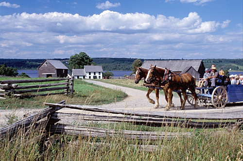
-
Article
Kitigaaryuit (Kittigazuit)
Kitigaaryuit is the name of an area (ca 5 km2) at the mouth of the East Channel of the Mackenzie River that was the gathering place of the Kitigaaryungmiut.
"https://d3d0lqu00lnqvz.cloudfront.net/media/media/edd62de2-9eff-48e0-978d-f634c3dc4dc8.jpg" // resources/views/front/categories/view.blade.php
https://d3d0lqu00lnqvz.cloudfront.net/media/media/edd62de2-9eff-48e0-978d-f634c3dc4dc8.jpg
-
Article
Gitwangak Battle Hill National Historic Site
Gitwangak Battle Hill (formerly Kitwanga Fort) is the site of a former Gitwangak fortified village on the Kitwanga River in British Columbia, northeast of Terrace.
"https://d3d0lqu00lnqvz.cloudfront.net/media/media/fa957cb9-e291-44d5-aac2-e406ec5ea9d1.JPG" // resources/views/front/categories/view.blade.php
https://d3d0lqu00lnqvz.cloudfront.net/media/media/fa957cb9-e291-44d5-aac2-e406ec5ea9d1.JPG
-
Article
Ksan
Ksan (or ‘Ksan) is a historical village, museum and campground, owned and operated by the Gitanmaax Band. It is located at the junction of the Skeena and Bulkley rivers in Hazelton, British Columbia. Ksan was established in 1970 as way to promote and preserve Gitxsan culture and history.
"https://d3d0lqu00lnqvz.cloudfront.net/media/media/2fd73ae3-5ed7-4894-b6ae-caa2ac25e639.jpg" // resources/views/front/categories/view.blade.php
https://d3d0lqu00lnqvz.cloudfront.net/media/media/2fd73ae3-5ed7-4894-b6ae-caa2ac25e639.jpg
-
Article
La Maison des Canadiens
“Within sight of this house over 100 men of the Queen’s Own Rifles were killed or wounded, in the first few minutes of the landings.”
"https://d3d0lqu00lnqvz.cloudfront.net/media/media/3a69be0a-4b74-40aa-a2d9-cfe6007d77a2.jpg" // resources/views/front/categories/view.blade.php
https://d3d0lqu00lnqvz.cloudfront.net/media/media/3a69be0a-4b74-40aa-a2d9-cfe6007d77a2.jpg