
Browse "Rivers"
-
Article
Main River
From its 4 headwater lakes (called Four Ponds - lakes are called "ponds" in Newfoundland and Labrador) in the Long Range Mountains on Newfoundland and Labrador's Great Northern Peninsula, the Main River drops quickly over boulder-strewn rapids.
"https://thecanadianencyclopedia.ca/images/tce_placeholder.jpg?v=e9dca980c9bdb3aa11e832e7ea94f5d9" // resources/views/front/categories/view.blade.php
https://thecanadianencyclopedia.ca/images/tce_placeholder.jpg?v=e9dca980c9bdb3aa11e832e7ea94f5d9
-
Article
Margaree River
The Margaree-Lake Ainslie system is the largest river system on Cape Breton Island, and one of the largest in Nova Scotia, with a total length of 120 km and a watershed of 1165 km2.
"https://thecanadianencyclopedia.ca/images/tce_placeholder.jpg?v=e9dca980c9bdb3aa11e832e7ea94f5d9" // resources/views/front/categories/view.blade.php
https://thecanadianencyclopedia.ca/images/tce_placeholder.jpg?v=e9dca980c9bdb3aa11e832e7ea94f5d9
-
Article
Mattawa River
The Mattawa River rises in Trout Lake in north-central Ontario, 198.5 m above sea level and drops to 50 m over around 65 km distance to the Ottawa River. Its watershed encompasses 1170 km2 of the Canadian Shield.
"https://thecanadianencyclopedia.ca/images/tce_placeholder.jpg?v=e9dca980c9bdb3aa11e832e7ea94f5d9" // resources/views/front/categories/view.blade.php
https://thecanadianencyclopedia.ca/images/tce_placeholder.jpg?v=e9dca980c9bdb3aa11e832e7ea94f5d9
-
Article
Miramichi River
The Miramichi River is 217 km long from its source in Juniper, in central New Brunswick, to the Gulf of St. Lawrence.
"https://d3d0lqu00lnqvz.cloudfront.net/media/media/169334dd-4829-4936-a09b-b91e809c65ef.jpg" // resources/views/front/categories/view.blade.php
https://d3d0lqu00lnqvz.cloudfront.net/media/media/169334dd-4829-4936-a09b-b91e809c65ef.jpg
-
Article
Moose River
The Moose River is 547 km long from the head of its tributary, the Mattagami River. It is formed by the confluence of the Mattagami and the Missinaibi rivers, and flows northeast 104 km to discharge into the bottom of James Bay in northern Ontario.
"https://thecanadianencyclopedia.ca/images/tce_placeholder.jpg?v=e9dca980c9bdb3aa11e832e7ea94f5d9" // resources/views/front/categories/view.blade.php
https://thecanadianencyclopedia.ca/images/tce_placeholder.jpg?v=e9dca980c9bdb3aa11e832e7ea94f5d9
-
Article
Nagwichoonjik Cultural Landscape
Nagwichoonjik, meaning "river flowing through a big country," is the Gwich'in name for the Mackenzie River, the longest river in Canada and the 9th longest river in the world. The river flows through the heart of the traditional homeland of the Gwichya Gwich'in, who now largely reside in Tsiigehtchic (formerly Arctic Red River), a small community of 200 people at the confluence of the Arctic Red and Mackenzie rivers, in the northern part of the Northwest Territories. ( See also Indigenous Territory).
"https://d3d0lqu00lnqvz.cloudfront.net/media/new_article_images/Tsiigehtchic/TsiigehtchicBothRivers.jpg" // resources/views/front/categories/view.blade.php
https://d3d0lqu00lnqvz.cloudfront.net/media/new_article_images/Tsiigehtchic/TsiigehtchicBothRivers.jpg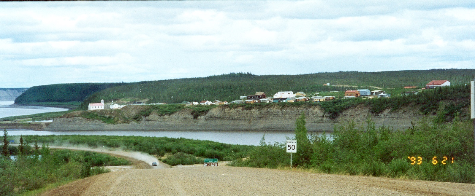
-
Article
Nass River
Nass River is 380 km long, rises in the northern interior of BC and flows generally southwest, draining approximately 20 700 km2, to reach the Pacific at Portland Inlet. Its major tributaries are the Bell-Irving, Meziadin and Cranberry rivers.
"https://d3d0lqu00lnqvz.cloudfront.net/media/media/98c7f804-42d2-47dd-a13b-335cd43c959f.jpg" // resources/views/front/categories/view.blade.php
https://d3d0lqu00lnqvz.cloudfront.net/media/media/98c7f804-42d2-47dd-a13b-335cd43c959f.jpg
-
Article
Nelson River
The Nelson River, 2,575 km long, flows north northeast out of Playgreen Lake, at the northwest tip of Lake Winnipeg. It spills out into a number of lakes, including Cross, Sipiwesk, Split and Stevens, flowing east from the latter into Hudson Bay.
"https://thecanadianencyclopedia.ca/images/tce_placeholder.jpg?v=e9dca980c9bdb3aa11e832e7ea94f5d9" // resources/views/front/categories/view.blade.php
https://thecanadianencyclopedia.ca/images/tce_placeholder.jpg?v=e9dca980c9bdb3aa11e832e7ea94f5d9
-
Article
Niagara River
The Niagara River, 58 km long, issues from Lake Erie and flows north over Niagara Falls to Lake Ontario. The river’s drainage area is about 684,000 km2, and its average flow at Queenston is 5,885 m3/s. The Niagara River forms part of the border between Canada and the United States.
"https://d3d0lqu00lnqvz.cloudfront.net/media/media/c9fad2bb-2972-411a-8527-e908fa8254b6.jpg" // resources/views/front/categories/view.blade.php
https://d3d0lqu00lnqvz.cloudfront.net/media/media/c9fad2bb-2972-411a-8527-e908fa8254b6.jpg
-
Article
North Saskatchewan River
The North Saskatchewan River (1,287 km long, the first 48.5 km of which is designated as a Canadian Heritage River) is a major tributary to the Saskatchewan River, which ultimately flows into Hudson Bay. The mean annual flow is 241 m3/s; however, flow varies between the peak in July and minimum in February. It served as a major transportation route from the end of the last Ice Age through the mid-20th century.
"https://d3d0lqu00lnqvz.cloudfront.net/media/media/98d61a99-4200-4393-92c7-61a42587d6cf.jpg" // resources/views/front/categories/view.blade.php
https://d3d0lqu00lnqvz.cloudfront.net/media/media/98d61a99-4200-4393-92c7-61a42587d6cf.jpg
-
Article
Qu'Appelle River
The Qu'Appelle River, 430 km long, rises in Lake Diefenbaker and meanders generally east across southern Saskatchewan, joining the Assiniboine River just east of the Manitoba border.
"https://thecanadianencyclopedia.ca/images/tce_placeholder.jpg?v=e9dca980c9bdb3aa11e832e7ea94f5d9" // resources/views/front/categories/view.blade.php
https://thecanadianencyclopedia.ca/images/tce_placeholder.jpg?v=e9dca980c9bdb3aa11e832e7ea94f5d9
-
Article
Red Deer River
The Red Deer River (740 km, mean annual flow rate 62 m3/s), is glacier-fed by streams from Mount Drummond and Cyclone Mountain in the Rockies of Banff National Park in Alberta. It flows east then south to join the South SASKATCHEWAN RIVER just inside Saskatchewan.
"https://thecanadianencyclopedia.ca/images/tce_placeholder.jpg?v=e9dca980c9bdb3aa11e832e7ea94f5d9" // resources/views/front/categories/view.blade.php
https://thecanadianencyclopedia.ca/images/tce_placeholder.jpg?v=e9dca980c9bdb3aa11e832e7ea94f5d9
-
Article
Restigouche River
Restigouche River (Ristigouche in Québec), 200 km long, rises in the highlands of northwestern New Brunswick as the Little Main Restigouche River.
"https://thecanadianencyclopedia.ca/images/tce_placeholder.jpg?v=e9dca980c9bdb3aa11e832e7ea94f5d9" // resources/views/front/categories/view.blade.php
https://thecanadianencyclopedia.ca/images/tce_placeholder.jpg?v=e9dca980c9bdb3aa11e832e7ea94f5d9
-
Article
Rivière Chaudière
Rivière Chaudière, 193 km long and with a basin 6690 km2, is located in southern Québec. It is named after the waters that "boil" from its falls or after the numerous glacial erosion kettles (chaudière is French for boiler and also for bucket).
"https://thecanadianencyclopedia.ca/images/tce_placeholder.jpg?v=e9dca980c9bdb3aa11e832e7ea94f5d9" // resources/views/front/categories/view.blade.php
https://thecanadianencyclopedia.ca/images/tce_placeholder.jpg?v=e9dca980c9bdb3aa11e832e7ea94f5d9
-
Article
Rivière de Rupert
Rivière de Rupert is 763 km long to the head of Lac Témiscamie. It drains Lac Mistassini and then follows a twisted course through a series of lakes and across a flat coastal plain to discharge into southeastern James Bay.
"https://thecanadianencyclopedia.ca/images/tce_placeholder.jpg?v=e9dca980c9bdb3aa11e832e7ea94f5d9" // resources/views/front/categories/view.blade.php
https://thecanadianencyclopedia.ca/images/tce_placeholder.jpg?v=e9dca980c9bdb3aa11e832e7ea94f5d9