
Browse "Rivers"
-
Article
Exploits River
The Exploits River, 246 km long is the longest river on the Island of Newfoundland. Its tributaries, the Lloyds and Victoria rivers, rise in the southwest corner of the Island and flow northeast into Red Indian Lake (250 km2).
"https://thecanadianencyclopedia.ca/images/tce_placeholder.jpg?v=e9dca980c9bdb3aa11e832e7ea94f5d9" // resources/views/front/categories/view.blade.php
https://thecanadianencyclopedia.ca/images/tce_placeholder.jpg?v=e9dca980c9bdb3aa11e832e7ea94f5d9
-
Article
French River
The French River, 290 km long (to head of Sturgeon River), rises from Lake Nipissing in northeastern Ontario and flows 110 km west towards Georgian Bay.
"https://thecanadianencyclopedia.ca/images/tce_placeholder.jpg?v=e9dca980c9bdb3aa11e832e7ea94f5d9" // resources/views/front/categories/view.blade.php
https://thecanadianencyclopedia.ca/images/tce_placeholder.jpg?v=e9dca980c9bdb3aa11e832e7ea94f5d9
-
Article
Gander River
Gander River, 175 km long, drainage basin 6,400 km2, is the principal river of northeast Newfoundland, emptying into Gander Bay.
"https://d3d0lqu00lnqvz.cloudfront.net/Gander_River-_Newfoundland-_Canada.jpg" // resources/views/front/categories/view.blade.php
https://d3d0lqu00lnqvz.cloudfront.net/Gander_River-_Newfoundland-_Canada.jpg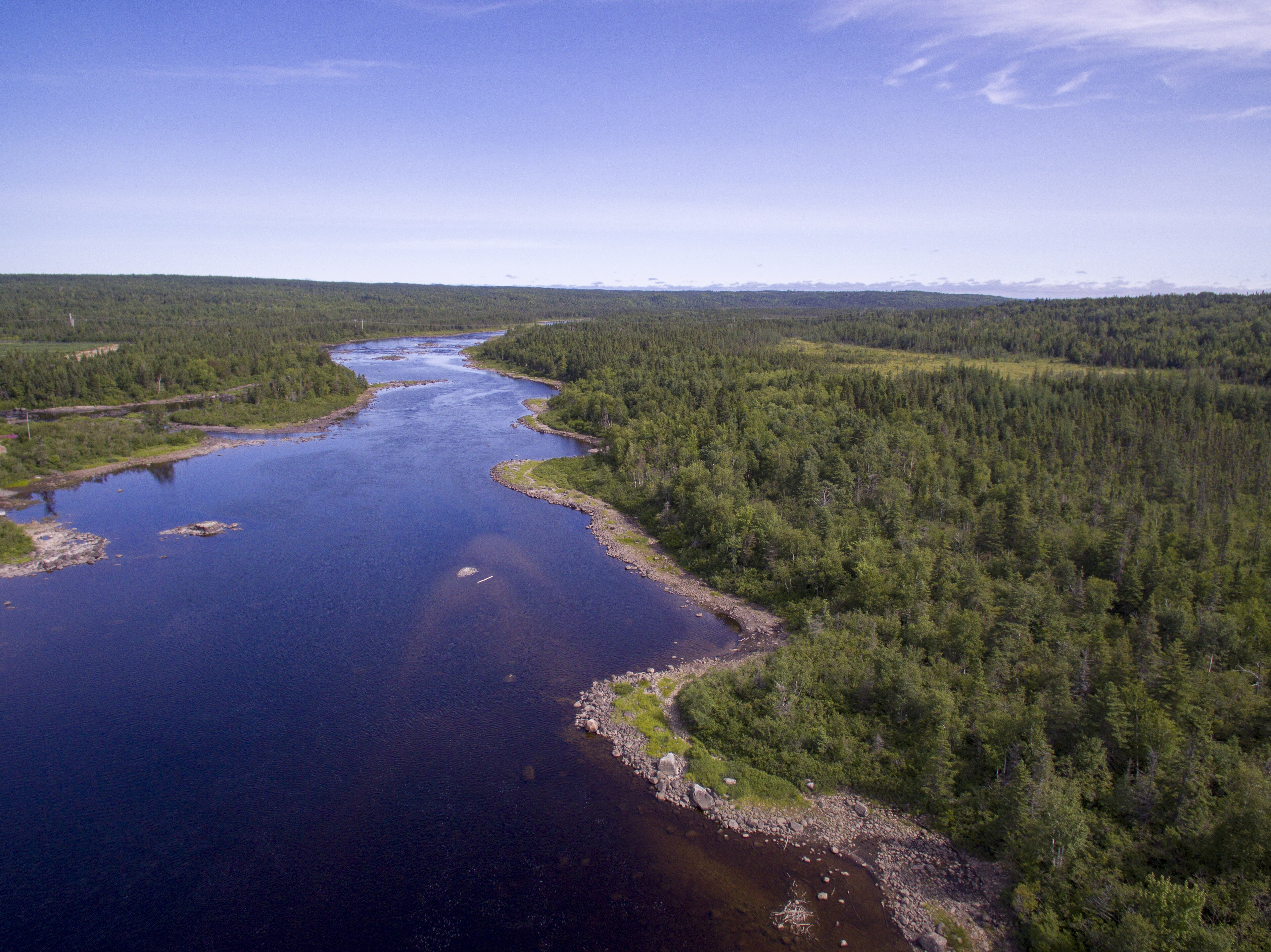
-
Article
George River
George River, 560 km long, in northern Québec, drains N into the E side of Ungava Bay. Its southern and eastern divides, along with those of tributary rivers Ford and De Pas, extend along much of the Québec-Newfoundland and Labrador border.
"https://thecanadianencyclopedia.ca/images/tce_placeholder.jpg?v=e9dca980c9bdb3aa11e832e7ea94f5d9" // resources/views/front/categories/view.blade.php
https://thecanadianencyclopedia.ca/images/tce_placeholder.jpg?v=e9dca980c9bdb3aa11e832e7ea94f5d9
-
Article
Grand River
From its source just south of Georgian Bay, the Grand River winds 266 km to Lake Erie, dropping 352 m along the way. Together with its major tributaries, the Speed, Nith, Conestogo and Eramosa rivers, it drains 6200 km2, the largest watershed in southern Ontario.
"https://thecanadianencyclopedia.ca/images/tce_placeholder.jpg?v=e9dca980c9bdb3aa11e832e7ea94f5d9" // resources/views/front/categories/view.blade.php
https://thecanadianencyclopedia.ca/images/tce_placeholder.jpg?v=e9dca980c9bdb3aa11e832e7ea94f5d9
-
Article
Harrison River
Harrison River, 15 km long, flows SW from Harrison Lk to join the Fraser River about 100 km upriver from Vancouver in southern BC.
"https://thecanadianencyclopedia.ca/images/tce_placeholder.jpg?v=e9dca980c9bdb3aa11e832e7ea94f5d9" // resources/views/front/categories/view.blade.php
https://thecanadianencyclopedia.ca/images/tce_placeholder.jpg?v=e9dca980c9bdb3aa11e832e7ea94f5d9
-
Article
Hayes River
The Hayes River, 483 km long, rises in Molson Lake (399 km2) northeast of Lake Winnipeg, flows northeast to Oxford Lake (401 km2) and Knee Lake, through the rock and bush of the Canadian Shield, across the clay flats of the Hudson Bay Lowlands and into the bay at YORK FACTORY.
"https://thecanadianencyclopedia.ca/images/tce_placeholder.jpg?v=e9dca980c9bdb3aa11e832e7ea94f5d9" // resources/views/front/categories/view.blade.php
https://thecanadianencyclopedia.ca/images/tce_placeholder.jpg?v=e9dca980c9bdb3aa11e832e7ea94f5d9
-
Article
Hillsborough River
The Hillsborough River begins near the white sand beaches of the north shore and winds 45 km through rich farm country to its mouth (Charlottetown Harbour) on the south shore of Prince Edward Island. At its mouth, the North and West rivers come together to meet the Hillsborough.
"https://thecanadianencyclopedia.ca/images/tce_placeholder.jpg?v=e9dca980c9bdb3aa11e832e7ea94f5d9" // resources/views/front/categories/view.blade.php
https://thecanadianencyclopedia.ca/images/tce_placeholder.jpg?v=e9dca980c9bdb3aa11e832e7ea94f5d9
-
Article
Humber River (Newfoundland)
The Humber River, 153 km long, drainage basin 7680 km2, is the principal river of western Newfoundland.
"https://thecanadianencyclopedia.ca/images/tce_placeholder.jpg?v=e9dca980c9bdb3aa11e832e7ea94f5d9" // resources/views/front/categories/view.blade.php
https://thecanadianencyclopedia.ca/images/tce_placeholder.jpg?v=e9dca980c9bdb3aa11e832e7ea94f5d9
-
Article
Humber River (Ontario)
Encompassing 908 km2 in total, the Humber River watershed is the largest in the Toronto region. The 126-kilometre long Humber River has its headwaters in the ancient rock of the NIAGARA ESCARPMENT and the glacial hills of the Oak Ridges Moraine.
"https://thecanadianencyclopedia.ca/images/tce_placeholder.jpg?v=e9dca980c9bdb3aa11e832e7ea94f5d9" // resources/views/front/categories/view.blade.php
https://thecanadianencyclopedia.ca/images/tce_placeholder.jpg?v=e9dca980c9bdb3aa11e832e7ea94f5d9
-
List
Indigenous Names of Rivers and Lakes in Canada
The names of many rivers and lakes in Canada have Indigenous origins. These bodies of water are named for Indigenous people, places, and aspects of Indigenous culture. Some of these lakes and rivers still bear the original name given to them by Indigenous people. Others have been renamed using an Indigenous word as a means of recognizing Indigenous history and working toward reconciliation. This list article explores the Indigenous names of five rivers and five lakes in Canada (see Longest Rivers in Canada and Largest Lakes in Canada).
"https://d3d0lqu00lnqvz.cloudfront.net/media/media/19ec5b64-165b-4f1c-b539-c89700680c09.jpg" // resources/views/front/categories/view.blade.php
https://d3d0lqu00lnqvz.cloudfront.net/media/media/19ec5b64-165b-4f1c-b539-c89700680c09.jpg
-
Article
Kazan River
Kazan River, 850 km long, rises near Kasba Lake in southern Nunavut near the Saskatchewan border. Flowing north it follows an irregular course through several lakes, draining a large part of the Barren Lands.
"https://thecanadianencyclopedia.ca/images/tce_placeholder.jpg?v=e9dca980c9bdb3aa11e832e7ea94f5d9" // resources/views/front/categories/view.blade.php
https://thecanadianencyclopedia.ca/images/tce_placeholder.jpg?v=e9dca980c9bdb3aa11e832e7ea94f5d9
-
Article
Kicking Horse River
The Kicking Horse River begins as glacial meltwater streams flowing down the west slope of the Rocky Mountains.
"https://thecanadianencyclopedia.ca/images/tce_placeholder.jpg?v=e9dca980c9bdb3aa11e832e7ea94f5d9" // resources/views/front/categories/view.blade.php
https://thecanadianencyclopedia.ca/images/tce_placeholder.jpg?v=e9dca980c9bdb3aa11e832e7ea94f5d9
-
Article
La Grande Rivière
La Grande Rivière, 893 km long, rises in the rugged forest highlands of central Québec and drains west into James Bay.
"https://d3d0lqu00lnqvz.cloudfront.net/media/media/33649494-8426-4ec2-8001-9f2613ea3d08.jpg" // resources/views/front/categories/view.blade.php
https://d3d0lqu00lnqvz.cloudfront.net/media/media/33649494-8426-4ec2-8001-9f2613ea3d08.jpg
-
Article
Mackenzie River
The Mackenzie River’s main stem is 1,738 km long, making it one of the longest rivers in Canada. The Mackenzie River system, which includes tributaries such as the Liard River, is 4,241 km. The Mackenzie River runs northwest through the Northwest Territories, from Great Slave Lake to the Beaufort Sea. Its total drainage basin — 1.8 million km2 — is the largest of any river in Canada and its mean discharge of 9,700 m3/s is second only to that of the St. Lawrence. The river's peak discharge occurs in June, but its flow is generally uniform because of the flat topography east of the river and the many large lakes in the system. The break-up of ice begins at the Liard Riverin late April, early May. The river is free of ice by early June and stays open until November.
"https://d3d0lqu00lnqvz.cloudfront.net/media/new_article_images/NaturalResources/dreamstime_xl_51730435.jpg" // resources/views/front/categories/view.blade.php
https://d3d0lqu00lnqvz.cloudfront.net/media/new_article_images/NaturalResources/dreamstime_xl_51730435.jpg