
Browse "Cities & Populated Places"
-
Article
Tracadie-Sheila
Tracadie-Sheila, NB, incorporated as a town in 1992, population 4933 (2011c), 4479 (2006c). The Town of Tracadie-Sheila is situated on the Gulf of ST LAWRENCE, 83 km southeast of BATHURST.
"https://thecanadianencyclopedia.ca/images/tce_placeholder.jpg?v=e9dca980c9bdb3aa11e832e7ea94f5d9" // resources/views/front/categories/view.blade.php
https://thecanadianencyclopedia.ca/images/tce_placeholder.jpg?v=e9dca980c9bdb3aa11e832e7ea94f5d9
-
Article
Trenton (NS)
Trenton, NS, incorporated as a town in 1911, population 2616 (2011c), 2741 (2006c). The Town of Trenton is located on the East River, immediately adjacent to New Glasgow.
"https://thecanadianencyclopedia.ca/images/tce_placeholder.jpg?v=e9dca980c9bdb3aa11e832e7ea94f5d9" // resources/views/front/categories/view.blade.php
https://thecanadianencyclopedia.ca/images/tce_placeholder.jpg?v=e9dca980c9bdb3aa11e832e7ea94f5d9
-
Article
Trinity
Trinity, NL, incorporated as a town in 1997, population 137 (2011c), 191 (2006c). The Town of Trinity is located on TRINITY BAY in northeast Newfoundland.
"https://d3d0lqu00lnqvz.cloudfront.net/media/media/58774878-3d11-4ee2-9eb0-03b03dad0d66.jpg" // resources/views/front/categories/view.blade.php
https://d3d0lqu00lnqvz.cloudfront.net/media/media/58774878-3d11-4ee2-9eb0-03b03dad0d66.jpg
-
Article
Trois-Rivières
Trois-Rivières, Quebec, incorporated as a city in 1857, population 139,163 (2021 census), 134,413 (2016 census). The city is located at the mouth of the Saint-Maurice River, on the north shore of the St. Lawrence, midway between Quebec City and Montreal and is the regional capital of Quebec's Mauricie region. Its name derives from the 3-armed delta formed by the river's islands at its mouth.
"https://d3d0lqu00lnqvz.cloudfront.net/media/media/f64e6118-f564-4f2e-aee3-8d7194dda785.jpg" // resources/views/front/categories/view.blade.php
https://d3d0lqu00lnqvz.cloudfront.net/media/media/f64e6118-f564-4f2e-aee3-8d7194dda785.jpg
-
Article
Tsiigehtchic
Tsiigehtchic, Northwest Territories, population 187 (2019). Tsiigehtchic is located at the confluence of the Mackenzie and Arctic Red rivers. It is home to the Gwichya Gwich’in First Nation (“people of the flat lands”) who speak an Athapaskan language (see Indigenous Languages in Canada). Formerly known as Arctic Red River, the community’s name was changed to Tsiigehtchic (“at the mouth of iron river”) in 1994. The community is on the Dempster Highway. It is accessible by summer ferry across the Mackenzie River and in winter by ice road. Tsiigehtchic is one of four communities in the Gwich’in Settlement Region. The region is an area created by the Gwich’in Comprehensive Land Claim Agreement (1992). The other three communities in the region are Aklavik, Fort McPherson and Inuvik. (See also Dinjii Zhuh (Gwich'in).)
"https://d3d0lqu00lnqvz.cloudfront.net/media/new_article_images/Tsiigehtchic/River.jpg" // resources/views/front/categories/view.blade.php
https://d3d0lqu00lnqvz.cloudfront.net/media/new_article_images/Tsiigehtchic/River.jpg
-
"https://thecanadianencyclopedia.ca/images/tce_placeholder.jpg?v=e9dca980c9bdb3aa11e832e7ea94f5d9" // resources/views/front/categories/view.blade.php
https://thecanadianencyclopedia.ca/images/tce_placeholder.jpg?v=e9dca980c9bdb3aa11e832e7ea94f5d9
-
Article
Tungsten (NWT)
Tungsten, NWT, was a settlement located in the Selwyn Mountains, near the NWT and Yukon border.
"https://thecanadianencyclopedia.ca/images/tce_placeholder.jpg?v=e9dca980c9bdb3aa11e832e7ea94f5d9" // resources/views/front/categories/view.blade.php
https://thecanadianencyclopedia.ca/images/tce_placeholder.jpg?v=e9dca980c9bdb3aa11e832e7ea94f5d9
-
Article
Twillingate
Twillingate, NL, incorporated as a town in 1962, population 2269 (2011c), 2448 (2006c). The Town of Twillingate is located on Twillingate Islands, Notre Dame Bay in northeast Newfoundland.
"https://thecanadianencyclopedia.ca/images/tce_placeholder.jpg?v=e9dca980c9bdb3aa11e832e7ea94f5d9" // resources/views/front/categories/view.blade.php
https://thecanadianencyclopedia.ca/images/tce_placeholder.jpg?v=e9dca980c9bdb3aa11e832e7ea94f5d9
-
Article
Tyendinaga Mohawk Territory
The Mohawks of the Bay of Quinte are part of the Kanyen’kehá:ka or Mohawk Nation. Kanyen’kehá:ka means “People of the Land of Flint.” The Mohawk Nation is in turn part of the Rotinonhsyón:ni (Haudenosaunee or Six Nations Confederacy), which translates in English to “People of the Longhouse.” As of February 2026, there were 11,881 members of the Mohawks of the Bay of Quinte living on Turtle Island and beyond. At that time, 2,090 of these members lived on Tyendinaga Mohawk Territory. The Territory is located on the northeastern shore of the Bay of Quinte, just east of Belleville, Ontario.
"https://d3d0lqu00lnqvz.cloudfront.net/media/new_article_images/Tyendinaga/TyendinagaPowwow.jpg" // resources/views/front/categories/view.blade.php
https://d3d0lqu00lnqvz.cloudfront.net/media/new_article_images/Tyendinaga/TyendinagaPowwow.jpg
-
Article
Ucluelet (BC)
Ucluelet, BC, incorporated as a district municipality in 1997, population 1627 (2011c), 1487 (2006c). The District of Ucluelet is located on the west coast of Vancouver Island, 175 km northwest of Victoria, at the entrance to Barkley Sound.
"https://d3d0lqu00lnqvz.cloudfront.net/media/media/4fa0038e-052c-4dd8-acc5-c3bba0cf8e6c.jpg" // resources/views/front/categories/view.blade.php
https://d3d0lqu00lnqvz.cloudfront.net/media/media/4fa0038e-052c-4dd8-acc5-c3bba0cf8e6c.jpg
-
Article
Ulukhaktok
Ulukhaktok, Northwest Territories, incorporated as a hamlet in 1984, population 396 (2016 census), 402 (2011 census). The hamlet of Ulukhaktok is located on the west coast of Victoria Island, on inlets of the Amundsen Gulf, 925 air kilometres north of Yellowknife. The area is the ancestral homeland of the Inuinnait.
"https://d3d0lqu00lnqvz.cloudfront.net/media/media/0668e8fb-1dc0-41b6-b5da-5ac9456eb38a.jpg" // resources/views/front/categories/view.blade.php
https://d3d0lqu00lnqvz.cloudfront.net/media/media/0668e8fb-1dc0-41b6-b5da-5ac9456eb38a.jpg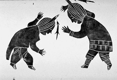
-
Article
Unity
Unity, Sask, incorporated as a town in 1919, population 2389 (2011c), 2147 (2006c). The Town of Unity is located in west-central Saskatchewan 70 km southwest of North Battleford. Settlement in the area commenced in 1904 and the
"https://thecanadianencyclopedia.ca/images/tce_placeholder.jpg?v=e9dca980c9bdb3aa11e832e7ea94f5d9" // resources/views/front/categories/view.blade.php
https://thecanadianencyclopedia.ca/images/tce_placeholder.jpg?v=e9dca980c9bdb3aa11e832e7ea94f5d9
-
Article
Upper Island Cove
Upper Island Cove, NL, incorporated as a town in 1965, population 1594 (2011c), 1667 (2006c). The Town of Upper Island Cove was created when two communities (Upper Island Cove and Spoon Cove) amalgamated. The town is located north of SPANIARD'S BAY on the northwest side of CONCEPTION BAY.
"https://thecanadianencyclopedia.ca/images/tce_placeholder.jpg?v=e9dca980c9bdb3aa11e832e7ea94f5d9" // resources/views/front/categories/view.blade.php
https://thecanadianencyclopedia.ca/images/tce_placeholder.jpg?v=e9dca980c9bdb3aa11e832e7ea94f5d9
-
Article
Upper Liard
Upper Liard, Yukon, settlement, population 125 (2016 census), 132 (2011 census). Upper Liard is located 7 km west of Watson Lake on the Alaska Highway.
"https://thecanadianencyclopedia.ca/images/tce_placeholder.jpg?v=e9dca980c9bdb3aa11e832e7ea94f5d9" // resources/views/front/categories/view.blade.php
https://thecanadianencyclopedia.ca/images/tce_placeholder.jpg?v=e9dca980c9bdb3aa11e832e7ea94f5d9
-
Article
Uranium City
Uranium City, Saskatchewan, northern settlement, population 91 (2021 census), 73 (2016 census). Uranium City is located about 50 km south of the provincial boundary with the Northwest Territories and 75 km east of the Saskatchewan-Alberta border.
"https://d3d0lqu00lnqvz.cloudfront.net/media/new_article_images/UraniumCity/Uranium_City.jpg" // resources/views/front/categories/view.blade.php
https://d3d0lqu00lnqvz.cloudfront.net/media/new_article_images/UraniumCity/Uranium_City.jpg