
Browse "Cities & Populated Places"
-
Article
St. John's
St. John's, NL, incorporated as a city in 1921, population 110,525 (2021 census), 108,860 (2016 census). The capital and largest city of Newfoundland and Labrador, the city of St. John's is located on the eastern side of the Avalon Peninsula of southeast Newfoundland. Its landlocked harbour is approached through a long, narrow channel and is protected by the high hills on which the city is built. The origin of the name St. John's is not known, but its use appears on a Portuguese map by Pedro Reinel (1516–20) as "Rio de San Johem" and later, in a 1527 letter by the English seaman John Rut, as the "Haven of St. John's." According to popular folklore, however, the city takes its name from the feast of Saint John the Baptist and the arrival of Italian explorer Giovanni Caboto (John Cabot) on the shores of Newfoundland on 24 June 1497.
"https://d3d0lqu00lnqvz.cloudfront.net/media/media/fa98a7ea-65f5-47f6-9d63-252242142821.jpg" // resources/views/front/categories/view.blade.php
https://d3d0lqu00lnqvz.cloudfront.net/media/media/fa98a7ea-65f5-47f6-9d63-252242142821.jpg
-
Article
St Lawrence
St Lawrence, NL, incorporated as a town in 1949, population 1244 (2011c), 1349 (2006c). The Town of St Lawrence is located in the southeast corner of Newfoundland on the Burin Peninsula.
"https://d3d0lqu00lnqvz.cloudfront.net/media/media/b7a47460-85e0-4234-bcc2-659dcd61fad9.jpg" // resources/views/front/categories/view.blade.php
https://d3d0lqu00lnqvz.cloudfront.net/media/media/b7a47460-85e0-4234-bcc2-659dcd61fad9.jpg
-
Article
St. Margarets Bay
St. Margarets Bay, 70 km2, is a small inlet of the Atlantic Ocean on the SE coast of Nova Scotia, 40 km W of HALIFAX. It is a favourite summer resort area, noted especially for its relatively warm surface water, sandy beaches and ideal sailing conditions for small craft.
"https://thecanadianencyclopedia.ca/images/tce_placeholder.jpg?v=e9dca980c9bdb3aa11e832e7ea94f5d9" // resources/views/front/categories/view.blade.php
https://thecanadianencyclopedia.ca/images/tce_placeholder.jpg?v=e9dca980c9bdb3aa11e832e7ea94f5d9
-
Article
St Marys
The CANADA COMPANY had the area surveyed in 1839. The first settlers were attracted to the community in the 1840s because its location on the banks of the 2 watercourses meant water power to run various mills.
"https://thecanadianencyclopedia.ca/images/tce_placeholder.jpg?v=e9dca980c9bdb3aa11e832e7ea94f5d9" // resources/views/front/categories/view.blade.php
https://thecanadianencyclopedia.ca/images/tce_placeholder.jpg?v=e9dca980c9bdb3aa11e832e7ea94f5d9
-
Article
St. Paul
St. Paul, Alberta, incorporated as a town in 1936, population 5,827 (2016 census), 5,405 (2011 census). The town of St. Paul, county seat for the county of St. Paul, is located on the north shore of Upper Thérien Lake, about 200 km northeast of Edmonton.
"https://d3d0lqu00lnqvz.cloudfront.net/media/media/d98dfd00-9c91-4c5d-bdbe-d68a2a98ce2e.jpg" // resources/views/front/categories/view.blade.php
https://d3d0lqu00lnqvz.cloudfront.net/media/media/d98dfd00-9c91-4c5d-bdbe-d68a2a98ce2e.jpg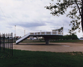
-
Article
St Peter's
St Peter's, NS, incorporated as a village in, inc 1940. St Peter's is situated between St Peter's Inlet and St Peter's Bay on the south shore of Cape Breton Island.
"https://thecanadianencyclopedia.ca/images/tce_placeholder.jpg?v=e9dca980c9bdb3aa11e832e7ea94f5d9" // resources/views/front/categories/view.blade.php
https://thecanadianencyclopedia.ca/images/tce_placeholder.jpg?v=e9dca980c9bdb3aa11e832e7ea94f5d9
-
Article
St. Peters Bay
St. Peters Bay, Prince Edward Island, Rural Municipality, incorporated in 1953, population 231 (2021 census), 237 (2016 census). St. Peters Bay the community is located at the eastern end of St. Peters Bay the body of water, along PEI’s northeastern shore. The village is known for its annual Blueberry Festival and the nearby PEI National Park in Greenwich.
"https://d3d0lqu00lnqvz.cloudfront.net/StPetersBay/DoctorRoddie.jpg" // resources/views/front/categories/view.blade.php
https://d3d0lqu00lnqvz.cloudfront.net/StPetersBay/DoctorRoddie.jpg
-
Article
St Pierre-Jolys
St-Pierre-Jolys, Manitoba, incorporated as a village in 1947, population 1099 (2011c), 839 (2006c). The Village of St-Pierre-Jolys is located 56 km southeast of WINNIPEG near the Rat River.
"https://thecanadianencyclopedia.ca/images/tce_placeholder.jpg?v=e9dca980c9bdb3aa11e832e7ea94f5d9" // resources/views/front/categories/view.blade.php
https://thecanadianencyclopedia.ca/images/tce_placeholder.jpg?v=e9dca980c9bdb3aa11e832e7ea94f5d9
-
Article
St. Stephen
St. Stephen, New Brunswick, incorporated as a town in 1973, population 4,415 (2016 census), 4,817 (2011 census). The town of St. Stephen is located on the St. Croix River in southwestern New Brunswick. First incorporated as a town in 1871, in 1973 St. Stephen was amalgamated with nearby Milltown (incorporated 1878) to form St. Stephen-Milltown. The incorporated name of St. Stephen has been used since 1975.
"https://thecanadianencyclopedia.ca/images/tce_placeholder.jpg?v=e9dca980c9bdb3aa11e832e7ea94f5d9" // resources/views/front/categories/view.blade.php
https://thecanadianencyclopedia.ca/images/tce_placeholder.jpg?v=e9dca980c9bdb3aa11e832e7ea94f5d9
-
Article
St Thomas
St Thomas, Ont, incorporated as a city in 1881, seat of Elgin County, population 37 905 (2011c), 36 110 (2006c). The City of St Thomas is located in southwestern Ontario, 29 km south of London. In 1803 Thomas TALBOT began to place settlers on a large tract of land he owned N of Lake Erie.
"https://thecanadianencyclopedia.ca/images/tce_placeholder.jpg?v=e9dca980c9bdb3aa11e832e7ea94f5d9" // resources/views/front/categories/view.blade.php
https://thecanadianencyclopedia.ca/images/tce_placeholder.jpg?v=e9dca980c9bdb3aa11e832e7ea94f5d9
-
Article
Stadacona
Stadacona was an Iroquoian village located at the present site of Quebec City, Quebec. It had an estimated population of about 500. French navigator Jacques Cartier was led to the village on his second voyage in 1535 and wintered at a safe distance, across the St-Charles River.
"https://d3d0lqu00lnqvz.cloudfront.net/media/media/24df7e90-74bb-4e4d-99ad-e63d85d72d54.jpg" // resources/views/front/categories/view.blade.php
https://d3d0lqu00lnqvz.cloudfront.net/media/media/24df7e90-74bb-4e4d-99ad-e63d85d72d54.jpg
-
Article
Ste-Anne-de-Beaupré
Sainte-Anne-de-Beaupré, Quebec, constituted as a town in 1973, population 2,888 (2021 census), 2,880 (2011 census). The town has an area 62.64 km2 and is located on the north shore of the St. Lawrence River, 35 km east of Québec City. The town of Sainte-Anne-de-Beaupré is known worldwide for its Basilica of Sainte-Anne-de-Beaupré, a national shrine and pilgrimage site attracting over one million visitors and pilgrims annually. On 28 July 2022, Pope Francis celebrated mass at the basilica as part of his Apostolic Journey to Canada.
"https://d3d0lqu00lnqvz.cloudfront.net/media/media/81c8f2b9-c8a4-426f-ace2-e07cf5b82ea7.mov" // resources/views/front/categories/view.blade.php
https://d3d0lqu00lnqvz.cloudfront.net/media/media/81c8f2b9-c8a4-426f-ace2-e07cf5b82ea7.mov -
Article
Ste. Madeleine Métis Community
Ste. Madeleine was a Métis homestead of about 250 people located in Manitoba, near the Saskatchewan border. Red River Métis citizens and families established the settlement in the late 1800s and early 1900s. The community existed until shortly after the government implemented the Prairie Farm Rehabilitation Act of 1935 (see Prairie Farm Rehabilitation Administration). The Act was designed to assist farmers during drought conditions. However, it dispossessed the community of their land. In 1939, the community was destroyed, and the land was converted to pastureland. The Métis were removed with little or no compensation.
"https://thecanadianencyclopedia.ca/images/tce_placeholder.jpg?v=e9dca980c9bdb3aa11e832e7ea94f5d9" // resources/views/front/categories/view.blade.php
https://thecanadianencyclopedia.ca/images/tce_placeholder.jpg?v=e9dca980c9bdb3aa11e832e7ea94f5d9
-
Article
Ste-Marie
Ste-Marie, Qué, Town, pop 11 320 (2001c), 10 966 (1996c), 10 513 (1991cA), 9536 (1986c), area 107.20 km2, inc 1855, is located on the Rivière CHAUDIÈRE. Situated on lowlands suitable for agriculture, it was built on part of the seigneury given in 1736 to Thomas-Jacques Taschereau.
"https://thecanadianencyclopedia.ca/images/tce_placeholder.jpg?v=e9dca980c9bdb3aa11e832e7ea94f5d9" // resources/views/front/categories/view.blade.php
https://thecanadianencyclopedia.ca/images/tce_placeholder.jpg?v=e9dca980c9bdb3aa11e832e7ea94f5d9
-
Article
Sainte-Scholastique
Sainte-Scholastique, Quebec, incorporated as a parish in 1834, population 1,618 (2019). The village of Sainte-Scholastique ceased to exist when the land was expropriated in 1969 for the construction of Montreal-Mirabel International Airport. It then became part of the new city of Mirabel.
"https://thecanadianencyclopedia.ca/images/tce_placeholder.jpg?v=e9dca980c9bdb3aa11e832e7ea94f5d9" // resources/views/front/categories/view.blade.php
https://thecanadianencyclopedia.ca/images/tce_placeholder.jpg?v=e9dca980c9bdb3aa11e832e7ea94f5d9
