
Browse "Cities & Populated Places"
-
Article
Simcoe
The town of Simcoe, including the nearby hamlet of Hillcrest, was one of 6 area municipalities formed as part of the Regional Municipality of Haldimand-Norfolk in 1974.
"https://thecanadianencyclopedia.ca/images/tce_placeholder.jpg?v=e9dca980c9bdb3aa11e832e7ea94f5d9" // resources/views/front/categories/view.blade.php
https://thecanadianencyclopedia.ca/images/tce_placeholder.jpg?v=e9dca980c9bdb3aa11e832e7ea94f5d9
-
Article
Sioux Narrows-Nestor Falls
Some 500 Ojibwa currently live on the nearby Whitefish Bay Reserve. European settlement dates from the late 1920s, although previously there were numerous lumber camps in the area.
"https://thecanadianencyclopedia.ca/images/tce_placeholder.jpg?v=e9dca980c9bdb3aa11e832e7ea94f5d9" // resources/views/front/categories/view.blade.php
https://thecanadianencyclopedia.ca/images/tce_placeholder.jpg?v=e9dca980c9bdb3aa11e832e7ea94f5d9
-
Article
Slave Lake
Slave Lake, Alberta, incorporated as a town in 1965, population 6,651 (2016 census), 6,782 (2011 census). The town of Slave Lake is about two kilometres from the southeastern shore of Lesser Slave Lake.
"https://d3d0lqu00lnqvz.cloudfront.net/media/media/04d79109-7d09-494b-943b-1d5a62085ec2.jpg" // resources/views/front/categories/view.blade.php
https://d3d0lqu00lnqvz.cloudfront.net/media/media/04d79109-7d09-494b-943b-1d5a62085ec2.jpg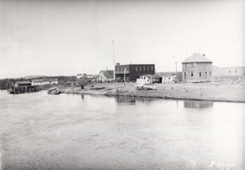
-
Article
Slocan
Slocan, British Columbia, incorporated as a village in 1958, population 272 (2016 census), 296 (2011 census). The village of Slocan is located 70 km by road northwest of Nelson, at the south end of Slocan Lake. Slocan is an Okanagan word meaning “pierce or strike on the head,” referring to the salmon-fishing practice of the Okanagan (see Interior Salish). The community was also known as Slocan City when it was an incorporated city (1901-1958).
"https://d3d0lqu00lnqvz.cloudfront.net/media/media/ade75a0e-66ab-432e-af8e-3566a6dad341.jpg" // resources/views/front/categories/view.blade.php
https://d3d0lqu00lnqvz.cloudfront.net/media/media/ade75a0e-66ab-432e-af8e-3566a6dad341.jpg
-
Article
Smithers
Smithers, British Columbia, incorporated as a town in 1967, population 5,401 (2016 census), 5,404 (2011 census). The town of Smithers is located on the Bulkley River in central BC, on Highway 16. The town is 334 km west of Prince George and 371 km east of Prince Rupert.
"https://thecanadianencyclopedia.ca/images/tce_placeholder.jpg?v=e9dca980c9bdb3aa11e832e7ea94f5d9" // resources/views/front/categories/view.blade.php
https://thecanadianencyclopedia.ca/images/tce_placeholder.jpg?v=e9dca980c9bdb3aa11e832e7ea94f5d9
-
Article
Smiths Falls
Smiths Falls, ON, incorporated as a town in 1882, population 9,254 (2021 census), 8,780 (2016 census). The Town of Smiths Falls is located on the Rideau River, 60 km southwest of Ottawa. The town is an important lockport on the waterway.
"https://thecanadianencyclopedia.ca/images/tce_placeholder.jpg?v=e9dca980c9bdb3aa11e832e7ea94f5d9" // resources/views/front/categories/view.blade.php
https://thecanadianencyclopedia.ca/images/tce_placeholder.jpg?v=e9dca980c9bdb3aa11e832e7ea94f5d9
-
Article
Snag
Snag, Yukon Territory, was a community located at the mouth of Snag Creek, 465 km northwest of Whitehorse. The creek was so named in 1898 by members of the US Geological Survey, possibly because it was choked with dead trees.
"https://thecanadianencyclopedia.ca/images/tce_placeholder.jpg?v=e9dca980c9bdb3aa11e832e7ea94f5d9" // resources/views/front/categories/view.blade.php
https://thecanadianencyclopedia.ca/images/tce_placeholder.jpg?v=e9dca980c9bdb3aa11e832e7ea94f5d9
-
Article
Snow Lake
Snow Lake, Manitoba, incorporated as a town in 1976, population 723 (2011c), 837 (2006c). The Town of Snow Lake is located 679 km northwest of Winnipeg on the Canadian SHIELD.
"https://thecanadianencyclopedia.ca/images/tce_placeholder.jpg?v=e9dca980c9bdb3aa11e832e7ea94f5d9" // resources/views/front/categories/view.blade.php
https://thecanadianencyclopedia.ca/images/tce_placeholder.jpg?v=e9dca980c9bdb3aa11e832e7ea94f5d9
-
Article
Sorel-Tracy
Sorel-Tracy, Quebec, incorporated as a city in 2000, population 35,165 (2021 census), 34,755 (2016 census). Sorel-Tracy is located on the south shore of the St. Lawrence River, at the mouth of the Richelieu River, approximately 80 km northeast of Montreal. Sorel-Tracy is the result of the voluntary amalgamation of the municipalities of Sorel (founded in 1642) and Tracy (incorporated in 1954) in 2000. Sorel-Tracy is known for its industrial port and metallurgy industry.
"https://d3d0lqu00lnqvz.cloudfront.net/media/media/d6a8cdc3-649a-4920-9797-0bfec5539b5f.jpg" // resources/views/front/categories/view.blade.php
https://d3d0lqu00lnqvz.cloudfront.net/media/media/d6a8cdc3-649a-4920-9797-0bfec5539b5f.jpg
-
Article
Souris (Man)
Souris, Manitoba, incorporated as a town in 1903, population 1837 (2011c), 1772 (2006c). The Town of Souris is located at the junction of Plum Creek and the SOURIS RIVER, 45 km by road southwest of Brandon.
"https://thecanadianencyclopedia.ca/images/tce_placeholder.jpg?v=e9dca980c9bdb3aa11e832e7ea94f5d9" // resources/views/front/categories/view.blade.php
https://thecanadianencyclopedia.ca/images/tce_placeholder.jpg?v=e9dca980c9bdb3aa11e832e7ea94f5d9
-
Article
Souris (PEI)
Souris, Prince Edward Island, incorporated as a town in 1910, population 1,079 (2021 census), 1,053 (2016 census). Located in Kings County in the northeastern portion of PEI, the town is situated along Colville Bay at the mouth of the Souris River. Due to the orientation of its port, there is minimal fast ice (ice anchored to the shore) in the harbour. Additionally, it is strategically close to major shipping routes, and it is PEI’s nearest practical port with the shortest sea voyage to both sides of the Atlantic. Souris has been the location of the interprovincial ferry terminal for the service to Quebec’s Magdalen Islands since 1971.
"https://d3d0lqu00lnqvz.cloudfront.net/souris/lighthouse.jpg" // resources/views/front/categories/view.blade.php
https://d3d0lqu00lnqvz.cloudfront.net/souris/lighthouse.jpg
-
Article
South Porcupine
South Porcupine, ON, one of five wards in the city of Timmins. Incorporated in 1911, South Porcupine became a part of Timmins in 1973. The town is named for an island in a local river reportedly shaped like a porcupine.
"https://d3d0lqu00lnqvz.cloudfront.net/media/media/32e4c070-eeb8-4b20-83d5-b09fd6ad1241.jpg" // resources/views/front/categories/view.blade.php
https://d3d0lqu00lnqvz.cloudfront.net/media/media/32e4c070-eeb8-4b20-83d5-b09fd6ad1241.jpg
-
Article
Spallumcheen
Spallumcheen, British-Columbia, incorporated as a district municipality in 1892, population 5,307 (2021 census), 5,106 (2016 census). The Township of Spallumcheen is located about seven kilometres north of Vernon and completely encloses the city of Armstrong.
"https://thecanadianencyclopedia.ca/images/tce_placeholder.jpg?v=e9dca980c9bdb3aa11e832e7ea94f5d9" // resources/views/front/categories/view.blade.php
https://thecanadianencyclopedia.ca/images/tce_placeholder.jpg?v=e9dca980c9bdb3aa11e832e7ea94f5d9
-
Article
Spaniard's Bay
Spaniard's Bay, NL, incorporated as a town in 1965, population 2622 (2011c), 2540 (2006c). The Town of Spaniard's Bay is located north of Bay Roberts on the west side of Conception Bay.
"https://thecanadianencyclopedia.ca/images/tce_placeholder.jpg?v=e9dca980c9bdb3aa11e832e7ea94f5d9" // resources/views/front/categories/view.blade.php
https://thecanadianencyclopedia.ca/images/tce_placeholder.jpg?v=e9dca980c9bdb3aa11e832e7ea94f5d9
-
Article
Sparwood
Sparwood, British Columbia, incorporated as a district municipality in 1966, population 3,784 (2016 census), 3,667 (2011 census). The District of Sparwood is located 32 km northeast of Fernie in the Elk River Valley, and on the traditional territory of the Ktunaxa people.
"https://thecanadianencyclopedia.ca/images/tce_placeholder.jpg?v=e9dca980c9bdb3aa11e832e7ea94f5d9" // resources/views/front/categories/view.blade.php
https://thecanadianencyclopedia.ca/images/tce_placeholder.jpg?v=e9dca980c9bdb3aa11e832e7ea94f5d9