Browse "Cities & Populated Places"
-
Article
Dorval
Dorval was a farming community and a resort area until the outset of the Second World War. In 1941 it became the home of the FERRY COMMAND and of a military airport, today's Montréal International Airport. After the war, this airport was an economic magnet.
"https://thecanadianencyclopedia.ca/images/tce_placeholder.jpg?v=e9dca980c9bdb3aa11e832e7ea94f5d9" // resources/views/front/categories/view.blade.php
https://thecanadianencyclopedia.ca/images/tce_placeholder.jpg?v=e9dca980c9bdb3aa11e832e7ea94f5d9
-
Article
Douglastown
Douglastown, NB, is an urban community within the city of MIRAMICHI located on the north bank of the MIRAMICHI RIVER.
"https://thecanadianencyclopedia.ca/images/tce_placeholder.jpg?v=e9dca980c9bdb3aa11e832e7ea94f5d9" // resources/views/front/categories/view.blade.php
https://thecanadianencyclopedia.ca/images/tce_placeholder.jpg?v=e9dca980c9bdb3aa11e832e7ea94f5d9
-
Article
Dresden
Dresden, Ontario, population centre, population 2,401 (2021 census), 2,451 (2016 census). Incorporated as a town in 1882, Dresden lost this status in 1998 after it merged into the new municipality of Chatham-Kent. Dresden is an agricultural community located in southwestern Ontario on the Sydenham River. The Dawn Settlement, near Dresden, was one of the final destinations of the Underground Railroad. In the mid-20th century, some businesses in Dresden became infamous for refusing to serve Black Canadians (see Racial Segregation of Black People).
"https://d3d0lqu00lnqvz.cloudfront.net/media/media/83ab1e40-ef36-47fc-9c13-ddd047b6aae7.jpg" // resources/views/front/categories/view.blade.php
https://d3d0lqu00lnqvz.cloudfront.net/media/media/83ab1e40-ef36-47fc-9c13-ddd047b6aae7.jpg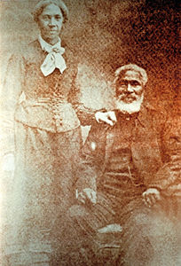
-
Article
Drumheller
Drumheller, Alberta, incorporated as a town in 1998, population 7,909 (2021 census), 7,982 (2016 census). The town of Drumheller is located on the Red Deer River in southern Alberta, 138 km northeast of Calgary. The Red Deer River valley is internationally known its abundance of fossils, particularly of dinosaurs.
"https://thecanadianencyclopedia.ca/images/tce_placeholder.jpg?v=e9dca980c9bdb3aa11e832e7ea94f5d9" // resources/views/front/categories/view.blade.php
https://thecanadianencyclopedia.ca/images/tce_placeholder.jpg?v=e9dca980c9bdb3aa11e832e7ea94f5d9
-
Article
Drummondville
Drummondville, Quebec, incorporated as a city in 1875, population 79,258 (2021 census), 75,423 (2016 census). Drummondville is located on the Saint-François River, a tributary of the St. Lawrence River, in the St. Lawrence Lowland. At the crossroads between highways 20 and 55, between 75 km and 150 km of Montreal, Quebec City, Trois-Rivières and Sherbrooke, it is also known as the “Coeur-du-Québec” (the Heart of Quebec.)
"https://thecanadianencyclopedia.ca/images/tce_placeholder.jpg?v=e9dca980c9bdb3aa11e832e7ea94f5d9" // resources/views/front/categories/view.blade.php
https://thecanadianencyclopedia.ca/images/tce_placeholder.jpg?v=e9dca980c9bdb3aa11e832e7ea94f5d9
-
"https://thecanadianencyclopedia.ca/images/tce_placeholder.jpg?v=e9dca980c9bdb3aa11e832e7ea94f5d9" // resources/views/front/categories/view.blade.php
https://thecanadianencyclopedia.ca/images/tce_placeholder.jpg?v=e9dca980c9bdb3aa11e832e7ea94f5d9
-
Article
Dundas
Dundas, Ont, Urban Community within the city of Hamilton. Dundas is located at the west end of Lake Ontario and is situated between 2 faces of the Niagara Escarpment.
"https://d3d0lqu00lnqvz.cloudfront.net/media/media/16ee164e-d06a-4543-9a83-163fa2ae8aa4.jpg" // resources/views/front/categories/view.blade.php
https://d3d0lqu00lnqvz.cloudfront.net/media/media/16ee164e-d06a-4543-9a83-163fa2ae8aa4.jpg
-
Article
Dunnville
Dunnville, Ont, urban area, population 5789 (2011c), 5729 (2006c). Dunnville was established in 1974 as a town in the Regional Municipality of Haldimand-Norfolk from the former townships of Canborough, Dunn, Moulton and Sherbrooke and the town of Dunnville.
"https://thecanadianencyclopedia.ca/images/tce_placeholder.jpg?v=e9dca980c9bdb3aa11e832e7ea94f5d9" // resources/views/front/categories/view.blade.php
https://thecanadianencyclopedia.ca/images/tce_placeholder.jpg?v=e9dca980c9bdb3aa11e832e7ea94f5d9
-
Article
East Gwillimbury
East Gwillimbury, Ontario, incorporated as a town in 1971, population 34,637 (2021 census), 23,991 (2016 census). Located in York Region, East Gwillimbury’s northern border is less than a kilometre from Lake Simcoe. Historic communities within East Gwillimbury include Sharon, Holland Landing, Queensville and Mount Albert. As of 2021, the town was Canada’s fastest growing municipality of over 5,000 people, with a population increase of over 44 per cent between 2016 and 2021. Throughout history, the East Gwillimbury area has been home to different Indigenous groups, namely the Wendat (Huron), Tionontati (Petun), Haudenosaunee and Anishinaabeg, including the Chippewas of Georgina Island First Nation. The land is part of the Williams Treaties (1923).
"https://d3d0lqu00lnqvz.cloudfront.net/EastGwillimbury/SharonTemple.jpg" // resources/views/front/categories/view.blade.php
https://d3d0lqu00lnqvz.cloudfront.net/EastGwillimbury/SharonTemple.jpg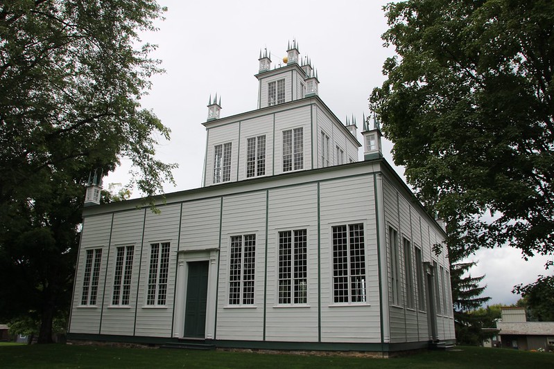
-
Article
East York
East York, Ont, Urban Community within the city of Toronto. East York was a borough until it was merged in 1998 into the new city of Toronto.
"https://d3d0lqu00lnqvz.cloudfront.net/media/media/a7323b4e-dfc4-4ae9-83c8-83937b615bf9.jpg" // resources/views/front/categories/view.blade.php
https://d3d0lqu00lnqvz.cloudfront.net/media/media/a7323b4e-dfc4-4ae9-83c8-83937b615bf9.jpg
-
Article
Eastern Townships
The Eastern Townships region is located in the Appalachian hills of south-central Quebec, between Montreal and Quebec City. The townships extend from Granby to Lac Mégantic and from Drummondville to the US border.
"https://d3d0lqu00lnqvz.cloudfront.net/media/media/2235ed70-ba4f-43c4-81e1-53b22e3e71bd.jpg" // resources/views/front/categories/view.blade.php
https://d3d0lqu00lnqvz.cloudfront.net/media/media/2235ed70-ba4f-43c4-81e1-53b22e3e71bd.jpg
-
Article
Eckville
Eckville, Alta, incorporated as a village in 1921 and as a town in 1966, population 1125 (2011c), 951 (2006c).
"https://thecanadianencyclopedia.ca/images/tce_placeholder.jpg?v=e9dca980c9bdb3aa11e832e7ea94f5d9" // resources/views/front/categories/view.blade.php
https://thecanadianencyclopedia.ca/images/tce_placeholder.jpg?v=e9dca980c9bdb3aa11e832e7ea94f5d9
-
Article
Edenwold
Edenwold, Sask, incorporated as a village in 1912, population 238 (2011c), 242 (2006c). The Village of Edenwold is located 44 km northeast of REGINA. The name was originally Edenwald after the Garden of Eden and wald, meaning forest in German.
"https://thecanadianencyclopedia.ca/images/tce_placeholder.jpg?v=e9dca980c9bdb3aa11e832e7ea94f5d9" // resources/views/front/categories/view.blade.php
https://thecanadianencyclopedia.ca/images/tce_placeholder.jpg?v=e9dca980c9bdb3aa11e832e7ea94f5d9
-
Article
Edmonton Elks
The Edmonton Elks (formerly the Edmonton Football Team, or EE Football Team, and the Edmonton Eskimos) is a community-owned football team that plays in the West Division of the Canadian Football League (CFL). In the CFL’s modern era (post-Second World War), the team has won the second-most Grey Cup championships (14). This included three victories in a row from 1954 to 1956 and an unprecedented five straight championships from 1978 to 1982. The club also holds the North American professional sports record for reaching the playoffs in 34 consecutive seasons (1972–2005). Notable alumni include former Alberta premiers Peter Lougheed and Don Getty, former lieutenant-governor of Alberta Norman Kwong, former Edmonton mayor Bill Smith, and former NFL star Warren Moon.
"https://d3d0lqu00lnqvz.cloudfront.net/media/media/eea23e59-cc99-4d53-a7e4-03625f457ad7.jpg" // resources/views/front/categories/view.blade.php
https://d3d0lqu00lnqvz.cloudfront.net/media/media/eea23e59-cc99-4d53-a7e4-03625f457ad7.jpg
-
Article
Edmundston
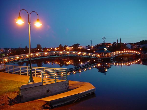
Edmundston, New Brunswick, incorporated as a city in 1952, population 16,437 (2021 census), 16,580 (2016 census). The City of Edmundston is nestled on the eastern bank of the Saint John River, opposite Madawaska, Maine, and 285 km north of Fredericton.
"https://d3d0lqu00lnqvz.cloudfront.net/media/media/Edmundston.jpg" // resources/views/front/categories/view.blade.php
https://d3d0lqu00lnqvz.cloudfront.net/media/media/Edmundston.jpg