Share on Facebook
 Share on X
 Share by Email
 Share on Google Classroom
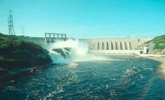
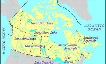
Smallwood Reservoir, 6527 km2, elev 472 m, tenth-largest freshwater body in Canada, is situated on the remote Labrador Plateau, near the Québec border. It was created in the 1960s for hydroelectric-power production by damming the CHURCHILL R at CHURCHILL FALLS and diking other rivers. The water level varies by 8.7 m, giving a usable water reserve of 28 billion m3.
Michikamau and Lobstick lakes were the largest of hundreds of lakes that now make up the reservoir, named for Joseph R. SMALLWOOD, first premier of Newfoundland. Originally inhabited by Naskapi, the area was first visited by Europeans John MCLEAN and Erland Erlandson in 1839. The area was first mapped by the Oblate missionary Father Babel, and later, in detail, by Albert LOW of the Dominion Geological Survey (1895).