Share on Facebook
 Share on X
 Share by Email
 Share on Google Classroom
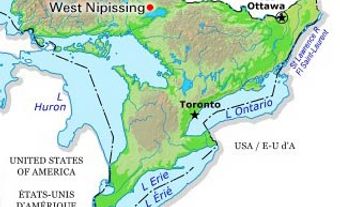
Gloucester, Ont, Unincorporated Place. Gloucester is located to the east of downtown OTTAWA. Its northern boundary is the OTTAWA RIVER.
Gloucester was first surveyed in 1792 and reputedly named after a member of the British royal family. Its first settler, Braddish Billings, arrived in 1812. Gloucester was a lumber area in its early days, but was largely lumbered out by the 1830s, after which agriculture became its primary economic activity. In 1850 Gloucester was incorporated as a township. Gloucester has, over the years, lost much of its area, including the original Billings settlement, as land was annexed to the city of Ottawa. In 2001 Gloucester lost its municipal status (incorporated as a city in 1981) as it and 10 other municipalities were merged to form the new city of Ottawa.
Today 40% of Gloucester's land is controlled by the federal government, in particular the Macdonald-Cartier International Airport and extensive greenbelt areas operated by the NATIONAL CAPITAL COMMISSION. Companies involved in high-tech manufacturing, telecommunications and supporting and supplying the aviation sector have developed in Gloucester.