
Browse "Places"
-
Article
Banff National Park
Banff National Park (established 1885, 6,641 km2) is Canada's first and most visited National Park. Its eastern gate is located approximately 100 km west of Calgary in the Rocky Mountains, and stretches 240 km along the eastern slope of the Continental Divide. Jasper National Park lies at its northern boundary. Originally set aside to preserve sulphur hot springs for public use, Banff's blend of towering peaks and flower-strewn meadows makes it among Canada's most exhilarating holiday areas.
"https://d3d0lqu00lnqvz.cloudfront.net/media/media/1a727bc0-c154-4802-909f-572644a69db4.jpg" // resources/views/front/categories/view.blade.php
https://d3d0lqu00lnqvz.cloudfront.net/media/media/1a727bc0-c154-4802-909f-572644a69db4.jpg
-
Article
Banff Springs Hotel
Fairmont Banff Springs (formerly Banff Springs Hotel) is a luxury hotel located in Banff National Park. (See also National Parks in Canada; Alberta.) This famous Canadian building is an excellent example of a resort hotel. It is known for its architectural design within a natural setting (the Rocky Mountains) as well as its ability to support a thriving sports and leisure culture. The hotel was developed as part of the Canadian Pacific Railway’s network of hotels, which were constructed across Canada in order to encourage the use of its transcontinental lines. Known as the “Castle in the Rockies,” the architecture of the Fairmont Banff Springs is predominantly in the Scottish Baronial style, featuring an Arts-and-Crafts interior.
"https://d3d0lqu00lnqvz.cloudfront.net/banffspringshotel/banffspringshotel.jpg" // resources/views/front/categories/view.blade.php
https://d3d0lqu00lnqvz.cloudfront.net/banffspringshotel/banffspringshotel.jpg
-
Article
Banks Island
Banks Island, 70 028 km2, fifth-largest island in Canada, is the westernmost island of the Arctic Archipelago.
"https://d3d0lqu00lnqvz.cloudfront.net/media/media/79d1e122-c898-4f67-8500-8c2d799e7700.jpg" // resources/views/front/categories/view.blade.php
https://d3d0lqu00lnqvz.cloudfront.net/media/media/79d1e122-c898-4f67-8500-8c2d799e7700.jpg
-
Article
Bar U Ranch
Bar U Ranch, officially known as the North West Cattle Company, was founded in 1882 in the southern foothills of the Rocky Mountains, in what would become the province of Alberta. Nicknamed “Bar U” after the shape of its cattle brand, the ranch was one of the largest of the ranches dominating the prairies in the late 1800s. In the early 1990s, Parks Canada bought Bar U with the aim of turning it into a public place commemorating Canada’s ranching history. The Bar U Ranch National Historic Site opened in July 1995.
"https://d3d0lqu00lnqvz.cloudfront.net/media/media/c1768818-c5e1-42ce-94fe-95920c9b2d13.jpg" // resources/views/front/categories/view.blade.php
https://d3d0lqu00lnqvz.cloudfront.net/media/media/c1768818-c5e1-42ce-94fe-95920c9b2d13.jpg
-
Article
Barachois Pond Provincial Park
One of the largest of 48 parks in Newfoundland and Labrador, Barachois Pond Provincial Park (established 1962, 35 km2), is located at the head of St George's Bay, 70 km south of Corner Brook along the Trans-Canada Highway.
"https://thecanadianencyclopedia.ca/images/tce_placeholder.jpg?v=e9dca980c9bdb3aa11e832e7ea94f5d9" // resources/views/front/categories/view.blade.php
https://thecanadianencyclopedia.ca/images/tce_placeholder.jpg?v=e9dca980c9bdb3aa11e832e7ea94f5d9
-
Article
Barkerville
Barkerville is a preserved and dynamic gold-rush town in the British Columbia interior. Each summer, its rich history during the Cariboo Gold Rush and subsequent gold mining in the area is demonstrated for visitors from all over the world.
"https://d3d0lqu00lnqvz.cloudfront.net/media/media/ed31d106-2195-4507-9bdd-dfcf07964328.jpg" // resources/views/front/categories/view.blade.php
https://d3d0lqu00lnqvz.cloudfront.net/media/media/ed31d106-2195-4507-9bdd-dfcf07964328.jpg
-
Article
Barns
Barns, like certain of our native birds and animals, have joined the ranks of "endangered species." No funds from wealthy societies, heritage trusts or governments are spent on the purchase and preservation of our oldest barns, and their demise can be expected.
"https://d3d0lqu00lnqvz.cloudfront.net/media/media/3aa26d95-7ea8-4a62-b55e-dee5d5678e87.jpg" // resources/views/front/categories/view.blade.php
https://d3d0lqu00lnqvz.cloudfront.net/media/media/3aa26d95-7ea8-4a62-b55e-dee5d5678e87.jpg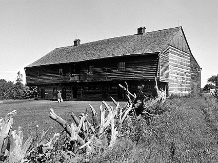
-
Article
Barrhead
Barrhead, Alta, incorporated as a town in 1946, population 4432 (2011c), 4209 (2006c). The Town of Barrhead is located 118 km northwest of Edmonton in the Paddle River valley.
"https://thecanadianencyclopedia.ca/images/tce_placeholder.jpg?v=e9dca980c9bdb3aa11e832e7ea94f5d9" // resources/views/front/categories/view.blade.php
https://thecanadianencyclopedia.ca/images/tce_placeholder.jpg?v=e9dca980c9bdb3aa11e832e7ea94f5d9
-
Article
Barrie
Barrie, Ontario, incorporated as a city in 1959, population 147,829 (2021 census), 141,434 (2016 census). Barrie is located at the head of Kempenfelt Bay, on the western edge of Lake Simcoe. Located within Simcoe County, Barrie shares borders with the municipalities of Oro-Medonte, Springwater, Essa and Innisfil. Throughout history, the Barrie area has been home to different Indigenous groups, namely the Huron-Wendat, Haudenosaunee and Anishinaabeg peoples. The land is covered by Treaties 16 and 18.
"https://d3d0lqu00lnqvz.cloudfront.net/media/new_article_images/Barrie/Cityscape.jpg" // resources/views/front/categories/view.blade.php
https://d3d0lqu00lnqvz.cloudfront.net/media/new_article_images/Barrie/Cityscape.jpg
-
Article
Barrington
Barrington, NS, Unincorporated Place. Barrington, a small community within the municipal district of Barrington (incorporated in 1879), is located on the southwestern tip of Nova Scotia.
"https://d3d0lqu00lnqvz.cloudfront.net/media/media/b025b87d-c65d-40cc-af2a-c487a30e8c2c.jpg" // resources/views/front/categories/view.blade.php
https://d3d0lqu00lnqvz.cloudfront.net/media/media/b025b87d-c65d-40cc-af2a-c487a30e8c2c.jpg
-
Article
Bas-Caraquet
Bas-Caraquet, NB, incorporated as a village in 1966, population 1380 (2011c), 1471 (2006c). The Village of Bas-Caraquet is located 7 km east of Caraquet.
"https://thecanadianencyclopedia.ca/images/tce_placeholder.jpg?v=e9dca980c9bdb3aa11e832e7ea94f5d9" // resources/views/front/categories/view.blade.php
https://thecanadianencyclopedia.ca/images/tce_placeholder.jpg?v=e9dca980c9bdb3aa11e832e7ea94f5d9
-
Article
Basilica of St John the Baptist
Visible from everywhere in St. John's, Newfoundland, and, so important in the 19th century, the most striking building as one entered the harbour, the Basilica of St. John the Baptist was built to assert the place and power of Newfoundland's Irish Catholic population.
"https://d3d0lqu00lnqvz.cloudfront.net/media/media/8f1efec9-7456-49a4-9ba3-31a5ffc330a4.jpg" // resources/views/front/categories/view.blade.php
https://d3d0lqu00lnqvz.cloudfront.net/media/media/8f1efec9-7456-49a4-9ba3-31a5ffc330a4.jpg
-
Macleans
Bata Shoe Museum Opens
The motto is equally fitting for Bata Ltd., itself, the global shoe manufacturing and retailing organization that served as the springboard for the museum.This article was originally published in Maclean's Magazine on May 15, 1995
"https://d3d0lqu00lnqvz.cloudfront.net/media/media/b688f437-e48f-4c47-bd7f-b465474d1c83.jpg" // resources/views/front/categories/view.blade.php
https://d3d0lqu00lnqvz.cloudfront.net/media/media/b688f437-e48f-4c47-bd7f-b465474d1c83.jpg
-
Article
Bathurst
Bathurst, New Brunswick, incorporated as a city in 1966, population 12,157 (2021 census), 11,897 (2016 census). The City of Bathurst is situated on Bathurst Harbour, an estuary where the Nepisiguit River meets Chaleur Bay. Bathurst is the administrative, commercial, educational and cultural hub of northeastern New Brunswick. The city is part of the Chaleur Regional Service Commission along with the neighbouring municipalities of Beresford, Nigadoo, Petit-Rocher, Pointe-Verte and Belledune, and sits adjacent to the Pabineau First Nation. (See First Nations in New Brunswick.)
"https://d3d0lqu00lnqvz.cloudfront.net/media/media/98212d1b-3593-4078-b72a-e3ae82fa3c5d.jpg" // resources/views/front/categories/view.blade.php
https://d3d0lqu00lnqvz.cloudfront.net/media/media/98212d1b-3593-4078-b72a-e3ae82fa3c5d.jpg
-
Article
Bathurst Inlet
Bathurst Inlet, a southeastern extension of Coronation Gulf, penetrating the arctic shore for some 200 km. The hamlet of Bathurst Inlet is located at the mouth of the Burnside River, which drains Contwoyto Lake to the southwest.
"https://d3d0lqu00lnqvz.cloudfront.net/media/media/b504d03a-1419-4bf4-ab27-00b5e8cc89a0.jpg" // resources/views/front/categories/view.blade.php
https://d3d0lqu00lnqvz.cloudfront.net/media/media/b504d03a-1419-4bf4-ab27-00b5e8cc89a0.jpg