
Browse "Cities & Populated Places"
-
Article
Richmond Hill
Richmond Hill, Ontario, is a city 23 km north of Lake Ontario, population 202,022 (2021 census), 195,022 (2016 census). It is one of nine municipalities that make up the Regional Municipality of York. The city is bordered by Aurora to the north, Whitchurch-Stouffville to the east, Markham to the east and south, Vaughan to the west and south, and King Township to the west. Richmond Hill became an incorporated village in 1872, changing status to town in 1957, and city in 2019. The modern borders were established in 1971 from the Town of Richmond Hill, as well as parts of King, Vaughan, Whitchurch and Markham Townships. Throughout history, the Richmond Hill area has been home to different Indigenous groups, namely the Huron Wendat, Haudenosaunee and Anishinaabeg. The land is covered by Treaty 13 and the Williams Treaties.
"https://d3d0lqu00lnqvz.cloudfront.net/media/new_article_images/RichmondHill/DowntownRichmondHill.jpg" // resources/views/front/categories/view.blade.php
https://d3d0lqu00lnqvz.cloudfront.net/media/new_article_images/RichmondHill/DowntownRichmondHill.jpg
-
Article
Rimouski
In the 18th century, agriculture and seasonal fishing were the only occupations, but the area experienced some growth when Québec City merchants, including William Price, began to develop the forest resources and built several sawmills.
"https://thecanadianencyclopedia.ca/images/tce_placeholder.jpg?v=e9dca980c9bdb3aa11e832e7ea94f5d9" // resources/views/front/categories/view.blade.php
https://thecanadianencyclopedia.ca/images/tce_placeholder.jpg?v=e9dca980c9bdb3aa11e832e7ea94f5d9
-
Article
Riverview
Riverview, incorporated as a town in 1973, population 19 128 (2011c), 17 832 (2006c). The Town of Riverview is situated on the Petitcodiac River opposite MONCTON.
"https://thecanadianencyclopedia.ca/images/tce_placeholder.jpg?v=e9dca980c9bdb3aa11e832e7ea94f5d9" // resources/views/front/categories/view.blade.php
https://thecanadianencyclopedia.ca/images/tce_placeholder.jpg?v=e9dca980c9bdb3aa11e832e7ea94f5d9
-
Article
Roberval
A navigation centre for the lake and an internationally renowned summer resort until the early 20th century, Roberval also had a few sawmills. The Ursulines built their provincial convent here in 1882. A hospital was added in 1918.
"https://thecanadianencyclopedia.ca/images/tce_placeholder.jpg?v=e9dca980c9bdb3aa11e832e7ea94f5d9" // resources/views/front/categories/view.blade.php
https://thecanadianencyclopedia.ca/images/tce_placeholder.jpg?v=e9dca980c9bdb3aa11e832e7ea94f5d9
-
Article
Roblin
Roblin, Manitoba, incorporated as a village in 1913 and as a town in 1963, population 1774 (2011c), 1672 (2006c). The Town of Roblin is situated on Goose Lake 400 km northwest of Winnipeg near the Manitoba-Saskatchewan border.
"https://d3d0lqu00lnqvz.cloudfront.net/media/media/4bdc8f29-c5bc-4346-8b69-eacb517ce926.jpg" // resources/views/front/categories/view.blade.php
https://d3d0lqu00lnqvz.cloudfront.net/media/media/4bdc8f29-c5bc-4346-8b69-eacb517ce926.jpg
-
Article
Rockwood
Rockwood, Manitoba, incorporated as a rural municipality in 1880, population 7964 (2011c), 7692 (2006c). The Rural Municipality of Rockwood is located north of Winnipeg; it includes the communities of Stony Mountain, Grosse Isle, Argyle, Balmoral, Gunton and Komarno.
"https://thecanadianencyclopedia.ca/images/tce_placeholder.jpg?v=e9dca980c9bdb3aa11e832e7ea94f5d9" // resources/views/front/categories/view.blade.php
https://thecanadianencyclopedia.ca/images/tce_placeholder.jpg?v=e9dca980c9bdb3aa11e832e7ea94f5d9
-
Article
Rocky Mountain House
Rocky Mountain House, Alberta, incorporated as a town in 1939, population 6,635 (2016 census), 6,933 (2011 census). The town of Rocky Mountain House is located on the North Saskatchewan River, 81 km west of Red Deer. It is near the site of the North West Company’s fur trade post of the same name.
"https://d3d0lqu00lnqvz.cloudfront.net/media/new_article_images/RockyMountainHouse/c007376.jpg" // resources/views/front/categories/view.blade.php
https://d3d0lqu00lnqvz.cloudfront.net/media/new_article_images/RockyMountainHouse/c007376.jpg
-
Article
Rooster Town
Rooster Town was a largely Métis community that existed on the southwest fringes of suburban Winnipeg from 1901 until the late 1950s. While there were numerous urban Métis fringe communities on the Prairies and in British Columbia, their history has been relatively forgotten. (See also Métis Road Allowance Communities.)
"https://d3d0lqu00lnqvz.cloudfront.net/media/media/093c5c4d-cdd7-4fe5-b8d1-753c6c5a7dd9.jpg" // resources/views/front/categories/view.blade.php
https://d3d0lqu00lnqvz.cloudfront.net/media/media/093c5c4d-cdd7-4fe5-b8d1-753c6c5a7dd9.jpg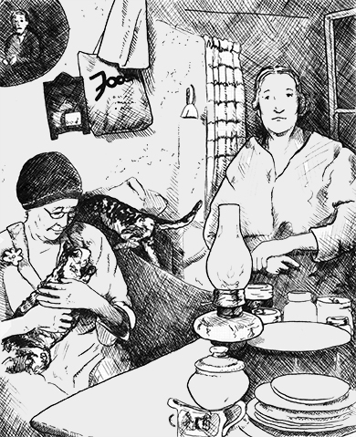
-
Article
Rosemère
In 1880, Rosemère was primarily an agricultural community. The beauty of the Laurentides region was later discovered and Rosemère established itself as a holiday destination.
"https://d3d0lqu00lnqvz.cloudfront.net/media/media/da9a5d37-763c-4f26-9866-1b7c4350f63e.jpg" // resources/views/front/categories/view.blade.php
https://d3d0lqu00lnqvz.cloudfront.net/media/media/da9a5d37-763c-4f26-9866-1b7c4350f63e.jpg
-
Article
Rosetown
Rosetown, Sask, incorporated as a town in 1911, population 2317 (2011c), 2277 (2006c). The Town of Rosetown is located 115 km southwest of SASKATOON. It is a focal point for the major transportation routes of the region and is
"https://thecanadianencyclopedia.ca/images/tce_placeholder.jpg?v=e9dca980c9bdb3aa11e832e7ea94f5d9" // resources/views/front/categories/view.blade.php
https://thecanadianencyclopedia.ca/images/tce_placeholder.jpg?v=e9dca980c9bdb3aa11e832e7ea94f5d9
-
Article
Ross River
Ross River, Yukon, settlement, population 293 (2016 census), 352 (2011 census). Ross River is located at the confluence of the Ross and Pelly rivers. It is on the Canol Road (seeCanol Pipeline) at the halfway point on the Campbell Highway. Ross River is 360 km by road northeast of Whitehorse.
"https://thecanadianencyclopedia.ca/images/tce_placeholder.jpg?v=e9dca980c9bdb3aa11e832e7ea94f5d9" // resources/views/front/categories/view.blade.php
https://thecanadianencyclopedia.ca/images/tce_placeholder.jpg?v=e9dca980c9bdb3aa11e832e7ea94f5d9
-
Article
Rossland
Rossland, BC, incorporated as a city in 1897, population 4,140 (2021 census), 3,729 (2016 census). The City of Rossland is located 10 km southwest of Trail in the eroded crater of a long-extinct volcano of the Monashee Mountains.
"https://thecanadianencyclopedia.ca/images/tce_placeholder.jpg?v=e9dca980c9bdb3aa11e832e7ea94f5d9" // resources/views/front/categories/view.blade.php
https://thecanadianencyclopedia.ca/images/tce_placeholder.jpg?v=e9dca980c9bdb3aa11e832e7ea94f5d9
-
Article
Rosthern
In 1891 and 1892 a group of Mennonite farmers, several from the Manitoba settlements, arrived in the area. Dr Seager WHEELER, a pioneer in scientific agriculture, had his farm in the area; it is now a national historic site.
"https://d3d0lqu00lnqvz.cloudfront.net/media/media/3aaaa54e-d3b3-45f2-97e7-ffa1b1d5118d.jpg" // resources/views/front/categories/view.blade.php
https://d3d0lqu00lnqvz.cloudfront.net/media/media/3aaaa54e-d3b3-45f2-97e7-ffa1b1d5118d.jpg
-
Article
Rothesay
Rothesay, NB, incorporated as a town in 1998, population 11 947 (2011c), 11 637 (2006c). It is situated on the eastern side of the Kennebecasis River, 22 km northeast of Saint John.
"https://thecanadianencyclopedia.ca/images/tce_placeholder.jpg?v=e9dca980c9bdb3aa11e832e7ea94f5d9" // resources/views/front/categories/view.blade.php
https://thecanadianencyclopedia.ca/images/tce_placeholder.jpg?v=e9dca980c9bdb3aa11e832e7ea94f5d9
-
Article
Rouyn-Noranda
Rouyn-Noranda, Qué, City, pop 28 270 (2001c), 30 936 A (1996c), 28 958 (1991c), area 348.07 km2, inc 1986, is the largest centre in the Abitibi-Témiscaming region and its administrative capital.
"https://thecanadianencyclopedia.ca/images/tce_placeholder.jpg?v=e9dca980c9bdb3aa11e832e7ea94f5d9" // resources/views/front/categories/view.blade.php
https://thecanadianencyclopedia.ca/images/tce_placeholder.jpg?v=e9dca980c9bdb3aa11e832e7ea94f5d9