
Browse "Places"
-
Article
Lloydminster
Lloydminster, Alberta and Saskatchewan, incorporated as a city in 1958, population 19,739 in Alberta and 11,843 in Saskatchewan (2021 census); 19,645 in Alberta and 11,765 in Saskatchewan (2016 census). The city of Lloydminster is known as the “Border City” since it is located on the Saskatchewan-Alberta border, about 275 km west of Saskatoon and 250 km east of Edmonton. It is one of two communities in Canada split by a provincial boundary, the other being Flin Flon, Manitoba.
"https://d3d0lqu00lnqvz.cloudfront.net/media/media/94afb778-e678-4eb6-999e-e723944f1edd.jpg" // resources/views/front/categories/view.blade.php
https://d3d0lqu00lnqvz.cloudfront.net/media/media/94afb778-e678-4eb6-999e-e723944f1edd.jpg
-
Article
Locomotives and Rolling Stock
The first locomotive to be constructed in Canada was built by the James Good family (1853) of Toronto. Named Toronto, the locomotive had a set of 4 driving wheels and 4 small front wheels for better travel through curves.
"https://d3d0lqu00lnqvz.cloudfront.net/media/media/d2b77d1e-1c32-438b-94cb-2761961ea891.jpg" // resources/views/front/categories/view.blade.php
https://d3d0lqu00lnqvz.cloudfront.net/media/media/d2b77d1e-1c32-438b-94cb-2761961ea891.jpg
-
Article
Logan Lake
Logan Lake, BC, incorporated as a district municipality in 1970, population 2073 (2011c), 2162 (2006c). The District of Logan Lake is in the heart of the Highland Valley, 17 km west of the COQUIHALLA HIGHWAY between Kamloops and Merritt.
"https://d3d0lqu00lnqvz.cloudfront.net/media/media/2f2cb1bd-d005-4483-b518-ed31a3f4608e.jpg" // resources/views/front/categories/view.blade.php
https://d3d0lqu00lnqvz.cloudfront.net/media/media/2f2cb1bd-d005-4483-b518-ed31a3f4608e.jpg
-
Article
Logy Bay-Middle Cove-Outer Cove
Logy Bay-Middle Cove-Outer Cove, NL, incorporated as a town in 1986, population 2098 (2011c), 1978 (2006c). The Town of Logy Bay-Middle Cove-Outer Cove is the result of the joining of three former communities on the outskirts of ST JOHN'S.
"https://thecanadianencyclopedia.ca/images/tce_placeholder.jpg?v=e9dca980c9bdb3aa11e832e7ea94f5d9" // resources/views/front/categories/view.blade.php
https://thecanadianencyclopedia.ca/images/tce_placeholder.jpg?v=e9dca980c9bdb3aa11e832e7ea94f5d9
-
Article
London
London, Ontario, incorporated as a city in 1855, population 422,324 (2021 census), 383,822 (2016 census). The City of London, the seat of Middlesex County, is centrally located in the southwest peninsula of the province, on the Quebec–Windsor corridor midway between Toronto (185 km) and Windsor (190 km). Due south lies Lake Erie, with Lake Huron to the northwest. London's market and service area to the north and northeast includes much highly productive farmland. To the southwest and southeast lie intensive cash-crop areas, especially Canada's main tobacco-growing area. Noted as a financial, educational and medical centre, London is also a regional base for business firms and government, both provincial and federal.
"https://d3d0lqu00lnqvz.cloudfront.net/media/media/05fb552e-40ae-4290-9740-edbcca6e04db.jpg" // resources/views/front/categories/view.blade.php
https://d3d0lqu00lnqvz.cloudfront.net/media/media/05fb552e-40ae-4290-9740-edbcca6e04db.jpg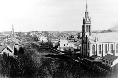
-
Article
Music in London
Ontario city situated halfway between Toronto and Windsor on the Thames River. It was laid out in 1826, incorporated as a town in 1846 (population 3500), and as a city in 1855.
"https://thecanadianencyclopedia.ca/images/tce_placeholder.jpg?v=e9dca980c9bdb3aa11e832e7ea94f5d9" // resources/views/front/categories/view.blade.php
https://thecanadianencyclopedia.ca/images/tce_placeholder.jpg?v=e9dca980c9bdb3aa11e832e7ea94f5d9
-
Article
Long Point
Long Point is a 40-km-long sand spit on the north shore of Lake Erie. The longest spit in Canada, Long Point, is the best-surviving example of a wetland and dune ecosystem in the Great Lakes basin. The southerly location and the moderating effect of Lake Erie allow rare and endangered species to thrive. Two sedges and a spikerush are unique to Canada. Long Point is also home to Cambarus diogenes, one of the rarest crayfish in Canada, and the endangered eastern spiny softshell turtle.
"https://d3d0lqu00lnqvz.cloudfront.net/sandhillcrane/Sandhill-Cranes-Longpoint.jpg" // resources/views/front/categories/view.blade.php
https://d3d0lqu00lnqvz.cloudfront.net/sandhillcrane/Sandhill-Cranes-Longpoint.jpg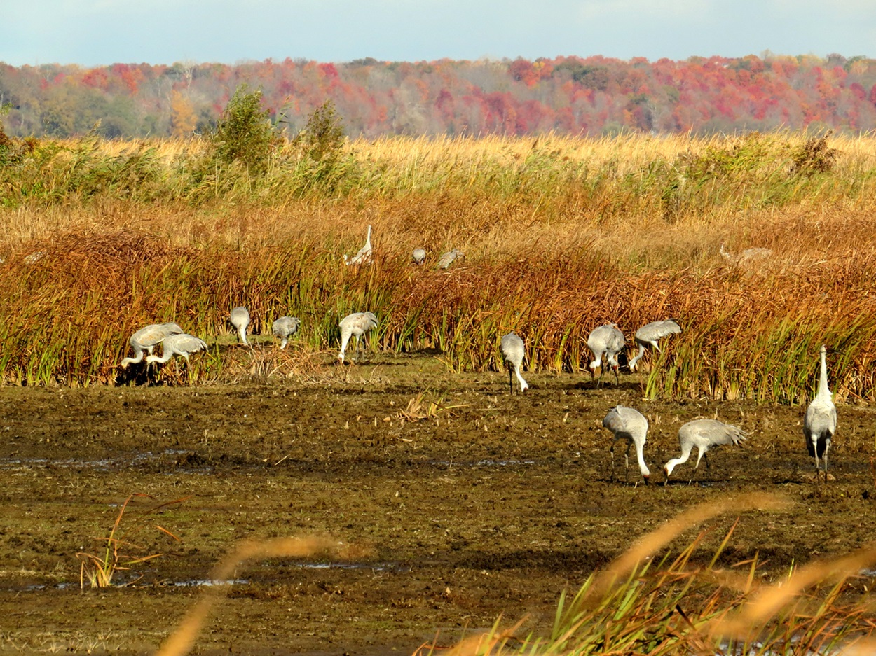
-
Article
Long Range Mountains
The range, generally steep on the coastal side and scarred by deep glaciation and faulting, reaches highland plateaus and flat-topped peaks before sloping away more gently to the east. In places deep fjords and bays cut into its base, and rivers, such as the HUMBER RIVER, flow through its valleys.
"https://d3d0lqu00lnqvz.cloudfront.net/media/media/efe7172c-e877-4f96-a652-0d67fdf65947.jpg" // resources/views/front/categories/view.blade.php
https://d3d0lqu00lnqvz.cloudfront.net/media/media/efe7172c-e877-4f96-a652-0d67fdf65947.jpg
-
List
Longest Rivers in Canada
Canada’s rivers have played a vital role in the country’s history and cultural heritage. As transportation routes for Indigenous people and early settlers, they connected the country before railways and other modes of transportation. They have also been a source of water, food and recreation for thousands of years. Below is a list of Canada’s 10 longest rivers. The list is ordered by the river’s total length, not just the portions within Canadian borders. Similarly, the length cited is the length of the river’s main stem and does not include tributaries.
"https://d3d0lqu00lnqvz.cloudfront.net/media/media/4f133fe0-0529-435c-859e-7fc144a682c6.jpg" // resources/views/front/categories/view.blade.php
https://d3d0lqu00lnqvz.cloudfront.net/media/media/4f133fe0-0529-435c-859e-7fc144a682c6.jpg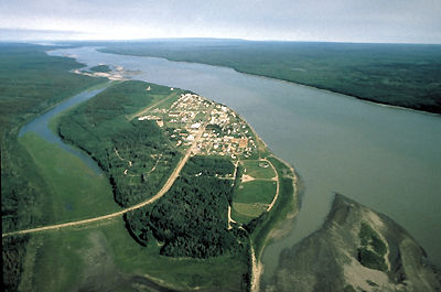
-
Article
Longueuil
Longueuil, Quebec, incorporated as a town in 1874, as a city in 1920, population 254,483 (2021 census), 239,897 (2016 census). Longueuil’s history dates to the 17th century with the settling of French colonists. It is today an important suburb of Montreal and is connected to the island of Montreal by the Jacques Cartier bridge and the Louis-Hippolyte-La Fontaine tunnel-bridge. Longueuil is criss-crossed by major expressways linking metropolitan Montreal to Quebec City, the Eastern Townships and northern New York State. The municipality of Longueuil is its own entity within the Longueuil agglomeration which includes other nearby cities. Longueuil is situated on the ancestral territory of the Kanyen’kehà:ka. The land remains unceded and is considered Indigenous territory.
"https://d3d0lqu00lnqvz.cloudfront.net/media/single_use_images/cocathédrale longueuil_cropped.png" // resources/views/front/categories/view.blade.php
https://d3d0lqu00lnqvz.cloudfront.net/media/single_use_images/cocathédrale longueuil_cropped.png
-
Article
Loretteville
Loretteville, QC, is a neighbourhood in Quebec City. Incorporated as a town in 1947, Loretteville amalgamated with Quebec City in 2002. Loretteville is located about 15 km northwest of downtown Quebec City, on the banks of Rivière Saint-Charles. It is often mistaken for the Huron-Wendat or Wendake reserve, an enclave within Loretteville (see also Reserves in Quebec).
"https://thecanadianencyclopedia.ca/images/tce_placeholder.jpg?v=e9dca980c9bdb3aa11e832e7ea94f5d9" // resources/views/front/categories/view.blade.php
https://thecanadianencyclopedia.ca/images/tce_placeholder.jpg?v=e9dca980c9bdb3aa11e832e7ea94f5d9
-
Article
L'Orignal
History L’Orignal was granted as part of the Seigneurie de Longueuil by the Company of New France to François Prévost in 1674 (seeSeigneurial System). The Seigneurie de Longueuil was one of only two seigneuries granted in the French regime in what is now Ontario (the other was René Robert Cavalier de La Salle's Fort Cataraqui, at present-day Kingston). L'Orignal was acquired in 1796 by Nathaniel Tredwell, a wealthy American from Plattsburg, New York. In 1812,...
"https://thecanadianencyclopedia.ca/images/tce_placeholder.jpg?v=e9dca980c9bdb3aa11e832e7ea94f5d9" // resources/views/front/categories/view.blade.php
https://thecanadianencyclopedia.ca/images/tce_placeholder.jpg?v=e9dca980c9bdb3aa11e832e7ea94f5d9
-
Article
Lorraine
Carved out of Bois-des-Filion, SAINTE-THÉRÈSE and ROSEMÈRE, Lorraine was set up as an ecologically sensitive, single-family dwelling, residential community by Anchor Investments Limited.
"https://d3d0lqu00lnqvz.cloudfront.net/media/media/ec9ac870-e07d-4155-ba11-1b97e5a4ac99.jpg" // resources/views/front/categories/view.blade.php
https://d3d0lqu00lnqvz.cloudfront.net/media/media/ec9ac870-e07d-4155-ba11-1b97e5a4ac99.jpg
-
Article
Louisbourg
In the 18th century, Louisbourg was a fortified town and an important strategic capital in the French colony of Île Royale (Cape Breton Island). It was the scene of two major military sieges in the Anglo-French wars for supremacy in North America. The fall of Louisbourg to the British in 1758 paved the way for the capture of Québec and the end of French rule in North America. Today, Louisbourg is a national historic site and a popular tourist destination in Cape Breton.
"https://d3d0lqu00lnqvz.cloudfront.net/media/media/5a0c0b6b-1a28-4955-ac10-111582958476.jpg" // resources/views/front/categories/view.blade.php
https://d3d0lqu00lnqvz.cloudfront.net/media/media/5a0c0b6b-1a28-4955-ac10-111582958476.jpg
-
Article
Lower Canada
Lower Canada was a British colony from 1791 to 1840. Its geographical boundaries comprised the southern portion of present-day Quebec. In 1791, Britain divided the Province of Quebec into Upper Canada and Lower Canada. (See: Constitutional Act 1791.) Britain had followed a similar policy of territorial division twice before. Prince Edward Island was detached from Nova Scotia in 1769. The provinces of Cape Breton and New Brunswick were created in 1784 in response to the wave of Loyalist immigration (which also occurred in Quebec). In 1841, Upper Canada and Lower Canada were renamed Canada West and Canada East, respectively. They were united as the single colony of the Province of Canada.
"https://d3d0lqu00lnqvz.cloudfront.net/media/media/0a40188b-4ef4-4e9e-90bb-ec21d39c1c45.jpg" // resources/views/front/categories/view.blade.php
https://d3d0lqu00lnqvz.cloudfront.net/media/media/0a40188b-4ef4-4e9e-90bb-ec21d39c1c45.jpg