
Browse "Places"
-
Article
Dark Harbour
Dark Harbour, located on the west side of GRAND MANAN ISLAND, New Brunswick, is the only suitable haven for fishing craft along the island's western shore, which is dominated by high cliffs. It is relatively isolated from the communities on the more hospitable eastern side facing the Bay of Fundy.
"https://thecanadianencyclopedia.ca/images/tce_placeholder.jpg?v=e9dca980c9bdb3aa11e832e7ea94f5d9" // resources/views/front/categories/view.blade.php
https://thecanadianencyclopedia.ca/images/tce_placeholder.jpg?v=e9dca980c9bdb3aa11e832e7ea94f5d9
-
Article
Darke Hall
Performance hall for the Conservatory of Performing Arts (formerly the Regina Conservatory of Music) at the University of Regina, as well as the Regina Symphony Orchestra (1929–70) and the Regina Musical Club (until 2007).
"https://d3d0lqu00lnqvz.cloudfront.net/Darke_Hall.jpg" // resources/views/front/categories/view.blade.php
https://d3d0lqu00lnqvz.cloudfront.net/Darke_Hall.jpg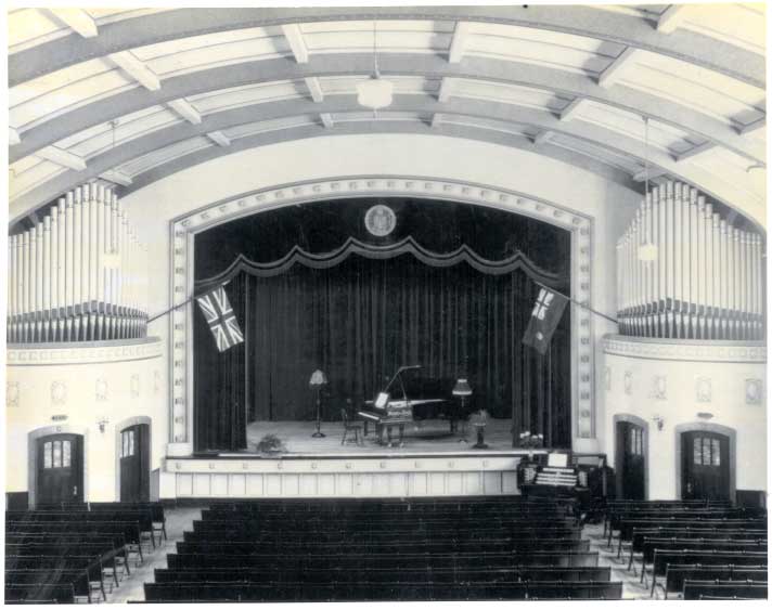
-
Article
Dartmouth
Dartmouth, Nova Scotia, metropolitan area, population (including Cole Harbour) 96,165 (2021 census), 92,301 (2016 census). Dartmouth is located on the eastern side of Halifax Harbour in the Halifax Regional Municipality (incorporated in 1996).
"https://d3d0lqu00lnqvz.cloudfront.net/media/media/09ef6dac-263c-4515-92b7-f062849a532b.jpg" // resources/views/front/categories/view.blade.php
https://d3d0lqu00lnqvz.cloudfront.net/media/media/09ef6dac-263c-4515-92b7-f062849a532b.jpg
-
Article
Dartmouth Lakes
The Dartmouth Lakes are 25 separate lakes located within the city of Dartmouth, NS, across the harbour from Halifax. Formed by Pleistocene glaciation about 15 000 years ago, they range in area from 1 to 140 ha.
"https://thecanadianencyclopedia.ca/images/tce_placeholder.jpg?v=e9dca980c9bdb3aa11e832e7ea94f5d9" // resources/views/front/categories/view.blade.php
https://thecanadianencyclopedia.ca/images/tce_placeholder.jpg?v=e9dca980c9bdb3aa11e832e7ea94f5d9
-
Article
Dauphin
Pierre de LA VÉRENDRYE first visited the area in the 1730s and gave the name Dauphin, for the eldest son of the king of France, to a post in the area (1741).
"https://thecanadianencyclopedia.ca/images/tce_placeholder.jpg?v=e9dca980c9bdb3aa11e832e7ea94f5d9" // resources/views/front/categories/view.blade.php
https://thecanadianencyclopedia.ca/images/tce_placeholder.jpg?v=e9dca980c9bdb3aa11e832e7ea94f5d9
-
"https://thecanadianencyclopedia.ca/images/tce_placeholder.jpg?v=e9dca980c9bdb3aa11e832e7ea94f5d9" // resources/views/front/categories/view.blade.php
https://thecanadianencyclopedia.ca/images/tce_placeholder.jpg?v=e9dca980c9bdb3aa11e832e7ea94f5d9
-
Article
Davis Strait
Some of the greatest depths in the eastern Arctic are reached here (3660 m) in the southern end of the strait. The surface waters are strongly affected by counterclockwise-flowing currents.
"https://d3d0lqu00lnqvz.cloudfront.net/media/media/9669519f-2a3e-42ad-83f1-b803cd3cf07b.jpg" // resources/views/front/categories/view.blade.php
https://d3d0lqu00lnqvz.cloudfront.net/media/media/9669519f-2a3e-42ad-83f1-b803cd3cf07b.jpg
-
Article
Dawson
Dawson (also Dawson City), Yukon, incorporated as a town in 1904, population 1,577 (2021 census), 1,375 (2016 census). The Town of Dawson is located on the east bank of the Yukon River at the mouth of the Klondike River, 530 km north of Whitehorse.
"https://d3d0lqu00lnqvz.cloudfront.net/media/media/9c017727-fcf3-484b-9dbb-02f507e8486e.jpg" // resources/views/front/categories/view.blade.php
https://d3d0lqu00lnqvz.cloudfront.net/media/media/9c017727-fcf3-484b-9dbb-02f507e8486e.jpg
-
Article
Dawson Archaeological Site
The Dawson site is an ancient Iroquoian village located on the Island of Montréal, next to Mount Royal. The site, which was initially located on a sand dune, covers about two acres.
"https://d3d0lqu00lnqvz.cloudfront.net/media/media/96890b03-5f94-4d4c-9109-577a21f8b989.jpg" // resources/views/front/categories/view.blade.php
https://d3d0lqu00lnqvz.cloudfront.net/media/media/96890b03-5f94-4d4c-9109-577a21f8b989.jpg
-
Article
Dawson Creek
Dawson Creek, British Columbia, incorporated as a city in 1958, population 12,323 (2021 census), 12,178 (2016 census). The City of Dawson Creek is located near the British Columbia-Alberta border, about 406 km northeast of Prince George and 589 km northwest of Edmonton.
"https://d3d0lqu00lnqvz.cloudfront.net/8_Street-_Dawson_Creek.jpg" // resources/views/front/categories/view.blade.php
https://d3d0lqu00lnqvz.cloudfront.net/8_Street-_Dawson_Creek.jpg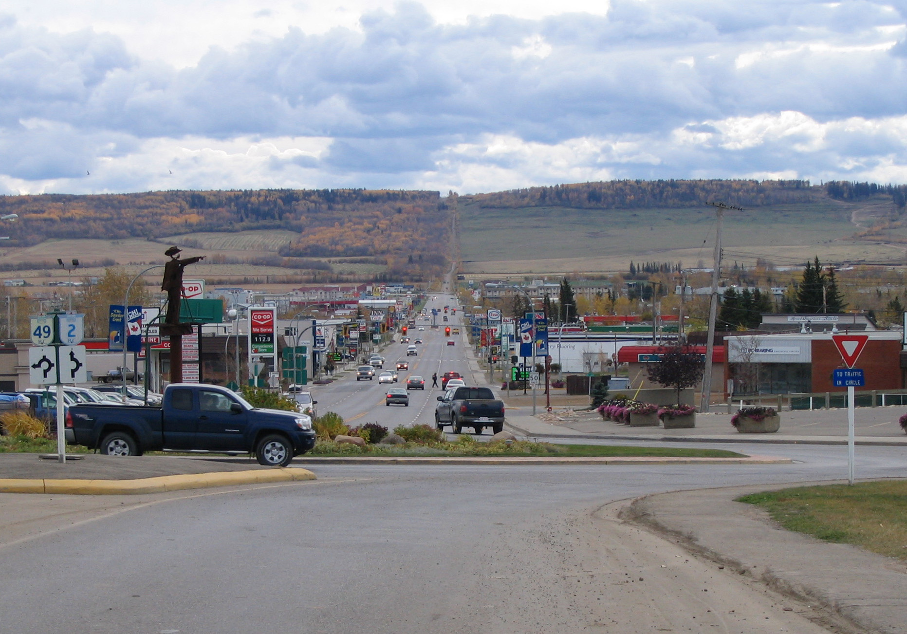
-
Article
Dawson Road
Dawson Road, a trail running from the northwest corner of Lake of the Woods to Fort Garry [Winnipeg], a distance of about 120 km, was the western end of the "Dawson Route," an all-Canadian route from Thunder Bay to the Red River district of southern Manitoba. Part land and part water, the route required a month of travel, and 70 loadings and unloadings of freight and baggage.
"https://d3d0lqu00lnqvz.cloudfront.net/media/media/4d571279-b338-4a0a-8cd0-090ed58468a5.jpg" // resources/views/front/categories/view.blade.php
https://d3d0lqu00lnqvz.cloudfront.net/media/media/4d571279-b338-4a0a-8cd0-090ed58468a5.jpg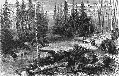
-
Article
Dean River
Dean River, 241 km long, world-famous steelhead- and salmon-fishing stream, rises in the Fraser Plateau of west-central BC, flows northwest and west through the COAST MOUNTAINS and empties near the head of Dean Channel.
"https://thecanadianencyclopedia.ca/images/tce_placeholder.jpg?v=e9dca980c9bdb3aa11e832e7ea94f5d9" // resources/views/front/categories/view.blade.php
https://thecanadianencyclopedia.ca/images/tce_placeholder.jpg?v=e9dca980c9bdb3aa11e832e7ea94f5d9
-
Article
Debert and Belmont Palaeoindian Sites
The Debert archaeological site was discovered near the city of Debert in north-central Nova Scotia in 1948, and excavated between 1962 and 1964.
"https://d3d0lqu00lnqvz.cloudfront.net/media/media/f28e80bc-14da-4c69-b71c-6e16f91ed72d.jpg" // resources/views/front/categories/view.blade.php
https://d3d0lqu00lnqvz.cloudfront.net/media/media/f28e80bc-14da-4c69-b71c-6e16f91ed72d.jpg
-
Article
Deep River
Deep River, Ont, incorporated as a town in 1959, population 4193 (2011c), 4216 (2006c). The Town of Deep River is located in eastern Ontario, 208 km northwest of Ottawa.
"https://thecanadianencyclopedia.ca/images/tce_placeholder.jpg?v=e9dca980c9bdb3aa11e832e7ea94f5d9" // resources/views/front/categories/view.blade.php
https://thecanadianencyclopedia.ca/images/tce_placeholder.jpg?v=e9dca980c9bdb3aa11e832e7ea94f5d9
-
Article
Deer Island
Deer Island abuts the border with the US at the entrance to Passamaquoddy Bay on the south coast of New Brunswick. Long in dispute with the US, sovereignty over the island passed to NB in 1817. The name is probably descriptive. Fishing is the most important economic activity.
"https://thecanadianencyclopedia.ca/images/tce_placeholder.jpg?v=e9dca980c9bdb3aa11e832e7ea94f5d9" // resources/views/front/categories/view.blade.php
https://thecanadianencyclopedia.ca/images/tce_placeholder.jpg?v=e9dca980c9bdb3aa11e832e7ea94f5d9