
Browse "Places"
-
Article
Outlook
The town of Outlook developed as a result of railway land development. In 1908 the Canadian Pacific Railway purchased the farm of a local homesteader and announced that it would be developed as a townsite.
"https://thecanadianencyclopedia.ca/images/tce_placeholder.jpg?v=e9dca980c9bdb3aa11e832e7ea94f5d9" // resources/views/front/categories/view.blade.php
https://thecanadianencyclopedia.ca/images/tce_placeholder.jpg?v=e9dca980c9bdb3aa11e832e7ea94f5d9
-
Article
Outremont
Outremont, one of the smallest cities in terms of area of the MONTRÉAL Urban Community (MUC), is one of the most affluent, beautiful and picturesque residential communities on the island.
"https://thecanadianencyclopedia.ca/images/tce_placeholder.jpg?v=e9dca980c9bdb3aa11e832e7ea94f5d9" // resources/views/front/categories/view.blade.php
https://thecanadianencyclopedia.ca/images/tce_placeholder.jpg?v=e9dca980c9bdb3aa11e832e7ea94f5d9
-
Article
Owen Sound
Owen Sound, Ont, incorporated as a city in 1920, population 21 688 (2011c), 21 753 (2006c). The City of Owen Sound is located on an inlet at the south end of GEORGIAN BAY, at the outlet of the Sydenham and Pottawatomi rivers, 190 km northwest of Toronto.
"https://thecanadianencyclopedia.ca/images/tce_placeholder.jpg?v=e9dca980c9bdb3aa11e832e7ea94f5d9" // resources/views/front/categories/view.blade.php
https://thecanadianencyclopedia.ca/images/tce_placeholder.jpg?v=e9dca980c9bdb3aa11e832e7ea94f5d9
-
Article
Oxbow Archaeological Site
The Oxbow site is located on a low terrace along the north bank of the Little Southwest Miramichi River, 1 km west of its confluence with the Northwest Miramichi, Northumberland County, New Brunswick.
"https://d3d0lqu00lnqvz.cloudfront.net/media/media/0ca6861b-eca0-4e2e-a2dd-b774d34d4352.jpg" // resources/views/front/categories/view.blade.php
https://d3d0lqu00lnqvz.cloudfront.net/media/media/0ca6861b-eca0-4e2e-a2dd-b774d34d4352.jpg
-
Article
Pacific National Exhibition (PNE)
The 6-hectare (15-acre) amusement park known today as "Playland" has been host to millions since its opening on the PNE site in 1910. Named "Happy Land" in 1926, the park moved to its current location in 1958 when the name was changed to "Playland.
"https://d3d0lqu00lnqvz.cloudfront.net/media/media/ad15874f-1d61-4a41-a1bb-d04030dc1c1a.jpg" // resources/views/front/categories/view.blade.php
https://d3d0lqu00lnqvz.cloudfront.net/media/media/ad15874f-1d61-4a41-a1bb-d04030dc1c1a.jpg
-
Article
Pacific Ocean and Canada
The Pacific Ocean is the world’s largest ocean. It covers more than 30 per cent of the Earth’s surface — an area roughly the same as the Atlantic and Indian oceans combined. Canada’s relationship with the Pacific Ocean is synonymous with the West Coast of British Columbia. The province’s entire ocean shoreline, including the coasts of Vancouver Island and Haida Gwaii, form Canada’s Pacific coastal region. More than 75 per cent of the province’s 5 million residents live within 50 km of the coast.
"https://d3d0lqu00lnqvz.cloudfront.net/media/new_article_images/PacificOcean/PacificOceanMapEN-1.png" // resources/views/front/categories/view.blade.php
https://d3d0lqu00lnqvz.cloudfront.net/media/new_article_images/PacificOcean/PacificOceanMapEN-1.png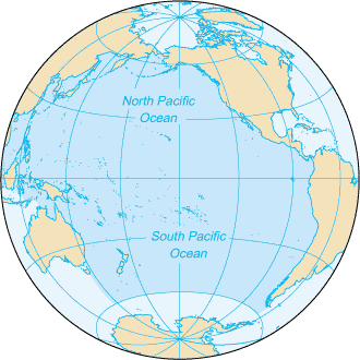
-
Article
Pacific Rim
The term Pacific Rim has been used to refer to all those countries with coastlines bordering the Pacific Ocean. However, in recent years the term has become synonymous with the Asia Pacific region which encompasses East and Southeast Asia, South Asia, Australia, New Zealand and North America.
"https://thecanadianencyclopedia.ca/images/tce_placeholder.jpg?v=e9dca980c9bdb3aa11e832e7ea94f5d9" // resources/views/front/categories/view.blade.php
https://thecanadianencyclopedia.ca/images/tce_placeholder.jpg?v=e9dca980c9bdb3aa11e832e7ea94f5d9
-
Article
Pacific Rim National Park Reserve
Pacific Rim National Park Reserve (285.8 km2) stretches for 105 km along the rugged west coast of Vancouver Island. Established in 1970, the Pacific Rim National Park Reserve comprises three sections: the Long Beach unit, the West Coast Trail unit and the Broken Group islands. Nestled along the southwestern coast of Vancouver Island, the National Park Reserve boasts sandy beaches and temperate rainforests. Pacific Rim National Park Reserve lies in the traditional territories of the Nuu-chah-nulth First Nations and was symbolically twinned with the Hallyo Haesang Sea National Park of Korea in 1997.
"https://d3d0lqu00lnqvz.cloudfront.net/pacificrimnationalparkreserve/Long-Beach_-_Pacific_Rim_National_Park_Reserve.jpg" // resources/views/front/categories/view.blade.php
https://d3d0lqu00lnqvz.cloudfront.net/pacificrimnationalparkreserve/Long-Beach_-_Pacific_Rim_National_Park_Reserve.jpg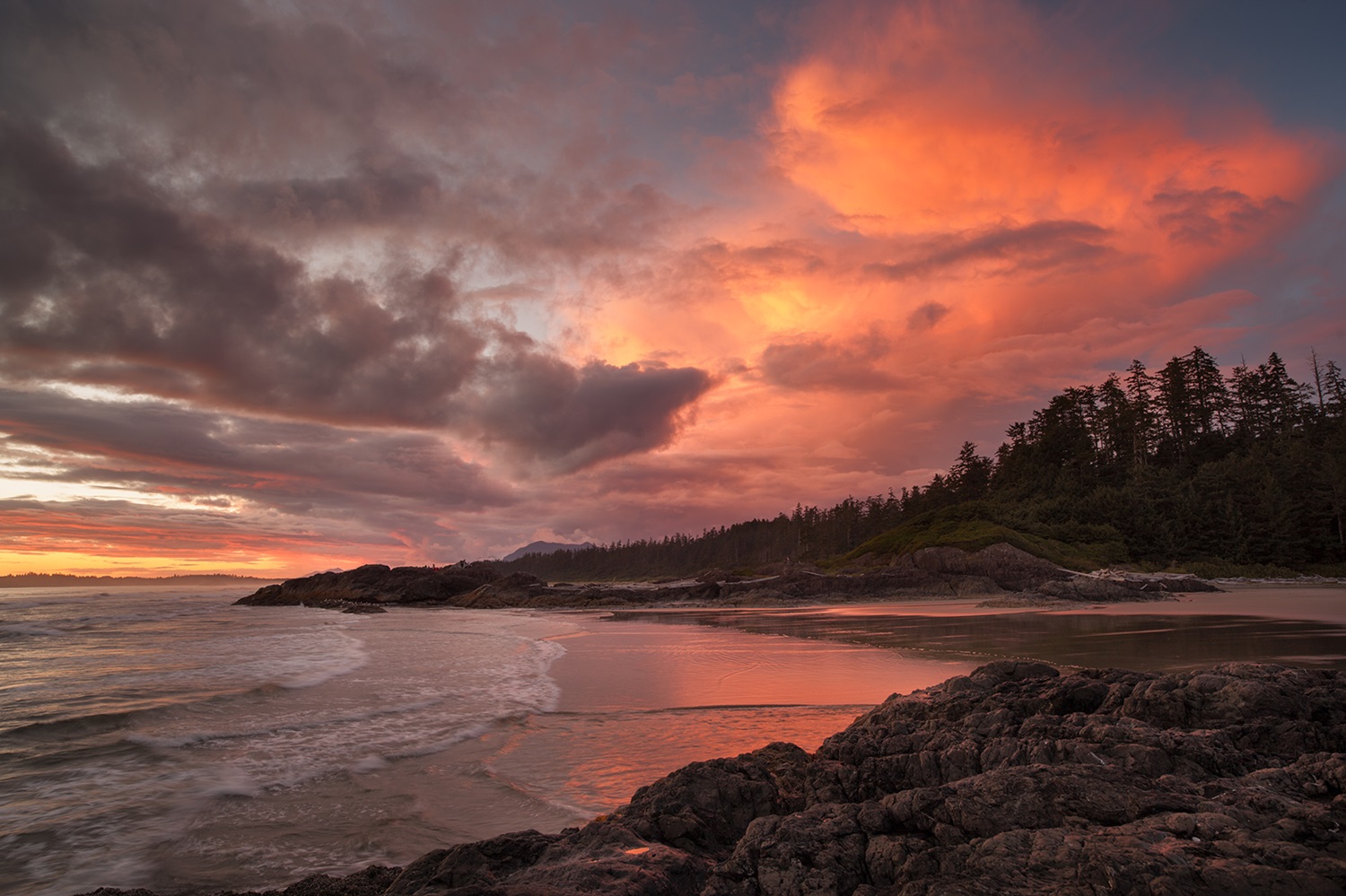
-
Article
Paddle Prairie Metis Settlement
The Paddle Prairie Metis Settlement is one of eight Métis Settlements in Alberta. The community is located in the northwest corner of the province near the Peace River. It is 1,739 km2, or roughly two and a half times the size of Edmonton. This makes Paddle Prairie the largest of the eight settlements in terms of area. It also makes it larger than the largest First Nation reserve in both the province and the country. (Blood 148, held by Kainai Nation in southern Alberta, is 1,342.9 km2.) The population of Paddle Prairie is 536, according to the settlement’s 2019 census. In addition, people may be a member of the settlement but live elsewhere.
"https://d3d0lqu00lnqvz.cloudfront.net/media/new_article_images/PPMS/School.jpg" // resources/views/front/categories/view.blade.php
https://d3d0lqu00lnqvz.cloudfront.net/media/new_article_images/PPMS/School.jpg
-
Article
Paldi
Paldi, British Columbia was established in 1917, about 75 km northwest of Victoria. It was one of the first multi-ethnic, migrant mill towns on Vancouver Island. Sikh entrepreneur Mayo Singh (born Mayan Singh Manhas) founded the community. He named Paldi after his own village in District Hoshiarpur in Punjab, India. (Singh originally named Paldi after himself, calling the settlement Mayo Siding. However, because there was already a town named Mayo in Yukon, Singh changed the name to Paldi in 1936.) Though Paldi no longer has a registered population, it remains a symbol of successful, intercultural living in Canada.
"https://d3d0lqu00lnqvz.cloudfront.net/MayoSingh/ChildrenAndTemple.jpg" // resources/views/front/categories/view.blade.php
https://d3d0lqu00lnqvz.cloudfront.net/MayoSingh/ChildrenAndTemple.jpg
-
Article
Paradise
Paradise, NL, incorporated as a town in 1981, population 17 695 (2011c), 12 584 (2006c). The Town of Paradise is situated inland approximately 13 km from downtown ST JOHN'S.
"https://thecanadianencyclopedia.ca/images/tce_placeholder.jpg?v=e9dca980c9bdb3aa11e832e7ea94f5d9" // resources/views/front/categories/view.blade.php
https://thecanadianencyclopedia.ca/images/tce_placeholder.jpg?v=e9dca980c9bdb3aa11e832e7ea94f5d9
-
Article
Parc national de la Gaspésie
In the heart of the Gaspé Peninsula, 196 km east of Rimouski, is Parc national de la Gaspésie (established 1981, 802 km2). First established in 1937 by means of special legislation, the park has in the past bowed to mining and forestry pressures. It is now completely protected through the park's Act.
"https://thecanadianencyclopedia.ca/images/tce_placeholder.jpg?v=e9dca980c9bdb3aa11e832e7ea94f5d9" // resources/views/front/categories/view.blade.php
https://thecanadianencyclopedia.ca/images/tce_placeholder.jpg?v=e9dca980c9bdb3aa11e832e7ea94f5d9
-
Article
Parksville
Parksville, BC, incorporated as a city in 1986, population 11 977 (2011c), 10 993 (2006c). The City of Parksville is located on the east coast of VANCOUVER ISLAND, 35 km northwest of NANAIMO.
"https://thecanadianencyclopedia.ca/images/tce_placeholder.jpg?v=e9dca980c9bdb3aa11e832e7ea94f5d9" // resources/views/front/categories/view.blade.php
https://thecanadianencyclopedia.ca/images/tce_placeholder.jpg?v=e9dca980c9bdb3aa11e832e7ea94f5d9
-
Article
Parliament
The term Parliament refers to the Crown, the House of Commons and the Senate. Together, these institutions create Canadian laws. Parliament has two branches: the executive (the Crown, prime minister and cabinet) and the legislative (the House of Commons and the Senate). This system is a blend of parliamentary democracy and constitutional monarchy. It is based on the Westminster tradition in Britain. Each of the Crown, Senate and Commons must agree with (assent to) a law before it is enacted. The government of the day derives its authority from the people who elected it. It is therefore a representative government, even though it acts in the name of the Crown — a largely symbolic institution. In formal terms, Parliament includes all three bodies. But in common usage, the legislative branch is often equated with Parliament.
"https://d3d0lqu00lnqvz.cloudfront.net/media/media/11551bec-a5f6-4e78-b101-265ddf7610cb.jpg" // resources/views/front/categories/view.blade.php
https://d3d0lqu00lnqvz.cloudfront.net/media/media/11551bec-a5f6-4e78-b101-265ddf7610cb.jpg
-
Article
Parliament Hill
Parliament Hill is a nine-hectare (0.09 km2) site in downtown Ottawa. It is home to Canada’s Parliament Buildings, the seat of the country’s federal government. Parliament Hill’s open grounds — a rarity among national parliaments — provide a place to gather for celebration or protest and are a National Historic Site. An excellent example of the gothic revival architecture style, the Parliament Buildings — Parliament (Centre Block) and two office buildings (East and West blocks) — officially opened on 6 June 1866. The Library of Parliament is the only part of the original Centre Block to have survived a fire in 1916. A Memorial Chamber and Peace Tower were added to the rebuilt Centre Block in honour of fallen First World War soldiers. The Centennial Flame was added to the grounds to mark Canada’s centennial in 1967. A $4.5–5 billion project to restore the Parliament Buildings began in 2002 and is due to be finished by 2031.
"https://d3d0lqu00lnqvz.cloudfront.net/media/media/dbd84edd-1c5c-4e10-ba3f-8b0c546b08c7.jpg" // resources/views/front/categories/view.blade.php
https://d3d0lqu00lnqvz.cloudfront.net/media/media/dbd84edd-1c5c-4e10-ba3f-8b0c546b08c7.jpg