
Browse "Parks & Nature Reserves"
-
Article
Toronto Feature: Tommy Thompson Park
This article is from our Toronto Feature series. Features from past programs are not updated.
"https://d3d0lqu00lnqvz.cloudfront.net/media/media/9f14c928-d1e3-40ad-8d1c-9910f990dd54.jpg" // resources/views/front/categories/view.blade.php
https://d3d0lqu00lnqvz.cloudfront.net/media/media/9f14c928-d1e3-40ad-8d1c-9910f990dd54.jpg
-
Article
Toronto Feature: Wychwood Park
This article is from our Toronto Feature series. Features from past programs are not updated.
"https://d3d0lqu00lnqvz.cloudfront.net/media/media/e150c523-b139-4758-aa53-6c3ed7d3ec25.jpg" // resources/views/front/categories/view.blade.php
https://d3d0lqu00lnqvz.cloudfront.net/media/media/e150c523-b139-4758-aa53-6c3ed7d3ec25.jpg
-
Article
Tuktut Nogait National Park
Tuktut Nogait National Park (established in 1998, 18 181 km2) was created through the efforts of the Inuit of Paulatuk, NWT. They wanted a national park to help protect the calving grounds of the Bluenose herd of barren-ground caribou, a game animal essential to their way of life. The agreement to establish the park in the Inuvialuit Settlement Area was signed in 1996, and the park's formal establishment occurred 2 years later. In 2005, Tuktut Nogait was expanded southward with the addition of a small portion in the Sahtu Settlement Area. When Nunavut was created in 1999, the national park's eastern boundary was incorporated into the NWT/Nunavut border. Most of its northern boundary runs parallel to the Amundsen Gulf, which lies 20 km to the north. The name Tuktut Nogait means "caribou calves" in Inuvialuktun.
"https://d3d0lqu00lnqvz.cloudfront.net/TuktutNogaitNationalPark/Evening_shadows_on_tundra.jpg" // resources/views/front/categories/view.blade.php
https://d3d0lqu00lnqvz.cloudfront.net/TuktutNogaitNationalPark/Evening_shadows_on_tundra.jpg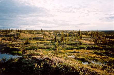
-
Article
Turtle Mountain Provincial Park
Named after the western painted turtle found in the park, Turtle Mountain Provincial Park (established 1961, 189 km2) is 100 km south of Brandon, Manitoba, butted against the international boundary.
"https://d3d0lqu00lnqvz.cloudfront.net/media/media/551e57b8-5735-4754-a520-399331837275.jpg" // resources/views/front/categories/view.blade.php
https://d3d0lqu00lnqvz.cloudfront.net/media/media/551e57b8-5735-4754-a520-399331837275.jpg
-
Article
Ukkusiksalik National Park
Ukkusiksalik National Park, Nunavut, size 20,885 km2, established in 2003, is located on the northwest side of Hudson Bay. It was first proposed as a National Park in 1978 because of the spectacular inland sea, Wager Bay, and the surrounding area. The name Ukkusiksalik in Inuktitut means "the place where soapstone to make pots and oil lamps is found."
"https://d3d0lqu00lnqvz.cloudfront.net/UkkusiksalikNationalPark/UkkusiksalikNationalPark.jpg" // resources/views/front/categories/view.blade.php
https://d3d0lqu00lnqvz.cloudfront.net/UkkusiksalikNationalPark/UkkusiksalikNationalPark.jpg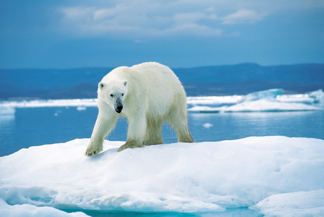
-
Article
Vancouver Feature: “Babes in the Woods” Discovered
The following article is a feature from our Vancouver Feature series. Past features are not updated. A Parks Board gardener, clearing leaves near Beaver Lake, came across a cheap fur coat. Lifting it up, he made a grisly discovery — the skeletal remains of two young children. Dubbed the Babes in the Woods by the press, the sensational, unsolved case remains a haunting piece of Vancouver lore.
"https://d3d0lqu00lnqvz.cloudfront.net/media/media/85ca6c68-6ce1-451a-a93d-794226b03e4c.jpg" // resources/views/front/categories/view.blade.php
https://d3d0lqu00lnqvz.cloudfront.net/media/media/85ca6c68-6ce1-451a-a93d-794226b03e4c.jpg
-
Article
Vuntut National Park
A portion of the Old Crow Plain (locally called the Old Crow Flats) was set aside, through the settlement of the Vuntut Gwitchin comprehensive land claim in 1993, for Vuntut National Park (established 1995, 4345 km2). The park is bound to the north by Ivvavik National Park and to the west by Alaska. Access to Vuntut National Park is by charter aircraft from the village of Old Crow, which only has year-round scheduled air service, or by a long canoe journey.
"https://d3d0lqu00lnqvz.cloudfront.net/media/media/0280eee2-9f7c-4cb4-a65b-a6e43d457819.jpg" // resources/views/front/categories/view.blade.php
https://d3d0lqu00lnqvz.cloudfront.net/media/media/0280eee2-9f7c-4cb4-a65b-a6e43d457819.jpg
-
Article
Wapusk National Park
Wapusk National Park (11,475.0 km2) became part of Canada's national parks system on 24 April 1996 when a federal-provincial agreement was signed providing for its establishment. This national park extends to the east and south of Churchill, Manitoba, and protects a representative sample of the features and wildlife of the Hudson and James Bay lowlands.
"https://d3d0lqu00lnqvz.cloudfront.net/media/media/2288f5ad-7780-4e6a-b579-e6f1614efd4e.jpg" // resources/views/front/categories/view.blade.php
https://d3d0lqu00lnqvz.cloudfront.net/media/media/2288f5ad-7780-4e6a-b579-e6f1614efd4e.jpg
-
Article
Whiteshell Provincial Park
Whiteshell Provincial Park (established 1961, 2,737.15 km2), 105 km east of Winnipeg, Manitoba, by the Trans-Canada Highway, is Precambrian Shield country. Whiteshell is connected to Nopiming Provincial Park to the north.
"https://d3d0lqu00lnqvz.cloudfront.net/media/media/a5b2bc47-c5be-4499-b2a0-f516d71e6330.jpg" // resources/views/front/categories/view.blade.php
https://d3d0lqu00lnqvz.cloudfront.net/media/media/a5b2bc47-c5be-4499-b2a0-f516d71e6330.jpg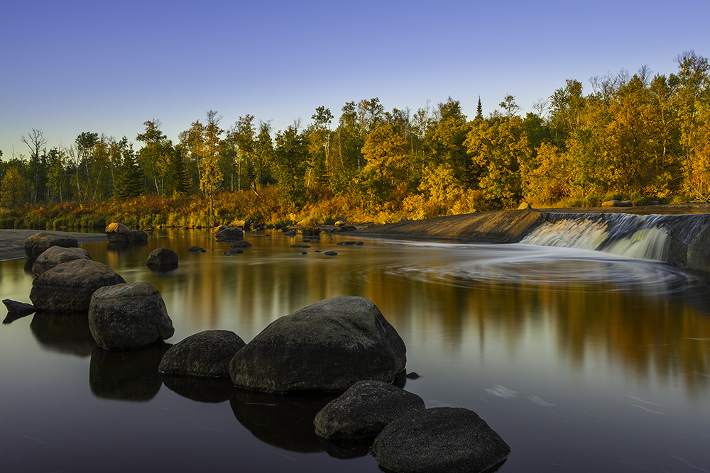
-
Article
Wood Buffalo National Park
Wood Buffalo National Park (established in 1922, 44 802 km2) was established to protect the last herd of wood bison. Canada's largest national park straddles the Alberta/NWT border. It was declared a World Heritage Site in 1983.
"https://d3d0lqu00lnqvz.cloudfront.net/media/media/dad4c55e-b36d-4cf2-8e66-7da2b6cc188a.jpg" // resources/views/front/categories/view.blade.php
https://d3d0lqu00lnqvz.cloudfront.net/media/media/dad4c55e-b36d-4cf2-8e66-7da2b6cc188a.jpg
-
Article
Writing-On-Stone Provincial Park
Writing-on-Stone Provincial Park is located in southern Alberta, just north of the Canada-US border. To the Siksikaitsitapi (Blackfoot Nation), the site is known as Áísínai’pi, which means “it is pictured” or “it is written” in the Blackfoot language. The park features thousands of rock paintings and carvings created by the Siksikaitsitapi, most of which date to 1050 BCE. Established as a provincial park in 1957, Áísínai’pi was designated a National Historic Site in 2004, and a UNESCO World Heritage Site in 2019.
"https://d3d0lqu00lnqvz.cloudfront.net/media/new_article_images/WritingOnStoneProvincialPark/44483655811_161e7e26ae_z.jpg" // resources/views/front/categories/view.blade.php
https://d3d0lqu00lnqvz.cloudfront.net/media/new_article_images/WritingOnStoneProvincialPark/44483655811_161e7e26ae_z.jpg
-
Article
Yoho National Park
Yoho National Park is a protected area located in the Rocky Mountains, in the southeast corner of British Columbia. The park was established in 1886, initially as the Mount Stephen reserve, making it (along with Glacier National Park, established the same day) the second oldest national park in Canada, following Banff. Spanning 1,313 km2 the park features 28 mountain peaks above 3,000 metres. Yoho National Park is one of seven parks in the Rocky Mountains that make up the Canadian Rocky Mountains UNESCO World Heritage site (the others are Jasper, Banff and Kootenay national parks, and Mount Robson, Mount Assiniboine and Hamber provincial parks). Among the reasons for the UNESCO designation are the Burgess Shale sites, several of which are located in Yoho National Park, featuring fossils from 540 million years ago. The name Yoho comes from a Cree expression of awe and wonder.
"https://d3d0lqu00lnqvz.cloudfront.net/media/new_article_images/Yoho National Park-3.jpg" // resources/views/front/categories/view.blade.php
https://d3d0lqu00lnqvz.cloudfront.net/media/new_article_images/Yoho National Park-3.jpg