
Browse "Geographical Features"
-
Article
Cabot Strait
Cabot Strait, the passage between southwest Newfoundland and Cape Breton Island. Named for explorer John Cabot, it is 110 km wide between Cape Ray, Nfld, and Cape North, NS.
"https://thecanadianencyclopedia.ca/images/tce_placeholder.jpg?v=e9dca980c9bdb3aa11e832e7ea94f5d9" // resources/views/front/categories/view.blade.php
https://thecanadianencyclopedia.ca/images/tce_placeholder.jpg?v=e9dca980c9bdb3aa11e832e7ea94f5d9
-
Article
Canadian Heritage Rivers System
Rivers are part of our lives and our heritage. They are the threads that bind the fabric of nature and humanity together.
"https://thecanadianencyclopedia.ca/images/tce_placeholder.jpg?v=e9dca980c9bdb3aa11e832e7ea94f5d9" // resources/views/front/categories/view.blade.php
https://thecanadianencyclopedia.ca/images/tce_placeholder.jpg?v=e9dca980c9bdb3aa11e832e7ea94f5d9
-
Article
Cap Wolstenholme
Cap Wolstenholme, 384 m high, is an imposing headland marking the western limit of Hudson Strait.
"https://thecanadianencyclopedia.ca/images/tce_placeholder.jpg?v=e9dca980c9bdb3aa11e832e7ea94f5d9" // resources/views/front/categories/view.blade.php
https://thecanadianencyclopedia.ca/images/tce_placeholder.jpg?v=e9dca980c9bdb3aa11e832e7ea94f5d9
-
Article
Cape Blomidon
Cape Blomidon lies along the southeast shore of the Bay of Fundy at the mouth of Minas Basin, the site of some of the world's highest tides.
"https://thecanadianencyclopedia.ca/images/tce_placeholder.jpg?v=e9dca980c9bdb3aa11e832e7ea94f5d9" // resources/views/front/categories/view.blade.php
https://thecanadianencyclopedia.ca/images/tce_placeholder.jpg?v=e9dca980c9bdb3aa11e832e7ea94f5d9
-
Article
Cape Kildare
Cape Kildare extends eastward into the Gulf of St Lawrence at the northern end of Prince Edward Island. Named by Samuel Holland in 1765 after James, 20th earl of Kildare, it is part of a series of capes in the area known as the Kildare Capes.
"https://thecanadianencyclopedia.ca/images/tce_placeholder.jpg?v=e9dca980c9bdb3aa11e832e7ea94f5d9" // resources/views/front/categories/view.blade.php
https://thecanadianencyclopedia.ca/images/tce_placeholder.jpg?v=e9dca980c9bdb3aa11e832e7ea94f5d9
-
"https://thecanadianencyclopedia.ca/images/tce_placeholder.jpg?v=e9dca980c9bdb3aa11e832e7ea94f5d9" // resources/views/front/categories/view.blade.php
https://thecanadianencyclopedia.ca/images/tce_placeholder.jpg?v=e9dca980c9bdb3aa11e832e7ea94f5d9
-
Article
Cape Race
Cape Race, elevation 30-40 m, is the southeastern extremity of Newfoundland's AVALON PENINSULA. Named for its flat-topped (Portuguese, raso) cliffs, it has a barren appearance that creates a stark impression for transatlantic
"https://d3d0lqu00lnqvz.cloudfront.net/media/media/983b186a-56db-4168-af4e-574578d3bd37.jpg" // resources/views/front/categories/view.blade.php
https://d3d0lqu00lnqvz.cloudfront.net/media/media/983b186a-56db-4168-af4e-574578d3bd37.jpg
-
Article
Cape Sable
Cape Sable is the southernmost point of land on CAPE SABLE ISLAND, which lies off the southwestern tip of Nova Scotia. It is composed of shifting sand dunes (French, sable) up to 9 m high and is nearly joined to the island by a sandy beach transversed by Hawk Channel.
"https://thecanadianencyclopedia.ca/images/tce_placeholder.jpg?v=e9dca980c9bdb3aa11e832e7ea94f5d9" // resources/views/front/categories/view.blade.php
https://thecanadianencyclopedia.ca/images/tce_placeholder.jpg?v=e9dca980c9bdb3aa11e832e7ea94f5d9
-
Article
Cape Spear
Cape Spear, elev 75 m, most easterly point in N America (excluding Greenland), is located 6.7 km SE of the entrance to St John's harbour, Nfld. A rocky, windswept promontory of Precambrian formation, with a thin, sporadic cover
"https://d3d0lqu00lnqvz.cloudfront.net/media/media/907c73d8-6d3f-45cf-a339-1e12575cd24a.jpg" // resources/views/front/categories/view.blade.php
https://d3d0lqu00lnqvz.cloudfront.net/media/media/907c73d8-6d3f-45cf-a339-1e12575cd24a.jpg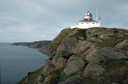
-
Article
Cape St Mary
Cape St Mary forms the southern boundary of St Mary's Bay in an area of Nova Scotia's northwestern coast known as the French Shore. Fishing is the principal activity in this region; the cape was once the site of the International Tuna Cup matches.
"https://thecanadianencyclopedia.ca/images/tce_placeholder.jpg?v=e9dca980c9bdb3aa11e832e7ea94f5d9" // resources/views/front/categories/view.blade.php
https://thecanadianencyclopedia.ca/images/tce_placeholder.jpg?v=e9dca980c9bdb3aa11e832e7ea94f5d9
-
Article
Cape St Mary's
Cape St Mary's, elevation 105 m, on Newfoundland's AVALON PENINSULA, is the steep and spectacular terminus of the land separating ST MARY'S BAY and PLACENTIA BAY near rich fishing grounds. The site of a lighthouse since 1860, the
"https://thecanadianencyclopedia.ca/images/tce_placeholder.jpg?v=e9dca980c9bdb3aa11e832e7ea94f5d9" // resources/views/front/categories/view.blade.php
https://thecanadianencyclopedia.ca/images/tce_placeholder.jpg?v=e9dca980c9bdb3aa11e832e7ea94f5d9
-
Article
Cape Traverse
Cape Traverse is a small peninsula along the southwestern shore of PEI on Northumberland Strait.
"https://thecanadianencyclopedia.ca/images/tce_placeholder.jpg?v=e9dca980c9bdb3aa11e832e7ea94f5d9" // resources/views/front/categories/view.blade.php
https://thecanadianencyclopedia.ca/images/tce_placeholder.jpg?v=e9dca980c9bdb3aa11e832e7ea94f5d9
-
Article
Cariboo Mountains
The Cariboo Mountains is the most northern range making up the Columbia Mountains.
"https://d3d0lqu00lnqvz.cloudfront.net/cariboo-mountains-flora-1105422859_0a2bdb6663_b.jpg" // resources/views/front/categories/view.blade.php
https://d3d0lqu00lnqvz.cloudfront.net/cariboo-mountains-flora-1105422859_0a2bdb6663_b.jpg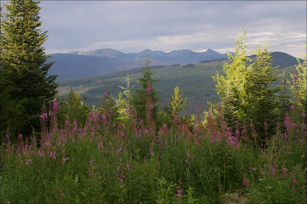
-
Article
Cascade Mountains
Cascade Mountains, BC, are the north end of largely volcanic mountain ranges extending to California, 180-260 km east of the Pacific Ocean. There are no active volcanoes in BC like the US Cascades' Mount St Helens and others.
"https://thecanadianencyclopedia.ca/images/tce_placeholder.jpg?v=e9dca980c9bdb3aa11e832e7ea94f5d9" // resources/views/front/categories/view.blade.php
https://thecanadianencyclopedia.ca/images/tce_placeholder.jpg?v=e9dca980c9bdb3aa11e832e7ea94f5d9
-
Article
Cassiar District
The Cassiar District lies in British Columbia's northwest corner; it historically encompasses the Stikine and Dease River watersheds and that of the upper Taku, NASS and Kechika.
"https://thecanadianencyclopedia.ca/images/tce_placeholder.jpg?v=e9dca980c9bdb3aa11e832e7ea94f5d9" // resources/views/front/categories/view.blade.php
https://thecanadianencyclopedia.ca/images/tce_placeholder.jpg?v=e9dca980c9bdb3aa11e832e7ea94f5d9