
Browse "Cities & Populated Places"
-
Article
Lac-Beauport
In the early 1800s the territory was opened up to exploit the forest resources. By the early 1820s the area around Lac Beauport was known as Waterloo Settlement. The first settlers were of English origin. In 1853 the parish municipality of Saint-Dunstan-du-Lac-Beauport was created.
"https://d3d0lqu00lnqvz.cloudfront.net/media/media/c17053a3-9a95-4ba1-8032-8c965bb82fee.jpg" // resources/views/front/categories/view.blade.php
https://d3d0lqu00lnqvz.cloudfront.net/media/media/c17053a3-9a95-4ba1-8032-8c965bb82fee.jpg
-
Article
Lac du Bonnet
Lac du Bonnet, Manitoba, incorporated as a rural municipality in 1917, population 2671 (2011c), 2812 (2006c). The Rural Municipality of Lac du Bonnet is located 100 km northeast of Winnipeg on Lac du Bonnet
"https://d3d0lqu00lnqvz.cloudfront.net/media/media/10511603-ff9a-4cd8-821c-641bba0ee988.jpg" // resources/views/front/categories/view.blade.php
https://d3d0lqu00lnqvz.cloudfront.net/media/media/10511603-ff9a-4cd8-821c-641bba0ee988.jpg
-
Article
Lac La Biche
Lac La Biche, Alberta, incorporated as a municipal district in 2007, population 7,673 (2021 census), 8,330 (2016 census). Lac La Biche County is located 225 km northeast of Edmonton on the south shore of the lake of the same name. Incorporated as a town in 1951, Lac La Biche amalgamated with Lakeland County in 2007 to create Lac La Biche County.
"https://thecanadianencyclopedia.ca/images/tce_placeholder.jpg?v=e9dca980c9bdb3aa11e832e7ea94f5d9" // resources/views/front/categories/view.blade.php
https://thecanadianencyclopedia.ca/images/tce_placeholder.jpg?v=e9dca980c9bdb3aa11e832e7ea94f5d9
-
Article
Lac-Mégantic (town)
Lac-Mégantic, Quebec was incorporated as a town in 1907, population 5,747 (2021 census), 5,654 (2016 census). Located in Estrie in the Regional County Municipality of Le Granit, the town of Lac-Mégantic is situated approximately 95 km east of Sherbrooke on the northeast shore of Lac Mégantic (see Eastern Townships). The town is Le Granit’s centre of industry (lumber and granite), administration and commerce. On 6 July 2013, a devastating train derailment occurred in Lac-Mégantic (see Lac-Mégantic Rail Disaster; Railway Disasters).
"https://d3d0lqu00lnqvz.cloudfront.net/media/media/0ba32689-d18b-4fa5-924f-8d7008f7ca20.jpg" // resources/views/front/categories/view.blade.php
https://d3d0lqu00lnqvz.cloudfront.net/media/media/0ba32689-d18b-4fa5-924f-8d7008f7ca20.jpg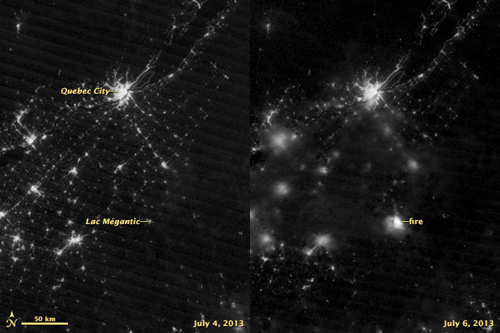
-
Article
Lachine
The development of the Lachine Canal in the 1820s, the establishment of the Montreal and Lachine Railroad in 1847, and the expansion of the trucking business in the 20th century gave Lachine a major role in the trade network extending to southwestern Canada and the US.
"https://thecanadianencyclopedia.ca/images/tce_placeholder.jpg?v=e9dca980c9bdb3aa11e832e7ea94f5d9" // resources/views/front/categories/view.blade.php
https://thecanadianencyclopedia.ca/images/tce_placeholder.jpg?v=e9dca980c9bdb3aa11e832e7ea94f5d9
-
Article
Lachute
Agriculture sustained the early settlers, but the town developed through its close connection with the paper and textile industries.
"https://thecanadianencyclopedia.ca/images/tce_placeholder.jpg?v=e9dca980c9bdb3aa11e832e7ea94f5d9" // resources/views/front/categories/view.blade.php
https://thecanadianencyclopedia.ca/images/tce_placeholder.jpg?v=e9dca980c9bdb3aa11e832e7ea94f5d9
-
Article
Lacombe
Lacombe, Alta, incorporated as a town in 1902 and as a city in 2010, population 11 707 (2011c), 10 752 (2006c). The City of Lacombe, the county seat for the County of Lacombe, is situated in rolling parkland some 118 km south of Edmonton.
"https://thecanadianencyclopedia.ca/images/tce_placeholder.jpg?v=e9dca980c9bdb3aa11e832e7ea94f5d9" // resources/views/front/categories/view.blade.php
https://thecanadianencyclopedia.ca/images/tce_placeholder.jpg?v=e9dca980c9bdb3aa11e832e7ea94f5d9
-
Article
Ladysmith
Ladysmith, BC, incorporated as a town in 1904, population 7921 (2011c), 7538 (2006c). The Town of Ladysmith is located on the east coast of VANCOUVER ISLAND, 85 km north of Victoria. It is located on Ladysmith Harbour on the northern edge of a lucrative farming area.
"https://thecanadianencyclopedia.ca/images/tce_placeholder.jpg?v=e9dca980c9bdb3aa11e832e7ea94f5d9" // resources/views/front/categories/view.blade.php
https://thecanadianencyclopedia.ca/images/tce_placeholder.jpg?v=e9dca980c9bdb3aa11e832e7ea94f5d9
-
Article
Lake Cowichan
Lake Cowichan, BC, incorporated as a town in 1996, population 2974 (2011c), 3012 (2006c). The Town of Lake Cowichan is located adjacent to the Cowichan River and Cowichan Lake on southern VANCOUVER ISLAND, 26 km west of DUNCAN.
"https://d3d0lqu00lnqvz.cloudfront.net/media/media/7c173143-b064-437c-9ca5-29f626b53c24.jpg" // resources/views/front/categories/view.blade.php
https://d3d0lqu00lnqvz.cloudfront.net/media/media/7c173143-b064-437c-9ca5-29f626b53c24.jpg
-
Article
L'Ancienne-Lorette
The history of L'Ancienne-Lorette goes back to 1674, when the Jesuit Pierre Chaumonot (1611-93) built a chapel on this site for the HURONS who had been forced to flee their homeland (Ontario) by the Iroquois.
"https://thecanadianencyclopedia.ca/images/tce_placeholder.jpg?v=e9dca980c9bdb3aa11e832e7ea94f5d9" // resources/views/front/categories/view.blade.php
https://thecanadianencyclopedia.ca/images/tce_placeholder.jpg?v=e9dca980c9bdb3aa11e832e7ea94f5d9
-
Article
Langley
Langley, BC, incorporated as a district municipality in 1873, population 104 177 (2011c), 93 726 (2006c). The Township of Langley is located about 40 km east of VANCOUVER. The city of Langley, population 25 081 (2011c), 23 606 (2006c), became a separate municipality in 1955.
"https://thecanadianencyclopedia.ca/images/tce_placeholder.jpg?v=e9dca980c9bdb3aa11e832e7ea94f5d9" // resources/views/front/categories/view.blade.php
https://thecanadianencyclopedia.ca/images/tce_placeholder.jpg?v=e9dca980c9bdb3aa11e832e7ea94f5d9
-
Article
LaSalle
History In 1667, René-Robert Cavelier de la Salle became seigneur of the land of present-day LaSalle. In order to avoid the Lachine Rapids, traders, explorers and Indigenous people portaged along a path that would become LaSalle Boulevard.
"https://d3d0lqu00lnqvz.cloudfront.net/media/media/c26e0d11-ffaa-4f9e-beae-00eff688b6b6.jpg" // resources/views/front/categories/view.blade.php
https://d3d0lqu00lnqvz.cloudfront.net/media/media/c26e0d11-ffaa-4f9e-beae-00eff688b6b6.jpg
-
Article
Laterrière
The name was first applied to the township (1850) and then the parish (1882). They were named after Marc-Pascal de Sales Laterrière, who represented Saguenay in the Legislative Assembly of the Province of Canada.
"https://d3d0lqu00lnqvz.cloudfront.net/media/media/b129fc4e-8039-4ddb-b986-6065a9b74dc1.jpg" // resources/views/front/categories/view.blade.php
https://d3d0lqu00lnqvz.cloudfront.net/media/media/b129fc4e-8039-4ddb-b986-6065a9b74dc1.jpg
-
Article
Laurentian Hills
Laurentian Hills, Ont, incorporated as a town in 2000, population 2811 (2011c), 2789 (2006c). The Town of Laurentian Hills is located close to the Ottawa River, about 210 km northwest of Ottawa. The town came into existence with
"https://thecanadianencyclopedia.ca/images/tce_placeholder.jpg?v=e9dca980c9bdb3aa11e832e7ea94f5d9" // resources/views/front/categories/view.blade.php
https://thecanadianencyclopedia.ca/images/tce_placeholder.jpg?v=e9dca980c9bdb3aa11e832e7ea94f5d9
-
Article
Le Gardeur
First set up as the parish municipality of Saint-Paul-l'Ermite in 1857, it was incorporated as a city under the same name in 1973 before changing its designation to Le Gardeur in 1978.
"https://thecanadianencyclopedia.ca/images/tce_placeholder.jpg?v=e9dca980c9bdb3aa11e832e7ea94f5d9" // resources/views/front/categories/view.blade.php
https://thecanadianencyclopedia.ca/images/tce_placeholder.jpg?v=e9dca980c9bdb3aa11e832e7ea94f5d9