
Browse "Cities & Populated Places"
-
Article
Kitimat
Kitimat, British Columbia, incorporated as a district municipality in 1953, population 8,236 (2021 census), 8,131 (2016 census). The district of Kitimat is located at the head of the Douglas Channel, 206 km east of Prince Rupert by road. Its name comes from the Tsimshian term for the Haisla inhabitants of the area, Kitamaat (“people of the snow”). The modern community was founded in the early 1950s.
"https://d3d0lqu00lnqvz.cloudfront.net/media/new_article_images/Kitimat/Kitimat_2008.jpg" // resources/views/front/categories/view.blade.php
https://d3d0lqu00lnqvz.cloudfront.net/media/new_article_images/Kitimat/Kitimat_2008.jpg
-
Article
Kitsilano
Kitsilano, a 549 ha waterfront section of VANCOUVER, incorporated into that city in 1886. It stretches south from English Bay to 16th Avenue and east from Alma to Burrard street.
"https://d3d0lqu00lnqvz.cloudfront.net/media/media/a1d97bef-a8f5-4fa4-89fe-aadf1c0107f6.jpg" // resources/views/front/categories/view.blade.php
https://d3d0lqu00lnqvz.cloudfront.net/media/media/a1d97bef-a8f5-4fa4-89fe-aadf1c0107f6.jpg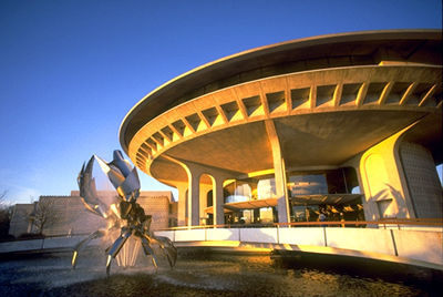
-
Article
Kleinburg
Kleinburg, Ont, straddles a hogback between 2 branches of the Humber River 40 km NW of Toronto. It has no legal entity, being part of the sprawling city of Vaughan (formerly Vaughan Township), and therefore no official boundaries. Founded around 1847 by an Alsatian immigrant, John Kline (sic), who built the first gristmill, it is known today as the site of one of Canada's largest art galleries, the McMichael Canadian Art Collection; for the Toronto...
"https://thecanadianencyclopedia.ca/images/tce_placeholder.jpg?v=e9dca980c9bdb3aa11e832e7ea94f5d9" // resources/views/front/categories/view.blade.php
https://thecanadianencyclopedia.ca/images/tce_placeholder.jpg?v=e9dca980c9bdb3aa11e832e7ea94f5d9
-
Article
Klondike
Klondike (also spelled Klondyke). The name is derived from a Gwich'in word, thron-duick (hammer river), and identifies a town, a river, and a range of hills in the Yukon.
"https://thecanadianencyclopedia.ca/images/tce_placeholder.jpg?v=e9dca980c9bdb3aa11e832e7ea94f5d9" // resources/views/front/categories/view.blade.php
https://thecanadianencyclopedia.ca/images/tce_placeholder.jpg?v=e9dca980c9bdb3aa11e832e7ea94f5d9
-
Article
Klondike Gold Rush
The discovery of gold in the Yukon in 1896 led to a stampede to the Klondike region between 1897 and 1899. This led to the establishment of Dawson City (1896) and subsequently, the Yukon Territory (1898). The Klondike gold rush solidified the public’s image of the North as more than a barren wasteland and left a body of literature that has popularized and romanticized the Yukon. (See also Gold Rushes in Canada)
"https://d3d0lqu00lnqvz.cloudfront.net/media/media/f8badbbb-95b8-44cf-a053-5589845ee1ef.jpg" // resources/views/front/categories/view.blade.php
https://d3d0lqu00lnqvz.cloudfront.net/media/media/f8badbbb-95b8-44cf-a053-5589845ee1ef.jpg
-
Article
Ksan
Ksan (or ‘Ksan) is a historical village, museum and campground, owned and operated by the Gitanmaax Band. It is located at the junction of the Skeena and Bulkley rivers in Hazelton, British Columbia. Ksan was established in 1970 as way to promote and preserve Gitxsan culture and history.
"https://d3d0lqu00lnqvz.cloudfront.net/media/media/2fd73ae3-5ed7-4894-b6ae-caa2ac25e639.jpg" // resources/views/front/categories/view.blade.php
https://d3d0lqu00lnqvz.cloudfront.net/media/media/2fd73ae3-5ed7-4894-b6ae-caa2ac25e639.jpg
-
Article
Kugaaruk
Kugaaruk, Nunavut, incorporated as a hamlet in 1972, population 771 (2011c), 688 (2006c). The Hamlet of Kugaaruk is located in the northeastern Arctic on the coast within Pelly Bay
"https://thecanadianencyclopedia.ca/images/tce_placeholder.jpg?v=e9dca980c9bdb3aa11e832e7ea94f5d9" // resources/views/front/categories/view.blade.php
https://thecanadianencyclopedia.ca/images/tce_placeholder.jpg?v=e9dca980c9bdb3aa11e832e7ea94f5d9
-
Article
La Baie
La Baie was founded in 1838 by employees of the Société des Vingt-et-un, a Charlevoix forestry company bought by William Price in 1842. Price's sawmills were soon joined by port facilities, making La Baie, a natural harbour, a major port on the Atlantic coast.
"https://thecanadianencyclopedia.ca/images/tce_placeholder.jpg?v=e9dca980c9bdb3aa11e832e7ea94f5d9" // resources/views/front/categories/view.blade.php
https://thecanadianencyclopedia.ca/images/tce_placeholder.jpg?v=e9dca980c9bdb3aa11e832e7ea94f5d9
-
Article
La Loche
The NORTH WEST COMPANY had a post at the Portage as early as 1808 and the HUDSON'S BAY COMPANY soon followed suit. Here the Athabasca and Mackenzie River brigades exchanged goods and furs with the La Loche brigade.
"https://thecanadianencyclopedia.ca/images/tce_placeholder.jpg?v=e9dca980c9bdb3aa11e832e7ea94f5d9" // resources/views/front/categories/view.blade.php
https://thecanadianencyclopedia.ca/images/tce_placeholder.jpg?v=e9dca980c9bdb3aa11e832e7ea94f5d9
-
Article
La Malbaie
La Malbaie, Quebec, incorporated as a town in 1999, pop 8,235 (2021 census), 8,271 (2016 census). La Malbaie is situated on the lower north shore of the St. Lawrence River at the mouth of Rivière Malbaie, 150 km east of Quebec City. The town is the result of two mergers. The first occurred in 1995 and involved La Malbaie (incorporated as a town in 1958) and Pointe-au-Pic (village, 1876). Four years later, Rivière-Malbaie (town, 1938), Saint-Fidèle (town, 1997), Cap-à-l'Aigle (village, 1916) and Sainte-Agnès (parish municipality, 1855) were included.
"https://d3d0lqu00lnqvz.cloudfront.net/media/media/e8e68977-8038-4c47-8ee4-2970a6e433c3.jpg" // resources/views/front/categories/view.blade.php
https://d3d0lqu00lnqvz.cloudfront.net/media/media/e8e68977-8038-4c47-8ee4-2970a6e433c3.jpg
-
Article
La Pocatière
In 1672, François Pollet de La Combe-Pocatière received the seigneurie de la Grande-Anse as a gift from his father-in-law, Nicholas Juchereau de Saint-Denys. This territory became the parish of Ste-Anne-de-La-Pocatière, and later, the city of La Pocatière.
"https://d3d0lqu00lnqvz.cloudfront.net/media/media/b102f2b5-4d17-48f9-a9d0-64c5fb825bac.jpg" // resources/views/front/categories/view.blade.php
https://d3d0lqu00lnqvz.cloudfront.net/media/media/b102f2b5-4d17-48f9-a9d0-64c5fb825bac.jpg
-
Article
La Ronge
Occupation of the present townsite started when Archdeacon John Alexander Mackay established a residential school and sawmill (1898). Not accessible by road until 1947, the largely Indigenous community grew very slowly for many years.
"https://thecanadianencyclopedia.ca/images/tce_placeholder.jpg?v=e9dca980c9bdb3aa11e832e7ea94f5d9" // resources/views/front/categories/view.blade.php
https://thecanadianencyclopedia.ca/images/tce_placeholder.jpg?v=e9dca980c9bdb3aa11e832e7ea94f5d9
-
Article
La Sarre
HistoryFounded in 1917, it was one of the first agricultural centres to be settled when the transcontinental railway opened up the Abitibi region around 1910.
"https://thecanadianencyclopedia.ca/images/tce_placeholder.jpg?v=e9dca980c9bdb3aa11e832e7ea94f5d9" // resources/views/front/categories/view.blade.php
https://thecanadianencyclopedia.ca/images/tce_placeholder.jpg?v=e9dca980c9bdb3aa11e832e7ea94f5d9
-
Article
La Tuque
La Tuque, Quebec, incorporated 1911, population 11,001 (2016 census), 11,227 (2011 census). La Tuque is located on the Rivière Saint-Maurice, 165 km north of Trois-Rivières. The town was built at the start of the 20th century at the site of a former trading post. It owes its name to a mountain shaped like a triangular woolen hat, popularly known as a “tuque.” The town’s economy is driven in large part by the forestry industry.
"https://thecanadianencyclopedia.ca/images/tce_placeholder.jpg?v=e9dca980c9bdb3aa11e832e7ea94f5d9" // resources/views/front/categories/view.blade.php
https://thecanadianencyclopedia.ca/images/tce_placeholder.jpg?v=e9dca980c9bdb3aa11e832e7ea94f5d9
-
Article
Labrador City
Labrador City, Newfoundland and Labrador, incorporated as a town in 1961, population 7,220 (2016 census), 7,367 (2011 census). The Town of Labrador City is in western Labrador near the Quebec border.
"https://thecanadianencyclopedia.ca/images/tce_placeholder.jpg?v=e9dca980c9bdb3aa11e832e7ea94f5d9" // resources/views/front/categories/view.blade.php
https://thecanadianencyclopedia.ca/images/tce_placeholder.jpg?v=e9dca980c9bdb3aa11e832e7ea94f5d9