Share on Facebook
 Share on X
 Share by Email
 Share on Google Classroom
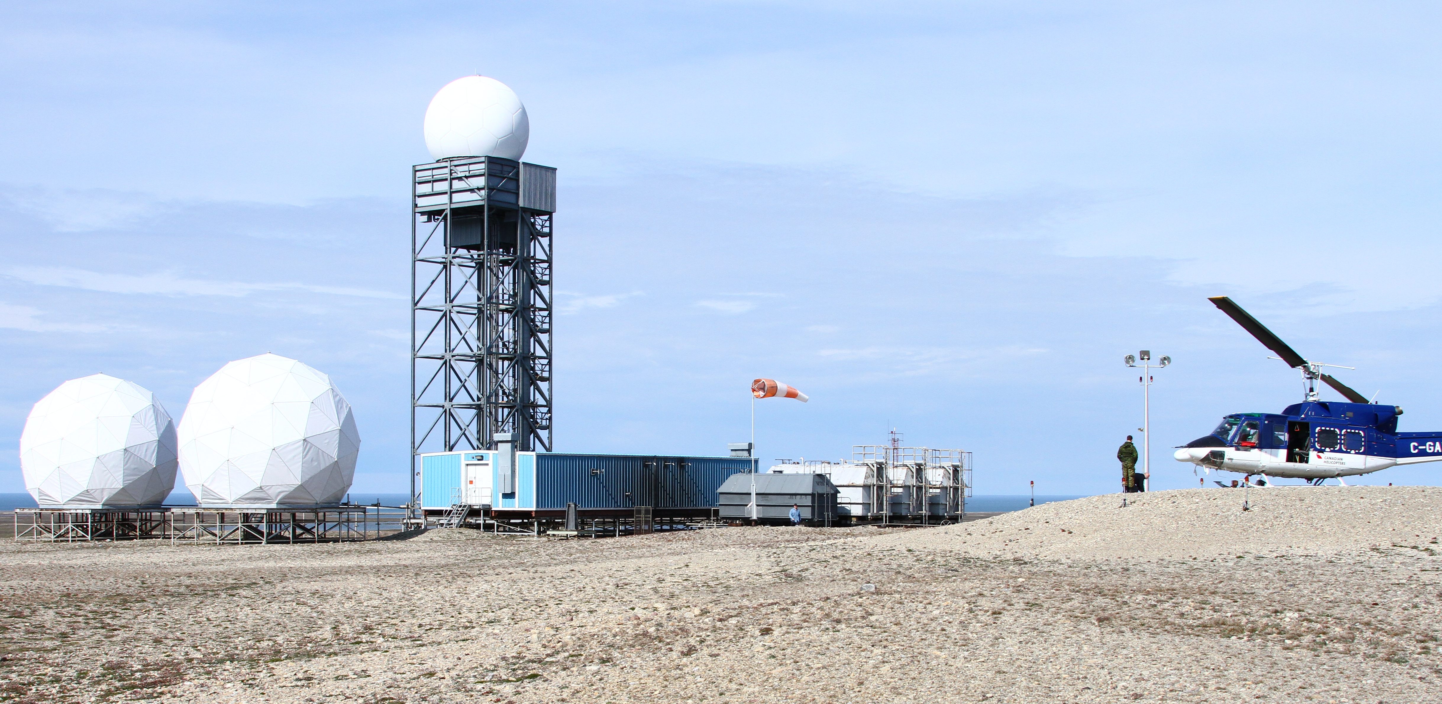
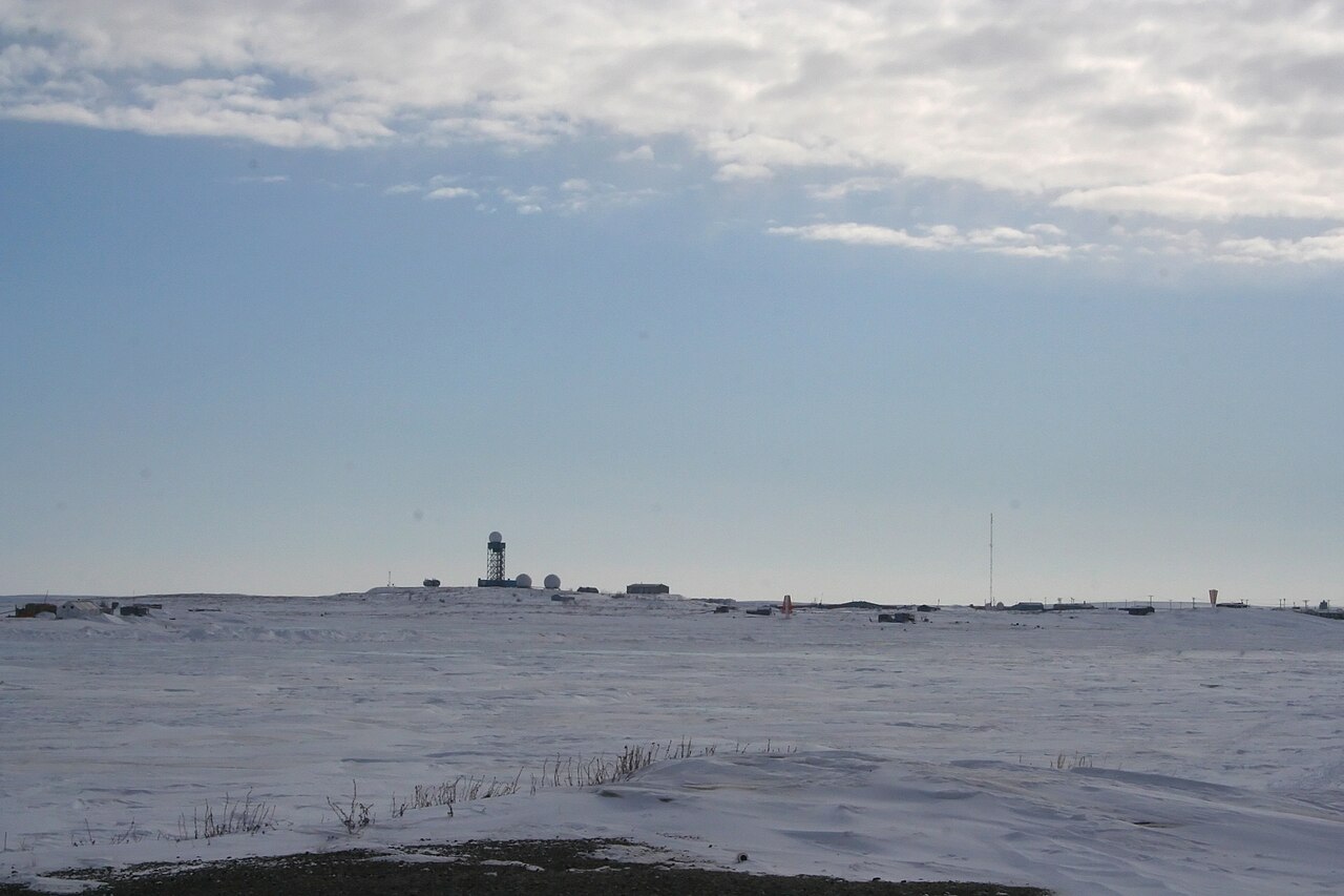
The DEW Line was a network of radar stations in the Yukon, Northwest Territories, Nunavut (as of 1999), the coast of Northern Alaska, Greenland and Iceland. Built by the United States and Canada, it was constructed in the early years of the Cold War. In the event of a hot war, the line could provide early warning of incoming nuclear-armed Soviet bombers so that they could be intercepted. However, in later years the Soviet nuclear threat shifted from manned bombers to Intercontinental Ballistic Missiles (ICBMS) and submarine-launched missiles. The DEW Line became less significant for North American air defence with the development of satellites and the Ballistic Missile Early Warning System (BMEWS). The DEW Line was decommissioned in 1993 and replaced with the North Warning System (NWS), a chain of unmanned stations. (See also Early Warning Radar and Arctic Sovereignty.)
Context and Purpose
The origins of the DEW Line lie in the early years of the Cold War. On 29 August 1949, the Soviet Union detonated its first atomic bomb. The prospect of Soviet long-range bombers armed with nuclear weapons represented a clear threat to the United States and Canada. Both countries decided to construct a radar line to provide early warning of attack. In the early 1950s, they cooperated to build the Pinetree Line along the 49th parallel (completed in 1954).
In 1952, the Massachusetts Institute of Technology (MIT) Lincoln Laboratory carried out a study into the air defence needs of the United States and Canada along the polar route and recommended a radar line in the far north. The American and Canadian governments discussed the idea in early 1953 but made no decision at that point. In June 1954, Canada decided to construct the Mid-Canada Line (McGill Fence) at approximately 59 degrees north latitude (completed in 1957).
Calls for an Arctic radar line grew, however, as Soviet technology developed. The Pinetree and Mid-Canada lines would not provide early enough warning of Soviet aircraft attacking from the north. In November 1954, Canada and the US agreed to build the DEW Line in the Arctic.
Construction
As the MIT study recommended, the DEW line would run approximately 69 degrees north latitude, about 280 km north of the Arctic Circle. First, though, it had to be shown that the DEW Line could be built and operated in arctic conditions. To this end, three prototype stations were built on Alaska’s northern coast from 1952 to 1954. The experiment proved that the DEW Line could be maintained, and construction of the line began in 1954.
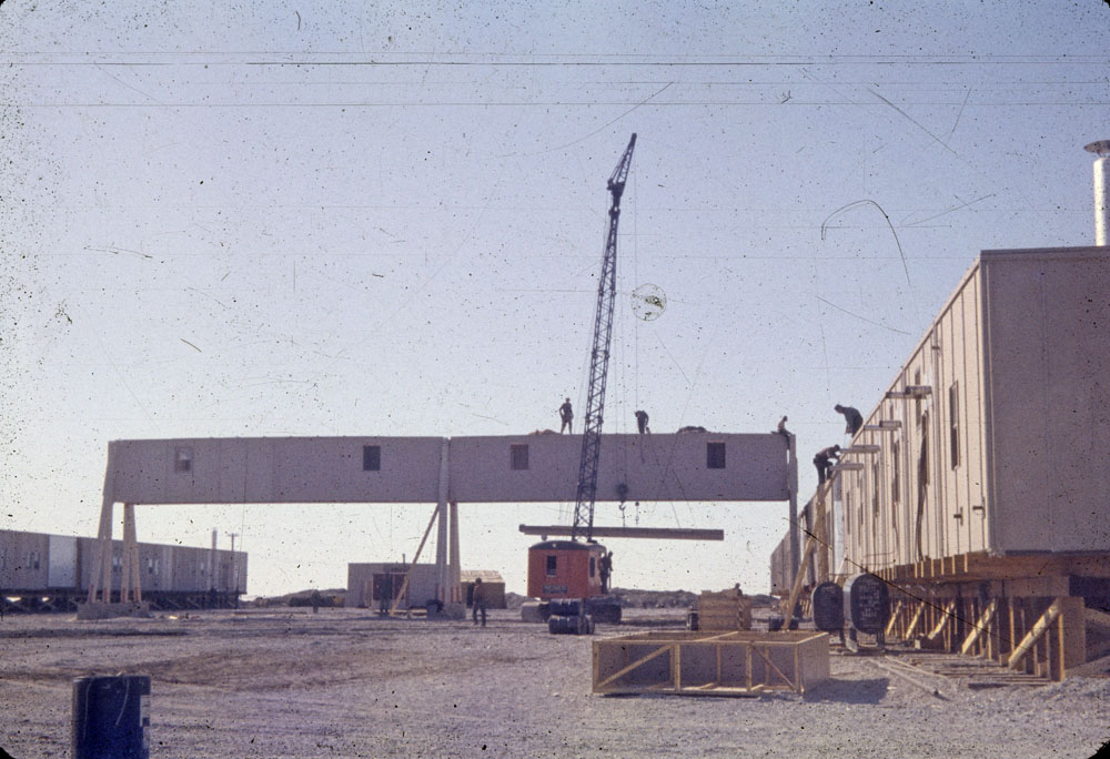
Building the DEW Line was a major logistical undertaking. In total, the project employed over 25,000 people. Over 9,600,000 cubic yards of gravel went into its construction. About 46,000 tons of steel were brought in for the project as well, enough to build an aircraft carrier like the USS Forrestal.
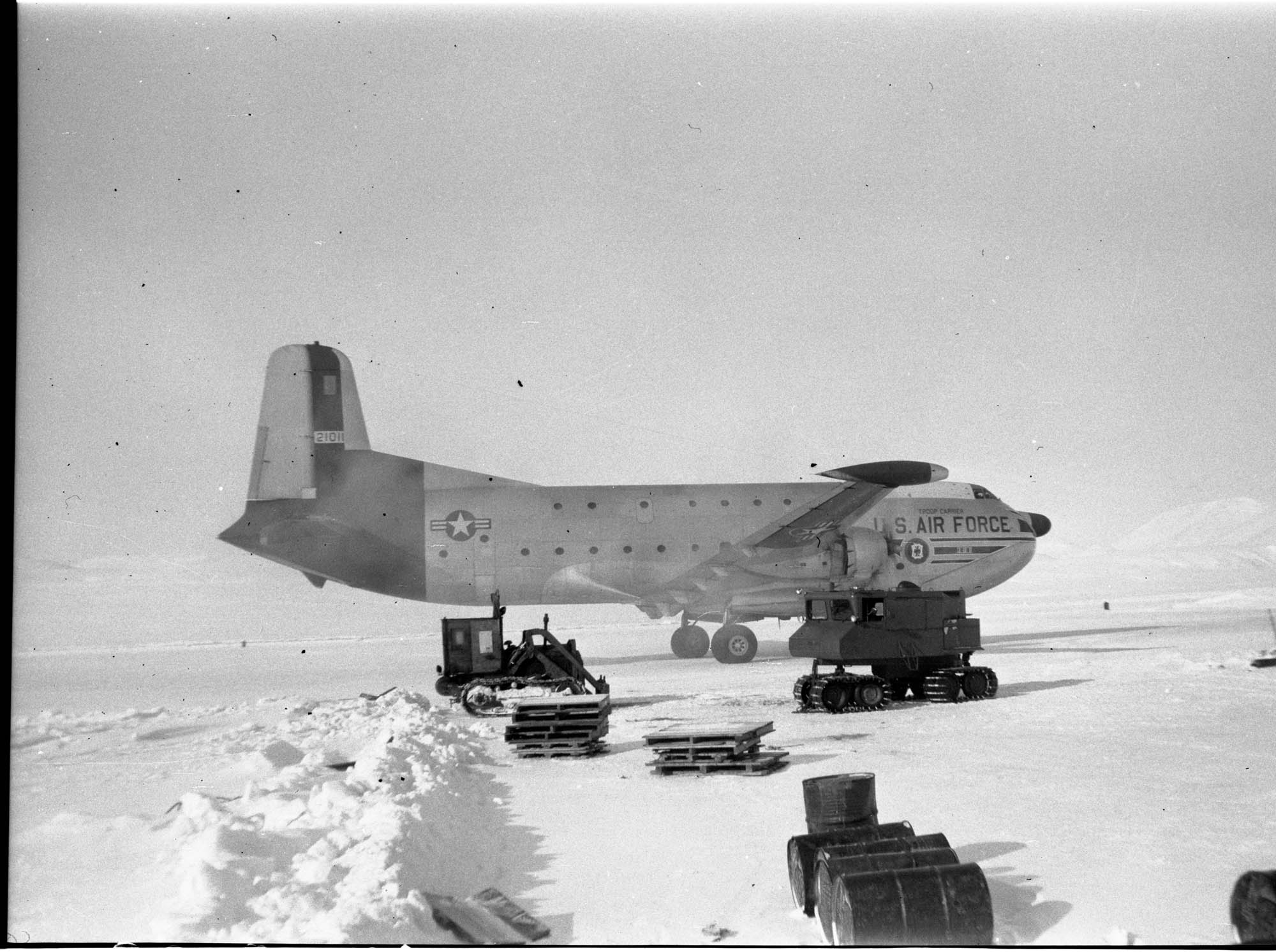
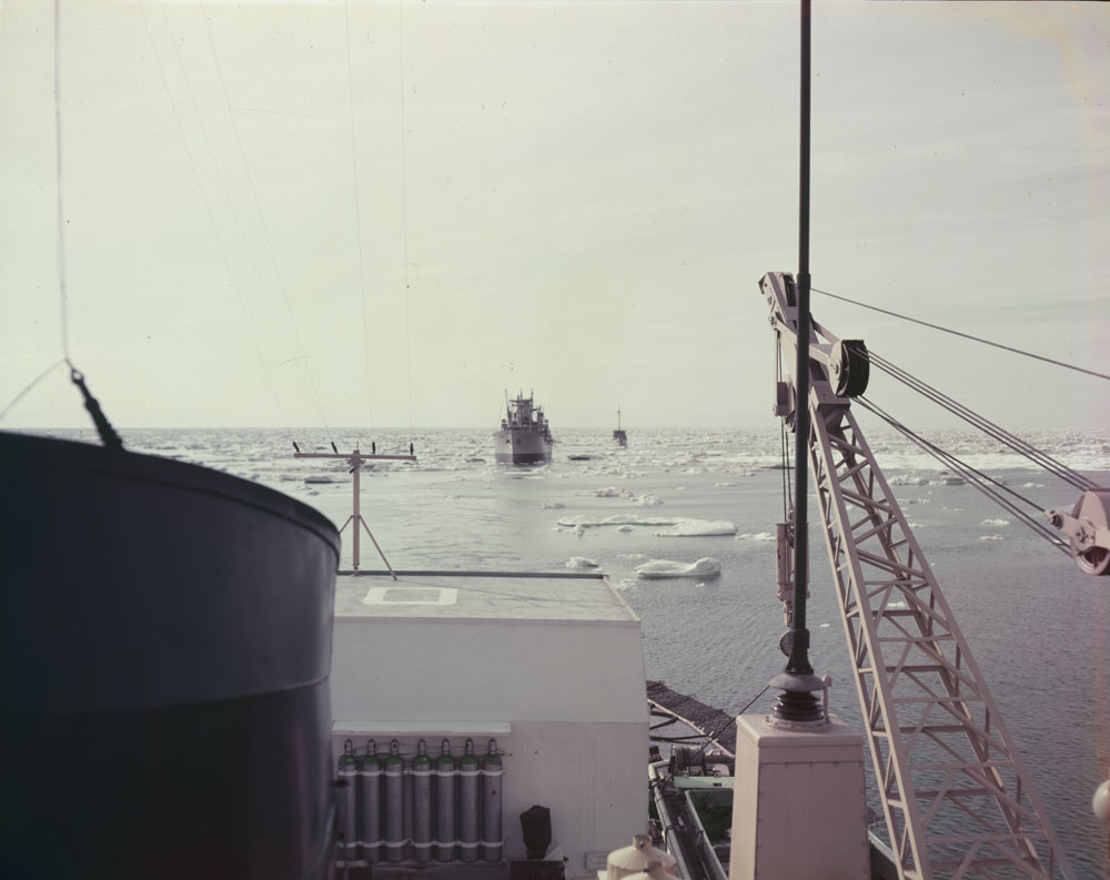
Overland supply was almost impossible, so materials had to be delivered by air and sea. Small advance parties flew to the sites in light planes equipped with skis and cleared enough snow for larger planes to land. These in turn brought small tractors, which cleared runways for freight planes. An annual sealift involving icebreakers, tugs, barges and cargo ships delivered thousands of tons of supplies to the sites in the summer.
Operation
On 31 July 1957, the DEW Line officially became operational. The original 57 radar stations stretched about 4,200 km from Cape Lisburne, Alaska, to Cape Dyer, Baffin Island. Forty-two of the sites were on Canadian soil.
The sites were divided between six sectors, two in Alaska and four in Canada. Each sector had a Main station, which was in the middle of the 800 km sector. Each of the Main stations had a crew of up to 150, including the station chief, the sector management team, a lead radar technician and seven subordinate technicians, as well as catering, maintenance and other personnel. They also had a small complement of United States Air Force or Royal Canadian Air Force officers trained to evaluate radar sightings.
Each of the Main sites had a 1.5 km-long gravel runway. The airstrips, combined, had a surface area of about 625 acres. In addition, each runway had a hangar and refueling facilities, along with a maintenance garage for vehicles, warehouses, fuel tanks and lodging for personnel stationed there. The Main sites were also equipped with shops and storage facilities and acted as supply and service centres for the sector.
There were also four to five Auxiliary stations between the Main sites, a total of 23 in Alaska and Canada. These Auxiliary sites, in turn, were about 160 km apart. Every Main and Auxiliary station contained a rotating radar with a range of 260 km, each overlapping with the adjacent radar station by about 100 km. Like the Main stations, each Auxiliary station had a lead radar technician and seven subordinate technicians. Usually, the lead technician was also the station chief. In total, each auxiliary station had a crew of about 20 civilian personnel.
The remaining 28 stations were Intermediate sites (or I-sites), located halfway between the Main and Auxiliary sites. I-sites were equipped with a pair of continuous-wave Doppler radar transmitters with receivers at the adjacent Main and Auxiliary sites. This formed an electronic fence or “trip wire” between sites. Each I site typically had three to five civilian staff.
Decommissioning
By 1962, four new radar stations had been added in Greenland and one in Iceland. The DEW Line was increasingly irrelevant, however. Shortly after the DEW Line’s construction, ICBMs became the main delivery system used by the Soviets. The DEW Line could not detect these missiles; instead, this was the purpose of the Ballistic Missile Early Warning System (BMEWS).
In 1963, the Intermediate sites were decommissioned. In 1985, modernization work began to convert the DEW Line into the North Warning System (NWS), which began limited operations in 1988. By that time, the threat of Soviet aggression had declined. From 1989 to 1993, the DEW Line’s Main and Auxiliary sites were decommissioned, though some radar stations were rebuilt as part of the new system. In 1993, the DEW Line was officially deactivated.
Significance and Legacy
The DEW Line played an important role in the creation of the North American Aerospace Defense Command (NORAD) in 1957–58. NORAD integrated the USAF and RCAF under a joint command for the purposes of continental defence.
The construction and operation of the DEW Line also led to economic development in the far north. New airfields, helicopter landing sites and surveys of the Arctic coastline opened up the high Arctic to southern Canadians. Air supply contracts stimulated growth in northern air transport companies, such as Pacific Western (later Canadian Airlines) and aircraft like the De Havilland Canada Beaver.
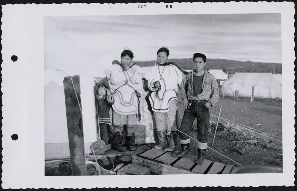
The DEW Line also had an impact on local Inuit and Inuvialuit populations. Many were employed in DEW Line construction and operation or had direct contact with station crews through trade and supply. Improved transportation and communication also aided the development of cooperatives. The Department of Northern Affairs and Natural Resources created Northern Service Officers (NSO) to protect the interests of Inuit and Inuvialuit and facilitate construction and operation of the DEW Line. Overall, however, the project disrupted traditional ways of life, encouraging permanent settlement while providing few long-term employment opportunities.
The DEW Line had a lasting impact on the arctic environment as well. Hundreds of millions of dollars have been spent to clean up heavy metals, hydrocarbons, solvents and polychlorinated biphenyls (PCBs) that have infiltrated the ecosystem.