
Browse "Places"
-
Article
Baddeck
Baddeck, NS, incorporated as a village in 1950, population 769 (2011c), 873 (2006c). The Village of Baddeck is located on the north shore of Bras d'Or Lake, 60 km west of North Sydney.
"https://d3d0lqu00lnqvz.cloudfront.net/media/media/29987043-6718-49ef-af1b-7073898c2060.jpg" // resources/views/front/categories/view.blade.php
https://d3d0lqu00lnqvz.cloudfront.net/media/media/29987043-6718-49ef-af1b-7073898c2060.jpg
-
Article
Badlands
Badlands are dramatic landforms characterized by a network of deep, narrow and winding gullies, along with occasional hoodoo rocks. Their steep, barren slopes provide striking evidence of the force of erosion by wind and water — a source of continual change in their terrain. Badlands are found in several places in Canada, most notably in southern Alberta. While the badlands of the Áísínai’pi (Writing-on-Stone) archeological site hold great cultural significance to the Siksika (Blackfoot) people, European explorers found the badlands unfamiliar and difficult to navigate, which is the source of their current name.
"https://d3d0lqu00lnqvz.cloudfront.net/media/media/251b5d36-82cc-4ec1-80e8-471cfd59098a.jpg" // resources/views/front/categories/view.blade.php
https://d3d0lqu00lnqvz.cloudfront.net/media/media/251b5d36-82cc-4ec1-80e8-471cfd59098a.jpg
-
Article
Baffin Bay
Circulation is generally anticlockwise; off Greenland, relatively warm, salty water moves north, while along Baffin Island, cold, fresher water originating from the Arctic Ocean flows south. Icebergs, formed by calving off the Greenland glaciers, appear year-round, but are most numerous in August.
"https://d3d0lqu00lnqvz.cloudfront.net/media/media/9dc94550-4e3e-4264-9c68-78b71ac3e6e1.jpg" // resources/views/front/categories/view.blade.php
https://d3d0lqu00lnqvz.cloudfront.net/media/media/9dc94550-4e3e-4264-9c68-78b71ac3e6e1.jpg
-
Article
Baffin Island
Baffin Island, Nunavut, 507,451 km2, 1,500 km long and 200–700 km wide, is the largest island in Canada and the fifth-largest island in the world. Located in Nunavut in the Arctic Archipelago, it is separated from Greenland by Davis Strait and Baffin Bay, from northern Quebec by Hudson Strait, and from the Melville Peninsula by the Foxe Basin and the narrow Fury and Hecla Strait. The island's immensity and bewildering coastline confused early explorers and concealed its geography until recent times.
"https://d3d0lqu00lnqvz.cloudfront.net/media/media/8d221872-5616-49d0-a982-986cd0455d73.jpg" // resources/views/front/categories/view.blade.php
https://d3d0lqu00lnqvz.cloudfront.net/media/media/8d221872-5616-49d0-a982-986cd0455d73.jpg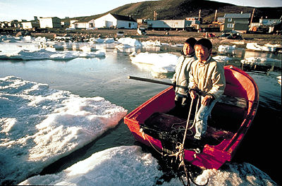
-
Article
Baie-Comeau
Baie-Comeau, Quebec, incorporated as a city in 1937, population 20,687 (2021 census), 21,536 (2016 census). Baie-Comeau is located on the north shore of the St. Lawrence River, at the mouth of the Rivière Manicouagan, 422 km northeast of Quebec City.
"https://d3d0lqu00lnqvz.cloudfront.net/Sainte-Amelie-_tresor_de_baie-Comeau_01.jpg" // resources/views/front/categories/view.blade.php
https://d3d0lqu00lnqvz.cloudfront.net/Sainte-Amelie-_tresor_de_baie-Comeau_01.jpg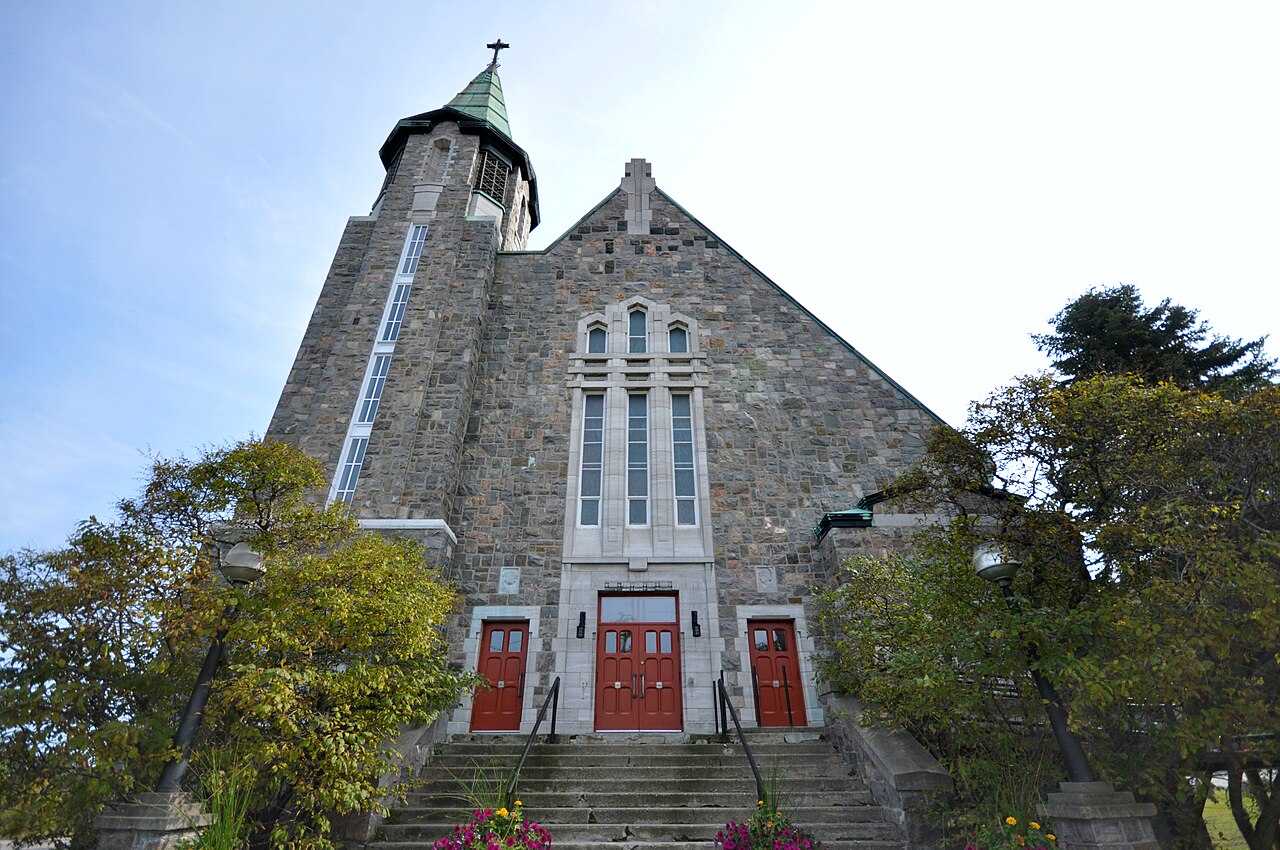
-
Article
Baie Verte
Baie Verte, NL, incorporated as a town in 1958, population 1370 (2011c), 1275 (2006c). The Town of Baie Verte is located on the Baie Verte Peninsula on the northeast coast of Newfoundland.
"https://thecanadianencyclopedia.ca/images/tce_placeholder.jpg?v=e9dca980c9bdb3aa11e832e7ea94f5d9" // resources/views/front/categories/view.blade.php
https://thecanadianencyclopedia.ca/images/tce_placeholder.jpg?v=e9dca980c9bdb3aa11e832e7ea94f5d9
-
Article
Baker Lake (Qamani'tuaq)
Baker Lake (a.k.a. Qamani’tuaq), Nunavut, incorporated as a hamlet in 1977, population 2,069 (2016 census), 1,872 (2011 census). The hamlet of Baker Lake is located at the northwest end of Baker Lake, about 280 km west of the mouth of Chesterfield Inlet on Hudson Bay. The community is approximately at the geographic centre of Canada. Baker Lake is the only inland Inuit community in Nunavut.
"https://d3d0lqu00lnqvz.cloudfront.net/media/media/40755f53-7867-4e0b-a59c-1efb9df6e171.jpg" // resources/views/front/categories/view.blade.php
https://d3d0lqu00lnqvz.cloudfront.net/media/media/40755f53-7867-4e0b-a59c-1efb9df6e171.jpg
-
Article
Balaklava Island
Balaklava Island, 8 km2, situated off the N coast of Vancouver Island, is located between Nigel and Hurst islands, and is flanked by Queen Charlotte Str in the N and Goletas Channel in the S. It is 15 km NW of Port Hardy, BC. This tiny island has a lighthouse at Scarlett Pt (1905) to aid shipping.
"https://thecanadianencyclopedia.ca/images/tce_placeholder.jpg?v=e9dca980c9bdb3aa11e832e7ea94f5d9" // resources/views/front/categories/view.blade.php
https://thecanadianencyclopedia.ca/images/tce_placeholder.jpg?v=e9dca980c9bdb3aa11e832e7ea94f5d9
-
Article
Baldoon
Sheriff Alexander C. Macdonell, Selkirk's agent, struggled for years at considerable expense to the earl to make a success of the venture, but found the swampy land and the difficulty of sheep farming to be serious obstacles.
"https://d3d0lqu00lnqvz.cloudfront.net/media/media/0c582e2e-b609-41c2-b9dc-50071198f9c4.jpg" // resources/views/front/categories/view.blade.php
https://d3d0lqu00lnqvz.cloudfront.net/media/media/0c582e2e-b609-41c2-b9dc-50071198f9c4.jpg
-
Article
Balgonie
Balgonie, Sask, incorporated as a town in 1907, population 1625 (2011c), 1384 (2006c). The Town of Balgonie is located 24 km east of Regina, between Pilot Butte and McLean on the Canadian Pacific Railway (CPR) main line. The name refers to Balgonie Castle in Scotland.
"https://thecanadianencyclopedia.ca/images/tce_placeholder.jpg?v=e9dca980c9bdb3aa11e832e7ea94f5d9" // resources/views/front/categories/view.blade.php
https://thecanadianencyclopedia.ca/images/tce_placeholder.jpg?v=e9dca980c9bdb3aa11e832e7ea94f5d9
-
Article
Balmoral
Balmoral, NB, incorporated as a village in 1972, population 1719 (2011c), 1706 (2006c). The Village of Balmoral is located in northern New Brunswick, 12 km southwest of Dalhousie and named for Balmoral Castle in Scotland.
"https://thecanadianencyclopedia.ca/images/tce_placeholder.jpg?v=e9dca980c9bdb3aa11e832e7ea94f5d9" // resources/views/front/categories/view.blade.php
https://thecanadianencyclopedia.ca/images/tce_placeholder.jpg?v=e9dca980c9bdb3aa11e832e7ea94f5d9
-
Article
Balmoral Grist Mill
Balmoral Grist Mill in Balmoral Mills, NS, was built in about 1874 by Alexander MacKay. The mill is located on Matheson's Brook and was once just one of 5 mills on the brook. It was used to grind local stocks of wheat, oats, barley, rye and buckwheat to produce flour and oatmeal.
"https://thecanadianencyclopedia.ca/images/tce_placeholder.jpg?v=e9dca980c9bdb3aa11e832e7ea94f5d9" // resources/views/front/categories/view.blade.php
https://thecanadianencyclopedia.ca/images/tce_placeholder.jpg?v=e9dca980c9bdb3aa11e832e7ea94f5d9
-
Article
Balzac Archaeological Site
The Balzac Archaeological site (Borden No. EhPm-34) is a late prehistoric camp and bison-processing site that was occupied from ca 2000 Before Present (BP) to 1850 AD.
"https://d3d0lqu00lnqvz.cloudfront.net/media/media/1a9e14d0-3eda-41ab-9f64-1603d5cb85e5.jpg" // resources/views/front/categories/view.blade.php
https://d3d0lqu00lnqvz.cloudfront.net/media/media/1a9e14d0-3eda-41ab-9f64-1603d5cb85e5.jpg
-
Article
Banff
Banff, Alberta, incorporated as a town in 1990, population 8,305 (2021 census), 7,851 (2016 census). The Town of Banff is located on the Bow River in the Canadian Rockies, a UNESCO World Heritage Site, 128 km west of Calgary.
"https://d3d0lqu00lnqvz.cloudfront.net/media/media/27f9bb3e-3454-4b12-9aca-ded0299bfe8c.jpg" // resources/views/front/categories/view.blade.php
https://d3d0lqu00lnqvz.cloudfront.net/media/media/27f9bb3e-3454-4b12-9aca-ded0299bfe8c.jpg
-
Article
Banff Centre for the Arts
Banff Centre for the Arts (Banff School of Fine Arts, 1933-89). In 1991 one of three divisions of the Banff Centre for Continuing Education, so named in 1978 when the Alberta Legislature proclaimed the Banff Act establishing the Banff School of Fine Arts as an autonomous institution.
"https://thecanadianencyclopedia.ca/images/tce_placeholder.jpg?v=e9dca980c9bdb3aa11e832e7ea94f5d9" // resources/views/front/categories/view.blade.php
https://thecanadianencyclopedia.ca/images/tce_placeholder.jpg?v=e9dca980c9bdb3aa11e832e7ea94f5d9