
Browse "Places"
-
Article
Coaldale
Coaldale, Alberta, incorporated as a town in 1952, population 8,215 (2016 census), 7,493 (2011 census). The town of Coaldale is located in southern Alberta, just east of Lethbridge.
"https://thecanadianencyclopedia.ca/images/tce_placeholder.jpg?v=e9dca980c9bdb3aa11e832e7ea94f5d9" // resources/views/front/categories/view.blade.php
https://thecanadianencyclopedia.ca/images/tce_placeholder.jpg?v=e9dca980c9bdb3aa11e832e7ea94f5d9
-
Article
Coast
Canada's mainland coast, including the islands of Newfoundland, Cape Breton and Prince Edward Island, is 71,261 km long and fronts on the North Pacific, Arctic and North Atlantic oceans. If all measurable islands are included, the saltwater coastline has been measured at 243,797 km long. There is an additional 3,800 km of freshwater coastline along the Great Lakes. Off Canada's coastline are its coastal waters extending seaward for 370 km.
"https://d3d0lqu00lnqvz.cloudfront.net/scenicplaces/Keji-seaside-lia.jpg" // resources/views/front/categories/view.blade.php
https://d3d0lqu00lnqvz.cloudfront.net/scenicplaces/Keji-seaside-lia.jpg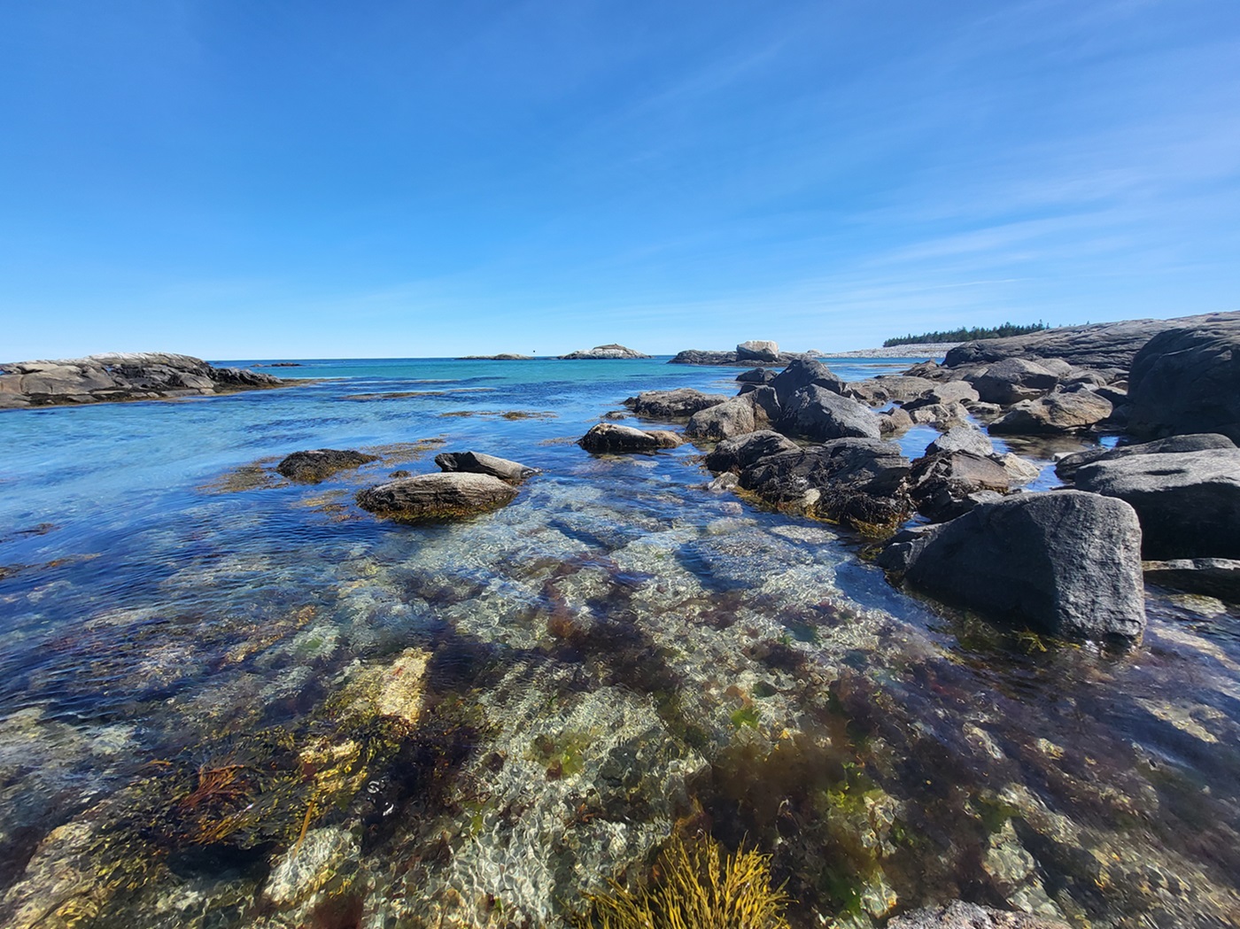
-
Article
Coast Mountains
The Coast Mountains are a continuous mountain chain extending from the Fraser Lowlands near Vancouver, 1,600 km north into the Yukon.
"https://thecanadianencyclopedia.ca/images/tce_placeholder.jpg?v=e9dca980c9bdb3aa11e832e7ea94f5d9" // resources/views/front/categories/view.blade.php
https://thecanadianencyclopedia.ca/images/tce_placeholder.jpg?v=e9dca980c9bdb3aa11e832e7ea94f5d9
-
Article
Coastal Waters
Canada has the longest coastlines of any country in the world (60,180 km excluding islands, 202,080 including all measurable islands). Canadian coastal waters support valuable biological resources (e.g., fish, crustaceans, molluscs, marine mammals and seaweeds) and are important for transportation, recreation and the mineral and hydrocarbon resources in the seafloor beneath them.
"https://d3d0lqu00lnqvz.cloudfront.net/scenicplaces/Keji-seaside-lia.jpg" // resources/views/front/categories/view.blade.php
https://d3d0lqu00lnqvz.cloudfront.net/scenicplaces/Keji-seaside-lia.jpg
-
Article
Coaticook
Like most localities in the Eastern Townships, the history of Coaticook starts out in English and ends up in French. The early pioneers were for the most part of American or British origin. The town's founder was Richard Baldwin, Sr, who built a house there in 1830.
"https://d3d0lqu00lnqvz.cloudfront.net/media/media/5337e007-618d-4242-8fa4-c4e30c93c459.jpg" // resources/views/front/categories/view.blade.php
https://d3d0lqu00lnqvz.cloudfront.net/media/media/5337e007-618d-4242-8fa4-c4e30c93c459.jpg
-
Article
Coats Island
Coats Island, Nunavut, 5,498 km2, is one of several islands that guard the northern entrance to Hudson Bay. Known originally as Cary Swan Nest, a name still applied to its southeast point, it received its modern name from William Coats, a sea captain who made many voyages into the bay for the Hudson's Bay Company between 1727 and 1751.
"https://d3d0lqu00lnqvz.cloudfront.net/media/media/853eb7cd-5eb0-46fe-b229-8f9b8b0136b4.jpg" // resources/views/front/categories/view.blade.php
https://d3d0lqu00lnqvz.cloudfront.net/media/media/853eb7cd-5eb0-46fe-b229-8f9b8b0136b4.jpg
-
Article
Cobalt (Ont)
Cobalt, Ont, incorporated as a town in 1907, population 1133 (2011c), 1224 (2006c). The Town of Cobalt, located about 480 km north of Toronto near the Québec border and Lake Timiskaming, lies between the clay belt to the north around New Liskeard and the heavily forested area of Temagami to the south.
"https://d3d0lqu00lnqvz.cloudfront.net/media/media/f0555ad3-4d10-4288-b3f2-ea1afde0054e.jpg" // resources/views/front/categories/view.blade.php
https://d3d0lqu00lnqvz.cloudfront.net/media/media/f0555ad3-4d10-4288-b3f2-ea1afde0054e.jpg
-
Article
Cobourg
Cobourg, Ont, incorporated as a town in 1837, population 18 519 (2011c), 18 210 (2006c). The Town of Cobourg is located on north shore of Lake Ontario, 112 km east of Toronto.
"https://thecanadianencyclopedia.ca/images/tce_placeholder.jpg?v=e9dca980c9bdb3aa11e832e7ea94f5d9" // resources/views/front/categories/view.blade.php
https://thecanadianencyclopedia.ca/images/tce_placeholder.jpg?v=e9dca980c9bdb3aa11e832e7ea94f5d9
-
Article
Cobourg and Peterborough Railway
One of the 2 earliest railway charters granted in Canada, the Cobourg Rail Road Co was incorporated in 1834 to build a railway from Cobourg northward to Peterborough across Rice Lake. The project was shelved until 1846, when it was revived as the Cobourg and Rice Lake Plank Road and Ferry Co. Samuel Gore built his plank road the 17 km to the lake, but it barely survived the first 2 winters.
"https://thecanadianencyclopedia.ca/images/tce_placeholder.jpg?v=e9dca980c9bdb3aa11e832e7ea94f5d9" // resources/views/front/categories/view.blade.php
https://thecanadianencyclopedia.ca/images/tce_placeholder.jpg?v=e9dca980c9bdb3aa11e832e7ea94f5d9
-
Article
Cochrane (Alta)
Cochrane, Alta, incorporated as a town in 1971, population 17 580 (2011c), 13 760 (2006c). The Town of Cochrane is located 35 km northwest of Calgary, on the BOW RIVER. It is named for Senator Matthew H.
"https://thecanadianencyclopedia.ca/images/tce_placeholder.jpg?v=e9dca980c9bdb3aa11e832e7ea94f5d9" // resources/views/front/categories/view.blade.php
https://thecanadianencyclopedia.ca/images/tce_placeholder.jpg?v=e9dca980c9bdb3aa11e832e7ea94f5d9
-
Article
Cochrane (ON)
Cochrane, Ontario, incorporated as a town in 1910, population 5,390 (2021 census), 5,321 (2016 census). The Town of Cochrane is located 375 km northwest of North Bay. Cochrane is the judicial seat for the Cochrane District.
"https://thecanadianencyclopedia.ca/images/tce_placeholder.jpg?v=e9dca980c9bdb3aa11e832e7ea94f5d9" // resources/views/front/categories/view.blade.php
https://thecanadianencyclopedia.ca/images/tce_placeholder.jpg?v=e9dca980c9bdb3aa11e832e7ea94f5d9
-
"https://thecanadianencyclopedia.ca/images/tce_placeholder.jpg?v=e9dca980c9bdb3aa11e832e7ea94f5d9" // resources/views/front/categories/view.blade.php
https://thecanadianencyclopedia.ca/images/tce_placeholder.jpg?v=e9dca980c9bdb3aa11e832e7ea94f5d9
-
Article
Coffee houses
Cafés that presented folk, blues and, occasionally, pop and jazz musicians. Like the boîte à chansons that was unique to French Canada, the coffee house - often in a converted house, a storefront or a church basement - was characterized by its limited seating capacity (an average of less than 100), informality, and intimacy
"https://thecanadianencyclopedia.ca/images/tce_placeholder.jpg?v=e9dca980c9bdb3aa11e832e7ea94f5d9" // resources/views/front/categories/view.blade.php
https://thecanadianencyclopedia.ca/images/tce_placeholder.jpg?v=e9dca980c9bdb3aa11e832e7ea94f5d9
-
Article
Cold Lake
Cold Lake, Alberta, incorporated as a city in 2000, population 15, 661 (2021 census), 14,976 (2016 census). The city of Cold Lake is located on a lake of the same name, 290 km northeast of Edmonton. The Cree called the lake “Kinosoo” or “big fish” after a Cree legend. European settlers named the lake for its deep, cold water.
"https://d3d0lqu00lnqvz.cloudfront.net/media/media/9a26c61d-d249-4e98-9fe3-21c0199423c0.jpg" // resources/views/front/categories/view.blade.php
https://d3d0lqu00lnqvz.cloudfront.net/media/media/9a26c61d-d249-4e98-9fe3-21c0199423c0.jpg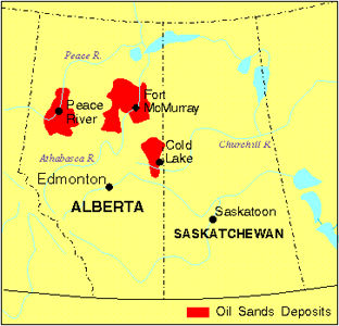
-
Article
Coldstream
Coldstream, BC, incorporated as a district municipality in 1906, population 10 314 (2011c), 9471 (2006c). The District of Coldstream lies in the valley of Coldstream Creek, about two kilometres southeast of VERNON. Captain Charles F.
"https://thecanadianencyclopedia.ca/images/tce_placeholder.jpg?v=e9dca980c9bdb3aa11e832e7ea94f5d9" // resources/views/front/categories/view.blade.php
https://thecanadianencyclopedia.ca/images/tce_placeholder.jpg?v=e9dca980c9bdb3aa11e832e7ea94f5d9