Browse "Places"
-
Article
Vanier (Qué)
Vanier, Qué, City, pop 11 054 (2001c), 11 174 (1996c), 10 833(1991c), area 4.59 km2, inc 1916, was originally named Québec-Ouest until 1966, when it was changed to Vanier in honour of Governor-General Georges-Philéas VANIER.
"https://thecanadianencyclopedia.ca/images/tce_placeholder.jpg?v=e9dca980c9bdb3aa11e832e7ea94f5d9" // resources/views/front/categories/view.blade.php
https://thecanadianencyclopedia.ca/images/tce_placeholder.jpg?v=e9dca980c9bdb3aa11e832e7ea94f5d9
-
Article
Vanscoy
Vanscoy, Sask, incorporated as a rural municipality in 1909, population 2714 (2011c), 2629 (2006c). The Rural Municipality of Vanscoy is located about 30 km southwest of SASKATOON. The original name for this rural municipality was Logantown.
"https://thecanadianencyclopedia.ca/images/tce_placeholder.jpg?v=e9dca980c9bdb3aa11e832e7ea94f5d9" // resources/views/front/categories/view.blade.php
https://thecanadianencyclopedia.ca/images/tce_placeholder.jpg?v=e9dca980c9bdb3aa11e832e7ea94f5d9
-
Article
Varennes
Varennes, Quebec, incorporated as a town in 1972, population 20,591 (2021 census), 20,585 (2016 census). Varennes is located on the south shore of the St. Lawrence River across from Pointe-aux-Trembles. Less than one kilometre from the shore, the Varennes Islands (Île au Beurre, Île aux Fermiers, Île de Varennes, La Grande Île, Île aux Cabanes, Île Masta, and Île Saint-Patrice) are administratively part of the town.
"https://d3d0lqu00lnqvz.cloudfront.net/media/media/1a704adb-dfed-40f4-bbe4-bb40c5cf3113.jpg" // resources/views/front/categories/view.blade.php
https://d3d0lqu00lnqvz.cloudfront.net/media/media/1a704adb-dfed-40f4-bbe4-bb40c5cf3113.jpg
-
Article
Varsity Estates Archaeological Site
The Varsity Estates archaeological site is located on a glacial till in the Bow River Valley of west Calgary, Alberta.
"https://d3d0lqu00lnqvz.cloudfront.net/media/media/78bccd27-c0fd-4488-b664-c03524a8471e.jpg" // resources/views/front/categories/view.blade.php
https://d3d0lqu00lnqvz.cloudfront.net/media/media/78bccd27-c0fd-4488-b664-c03524a8471e.jpg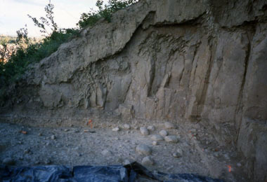
-
Article
Vaudreuil-Dorion
Vaudreuil-Dorion, Quebec, incorporated as a municipality in 1845 and 1850, as a city in 1994, population 43,268 (2021 census), 38,117 (2016 census). Vaudreuil-Dorion is the result of the merger of two sister towns, Vaudreuil and Dorion. Vaudreuil-Dorion is located about 50 km west of Montreal, opposite Pincourt on Île Perrot on the south shore of Lac des Deux-Montagnes.
"https://d3d0lqu00lnqvz.cloudfront.net/Vaudreuil-Dorion-Section_pres_de_l-A40_du_Jardin_Champ_de_Reves_en_mai_2023.png" // resources/views/front/categories/view.blade.php
https://d3d0lqu00lnqvz.cloudfront.net/Vaudreuil-Dorion-Section_pres_de_l-A40_du_Jardin_Champ_de_Reves_en_mai_2023.png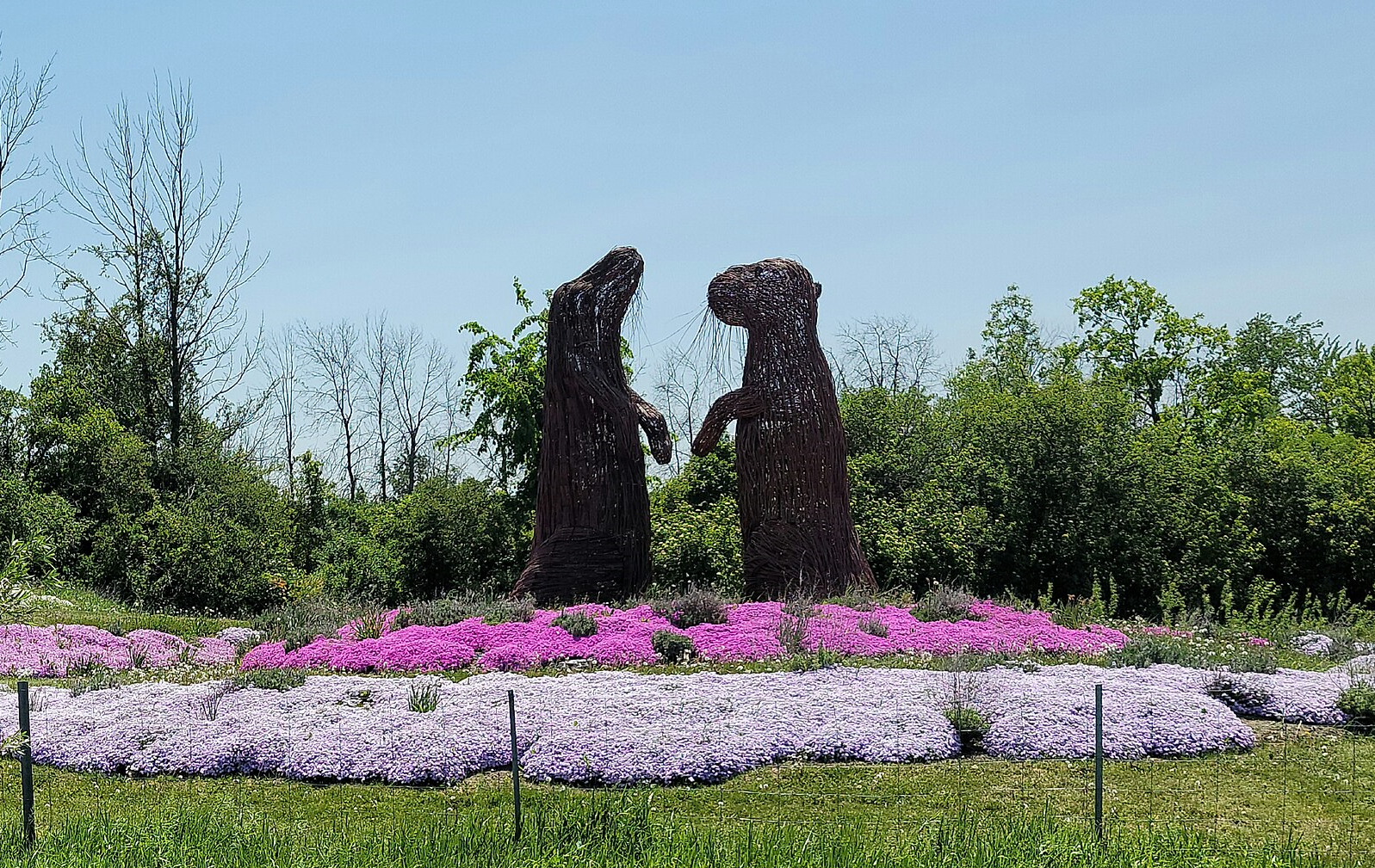
-
Article
Vaughan
Vaughan, ON, incorporated as a city in 1991, population 323,103 (2021 census), 306,233 (2016 census). The City of Vaughan — which includes the five constituent communities of Maple, Kleinburg, Concord, Woodbridge and part of Thornhill — is located in the York regional municipality, next to the northwest boundary of metropolitan Toronto. Traditionally an agricultural and milling community, Vaughan’s economy diversified over the latter half of the 20th century as immigration increased and the township developed into a city. Today, Vaughan is a multicultural community with a growing metropolitan core.
"https://d3d0lqu00lnqvz.cloudfront.net/media/media/c51ebfa2-7e27-4826-aad3-bcb5814f2ad4.jpg" // resources/views/front/categories/view.blade.php
https://d3d0lqu00lnqvz.cloudfront.net/media/media/c51ebfa2-7e27-4826-aad3-bcb5814f2ad4.jpg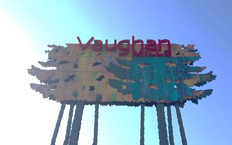
-
Article
Vegetation Regions
Canada has seven primary vegetation regions, in addition to the marine flora found along the country’s coasts. Vegetation regions are geographical areas characterized by distinct plant communities. Community composition, determined primarily by climate (e.g., temperature, precipitation and sunlight), may be affected by factors such as geology, soil composition and erosion, water drainage patterns and human interference. Each vegetation region supports a characteristic animal community that may also affect its composition. This article is a full-length entry about Vegetation Regions. For a plain-language summary, please see Vegetation Regions (Plain-Language Summary).
"https://d3d0lqu00lnqvz.cloudfront.net/media/media/56fb0e04-1063-4112-aa2e-881175f15c4d.jpg" // resources/views/front/categories/view.blade.php
https://d3d0lqu00lnqvz.cloudfront.net/media/media/56fb0e04-1063-4112-aa2e-881175f15c4d.jpg
-
Article
Vegetation Regions (Plain-Language Summary)
Canada has seven primary vegetation regions, in addition to the marine flora found along the country’s coasts. Each region is characterized by distinct plant communities. The plants in each region are mostly determined by climate. Other factors that determine which plants grow in which region include geology, soil composition and erosion, water drainage patterns and human interference. This article is a plain-language summary of Vegetation Regions. If you are interested in reading about this topic more in depth, please see our full-length entry, Vegetation Regions.
"https://d3d0lqu00lnqvz.cloudfront.net/media/new_article_images/GeographyofAlberta/AlbertaPrairie.jpg" // resources/views/front/categories/view.blade.php
https://d3d0lqu00lnqvz.cloudfront.net/media/new_article_images/GeographyofAlberta/AlbertaPrairie.jpg
-
Article
Vegreville
Vegreville, Alberta, incorporated as a town in 1906, population 5,708 (2016 census), 5,717 (2011 census). The town of Vegreville is located in the parkland region of east-central Alberta, 100 km east of Edmonton. It serves a rich agricultural region specializing in grains and some livestock.
"https://d3d0lqu00lnqvz.cloudfront.net/media/media/b8c1d06f-d8cf-4165-8482-e6a2dca8f83d.jpg" // resources/views/front/categories/view.blade.php
https://d3d0lqu00lnqvz.cloudfront.net/media/media/b8c1d06f-d8cf-4165-8482-e6a2dca8f83d.jpg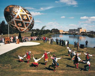
-
Article
Verchères
Verchères, Quebec, municipality incorporated in 1971, population 5,759 (2021 census), 5,835 (2016 census). Verchères is 62 km northeast of Montreal, situated on the south shore of the St. Lawrence River between Longueuil and Sorel.
"https://d3d0lqu00lnqvz.cloudfront.net/media/media/5112ad49-d9a3-45a2-9cdd-ffa488d5f65a.jpg" // resources/views/front/categories/view.blade.php
https://d3d0lqu00lnqvz.cloudfront.net/media/media/5112ad49-d9a3-45a2-9cdd-ffa488d5f65a.jpg
-
Article
Verdun
Verdun is a borough of the city of Montreal, Quebec. It is located on the banks of the St. Lawrence River, five minutes from downtown Montreal. Mainland Verdun is characterized by medium-density residential dwellings. L'Île des Soeurs is also part of the borough. In Verdun, residents and visitors alike can enjoy the expansive shoreline of the St. Lawrence River and l'Île des Soeurs.
"https://d3d0lqu00lnqvz.cloudfront.net/verdun/Verdun_vue_de_Ile_des_Soeurs.jpg" // resources/views/front/categories/view.blade.php
https://d3d0lqu00lnqvz.cloudfront.net/verdun/Verdun_vue_de_Ile_des_Soeurs.jpg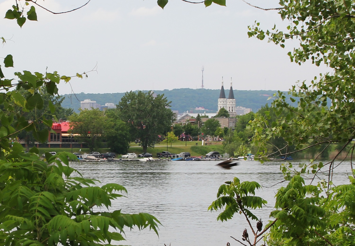
-
Article
Vermilion
Vermilion, Alta, incorporated as a town in 1906, population 3930 (2011c), 4036 (2006c). The Town of Vermilion is located on the Vermilion River 190 km east of Edmonton.
"https://thecanadianencyclopedia.ca/images/tce_placeholder.jpg?v=e9dca980c9bdb3aa11e832e7ea94f5d9" // resources/views/front/categories/view.blade.php
https://thecanadianencyclopedia.ca/images/tce_placeholder.jpg?v=e9dca980c9bdb3aa11e832e7ea94f5d9
-
Article
Vermilion Pass
Vermilion Pass, elevation 1,651 m, is situated between Boom and Storm mountains on the British Columbia-Alberta border, 42 km West of Banff.
"https://d3d0lqu00lnqvz.cloudfront.net/Stanley_Peak_3153_meters_from_Vermillion_Pass-1.jpg" // resources/views/front/categories/view.blade.php
https://d3d0lqu00lnqvz.cloudfront.net/Stanley_Peak_3153_meters_from_Vermillion_Pass-1.jpg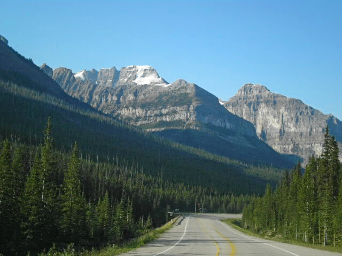
-
Article
Vermilion River
Vermilion River, 70 km (from its headstream to its confluence with the Kootenay R), rises in the Continental Ranges on the BC-Alberta border at the N end of KOOTENAY NATIONAL PARK. Fed by Tokumm Cr, it drains in a southerly direction, eventually emptying into the Kootenay R.
"https://thecanadianencyclopedia.ca/images/tce_placeholder.jpg?v=e9dca980c9bdb3aa11e832e7ea94f5d9" // resources/views/front/categories/view.blade.php
https://thecanadianencyclopedia.ca/images/tce_placeholder.jpg?v=e9dca980c9bdb3aa11e832e7ea94f5d9
-
Article
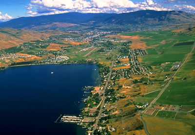
Vernon
Vernon, British Columbia, incorporated as a city in 1892, population 44,519 (2021 census), 40,116 (2016 census). The City of Vernon is located in the North Okanagan Valley, nestled between Okanagan, Kalamalka and Swan lakes.
"https://d3d0lqu00lnqvz.cloudfront.net/media/media/9442225e-ac4a-4c14-83f0-31050d516a0b.jpg" // resources/views/front/categories/view.blade.php
https://d3d0lqu00lnqvz.cloudfront.net/media/media/9442225e-ac4a-4c14-83f0-31050d516a0b.jpg