
Browse "Places"
-
Article
Ukrainian Cultural Heritage Village
The Ukrainian Cultural Heritage Village is a living history site, located 50 km east of Edmonton, Alberta, on the Yellowhead Highway near Elk Island National Park.
"https://d3d0lqu00lnqvz.cloudfront.net/media/media/29337e77-348f-4f57-ba2e-99208b0a8144.jpg" // resources/views/front/categories/view.blade.php
https://d3d0lqu00lnqvz.cloudfront.net/media/media/29337e77-348f-4f57-ba2e-99208b0a8144.jpg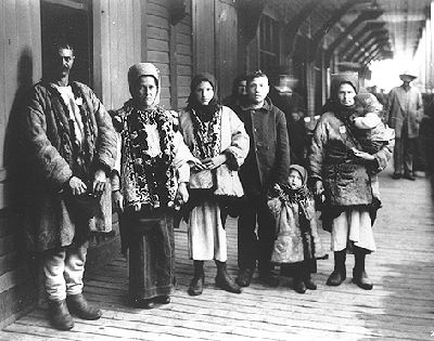
-
Article
Ulukhaktok
Ulukhaktok, Northwest Territories, incorporated as a hamlet in 1984, population 396 (2016 census), 402 (2011 census). The hamlet of Ulukhaktok is located on the west coast of Victoria Island, on inlets of the Amundsen Gulf, 925 air kilometres north of Yellowknife. The area is the ancestral homeland of the Inuinnait.
"https://d3d0lqu00lnqvz.cloudfront.net/media/media/0668e8fb-1dc0-41b6-b5da-5ac9456eb38a.jpg" // resources/views/front/categories/view.blade.php
https://d3d0lqu00lnqvz.cloudfront.net/media/media/0668e8fb-1dc0-41b6-b5da-5ac9456eb38a.jpg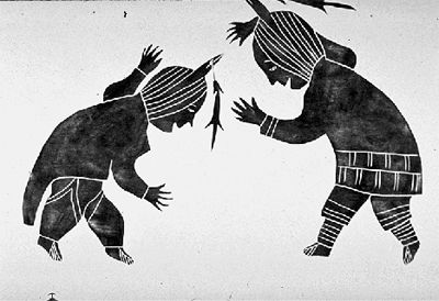
-
search.types.interactivemap
UNESCO World Heritage Sites in Canada Interactive Map
The map below indicates the location of World Heritage Sites in Canada. Click on individual points to learn a site’s name, the year it was designated, and what the site includes. World Heritage Sites are created by the United Nations Educational, Scientific and Cultural Organization (UNESCO). There are 22 UNESCO World Heritage Sites in Canada, as well as one UNESCO Place of History and Memory linked to enslavement and the slave trade — Africville.
"https://d3d0lqu00lnqvz.cloudfront.net/media/new_article_images/UNESCOwhsMap/WHSmapScreenGrab.png" // resources/views/front/categories/view.blade.php
https://d3d0lqu00lnqvz.cloudfront.net/media/new_article_images/UNESCOwhsMap/WHSmapScreenGrab.png
-
Article
Ungava Peninsula
The Ungava Peninsula is a large peninsula approximately 350 000 km2 in area and washed by the waters of Hudson Bay, Hudson Strait and Ungava Bay.
"https://thecanadianencyclopedia.ca/images/tce_placeholder.jpg?v=e9dca980c9bdb3aa11e832e7ea94f5d9" // resources/views/front/categories/view.blade.php
https://thecanadianencyclopedia.ca/images/tce_placeholder.jpg?v=e9dca980c9bdb3aa11e832e7ea94f5d9
-
Article
Union Station
Union Station, Toronto, was designed by architects Ross and Macdonald, Hugh G. Jones and John M. Lyle for the Grand Trunk Railway of Canada and Canadian Pacific Railway.
"https://d3d0lqu00lnqvz.cloudfront.net/media/media/1cbdc5c6-e70b-4225-9415-f4e0cee349d2.jpg" // resources/views/front/categories/view.blade.php
https://d3d0lqu00lnqvz.cloudfront.net/media/media/1cbdc5c6-e70b-4225-9415-f4e0cee349d2.jpg
-
Article
UNESCO World Heritage Sites in Canada
World Heritage sites are areas designated by the United Nations Educational, Scientific and Cultural Organization (UNESCO), with the goal of preserving places of cultural, natural and historic significance. There are 22 UNESCO World Heritage sites in Canada, as well as one UNESCO Place of History and Memory linked to enslavement and the slave trade — Africville.
"https://d3d0lqu00lnqvz.cloudfront.net/media/media/2c1c6060-205a-4d09-bf23-cf368ca2cb95.jpg" // resources/views/front/categories/view.blade.php
https://d3d0lqu00lnqvz.cloudfront.net/media/media/2c1c6060-205a-4d09-bf23-cf368ca2cb95.jpg
-
Article
Unity
Unity, Sask, incorporated as a town in 1919, population 2389 (2011c), 2147 (2006c). The Town of Unity is located in west-central Saskatchewan 70 km southwest of North Battleford. Settlement in the area commenced in 1904 and the
"https://thecanadianencyclopedia.ca/images/tce_placeholder.jpg?v=e9dca980c9bdb3aa11e832e7ea94f5d9" // resources/views/front/categories/view.blade.php
https://thecanadianencyclopedia.ca/images/tce_placeholder.jpg?v=e9dca980c9bdb3aa11e832e7ea94f5d9
-
Article
Unusual Museums in Canada
Canada has world-class history, art, science and natural history museums, but not every tourist guide covers the country’s more unusual institutions. Some museums specialize in research and preservation of a particular aspect of history, while others take a whimsical approach to their displays. Here are several of Canada’s more unique museums.
"https://d3d0lqu00lnqvz.cloudfront.net/unusualmuseums/Torrington_Gopher_Hole_Museum.jpg" // resources/views/front/categories/view.blade.php
https://d3d0lqu00lnqvz.cloudfront.net/unusualmuseums/Torrington_Gopher_Hole_Museum.jpg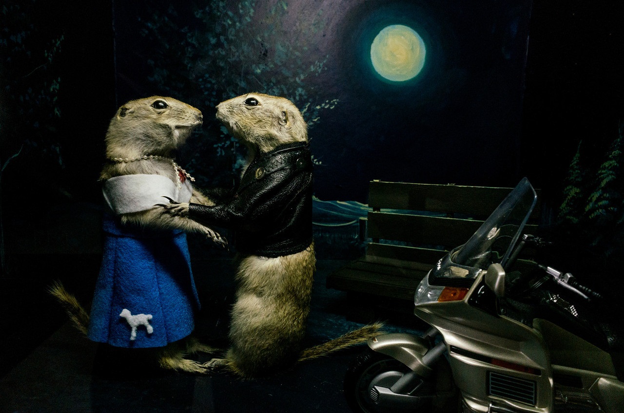
-
Article
Upper Canada
Upper Canada was the predecessor of modern-day Ontario. It was created in 1791 by the division of the old Province of Quebec into Lower Canada in the east and Upper Canada in the west. Upper Canada was a wilderness society settled largely by Loyalists and land-hungry farmers moving north from the United States. Upper Canada endured the War of 1812 with America, William Lyon Mackenzie’s Rebellion of 1837, the colonial rule of the Family Compact and half a century of economic and political growing pains. With the Act of Union in 1841, it was renamed Canada West and merged with Lower Canada (Canada East) into the Province of Canada.
"https://d3d0lqu00lnqvz.cloudfront.net/media/media/ab6ffbc8-72e2-4fc1-9007-43a1b2c8948d.jpg" // resources/views/front/categories/view.blade.php
https://d3d0lqu00lnqvz.cloudfront.net/media/media/ab6ffbc8-72e2-4fc1-9007-43a1b2c8948d.jpg
-
Article
Upper Canada College
UCC was modelled after Britain's top all-boys schools, most notably Eton College, and employed a principal and eight teachers to educate 57 students in its first year.
"https://d3d0lqu00lnqvz.cloudfront.net/media/media/5090b907-78e2-4d1d-82a1-12e989970250.jpg" // resources/views/front/categories/view.blade.php
https://d3d0lqu00lnqvz.cloudfront.net/media/media/5090b907-78e2-4d1d-82a1-12e989970250.jpg
-
Article
Upper Canada Village
Upper Canada Village, developed during the 1950s and 1960s near Morrisburg, Ont, a replica of a 19th-century community that might have existed along the St Lawrence R.
"https://thecanadianencyclopedia.ca/images/tce_placeholder.jpg?v=e9dca980c9bdb3aa11e832e7ea94f5d9" // resources/views/front/categories/view.blade.php
https://thecanadianencyclopedia.ca/images/tce_placeholder.jpg?v=e9dca980c9bdb3aa11e832e7ea94f5d9
-
Article
Upper Fort Garry
Upper Fort Garry, situated at the forks of the Red and Assiniboine rivers in the heart of the Red River Colony, was a Hudson's Bay Company post established in 1822. Previous fur-trade posts had been located periodically in the area.
"https://d3d0lqu00lnqvz.cloudfront.net/media/media/b5748976-ab49-4777-a67f-35814c3d37fb.jpg" // resources/views/front/categories/view.blade.php
https://d3d0lqu00lnqvz.cloudfront.net/media/media/b5748976-ab49-4777-a67f-35814c3d37fb.jpg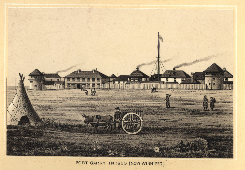
-
Article
Upper Island Cove
Upper Island Cove, NL, incorporated as a town in 1965, population 1594 (2011c), 1667 (2006c). The Town of Upper Island Cove was created when two communities (Upper Island Cove and Spoon Cove) amalgamated. The town is located north of SPANIARD'S BAY on the northwest side of CONCEPTION BAY.
"https://thecanadianencyclopedia.ca/images/tce_placeholder.jpg?v=e9dca980c9bdb3aa11e832e7ea94f5d9" // resources/views/front/categories/view.blade.php
https://thecanadianencyclopedia.ca/images/tce_placeholder.jpg?v=e9dca980c9bdb3aa11e832e7ea94f5d9
-
Article
Upper Liard
Upper Liard, Yukon, settlement, population 125 (2016 census), 132 (2011 census). Upper Liard is located 7 km west of Watson Lake on the Alaska Highway.
"https://thecanadianencyclopedia.ca/images/tce_placeholder.jpg?v=e9dca980c9bdb3aa11e832e7ea94f5d9" // resources/views/front/categories/view.blade.php
https://thecanadianencyclopedia.ca/images/tce_placeholder.jpg?v=e9dca980c9bdb3aa11e832e7ea94f5d9
-
Article
Uranium City
Uranium City, Saskatchewan, northern settlement, population 91 (2021 census), 73 (2016 census). Uranium City is located about 50 km south of the provincial boundary with the Northwest Territories and 75 km east of the Saskatchewan-Alberta border.
"https://d3d0lqu00lnqvz.cloudfront.net/media/new_article_images/UraniumCity/Uranium_City.jpg" // resources/views/front/categories/view.blade.php
https://d3d0lqu00lnqvz.cloudfront.net/media/new_article_images/UraniumCity/Uranium_City.jpg