Browse "Places"
-
Article
Truro
Truro, Nova Scotia, incorporated as a town in 1875, population 12,954 (2021 census), 12,261 (2016 census). The Town of Truro is located along the Salmon River 100 km northeast of Halifax on Cobequid Bay, Minas Basin. The town derives its name from New England settlers and likely honours Truro in Cornwall, England.
"https://d3d0lqu00lnqvz.cloudfront.net/truro/truro-victoria-park.jpg" // resources/views/front/categories/view.blade.php
https://d3d0lqu00lnqvz.cloudfront.net/truro/truro-victoria-park.jpg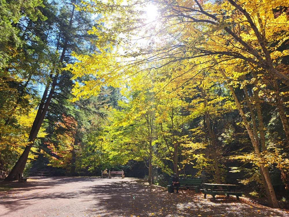
-
Article
Tsiigehtchic
Tsiigehtchic, Northwest Territories, population 187 (2019). Tsiigehtchic is located at the confluence of the Mackenzie and Arctic Red rivers. It is home to the Gwichya Gwich’in First Nation (“people of the flat lands”) who speak an Athapaskan language (see Indigenous Languages in Canada). Formerly known as Arctic Red River, the community’s name was changed to Tsiigehtchic (“at the mouth of iron river”) in 1994. The community is on the Dempster Highway. It is accessible by summer ferry across the Mackenzie River and in winter by ice road. Tsiigehtchic is one of four communities in the Gwich’in Settlement Region. The region is an area created by the Gwich’in Comprehensive Land Claim Agreement (1992). The other three communities in the region are Aklavik, Fort McPherson and Inuvik. (See also Dinjii Zhuh (Gwich'in).)
"https://d3d0lqu00lnqvz.cloudfront.net/media/new_article_images/Tsiigehtchic/River.jpg" // resources/views/front/categories/view.blade.php
https://d3d0lqu00lnqvz.cloudfront.net/media/new_article_images/Tsiigehtchic/River.jpg
-
Article
Tudor Hall/Salle Tudor
The hall's excellent acoustics were attributed to its oak-panelled walls. For a long time free noon-hour recitals were given daily by the organist Herbert Sanders.
"https://d3d0lqu00lnqvz.cloudfront.net/media/media/4a3d3957-8c00-4802-830a-2d8a98cf0d70.jpg" // resources/views/front/categories/view.blade.php
https://d3d0lqu00lnqvz.cloudfront.net/media/media/4a3d3957-8c00-4802-830a-2d8a98cf0d70.jpg
-
Article
Tuktoyaktuk
Tuktoyaktuk, NWT, incorporated as a hamlet in 1970, population 937 (2021 census), 898 (2016 census). The Hamlet of Tuktoyaktuk is located on the coast of the Beaufort Sea, east of the Mackenzie River delta, and 1,135 km northwest of Yellowknife by air. Tuktoyaktuk, commonly referred to as Tuk, is a transportation and government centre, as well as a base for oil and natural gas exploration.
"https://d3d0lqu00lnqvz.cloudfront.net/Tuktoyaktuk/View_from_Cessna_172_over_Tuktoyaktuk.jpg" // resources/views/front/categories/view.blade.php
https://d3d0lqu00lnqvz.cloudfront.net/Tuktoyaktuk/View_from_Cessna_172_over_Tuktoyaktuk.jpg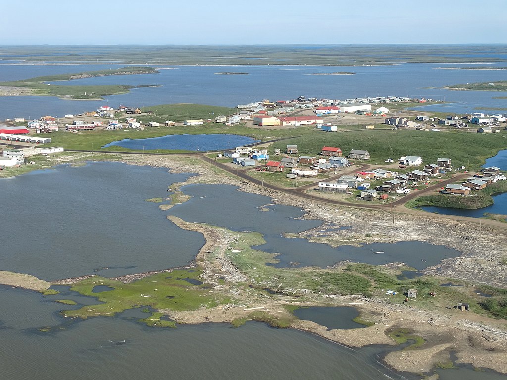
-
Article
Tuktut Nogait National Park
Tuktut Nogait National Park (established in 1998, 18 181 km2) was created through the efforts of the Inuit of Paulatuk, NWT. They wanted a national park to help protect the calving grounds of the Bluenose herd of barren-ground caribou, a game animal essential to their way of life. The agreement to establish the park in the Inuvialuit Settlement Area was signed in 1996, and the park's formal establishment occurred 2 years later. In 2005, Tuktut Nogait was expanded southward with the addition of a small portion in the Sahtu Settlement Area. When Nunavut was created in 1999, the national park's eastern boundary was incorporated into the NWT/Nunavut border. Most of its northern boundary runs parallel to the Amundsen Gulf, which lies 20 km to the north. The name Tuktut Nogait means "caribou calves" in Inuvialuktun.
"https://d3d0lqu00lnqvz.cloudfront.net/TuktutNogaitNationalPark/Evening_shadows_on_tundra.jpg" // resources/views/front/categories/view.blade.php
https://d3d0lqu00lnqvz.cloudfront.net/TuktutNogaitNationalPark/Evening_shadows_on_tundra.jpg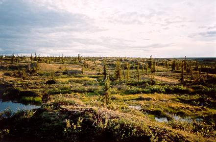
-
"https://thecanadianencyclopedia.ca/images/tce_placeholder.jpg?v=e9dca980c9bdb3aa11e832e7ea94f5d9" // resources/views/front/categories/view.blade.php
https://thecanadianencyclopedia.ca/images/tce_placeholder.jpg?v=e9dca980c9bdb3aa11e832e7ea94f5d9
-
Article
Tumbler Ridge
Tumbler Ridge, BC, incorporated as a district municipality in 1981, population 2,399 (2021 census), 1,987 (2016 census). The District of Tumbler Ridge is located in northeastern British Columbia, 120 km southwest of Dawson Creek.
"https://d3d0lqu00lnqvz.cloudfront.net/tumblerridge/tumbler-ridge-falls.jpg" // resources/views/front/categories/view.blade.php
https://d3d0lqu00lnqvz.cloudfront.net/tumblerridge/tumbler-ridge-falls.jpg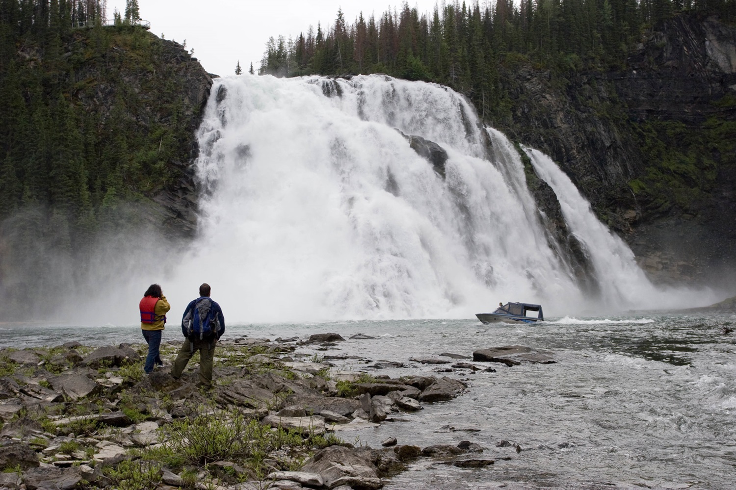
-
Article
Tundra
Tundra, which comes from a Sami word meaning “barren land,” refers to a treeless arctic region characterized by permafrost. Canada’s tundra is known for its freezing temperatures, lack of trees, low-growing vegetation and abundant rock outcrops. The southern boundary of tundra in Canada extends from the Mackenzie River delta to the southern reaches of Hudson Bay and northeast to the Labrador Peninsula. The term “alpine tundra” is often used to describe any area above the treeline in mountainous areas. But “alpine tundra” and “arctic tundra” are not interchangeable. While the two regions share some similarities, the differences are significant.
"https://d3d0lqu00lnqvz.cloudfront.net/media/media/49bea33f-0f3c-4b4c-b687-c347c4e03047.jpg" // resources/views/front/categories/view.blade.php
https://d3d0lqu00lnqvz.cloudfront.net/media/media/49bea33f-0f3c-4b4c-b687-c347c4e03047.jpg
-
Article
Tungsten (NWT)
Tungsten, NWT, was a settlement located in the Selwyn Mountains, near the NWT and Yukon border.
"https://thecanadianencyclopedia.ca/images/tce_placeholder.jpg?v=e9dca980c9bdb3aa11e832e7ea94f5d9" // resources/views/front/categories/view.blade.php
https://thecanadianencyclopedia.ca/images/tce_placeholder.jpg?v=e9dca980c9bdb3aa11e832e7ea94f5d9
-
Article
Turner Valley Gas Plant
On 14 May 1914 the history of Alberta changed forever when A.W. Dingman struck gas near Turner Valley. The Turner Valley Gas Plant Historic Site commemorates this event.
"https://thecanadianencyclopedia.ca/images/tce_placeholder.jpg?v=e9dca980c9bdb3aa11e832e7ea94f5d9" // resources/views/front/categories/view.blade.php
https://thecanadianencyclopedia.ca/images/tce_placeholder.jpg?v=e9dca980c9bdb3aa11e832e7ea94f5d9
-
Article
Turtle Mountain Provincial Park
Named after the western painted turtle found in the park, Turtle Mountain Provincial Park (established 1961, 189 km2) is 100 km south of Brandon, Manitoba, butted against the international boundary.
"https://d3d0lqu00lnqvz.cloudfront.net/media/media/551e57b8-5735-4754-a520-399331837275.jpg" // resources/views/front/categories/view.blade.php
https://d3d0lqu00lnqvz.cloudfront.net/media/media/551e57b8-5735-4754-a520-399331837275.jpg
-
Article
Twillingate
Twillingate, NL, incorporated as a town in 1962, population 2269 (2011c), 2448 (2006c). The Town of Twillingate is located on Twillingate Islands, Notre Dame Bay in northeast Newfoundland.
"https://thecanadianencyclopedia.ca/images/tce_placeholder.jpg?v=e9dca980c9bdb3aa11e832e7ea94f5d9" // resources/views/front/categories/view.blade.php
https://thecanadianencyclopedia.ca/images/tce_placeholder.jpg?v=e9dca980c9bdb3aa11e832e7ea94f5d9
-
Article
Tyendinaga Mohawk Territory
The Mohawks of the Bay of Quinte are part of the Kanyen’kehá:ka or Mohawk Nation. Kanyen’kehá:ka means “People of the Land of Flint.” The Mohawk Nation is in turn part of the Rotinonhsyón:ni (Haudenosaunee or Six Nations Confederacy), which translates in English to “People of the Longhouse.” As of February 2026, there were 11,881 members of the Mohawks of the Bay of Quinte living on Turtle Island and beyond. At that time, 2,090 of these members lived on Tyendinaga Mohawk Territory. The Territory is located on the northeastern shore of the Bay of Quinte, just east of Belleville, Ontario.
"https://d3d0lqu00lnqvz.cloudfront.net/media/new_article_images/Tyendinaga/TyendinagaPowwow.jpg" // resources/views/front/categories/view.blade.php
https://d3d0lqu00lnqvz.cloudfront.net/media/new_article_images/Tyendinaga/TyendinagaPowwow.jpg
-
Article
Ucluelet (BC)
Ucluelet, BC, incorporated as a district municipality in 1997, population 1627 (2011c), 1487 (2006c). The District of Ucluelet is located on the west coast of Vancouver Island, 175 km northwest of Victoria, at the entrance to Barkley Sound.
"https://d3d0lqu00lnqvz.cloudfront.net/media/media/4fa0038e-052c-4dd8-acc5-c3bba0cf8e6c.jpg" // resources/views/front/categories/view.blade.php
https://d3d0lqu00lnqvz.cloudfront.net/media/media/4fa0038e-052c-4dd8-acc5-c3bba0cf8e6c.jpg
-
Article
Ukkusiksalik National Park
Ukkusiksalik National Park, Nunavut, size 20,885 km2, established in 2003, is located on the northwest side of Hudson Bay. It was first proposed as a National Park in 1978 because of the spectacular inland sea, Wager Bay, and the surrounding area. The name Ukkusiksalik in Inuktitut means "the place where soapstone to make pots and oil lamps is found."
"https://d3d0lqu00lnqvz.cloudfront.net/UkkusiksalikNationalPark/UkkusiksalikNationalPark.jpg" // resources/views/front/categories/view.blade.php
https://d3d0lqu00lnqvz.cloudfront.net/UkkusiksalikNationalPark/UkkusiksalikNationalPark.jpg