
Browse "Places"
-
Article
Rocky Mountain House National Historic Site
Rocky Mountain House National Historic Site, near Rocky Mountain House, Alberta, commemorates a series of fur-trade posts built between 1799 and 1864 by the North West Co and the Hudson's Bay Co (HBC) near the junction of the North Saskatchewan and Clearwater rivers.
"https://thecanadianencyclopedia.ca/images/tce_placeholder.jpg?v=e9dca980c9bdb3aa11e832e7ea94f5d9" // resources/views/front/categories/view.blade.php
https://thecanadianencyclopedia.ca/images/tce_placeholder.jpg?v=e9dca980c9bdb3aa11e832e7ea94f5d9
-
Article
Rocky Mountain Trench
The Rocky Mountain Trench is a long and deep valley extending approximately 1,500 km from the Bitterroot Valley in northwest Montana through British Columbia to the Liard Plain just south of the Yukon Territory. Its predominantly flat floor is 3–20 km wide and ranges in elevation between 600 m and 1,000 m above sea level. With walls made of sedimentary, volcanic and igneous rock, the Trench is sometimes referred to as the “Valley of a Thousand Peaks” because of the towering mountain ranges on either side: the Rocky Mountains to the east and the Columbia, Omineca and Cassiar mountains to the west. Humans have relied on the rich resources provided by this distinctive landscape from pre-colonial times to the present.
"https://d3d0lqu00lnqvz.cloudfront.net/media/media/061fe992-a3bf-45bc-906d-216d1bef45c7.jpg" // resources/views/front/categories/view.blade.php
https://d3d0lqu00lnqvz.cloudfront.net/media/media/061fe992-a3bf-45bc-906d-216d1bef45c7.jpg
-
Article
Canadian Rocky Mountains
The Canadian Rocky Mountains, or Canadian Rockies, are the Canadian section of the North American Rocky Mountains, a mountain range in western North America which extends from New Mexico in the south to Alaska in the North. Stretching across much of the British Columbia-Alberta boundary, the Rockies are bounded by the prairies to the east. The tallest peak is Mount Robson, with an elevation of 3,954 m. Many of the national parks in these mountains, such as Banff National Park, Jasper National Park, Yoho National Park, Kootenay National Park and Waterton-Glacier International Peace Park are UNESCO World Heritage Sites.
"https://d3d0lqu00lnqvz.cloudfront.net/media/media/9b601dc6-d3d2-482c-8164-e3f8d453a78b.jpg" // resources/views/front/categories/view.blade.php
https://d3d0lqu00lnqvz.cloudfront.net/media/media/9b601dc6-d3d2-482c-8164-e3f8d453a78b.jpg
-
Article
Rogers Pass
During the summer of 1885 the railway was constructed over the pass at great expense. Over 6.4 km of snowsheds (31) were built to protect trains, trackage and workmen from AVALANCHES (the area receives up to 15 m of snow each winter).
"https://d3d0lqu00lnqvz.cloudfront.net/media/media/4a73903a-ec12-49d4-86cb-2a9cbd3c3f23.jpg" // resources/views/front/categories/view.blade.php
https://d3d0lqu00lnqvz.cloudfront.net/media/media/4a73903a-ec12-49d4-86cb-2a9cbd3c3f23.jpg
-
Article
Rondeau Provincial Park
Rondeau Provincial Park (established 1894, 33 km2) provides environmental protection and recreation on one of 3 peninsulas jutting south into Lake ERIE. It lies 120 km east of Windsor and 115 km southwest of London.
"https://thecanadianencyclopedia.ca/images/tce_placeholder.jpg?v=e9dca980c9bdb3aa11e832e7ea94f5d9" // resources/views/front/categories/view.blade.php
https://thecanadianencyclopedia.ca/images/tce_placeholder.jpg?v=e9dca980c9bdb3aa11e832e7ea94f5d9
-
Article
Rooster Town
Rooster Town was a largely Métis community that existed on the southwest fringes of suburban Winnipeg from 1901 until the late 1950s. While there were numerous urban Métis fringe communities on the Prairies and in British Columbia, their history has been relatively forgotten. (See also Métis Road Allowance Communities.)
"https://d3d0lqu00lnqvz.cloudfront.net/media/media/093c5c4d-cdd7-4fe5-b8d1-753c6c5a7dd9.jpg" // resources/views/front/categories/view.blade.php
https://d3d0lqu00lnqvz.cloudfront.net/media/media/093c5c4d-cdd7-4fe5-b8d1-753c6c5a7dd9.jpg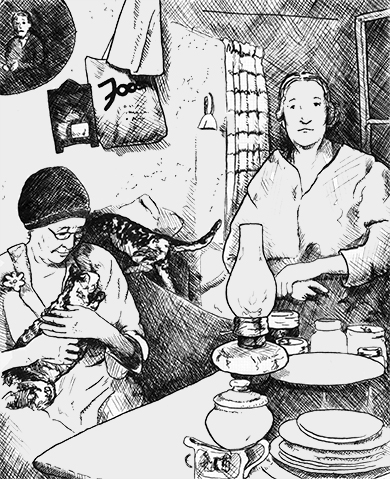
-
Article
Rosemère
Rosemère, Quebec, incorporated as a city in 1958, population 14,090 (2021 census), 13,958 (2016 census). Rosemère is located on the south bank of the Rivière des Mille Îles across from Laval.
"https://d3d0lqu00lnqvz.cloudfront.net/media/media/da9a5d37-763c-4f26-9866-1b7c4350f63e.jpg" // resources/views/front/categories/view.blade.php
https://d3d0lqu00lnqvz.cloudfront.net/media/media/da9a5d37-763c-4f26-9866-1b7c4350f63e.jpg
-
Article
Rosetown
Rosetown, Sask, incorporated as a town in 1911, population 2317 (2011c), 2277 (2006c). The Town of Rosetown is located 115 km southwest of SASKATOON. It is a focal point for the major transportation routes of the region and is
"https://thecanadianencyclopedia.ca/images/tce_placeholder.jpg?v=e9dca980c9bdb3aa11e832e7ea94f5d9" // resources/views/front/categories/view.blade.php
https://thecanadianencyclopedia.ca/images/tce_placeholder.jpg?v=e9dca980c9bdb3aa11e832e7ea94f5d9
-
Article
Ross Farm
Ross Farm, at New Ross, NS, 28 km north of Chester, dates from 1816, when Captain William Ross led 172 disbanded soldiers into the Nova Scotia interior to establish an agricultural settlement.
"https://thecanadianencyclopedia.ca/images/tce_placeholder.jpg?v=e9dca980c9bdb3aa11e832e7ea94f5d9" // resources/views/front/categories/view.blade.php
https://thecanadianencyclopedia.ca/images/tce_placeholder.jpg?v=e9dca980c9bdb3aa11e832e7ea94f5d9
-
Article
Ross River
Ross River, Yukon, settlement, population 293 (2016 census), 352 (2011 census). Ross River is located at the confluence of the Ross and Pelly rivers. It is on the Canol Road (seeCanol Pipeline) at the halfway point on the Campbell Highway. Ross River is 360 km by road northeast of Whitehorse.
"https://thecanadianencyclopedia.ca/images/tce_placeholder.jpg?v=e9dca980c9bdb3aa11e832e7ea94f5d9" // resources/views/front/categories/view.blade.php
https://thecanadianencyclopedia.ca/images/tce_placeholder.jpg?v=e9dca980c9bdb3aa11e832e7ea94f5d9
-
Article
Ross-Thomson House
The Ross-Thomson House is located in SHELBURNE, NS. At the end of the American Revolution, thousands of LOYALISTS arrived in Shelburne. Many quickly left, but others, like George and Robert Ross, settled and began businesses in the new town.
"https://thecanadianencyclopedia.ca/images/tce_placeholder.jpg?v=e9dca980c9bdb3aa11e832e7ea94f5d9" // resources/views/front/categories/view.blade.php
https://thecanadianencyclopedia.ca/images/tce_placeholder.jpg?v=e9dca980c9bdb3aa11e832e7ea94f5d9
-
Article
Rossland
Rossland, BC, incorporated as a city in 1897, population 4,140 (2021 census), 3,729 (2016 census). The City of Rossland is located 10 km southwest of Trail in the eroded crater of a long-extinct volcano of the Monashee Mountains.
"https://thecanadianencyclopedia.ca/images/tce_placeholder.jpg?v=e9dca980c9bdb3aa11e832e7ea94f5d9" // resources/views/front/categories/view.blade.php
https://thecanadianencyclopedia.ca/images/tce_placeholder.jpg?v=e9dca980c9bdb3aa11e832e7ea94f5d9
-
Article
Rosthern
In 1891 and 1892 a group of Mennonite farmers, several from the Manitoba settlements, arrived in the area. Dr Seager WHEELER, a pioneer in scientific agriculture, had his farm in the area; it is now a national historic site.
"https://d3d0lqu00lnqvz.cloudfront.net/media/media/3aaaa54e-d3b3-45f2-97e7-ffa1b1d5118d.jpg" // resources/views/front/categories/view.blade.php
https://d3d0lqu00lnqvz.cloudfront.net/media/media/3aaaa54e-d3b3-45f2-97e7-ffa1b1d5118d.jpg
-
Article
Rothesay
Rothesay, NB, incorporated as a town in 1998, population 11 947 (2011c), 11 637 (2006c). It is situated on the eastern side of the Kennebecasis River, 22 km northeast of Saint John.
"https://thecanadianencyclopedia.ca/images/tce_placeholder.jpg?v=e9dca980c9bdb3aa11e832e7ea94f5d9" // resources/views/front/categories/view.blade.php
https://thecanadianencyclopedia.ca/images/tce_placeholder.jpg?v=e9dca980c9bdb3aa11e832e7ea94f5d9
-
Article
Rouge National Urban Park
Rouge National Urban Park is an ecologically protected zone in the Greater Toronto Area that encompasses much of the valleys of the Rouge River and Little Rouge Creek. A total of 79.1 km2 of land has been committed to the park, which straddles parts of the Ontario cities of Toronto, Markham, Pickering and the Township of Uxbridge. The historic area includes farmland, green space, wetlands and rivers alongside urban development, roads and highways. Established 15 May 2015 and managed by Parks Canada, Rouge is Canada’s first National Urban Park and the largest urban park in North America.
"https://d3d0lqu00lnqvz.cloudfront.net/media/media/89696c73-3105-407f-b3ce-ae56d9472b7d.jpg" // resources/views/front/categories/view.blade.php
https://d3d0lqu00lnqvz.cloudfront.net/media/media/89696c73-3105-407f-b3ce-ae56d9472b7d.jpg