
Browse "Cities & Populated Places"
-
Article
Melfort
The rail line, which arrived in 1909, made Melfort a trade and cultural centre for the surrounding area. It was incorporated as a village in 1903, as a town in 1907 and a city in 1980.
"https://thecanadianencyclopedia.ca/images/tce_placeholder.jpg?v=e9dca980c9bdb3aa11e832e7ea94f5d9" // resources/views/front/categories/view.blade.php
https://thecanadianencyclopedia.ca/images/tce_placeholder.jpg?v=e9dca980c9bdb3aa11e832e7ea94f5d9
-
Article
Melville
The community's growth beyond that of others in the area came as a result of its designation as a divisional point by the railway. The importance of the railway has since been balanced somewhat by the city's role as a service centre for the poultry, livestock and grain farmers in the area.
"https://thecanadianencyclopedia.ca/images/tce_placeholder.jpg?v=e9dca980c9bdb3aa11e832e7ea94f5d9" // resources/views/front/categories/view.blade.php
https://thecanadianencyclopedia.ca/images/tce_placeholder.jpg?v=e9dca980c9bdb3aa11e832e7ea94f5d9
-
Article
Merrickville-Wolford
Merrickville-Wolford, Ont, incorporated as a village in 1998, population 2850 (2011c), 2867 (2006c). The Village of Merrickville-Wolford is located on the Rideau River, 55 km southwest of Ottawa.
"https://thecanadianencyclopedia.ca/images/tce_placeholder.jpg?v=e9dca980c9bdb3aa11e832e7ea94f5d9" // resources/views/front/categories/view.blade.php
https://thecanadianencyclopedia.ca/images/tce_placeholder.jpg?v=e9dca980c9bdb3aa11e832e7ea94f5d9
-
Article
Metchosin
Metchosin, British Columbia, incorporated as a district municipality in 1984, population 4,708 (2016 census), 4,803 (2011 census). The District of Metchosin is located on Vancouver Island. It overlooks the Juan de Fuca Strait. Metchosin is part of the Greater Victoria area. From the late 1800s to 1958, a quarantine station operated at William Head in Metchosin. Many immigrants arriving to Canada by ship were quarantined at William Head before being allowed to enter the country. This was done in an effort to prevent the spread of infectious diseases common on overcrowded ships. In addition, from 1924 to 1956, there was a leper colony on nearby Bentinck Island.
"https://d3d0lqu00lnqvz.cloudfront.net/media/media/853b5d41-e9b6-4b2e-a205-03a54f80d5b2.jpg" // resources/views/front/categories/view.blade.php
https://d3d0lqu00lnqvz.cloudfront.net/media/media/853b5d41-e9b6-4b2e-a205-03a54f80d5b2.jpg
-
Article
Métis Road Allowance Communities
Road allowance communities were home to Métis families throughout the late 1800s until the mid- to late 1900s. Métis peoples used the road allowances as new home communities after experiencing relocations, migrations and dispossession from their homelands. After resistance and violence in a period during and after the Riel Resistance of 1869–1870 and the North–West Resistance in 1885, Métis were marginalized and labelled as rebellious or troublesome by the government of Canada and the provinces.
"https://d3d0lqu00lnqvz.cloudfront.net/media/media/RoosterTownFamily.jpg" // resources/views/front/categories/view.blade.php
https://d3d0lqu00lnqvz.cloudfront.net/media/media/RoosterTownFamily.jpg
-
Article
History of Métis Settlements in Canada
Métis communities are found in many provinces and territories in Canada; however, the only legislated Métis land base is in Alberta. Eight Métis settlements are located across the northern and central-eastern part of the province: Paddle Prairie, Peavine, Gift Lake, East Prairie, Buffalo Lake, Kikino, Elizabeth and Fishing Lake. As of 2021, the settlements cover 1.25 million acres of land and are home to approximately 4,238 people. That year, 3,540 people reported that they were registered members of Métis Settlements in Alberta. The Métis Settlements are self-governing and provide for the protection of Métis culture and identity.
"https://d3d0lqu00lnqvz.cloudfront.net/MetisSettlementsFlag/Metis_Settlements_Flag.gif" // resources/views/front/categories/view.blade.php
https://d3d0lqu00lnqvz.cloudfront.net/MetisSettlementsFlag/Metis_Settlements_Flag.gif
-
Article
Middleton
Middleton, NS, incorporated as a town in 1909, population 1749 (2011c), 1829 (2006c). The Town of Middleton is located in Nova Scotia's historic ANNAPOLIS VALLEY.
"https://d3d0lqu00lnqvz.cloudfront.net/media/media/bcfd90ed-d214-45b6-8e09-5896fdf32004.jpg" // resources/views/front/categories/view.blade.php
https://d3d0lqu00lnqvz.cloudfront.net/media/media/bcfd90ed-d214-45b6-8e09-5896fdf32004.jpg
-
Article
Midland
Midland, Ont, incorporated as a town in 1890, population 16 572 (2011c), 16 330 (2006c). The Town of Midland is located on Midland Bay, an inlet of Georgian Bay. It is about 145 km by road north of Toronto.
"https://d3d0lqu00lnqvz.cloudfront.net/media/media/16b8b94b-0ca0-468a-8f8f-09141c3462be.jpg" // resources/views/front/categories/view.blade.php
https://d3d0lqu00lnqvz.cloudfront.net/media/media/16b8b94b-0ca0-468a-8f8f-09141c3462be.jpg
-
Article
Milton
Milton, Ontario, incorporated as a town in 1857, population 132,979 (2021 census), 110,128 (2016 census). One of four municipalities in Halton Region, Milton’s odd shape means it shares a border with six communities. Milton’s modern borders were created in 1974, from Nassagaweya Township, the Town of Milton, and parts of Esquesing, Trafalgar, and Nelson townships. Throughout history, the Milton area has been home to different Indigenous groups, namely the Neutral, Huron-Wendat, Haudenosaunee and Anishinaabeg, including the Mississauga. The land is within treaties 3 ¾, 14, and 19 (see Upper Canada Land Surrenders).
"https://d3d0lqu00lnqvz.cloudfront.net/media/new_article_images/Milton/MiltonDowntown.jpg" // resources/views/front/categories/view.blade.php
https://d3d0lqu00lnqvz.cloudfront.net/media/new_article_images/Milton/MiltonDowntown.jpg
-
Article
Minnedosa
Minnedosa, Man, Manitoba, incorporated as a town in 1883, population 2587 (2011c), 2474 (2006c). The Town of Minnedosa is located 205 km northwest of Winnipeg, on the east side of the Little Saskatchewan River.
"https://thecanadianencyclopedia.ca/images/tce_placeholder.jpg?v=e9dca980c9bdb3aa11e832e7ea94f5d9" // resources/views/front/categories/view.blade.php
https://thecanadianencyclopedia.ca/images/tce_placeholder.jpg?v=e9dca980c9bdb3aa11e832e7ea94f5d9
-
Article
Minto
Minto, NB, incorporated as a village in1962, population 2505 (2011c), 2681 (2006c). It is located 56 km north of Fredericton in the Minto coalfields.
"https://thecanadianencyclopedia.ca/images/tce_placeholder.jpg?v=e9dca980c9bdb3aa11e832e7ea94f5d9" // resources/views/front/categories/view.blade.php
https://thecanadianencyclopedia.ca/images/tce_placeholder.jpg?v=e9dca980c9bdb3aa11e832e7ea94f5d9
-
Article
Mirabel
Mirabel, Quebec, incorporated as a city in 1971, population 50,513 (2016 census), 41,957 (2011 census). Mirabel is located some 57 km northwest of Montreal, is one of Quebec's youngest cities and also one of its most extended. It is home to the former Montreal-Mirabel International Airport. Mirabel is situated on the ancestral lands of the Haudenosaunee, including the Kanyen'kehà:ka, as well as the Anishinaabeg, notably the Algonquin (see Indigenous peoples in Canada).
"https://thecanadianencyclopedia.ca/images/tce_placeholder.jpg?v=e9dca980c9bdb3aa11e832e7ea94f5d9" // resources/views/front/categories/view.blade.php
https://thecanadianencyclopedia.ca/images/tce_placeholder.jpg?v=e9dca980c9bdb3aa11e832e7ea94f5d9
-
Article
Miramichi
Miramichi, New Brunswick, incorporated as a city in 1995, population 17,692 (2021 census), 17,537 (2016 census). The City of Miramichi is in northeastern New Brunswick at the mouth of the Miramichi River, one of Canada's most famous salmon rivers.
"https://d3d0lqu00lnqvz.cloudfront.net/media/media/177eafa5-be90-43c9-879c-7a35bbb3333f.jpg" // resources/views/front/categories/view.blade.php
https://d3d0lqu00lnqvz.cloudfront.net/media/media/177eafa5-be90-43c9-879c-7a35bbb3333f.jpg
-
Article
Mission
Mission, BC, incorporated as a district municipality in 1969, population 36 426 (2011c), 34 505 (2006c). The District of Mission is located on the north bank ofthe FRASER RIVER, 70 km by road east of VANCOUVER.
"https://d3d0lqu00lnqvz.cloudfront.net/media/media/6232f070-823a-44e3-8285-5bb9d14cf197.jpg" // resources/views/front/categories/view.blade.php
https://d3d0lqu00lnqvz.cloudfront.net/media/media/6232f070-823a-44e3-8285-5bb9d14cf197.jpg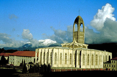
-
Article
Mississauga
Mississauga, Ontario, incorporated as a city in 1974, population 717,961 (2021 census), 721,599 (2016 census). The city was created by the amalgamation of the Town of Mississauga and the Towns of Port Credit and Streetsville. Located west of Toronto, Mississauga is part of the Regional Municipality of Peel. It is located within the Credit and Humber river watersheds. Throughout history, the Mississauga area has been home to different Indigenous groups, namely the Huron-Wendat, Haudenosaunee and Anishinaabeg, including the Mississauga. The land is covered by treaties 14, 19, 22 and 23.
"https://d3d0lqu00lnqvz.cloudfront.net/media/new_article_images/Mississauga/SquareOne.jpg" // resources/views/front/categories/view.blade.php
https://d3d0lqu00lnqvz.cloudfront.net/media/new_article_images/Mississauga/SquareOne.jpg