Browse "Places"
-
Article
Mirabel
Mirabel, Quebec, incorporated as a city in 1971, population 50,513 (2016 census), 41,957 (2011 census). Mirabel is located some 57 km northwest of Montreal, is one of Quebec's youngest cities and also one of its most extended. It is home to the former Montreal-Mirabel International Airport. Mirabel is situated on the ancestral lands of the Haudenosaunee, including the Kanyen'kehà:ka, as well as the Anishinaabeg, notably the Algonquin (see Indigenous peoples in Canada).
"https://thecanadianencyclopedia.ca/images/tce_placeholder.jpg?v=e9dca980c9bdb3aa11e832e7ea94f5d9" // resources/views/front/categories/view.blade.php
https://thecanadianencyclopedia.ca/images/tce_placeholder.jpg?v=e9dca980c9bdb3aa11e832e7ea94f5d9
-
Article
Miramichi
Miramichi, New Brunswick, incorporated as a city in 1995, population 17,692 (2021 census), 17,537 (2016 census). The City of Miramichi is in northeastern New Brunswick at the mouth of the Miramichi River, one of Canada's most famous salmon rivers.
"https://d3d0lqu00lnqvz.cloudfront.net/media/media/177eafa5-be90-43c9-879c-7a35bbb3333f.jpg" // resources/views/front/categories/view.blade.php
https://d3d0lqu00lnqvz.cloudfront.net/media/media/177eafa5-be90-43c9-879c-7a35bbb3333f.jpg
-
Article
Miramichi River
The Miramichi River is 217 km long from its source in Juniper, in central New Brunswick, to the Gulf of St. Lawrence.
"https://d3d0lqu00lnqvz.cloudfront.net/media/media/169334dd-4829-4936-a09b-b91e809c65ef.jpg" // resources/views/front/categories/view.blade.php
https://d3d0lqu00lnqvz.cloudfront.net/media/media/169334dd-4829-4936-a09b-b91e809c65ef.jpg
-
Article
Miscou Island
Miscou Island, 64 km2, comprises the most eastern part of Gloucester County, New Brunswick, on the west side of the Gulf of St Lawrence and at the entrance to CHALEUR BAY.
"https://thecanadianencyclopedia.ca/images/tce_placeholder.jpg?v=e9dca980c9bdb3aa11e832e7ea94f5d9" // resources/views/front/categories/view.blade.php
https://thecanadianencyclopedia.ca/images/tce_placeholder.jpg?v=e9dca980c9bdb3aa11e832e7ea94f5d9
-
Article
Mission
Mission, BC, incorporated as a district municipality in 1969, population 36 426 (2011c), 34 505 (2006c). The District of Mission is located on the north bank ofthe FRASER RIVER, 70 km by road east of VANCOUVER.
"https://d3d0lqu00lnqvz.cloudfront.net/media/media/6232f070-823a-44e3-8285-5bb9d14cf197.jpg" // resources/views/front/categories/view.blade.php
https://d3d0lqu00lnqvz.cloudfront.net/media/media/6232f070-823a-44e3-8285-5bb9d14cf197.jpg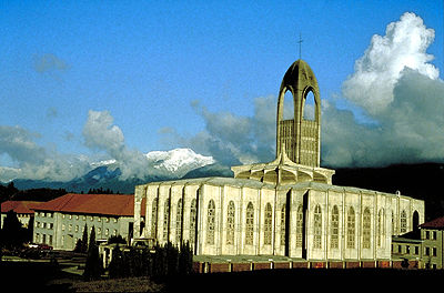
-
Article
Mississauga
Mississauga, Ontario, incorporated as a city in 1974, population 717,961 (2021 census), 721,599 (2016 census). The city was created by the amalgamation of the Town of Mississauga and the Towns of Port Credit and Streetsville. Located west of Toronto, Mississauga is part of the Regional Municipality of Peel. It is located within the Credit and Humber river watersheds. Throughout history, the Mississauga area has been home to different Indigenous groups, namely the Huron-Wendat, Haudenosaunee and Anishinaabeg, including the Mississauga. The land is covered by treaties 14, 19, 22 and 23.
"https://d3d0lqu00lnqvz.cloudfront.net/media/new_article_images/Mississauga/SquareOne.jpg" // resources/views/front/categories/view.blade.php
https://d3d0lqu00lnqvz.cloudfront.net/media/new_article_images/Mississauga/SquareOne.jpg
-
Article
Mississaugas of the Credit First Nation
The Mississaugas of the Credit are a First Nation based in southwestern Ontario. Their reserve, known as New Credit, occupies just under 6,000 acres (about 24 km2). It straddles Brant and Haldimand Counties and is adjacent to the Six Nations of the Grand River reserve. As of April 2026, Mississaugas of the Credit First Nation has 2,980 registered members. Of those members, 967 members live on the New Credit reserve and 1,968 members live off-reserve (see also Reserves in Ontario).
"https://d3d0lqu00lnqvz.cloudfront.net/MississaugasOfTheCreditFN/ThreeFires31.JPG" // resources/views/front/categories/view.blade.php
https://d3d0lqu00lnqvz.cloudfront.net/MississaugasOfTheCreditFN/ThreeFires31.JPG
-
Article
Mistaken Point
Mistaken Point was designated as Canada’s 18th World Heritage Site by the United Nations Educational, Scientific and Cultural Organization (UNESCO) in 2016. It is located in southeastern Newfoundland. Mistaken Point is the oldest grouping of large, biologically complex fossilized creatures found anywhere in the world. The fossils date from 580 to 560 million years ago, when large, multicellular organisms began to appear. Mistaken Point was the fifth Canadian fossil site to be recognized by UNESCO, following Dinosaur Provincial Park (1979), Canadian Rocky Mountain Parks (1984), Miguasha National Park (1999) and Joggins Fossil Cliffs (2008).
"https://d3d0lqu00lnqvz.cloudfront.net/media/new_article_images/MistakenPoint/7230862706_8985c1c244_o.jpg" // resources/views/front/categories/view.blade.php
https://d3d0lqu00lnqvz.cloudfront.net/media/new_article_images/MistakenPoint/7230862706_8985c1c244_o.jpg
-
Article
Mohawk Institute
The Mohawk Institute was established in 1828 near Brantford, Ontario. It was one of the earliest and longest-running Indian residential schools. It was initially founded by Reverend Robert Lugger, a missionary of a Puritan Protestant organization. The Mohawk Institute evolved from a Kanyen’kehá:ka (Mohawk) Indian day school and was a model for other residential schools. The people involved intended to assimilate First Nations children into Euro-Canadian society. They did this through converting children and, as adults, having them do the same within their communities. The Mohawk Institute operated for 141 years, closing in 1970.
"https://d3d0lqu00lnqvz.cloudfront.net/MohawkInstitute/15054127924_92486c0870_o.jpg" // resources/views/front/categories/view.blade.php
https://d3d0lqu00lnqvz.cloudfront.net/MohawkInstitute/15054127924_92486c0870_o.jpg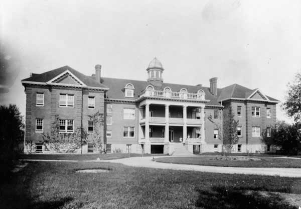
-
Article
Monashee Mountains
The Monashee Mountains are a 400 km-long range of varied origin in southern British Columbia.
"https://d3d0lqu00lnqvz.cloudfront.net/Monashee_peaks.jpg" // resources/views/front/categories/view.blade.php
https://d3d0lqu00lnqvz.cloudfront.net/Monashee_peaks.jpg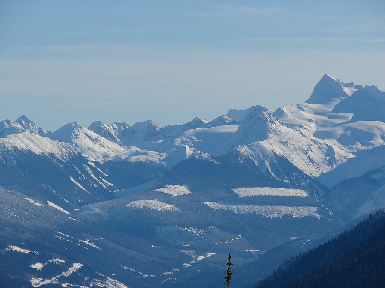
-
Article
Moncton
Moncton, NB, incorporated as a city in 1890, population 71,889 (2016 census),69,074 (2011 census), is the largest city in New Brunswick. The City of Moncton is located in eastern New Brunswick on a bend of the Petitcodiac River. With a population of 144,810 (2016) the Greater Moncton region includes the steadily growing city of Dieppe and the town of Riverview.
"https://thecanadianencyclopedia.ca/images/tce_placeholder.jpg?v=e9dca980c9bdb3aa11e832e7ea94f5d9" // resources/views/front/categories/view.blade.php
https://thecanadianencyclopedia.ca/images/tce_placeholder.jpg?v=e9dca980c9bdb3aa11e832e7ea94f5d9
-
Article
Music in Moncton
New Brunswick city originally known as LeCoude and first settled in 1750 by Acadians. The Acadians were dispersed in 1758 but returned in sufficient numbers to constitute a fundamental segment of the Moncton community.
"https://thecanadianencyclopedia.ca/images/tce_placeholder.jpg?v=e9dca980c9bdb3aa11e832e7ea94f5d9" // resources/views/front/categories/view.blade.php
https://thecanadianencyclopedia.ca/images/tce_placeholder.jpg?v=e9dca980c9bdb3aa11e832e7ea94f5d9
-
Article
Mont-Joli
Further growth resulted from the establishment of train repair yards. The headquarters of the Canada and Gulf Terminal Ry (linking Mont-Joli and Matane) located in the village in 1910. These developments led to the opening of a foundry that produced railway equipment.
"https://thecanadianencyclopedia.ca/images/tce_placeholder.jpg?v=e9dca980c9bdb3aa11e832e7ea94f5d9" // resources/views/front/categories/view.blade.php
https://thecanadianencyclopedia.ca/images/tce_placeholder.jpg?v=e9dca980c9bdb3aa11e832e7ea94f5d9
-
Article
Mont-Saint-Hilaire
This area, part of the seigneury granted to Jean-Baptiste Hertel de Rouville in 1694, was sufficiently settled at the end of the 18th century to warrant the creation of a mission church, Saint-Hilaire.
"https://thecanadianencyclopedia.ca/images/tce_placeholder.jpg?v=e9dca980c9bdb3aa11e832e7ea94f5d9" // resources/views/front/categories/view.blade.php
https://thecanadianencyclopedia.ca/images/tce_placeholder.jpg?v=e9dca980c9bdb3aa11e832e7ea94f5d9
-
Article
Mont Sainte-Anne
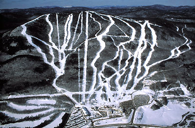
Internationally known for its SKIING facilities, 7 World Cup races have been held there since 1969. The area is superbly equipped; downhill skiers and snowboarders enjoy 51 runs totalling 60 km (15 km are illuminated for night skiing).
"https://d3d0lqu00lnqvz.cloudfront.net/media/media/d7932e1a-76b9-4c9e-bbb5-1ffc418839f7.jpg" // resources/views/front/categories/view.blade.php
https://d3d0lqu00lnqvz.cloudfront.net/media/media/d7932e1a-76b9-4c9e-bbb5-1ffc418839f7.jpg