
Browse "Places"
-
Article
Atikokan
Atikokan, Ont, incorporated as a township in 1954, population 2787 (2011c), 3293 (2006c). The Township of Atikokan is located in northwestern Ontario on the Atikokan River, 220 km west of Thunder Bay.
"https://thecanadianencyclopedia.ca/images/tce_placeholder.jpg?v=e9dca980c9bdb3aa11e832e7ea94f5d9" // resources/views/front/categories/view.blade.php
https://thecanadianencyclopedia.ca/images/tce_placeholder.jpg?v=e9dca980c9bdb3aa11e832e7ea94f5d9
-
Article
Atlantic Provinces
Nova Scotia, Prince Edward Island, New Brunswick and Newfoundland and Labrador constitute the Atlantic provinces. The three maritime provinces (NS, PEI and NB) have much in common — among other things, they share a historical and cultural heritage, and their residents have remarkably similar attitudes towards Canada, the US and Britain. Newfoundland development and Newfoundlanders have been shaped by quite different forces and personalities.
"https://d3d0lqu00lnqvz.cloudfront.net/peggyscove/peggy-s-cove-2.jpg" // resources/views/front/categories/view.blade.php
https://d3d0lqu00lnqvz.cloudfront.net/peggyscove/peggy-s-cove-2.jpg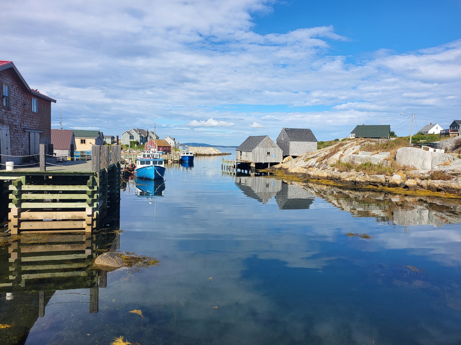
-
Article
Atlin
Atlin, BC, Unincorporated Place, elevation 671 m. Atlin is a small community of about 400 residents situated on Atlin Lake in the lake district of the northwest corner of the province, 182 kilometres southeast of Whitehorse, Yukon.
"https://thecanadianencyclopedia.ca/images/tce_placeholder.jpg?v=e9dca980c9bdb3aa11e832e7ea94f5d9" // resources/views/front/categories/view.blade.php
https://thecanadianencyclopedia.ca/images/tce_placeholder.jpg?v=e9dca980c9bdb3aa11e832e7ea94f5d9
-
Article
Atlin Lake
Atlin Lake, 775 km2, elev 668 m, is a long, narrow lake in northwestern BC touching the Yukon border. The source of the Yukon River, it was inundated by prospectors during the Klondike Gold Rush 1897-98. The town of Atlin is on the E shore.
"https://thecanadianencyclopedia.ca/images/tce_placeholder.jpg?v=e9dca980c9bdb3aa11e832e7ea94f5d9" // resources/views/front/categories/view.blade.php
https://thecanadianencyclopedia.ca/images/tce_placeholder.jpg?v=e9dca980c9bdb3aa11e832e7ea94f5d9
-
Article
Attawapiskat River
Attawapiskat River, 748 km long, formed by the confluence of the Pineimuta, Trading and Otoskwin rivers at Attawapiskat Lake, in northeastern Ontario, flows east, jogs north and runs east to the flatland by James Bay. Its drainage area is 50 200 km2 and its mean discharge 626 m3/s.
"https://thecanadianencyclopedia.ca/images/tce_placeholder.jpg?v=e9dca980c9bdb3aa11e832e7ea94f5d9" // resources/views/front/categories/view.blade.php
https://thecanadianencyclopedia.ca/images/tce_placeholder.jpg?v=e9dca980c9bdb3aa11e832e7ea94f5d9
-
Article
Auditorium de Québec/Le Capitole
Auditorium de Québec (from 1930 Le Capitol and from 1992 Le Capitole de Québec). Designed by the US architect Walter S. Painter and built 1902-4 at 972 St-Jean St, Quebec City, on the initiative of the mayor, S.N. Parent.
"https://thecanadianencyclopedia.ca/images/tce_placeholder.jpg?v=e9dca980c9bdb3aa11e832e7ea94f5d9" // resources/views/front/categories/view.blade.php
https://thecanadianencyclopedia.ca/images/tce_placeholder.jpg?v=e9dca980c9bdb3aa11e832e7ea94f5d9
-
Article
Aulavik National Park
Centred on the wide Thomsen River valley on Banks Island, Aulavik National Park (set aside 1992, 12 200 km2) has an Inuvialuktun name that means "where people travel." The name was suggested by one of the elders of Sachs Harbour, the only community on the island.
"https://d3d0lqu00lnqvz.cloudfront.net/media/media/2303927f-a9a7-4140-b49b-6d17f8e0dbc2.jpg" // resources/views/front/categories/view.blade.php
https://d3d0lqu00lnqvz.cloudfront.net/media/media/2303927f-a9a7-4140-b49b-6d17f8e0dbc2.jpg
-
Article
Aurora
Aurora, Ontario, incorporated as a town in 1888, population 62,057 (2021 census), 55,445 (2016 census). It is surrounded by Newmarket to the north, Whitchurch-Stouffville to the east, Richmond Hill to the south and the Township of King to the west.
"https://d3d0lqu00lnqvz.cloudfront.net/aurora/auroraontario/Hillary_House_and_Koffler_Museum_of_Medicine-Aurora-Ontario.jpg" // resources/views/front/categories/view.blade.php
https://d3d0lqu00lnqvz.cloudfront.net/aurora/auroraontario/Hillary_House_and_Koffler_Museum_of_Medicine-Aurora-Ontario.jpg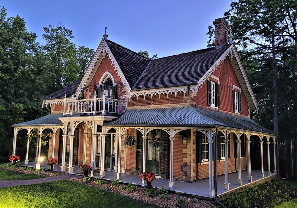
-
Article
Auyuittuq National Park
Located on the Cumberland Peninsula of Baffin Island, Nunavut, Auyuittuq National Park (established 2001, 19,089 km2) was Canada's first national park located north of the Arctic Circle. It was first set up as a national park reserve in 1976 and established as a national park through the Nunavut Land Claims Agreement. Auyuittuq means "the land that never melts" in Inuktitut.
"https://d3d0lqu00lnqvz.cloudfront.net/media/media/a4b74f70-c61f-4cfe-a857-0848e3cb40bd.jpg" // resources/views/front/categories/view.blade.php
https://d3d0lqu00lnqvz.cloudfront.net/media/media/a4b74f70-c61f-4cfe-a857-0848e3cb40bd.jpg
-
Article
Avalon Peninsula
Avalon Peninsula, 9220 km2, is a spreading peninsula thrust out into the rich fishing grounds of the north Atlantic, forming the southeast corner of insular Newfoundland.
"https://d3d0lqu00lnqvz.cloudfront.net/media/media/9174fc30-b6b6-4ab0-b12f-9fbca2dab7b8.jpg" // resources/views/front/categories/view.blade.php
https://d3d0lqu00lnqvz.cloudfront.net/media/media/9174fc30-b6b6-4ab0-b12f-9fbca2dab7b8.jpg
-
Article
Axel Heiberg Island
Axel Heiberg Island, Nunavut, is Canada’s second northernmost island, located in the High Arctic approximately 1,200 km from the North Pole.
"https://d3d0lqu00lnqvz.cloudfront.net/media/media/0dc72b02-1baf-4d5c-b7f6-1e64d9a7440c.JPG" // resources/views/front/categories/view.blade.php
https://d3d0lqu00lnqvz.cloudfront.net/media/media/0dc72b02-1baf-4d5c-b7f6-1e64d9a7440c.JPG
-
Article
Aylmer (Ont)
Aylmer, Ont, incorporated as a town in 1887, population 7151 (2011c), 7069 (2006c). The Town of Aylmer is located 50 km south of London and 15 km north of Lake Erie, on Catfish Creek.
"https://thecanadianencyclopedia.ca/images/tce_placeholder.jpg?v=e9dca980c9bdb3aa11e832e7ea94f5d9" // resources/views/front/categories/view.blade.php
https://thecanadianencyclopedia.ca/images/tce_placeholder.jpg?v=e9dca980c9bdb3aa11e832e7ea94f5d9
-
Article
Aylmer (Qué)
Aylmer, Qué, Sector, pop 41 532 (2006c), 36 085 (2001c). Aylmer is located on Lac Deschênes on the Ottawa River and was a city from 1975-2002 before it merged with 4 other cities to form the new city of Gatineau.
"https://thecanadianencyclopedia.ca/images/tce_placeholder.jpg?v=e9dca980c9bdb3aa11e832e7ea94f5d9" // resources/views/front/categories/view.blade.php
https://thecanadianencyclopedia.ca/images/tce_placeholder.jpg?v=e9dca980c9bdb3aa11e832e7ea94f5d9
-
Article
Bache Peninsula Archaeological Sites
The Bache Peninsula archaeological sites are located on Ellesmere Island in Nunavut. The sites were occupied about 4200 years ago by hunting bands believed to have originated from northeast Asia and Alaska.
"https://thecanadianencyclopedia.ca/images/tce_placeholder.jpg?v=e9dca980c9bdb3aa11e832e7ea94f5d9" // resources/views/front/categories/view.blade.php
https://thecanadianencyclopedia.ca/images/tce_placeholder.jpg?v=e9dca980c9bdb3aa11e832e7ea94f5d9
-
Article
Back River
Back River, 974 km long, rises in Contwoyto Lake, north of Great Slave Lake, NWT, and flows northeast across the Barren Lands of Nunavut to Chantrey Inlet, south of King William Island. It has a drainage area of 106,500 km2 and a mean discharge of 612 m3/sec. The river is turbulent in its upper course, but as it enters a broad plain, it widens to form Lakes Pelly, Garry, Upper Macdougall and Lower Macdougall. On its final leg, it narrows to cut through another rocky section to the coast. The Thelon Game Sanctuary lies along part of its length between the Consul and Baillie rivers.
"https://d3d0lqu00lnqvz.cloudfront.net/media/media/a482d857-2391-4492-83fe-ea3938b7020d.jpg" // resources/views/front/categories/view.blade.php
https://d3d0lqu00lnqvz.cloudfront.net/media/media/a482d857-2391-4492-83fe-ea3938b7020d.jpg