Browse "Places"
-
Article
Innisfail
Innisfail, Alta, incorporated as a town in 1903, population 7876 (2011c), 7331 (2006c). The Town of Innisfail is located on the CP Rail line 121 km north of Calgary.
"https://d3d0lqu00lnqvz.cloudfront.net/media/media/1e459b6f-fe80-4090-8780-016a87e863bd.jpg" // resources/views/front/categories/view.blade.php
https://d3d0lqu00lnqvz.cloudfront.net/media/media/1e459b6f-fe80-4090-8780-016a87e863bd.jpg
-
Article
Innisfil
Innisfil, Ontario, incorporated as a town in 1991, population 43,326 (2021 census), 36,566 (2016 census). The town of Innisfil is located 75 km north of Toronto along the shore of Lake Simcoe.
"https://d3d0lqu00lnqvz.cloudfront.net/media/media/4541da10-f493-4d2b-bf7b-9e1a825d7c64.jpg" // resources/views/front/categories/view.blade.php
https://d3d0lqu00lnqvz.cloudfront.net/media/media/4541da10-f493-4d2b-bf7b-9e1a825d7c64.jpg
-
Article
Innuitian Region
The Innuitian Region (also known as the Innuitian Orogen) is one of Canada’s six geological regions.
"https://d3d0lqu00lnqvz.cloudfront.net/media/media/5176d9ce-bf5f-4fdf-9453-c0f71b3128e6.jpg" // resources/views/front/categories/view.blade.php
https://d3d0lqu00lnqvz.cloudfront.net/media/media/5176d9ce-bf5f-4fdf-9453-c0f71b3128e6.jpg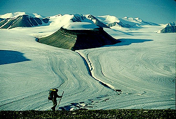
-
Article
Intendant's Palace Archaeological Site
The site of the Intendant's Palace is in the Lower Town of Québec City below the Côte du Palais.
"https://thecanadianencyclopedia.ca/images/tce_placeholder.jpg?v=e9dca980c9bdb3aa11e832e7ea94f5d9" // resources/views/front/categories/view.blade.php
https://thecanadianencyclopedia.ca/images/tce_placeholder.jpg?v=e9dca980c9bdb3aa11e832e7ea94f5d9
-
Article
Intercolonial Railway
The Intercolonial Railway was a rail line that operated from 1872 to 1918, connecting Nova Scotia, New Brunswick, Québec and Ontario. The line was Canada’s first national infrastructure project. Plans for its construction date to the 1830s, but the project only gained momentum during the Confederation conferences of 1864 in Charlottetown and Québec City, where construction of the Intercolonial Railway was negotiated for the Maritime colonies’ entry to British North American union. Construction began shortly after Canada became a country in 1867, with most lines completed by the mid-1870s.
"https://d3d0lqu00lnqvz.cloudfront.net/Intercolonial_Locomotive_76.jpg" // resources/views/front/categories/view.blade.php
https://d3d0lqu00lnqvz.cloudfront.net/Intercolonial_Locomotive_76.jpg
-
Article
Intergenerational Trauma and Residential Schools
Historical trauma occurs when trauma caused by historical oppression is passed down through generations. For more than 100 years, the Canadian government supported residential school programs that isolated Indigenous children from their families and communities (see Residential Schools in Canada). Under the guise of educating and preparing Indigenous children for their participation in Canadian society, the federal government and other administrators of the residential school system committed what has since been described as an act of cultural genocide. As generations of students left these institutions, they returned to their home communities without the knowledge, skills or tools to cope in either world. The impacts of their institutionalization in residential school continue to be felt by subsequent generations. This is called intergenerational trauma. This is the full-length entry about Intergenerational Trauma and Residential Schools. For a plain-language summary, please see Intergenerational Trauma and Residential Schools (Plain-Language Summary).
"https://thecanadianencyclopedia.ca/images/tce_placeholder.jpg?v=e9dca980c9bdb3aa11e832e7ea94f5d9" // resources/views/front/categories/view.blade.php
https://thecanadianencyclopedia.ca/images/tce_placeholder.jpg?v=e9dca980c9bdb3aa11e832e7ea94f5d9
-
Article
Inuit Experiences at Residential School
Residential schools were government-sponsored religious schools created to assimilate Indigenous children into Euro-Canadian culture. Schools in the North were run by missionaries for nearly a century before the federal government began to open new, so-called modern institutions in the 1950s. This was less than a decade after a Special Joint Committee (see Indigenous Suffrage) found that the system was ineffectual. The committee’s recommendations led to the eventual closure of residential schools across the country.
"https://d3d0lqu00lnqvz.cloudfront.net/InuitResidentialSchool/Inuit-Residenital-School (Library and Archives Canada_PA-042133).jpg" // resources/views/front/categories/view.blade.php
https://d3d0lqu00lnqvz.cloudfront.net/InuitResidentialSchool/Inuit-Residenital-School (Library and Archives Canada_PA-042133).jpg.jpg)
-
Article
Inuvik
Inuvik, NWT, incorporated as a town in 1970, population 3463 (2011c), 3484 (2006c). The Town of Inuvik is located on the MACKENZIE RIVER delta, 97 km south of the BEAUFORT SEA and 1086 air km northwest of Yellowknife.
"https://d3d0lqu00lnqvz.cloudfront.net/media/media/e6b68eba-9d02-4243-97c0-eb058faa8ce2.jpg" // resources/views/front/categories/view.blade.php
https://d3d0lqu00lnqvz.cloudfront.net/media/media/e6b68eba-9d02-4243-97c0-eb058faa8ce2.jpg
-
Article
Invermere
Invermere, British Columbia, incorporated as a district municipality in 1983, population 3,391 (2016 census), 2,955 (2011 census). The District of Invermere is located on the northwestern shore of Windermere Lake in the Rocky Mountain Trench. Invermere is 130 km north of Cranbrook and 120 km southeast of Golden.
"https://thecanadianencyclopedia.ca/images/tce_placeholder.jpg?v=e9dca980c9bdb3aa11e832e7ea94f5d9" // resources/views/front/categories/view.blade.php
https://thecanadianencyclopedia.ca/images/tce_placeholder.jpg?v=e9dca980c9bdb3aa11e832e7ea94f5d9
-
Article
Iqaluit
Iqaluit, Nunavut, incorporated as a city in 2001, population 7,429 (2021 census), 7,740 (2016 census). Iqaluit is the capital and largest community in Canada’s newest territory, Nunavut. It is also the territory's only city. Iqaluit is situated at the northeast head of Frobisher Bay, on southern Baffin Island. In an area long used by the Inuit and their ancestors, it is surrounded by hills close to the Sylvia Grinnell River and looks across the bay to the mountains of the Meta Incognita Peninsula.
"https://d3d0lqu00lnqvz.cloudfront.net/TCEImages/413364c4-0f53-4564-9ec5-2090b6387005.jpg" // resources/views/front/categories/view.blade.php
https://d3d0lqu00lnqvz.cloudfront.net/TCEImages/413364c4-0f53-4564-9ec5-2090b6387005.jpg
-
Macleans
Iqaluit: Future Capital
Adapting. It's a buzzword among the Inuit, and for good reason.This article was originally published in Maclean's Magazine on February 19, 1996
"https://d3d0lqu00lnqvz.cloudfront.net/media/media/af7269d4-d65f-451f-af70-3e54fcb8a8f1.jpg" // resources/views/front/categories/view.blade.php
https://d3d0lqu00lnqvz.cloudfront.net/media/media/af7269d4-d65f-451f-af70-3e54fcb8a8f1.jpg
-
Article
Irishtown-Summerside
Irishtown-Summerside, NL, incorporated as a town in 1991, population 1428 (2011c), 1290 (2006c). Irishtown-Summerside is located on Humber Arm in the Bay of Islands near Corner Brook.
"https://thecanadianencyclopedia.ca/images/tce_placeholder.jpg?v=e9dca980c9bdb3aa11e832e7ea94f5d9" // resources/views/front/categories/view.blade.php
https://thecanadianencyclopedia.ca/images/tce_placeholder.jpg?v=e9dca980c9bdb3aa11e832e7ea94f5d9
-
Article
Iroquois Falls
Iroquois Falls, Ontario, incorporated as a town in 1915, population 4,418 (2021 census), 4,537 (2016 census). The Town of Iroquois Falls is located 334 km northwest of North Bay.
"https://thecanadianencyclopedia.ca/images/tce_placeholder.jpg?v=e9dca980c9bdb3aa11e832e7ea94f5d9" // resources/views/front/categories/view.blade.php
https://thecanadianencyclopedia.ca/images/tce_placeholder.jpg?v=e9dca980c9bdb3aa11e832e7ea94f5d9
-
Article
Islands in Canada
An island is a piece of land surrounded by water. By custom it is agreed that this definition does not apply to the five largest pieces of land that form the continents (see plate tectonics). The largest island in the world is Greenland (2,175,596 km2); the largest in Canada is Baffin Island (507,451 km2). Seventeen other Canadian islands exceed 10,000 km2 in area. The islands lying north of the mainland of Canada, are generally referred to as the Canadian Arctic Archipelago. They include the Queen Elizabeth Islands, those lying north of the strait (known successively from west to east as M'Clure Strait, Viscount Melville Sound, Barrow Strait and Lancaster Sound), which extends east-west approximately along 74° north latitude. Manitoulin Island (2,765 km2), the largest island in the world located in a freshwater lake (as distinct from a flowing river), itself contains 17 lakes containing islands.
"https://d3d0lqu00lnqvz.cloudfront.net/scenicplaces/haida-gwaii-aerial.jpg" // resources/views/front/categories/view.blade.php
https://d3d0lqu00lnqvz.cloudfront.net/scenicplaces/haida-gwaii-aerial.jpg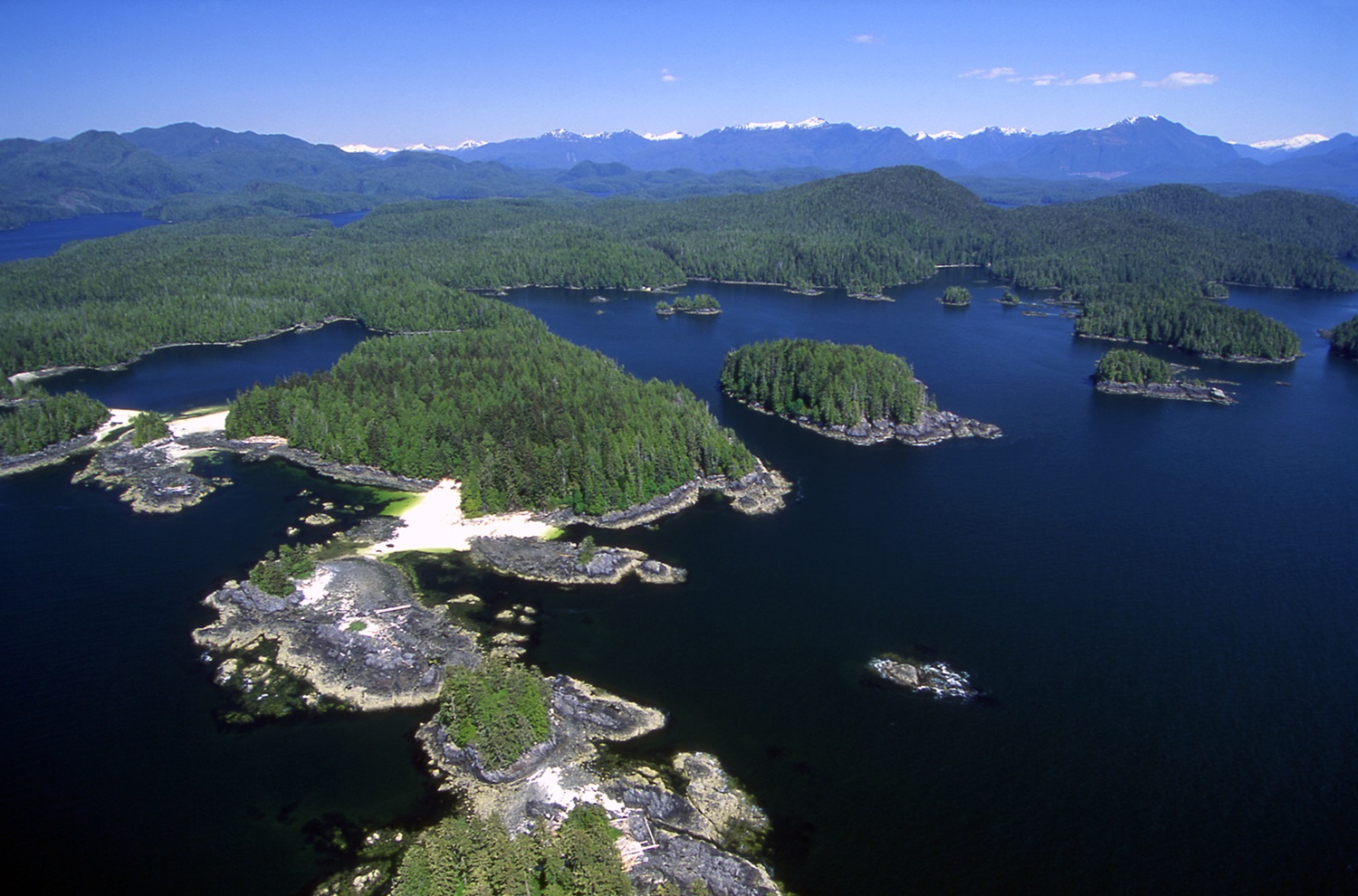
-
Article
Ivvavik National Park
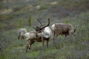
High mountains, broad river valleys, endless tundra, and the Arctic seacoast come together within Ivvavik National Park (est 1984, 9750 km2) to create a wilderness paradise. Located about 800 km northwest of Whitehorse, YT, or 200 km west of Inuvik, NWT, it is just about as far away as you can get from anywhere. Access is usually by charter aircraft from Inuvik. Initially known as Northern Yukon National Park, it was given an Inuvialuit name in 1992. Ivvavik means "place of giving birth and raising young" in reference to the Porcupine Caribou herd that has its calving grounds along the Beaufort Sea coast. It is Canada's first park established through a native land claim settlement. Due to its isolation, it is one of the least visited national parks in Canada.
"https://d3d0lqu00lnqvz.cloudfront.net/media/media/ba702448-1511-48f9-b516-fe8723fbb166.jpg" // resources/views/front/categories/view.blade.php
https://d3d0lqu00lnqvz.cloudfront.net/media/media/ba702448-1511-48f9-b516-fe8723fbb166.jpg