
Browse "Places"
-
Article
Gananoque
Gananoque, Ont, incorporated as a town in 1890, population 5194 (2011c), 5285 (2006c). The Town of Gananoque is located at the confluence of the St Lawrence and Gananoque rivers, 29 km east of Kingston.
"https://thecanadianencyclopedia.ca/images/tce_placeholder.jpg?v=e9dca980c9bdb3aa11e832e7ea94f5d9" // resources/views/front/categories/view.blade.php
https://thecanadianencyclopedia.ca/images/tce_placeholder.jpg?v=e9dca980c9bdb3aa11e832e7ea94f5d9
-
Article
Gander
Gander, NL, incorporated as a town in 1954, population 11,880 (2021 census), 11,688 (2016 census). The town of Gander is located on Gander Lake in east-central Newfoundland. Both the town and the lake are named after the Gander River.
"https://d3d0lqu00lnqvz.cloudfront.net/Gander/gander-airport-1.jpg" // resources/views/front/categories/view.blade.php
https://d3d0lqu00lnqvz.cloudfront.net/Gander/gander-airport-1.jpg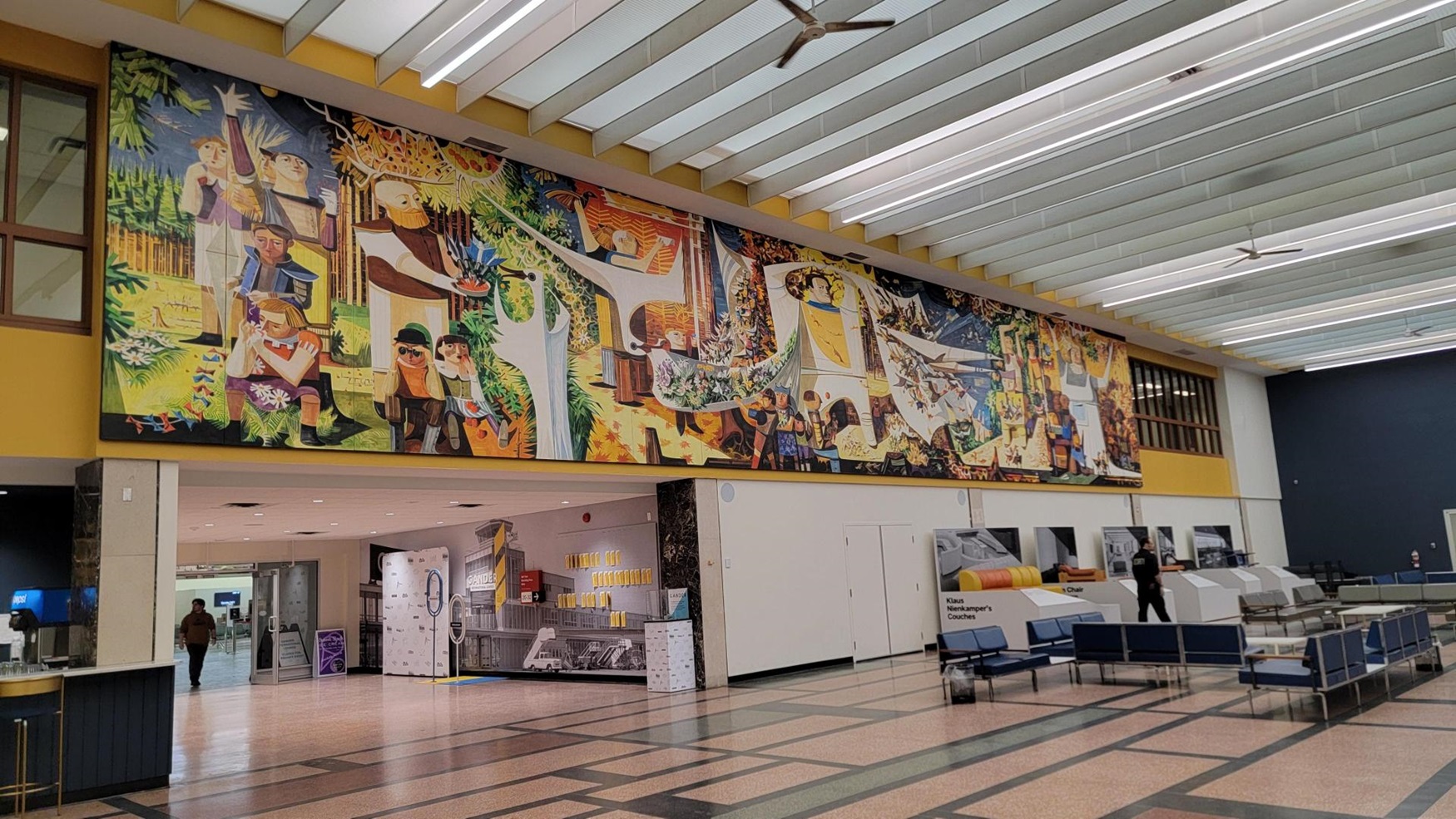
-
Article
Gander River
Gander River, 175 km long, drainage basin 6,400 km2, is the principal river of northeast Newfoundland, emptying into Gander Bay.
"https://d3d0lqu00lnqvz.cloudfront.net/Gander_River-_Newfoundland-_Canada.jpg" // resources/views/front/categories/view.blade.php
https://d3d0lqu00lnqvz.cloudfront.net/Gander_River-_Newfoundland-_Canada.jpg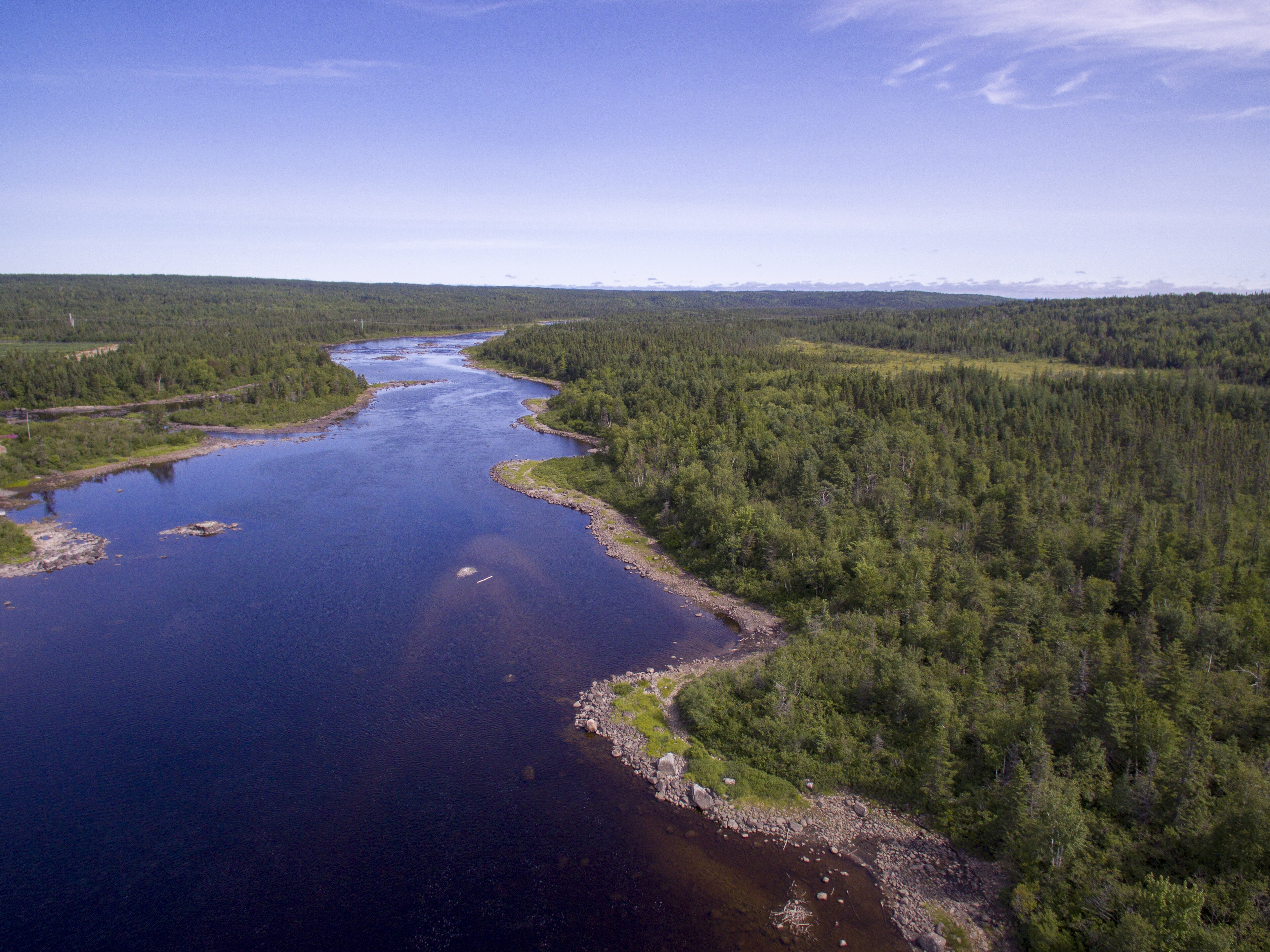
-
Article
Ganges
Ganges, BC, Unincorporated Place. Ganges is the major community centre of SALTSPRING ISLAND, the largest island in the southern GULF ISLANDS chain. Named after HMS Ganges, flagship of the Pacific Station 1857-60, it is located at
"https://thecanadianencyclopedia.ca/images/tce_placeholder.jpg?v=e9dca980c9bdb3aa11e832e7ea94f5d9" // resources/views/front/categories/view.blade.php
https://thecanadianencyclopedia.ca/images/tce_placeholder.jpg?v=e9dca980c9bdb3aa11e832e7ea94f5d9
-
Article
Garden River First Nation
Garden River First Nation refers to both an Anishinaabe community and a reserve. The reserve, legally known as Garden River 14, consists of over 20,700 hectares of land, located along the St. Mary’s River in Ontario (see also Reserves in Ontario; First Nations in Ontario). The community and reserve are named after a tributary of the St. Mary’s River. The Anishinaabe planted gardens at the mouth of the tributary. As of February 2026, Garden River had a total registered population of 3,803 people, with 2,490 residing off reserve. It is governed by an elected Chief and council under the terms of the First Nations Elections Act.
"https://d3d0lqu00lnqvz.cloudfront.net/GardenRiverFirstNation/band-office_resized.jpg" // resources/views/front/categories/view.blade.php
https://d3d0lqu00lnqvz.cloudfront.net/GardenRiverFirstNation/band-office_resized.jpg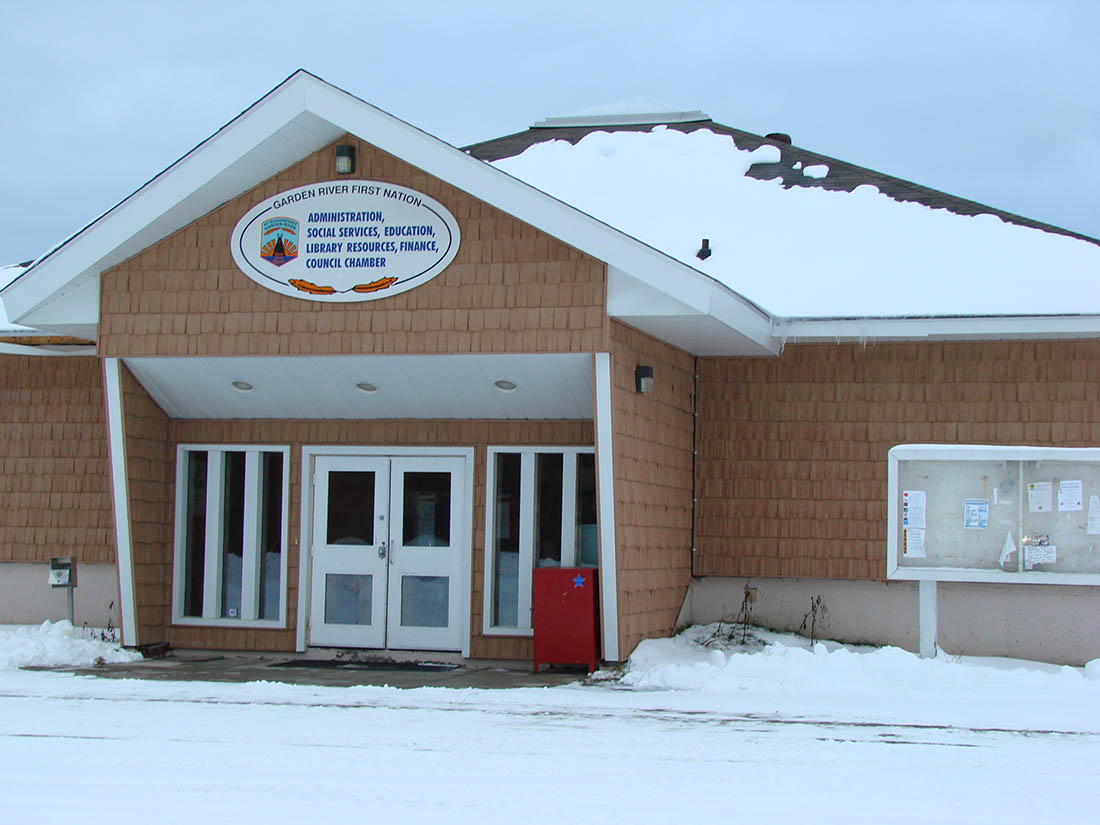
-
Article
Garibaldi Provincial Park
Garibaldi Provincial Park (established 1927, 194,000 ha) is a mountain wilderness located 64 km north of Vancouver, normally reached by a short trail from Highway 99, north of Squamish.
"https://d3d0lqu00lnqvz.cloudfront.net/media/media/422e8bec-0d3c-48b7-b19e-f4fd6cfaaa96.jpg" // resources/views/front/categories/view.blade.php
https://d3d0lqu00lnqvz.cloudfront.net/media/media/422e8bec-0d3c-48b7-b19e-f4fd6cfaaa96.jpg
-
Article
Garson
Garson, Manitoba, unincorporated village, population 483 (2011c), 324 (2006c). Garson was incorporated as the Village of Lyall in 1915 and amalgamated into the Rural Municipality of Brokenhead in 2003. The community is located 37 km northeast of Winnipeg.
"https://thecanadianencyclopedia.ca/images/tce_placeholder.jpg?v=e9dca980c9bdb3aa11e832e7ea94f5d9" // resources/views/front/categories/view.blade.php
https://thecanadianencyclopedia.ca/images/tce_placeholder.jpg?v=e9dca980c9bdb3aa11e832e7ea94f5d9
-
Article
Gaspé
It is one of the oldest settlements in North America: on 24 July 1534, Jacques Cartier took possession of Canada on behalf of the king of France and placed a cross at this location, which very soon became a fishing port and supply centre for New France.
"https://d3d0lqu00lnqvz.cloudfront.net/media/media/bbc9e3a7-9a38-4b2c-848d-b51eba03f1fd.jpg" // resources/views/front/categories/view.blade.php
https://d3d0lqu00lnqvz.cloudfront.net/media/media/bbc9e3a7-9a38-4b2c-848d-b51eba03f1fd.jpg
-
Article
Gaspé Peninsula
The Gaspé Peninsula (or Péninsule de la Gaspésie in French) is a large peninsula in eastern Québec jutting out into the Gulf of St Lawrence. Part of the Appalachian Region, its elevation is higher in the northern part of the peninsula, where the Chic-Choc Mountains are found, with lesser elevations towards its southern coast. Mont Jacques-Cartier at 1268 m is the highest point both on the peninsula and of the Appalachian Region in Canada. Except for the copper-mining town of Murdochville, most of the population lives along the lengthy coastline within a few kilometres of the St Lawrence River, the Gulf of St Lawrence and Chaleur Bay. Principal towns include New Richmond, Gaspé and Matane.
"https://d3d0lqu00lnqvz.cloudfront.net/media/media/ad3866be-b4ea-484b-a7c6-4e112b36cf85.jpg" // resources/views/front/categories/view.blade.php
https://d3d0lqu00lnqvz.cloudfront.net/media/media/ad3866be-b4ea-484b-a7c6-4e112b36cf85.jpg
-
Article
Gastown
Gastown is a retail and commercial district in Vancouver, British Columbia. It is bounded by Cordova Street and the waterfront between Richards Street and Main Street. The original Gastown settlement formed the nucleus for the City of Vancouver and is now a National Historic Site. Today, Gastown is a popular tourist destination and home to restaurants, gift shops, boutiques, galleries, nightclubs and bars. It is also part of the Downtown Eastside, Vancouver’s lowest-income neighbourhood, and the location of single resident occupancy hotels, social housing and social services.
"https://d3d0lqu00lnqvz.cloudfront.net/media/media/de041c94-dd8a-4af8-8def-f3bc4cc26777.jpg" // resources/views/front/categories/view.blade.php
https://d3d0lqu00lnqvz.cloudfront.net/media/media/de041c94-dd8a-4af8-8def-f3bc4cc26777.jpg
-
Article
Gatineau
Gatineau, Quebec, incorporated as a city in 2002, population 291,041 (2021 census), 276,245 (2016 census). Gatineau was formed in 2002 following the amalgamation of the municipalities of Aylmer, Buckingham, Gatineau, Hull and Masson-Angers. The city is part of Canada’s National Capital Region. Gatineau’s city council consists of a mayor and 18 councillors elected by district.
"https://d3d0lqu00lnqvz.cloudfront.net/media/media/74216004-eb52-47e1-b498-61964bbbb37a.jpg" // resources/views/front/categories/view.blade.php
https://d3d0lqu00lnqvz.cloudfront.net/media/media/74216004-eb52-47e1-b498-61964bbbb37a.jpg
-
Macleans
Gehry's Bilbao Museum Sensation (Nov97 Updates)
In architectural circles, they are calling it a masterpiece, the crowning achievement of Canadian-born, California-based Gehry's long career.This article was originally published in Maclean's Magazine on November 3, 1997
"https://d3d0lqu00lnqvz.cloudfront.net/media/media/ce03a686-a5ff-4235-ac06-c33d8f41618d.jpg" // resources/views/front/categories/view.blade.php
https://d3d0lqu00lnqvz.cloudfront.net/media/media/ce03a686-a5ff-4235-ac06-c33d8f41618d.jpg
-
Article
Geography
The core of geography deals with the description and analysis of physical and environmental phenomena and their interrelationships, and with the changing patterns of human population and their activities as they affect Earth. As history interprets temporal sequences, so geography interprets spatial sequences and associations.
"https://d3d0lqu00lnqvz.cloudfront.net/hainesjunction/haines-junction-sunrise.jpg" // resources/views/front/categories/view.blade.php
https://d3d0lqu00lnqvz.cloudfront.net/hainesjunction/haines-junction-sunrise.jpg
-
Collection
Geography
Geography is the study of places, Earth’s physical features and environmental phenomena. Geographers also examine human populations and their impact on the natural world. This collection from The Canadian Encyclopedia covers a wide range of topics in both physical and human geography. These topics include geographic regions, sustainable development, and Indigenous populations.
"https://d3d0lqu00lnqvz.cloudfront.net/media/quiz_images/Geography-2.jpg" // resources/views/front/categories/view.blade.php
https://d3d0lqu00lnqvz.cloudfront.net/media/quiz_images/Geography-2.jpg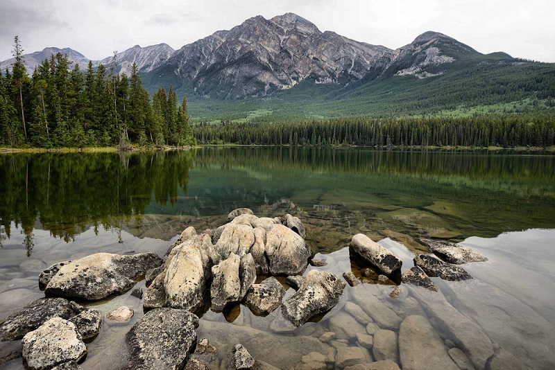
-
Article
Geography of British Columbia
British Columbia is divided by two of Canada’s seven physiographic regions. These regions are the Cordillera and the Interior Plains. The vast majority of the province is in the Cordillera region, while the northeast corner is part of the Interior Plains. Within the Cordillera region there are many mountain ranges, including the Rocky Mountains and the Coast Mountains. British Columbia’s wet, coastal climate is also home to some of the tallest coniferous trees in Canada, such as the Douglas fir.
"https://d3d0lqu00lnqvz.cloudfront.net/media/new_article_images/GeographyOfBC/CoastMountains.jpg" // resources/views/front/categories/view.blade.php
https://d3d0lqu00lnqvz.cloudfront.net/media/new_article_images/GeographyOfBC/CoastMountains.jpg