
Browse "Places"
-
Article
Stagecoach
The principal means of public overland transportation in Canada and the US in the first half of the 19th century, the stagecoach was a 4-wheeled vehicle pulled by 4 or more horses. Six or more passengers sat in the suspended
"https://d3d0lqu00lnqvz.cloudfront.net/media/media/e4ffe6a0-221c-4235-aa25-197d12d0167d.jpg" // resources/views/front/categories/view.blade.php
https://d3d0lqu00lnqvz.cloudfront.net/media/media/e4ffe6a0-221c-4235-aa25-197d12d0167d.jpg
-
Article
Stanley Park
Stanley Park (established 1887, 4 km2) is Vancouver’s first city park and one of the largest urban parks in Canada. It encompasses the peninsula west of downtown Vancouver and is surrounded by the waters of Burrard Inlet, Coal Harbour and English Bay. Stanley Park is located on the traditional territory of Coast Salish First Nations, including the Musqueam, Squamish and Tsleil Waututh. In 1886, the council for the City of Vancouver sent a request to the Canadian government for permission to use the military reserve to the west of the city as a public park. The Canadian government granted the city permission to create such a park in 1887. Stanley Park later opened to the public on 27 September 1888. The park is named for Governor General Frederick Arthur Stanley.
"https://d3d0lqu00lnqvz.cloudfront.net/media/media/a9ddf5c7-660a-4dd5-9d9c-6387da6a5b36.jpg" // resources/views/front/categories/view.blade.php
https://d3d0lqu00lnqvz.cloudfront.net/media/media/a9ddf5c7-660a-4dd5-9d9c-6387da6a5b36.jpg
-
Article
Ste-Anne-de-Beaupré
Sainte-Anne-de-Beaupré, Quebec, constituted as a town in 1973, population 2,888 (2021 census), 2,880 (2011 census). The town has an area 62.64 km2 and is located on the north shore of the St. Lawrence River, 35 km east of Québec City. The town of Sainte-Anne-de-Beaupré is known worldwide for its Basilica of Sainte-Anne-de-Beaupré, a national shrine and pilgrimage site attracting over one million visitors and pilgrims annually. On 28 July 2022, Pope Francis celebrated mass at the basilica as part of his Apostolic Journey to Canada.
"https://d3d0lqu00lnqvz.cloudfront.net/media/media/81c8f2b9-c8a4-426f-ace2-e07cf5b82ea7.mov" // resources/views/front/categories/view.blade.php
https://d3d0lqu00lnqvz.cloudfront.net/media/media/81c8f2b9-c8a4-426f-ace2-e07cf5b82ea7.mov -
Article
Ste. Madeleine Métis Community
Ste. Madeleine was a Métis homestead of about 250 people located in Manitoba, near the Saskatchewan border. Red River Métis citizens and families established the settlement in the late 1800s and early 1900s. The community existed until shortly after the government implemented the Prairie Farm Rehabilitation Act of 1935 (see Prairie Farm Rehabilitation Administration). The Act was designed to assist farmers during drought conditions. However, it dispossessed the community of their land. In 1939, the community was destroyed, and the land was converted to pastureland. The Métis were removed with little or no compensation.
"https://thecanadianencyclopedia.ca/images/tce_placeholder.jpg?v=e9dca980c9bdb3aa11e832e7ea94f5d9" // resources/views/front/categories/view.blade.php
https://thecanadianencyclopedia.ca/images/tce_placeholder.jpg?v=e9dca980c9bdb3aa11e832e7ea94f5d9
-
Article
Ste-Marie
Ste-Marie, Qué, Town, pop 11 320 (2001c), 10 966 (1996c), 10 513 (1991cA), 9536 (1986c), area 107.20 km2, inc 1855, is located on the Rivière CHAUDIÈRE. Situated on lowlands suitable for agriculture, it was built on part of the seigneury given in 1736 to Thomas-Jacques Taschereau.
"https://thecanadianencyclopedia.ca/images/tce_placeholder.jpg?v=e9dca980c9bdb3aa11e832e7ea94f5d9" // resources/views/front/categories/view.blade.php
https://thecanadianencyclopedia.ca/images/tce_placeholder.jpg?v=e9dca980c9bdb3aa11e832e7ea94f5d9
-
Article
Sainte-Scholastique
Sainte-Scholastique, Quebec, incorporated as a parish in 1834, population 1,618 (2019). The village of Sainte-Scholastique ceased to exist when the land was expropriated in 1969 for the construction of Montreal-Mirabel International Airport. It then became part of the new city of Mirabel.
"https://thecanadianencyclopedia.ca/images/tce_placeholder.jpg?v=e9dca980c9bdb3aa11e832e7ea94f5d9" // resources/views/front/categories/view.blade.php
https://thecanadianencyclopedia.ca/images/tce_placeholder.jpg?v=e9dca980c9bdb3aa11e832e7ea94f5d9
-
Article
Mount Steele
Mount Steele, elevation 5067 m, is located among Canada's highest mountains in the St Elias Range of Yukon.
"https://d3d0lqu00lnqvz.cloudfront.net/media/media/a64c2753-6c2c-4abe-a75b-d9e9202495e4.jpg" // resources/views/front/categories/view.blade.php
https://d3d0lqu00lnqvz.cloudfront.net/media/media/a64c2753-6c2c-4abe-a75b-d9e9202495e4.jpg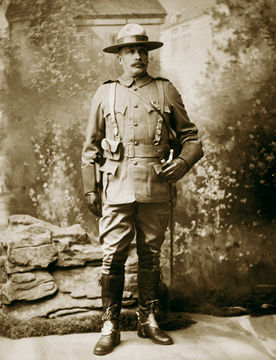
-
Article
Stefansson Island
Stefansson Island, 4463 km2, highest elevation 256 m, in the ARCTIC ARCHIPELAGO, is a low, gently rolling, lake-strewn plain. Being largely barren, with continuous vegetation only in wet lowlands, it supports small herds of muskoxen and Peary caribou.
"https://thecanadianencyclopedia.ca/images/tce_placeholder.jpg?v=e9dca980c9bdb3aa11e832e7ea94f5d9" // resources/views/front/categories/view.blade.php
https://thecanadianencyclopedia.ca/images/tce_placeholder.jpg?v=e9dca980c9bdb3aa11e832e7ea94f5d9
-
Article
Steinbach
Steinbach, Manitoba, incorporated as a city in 1997, population 13 524 (2011c), 11 066 (2006c). The City of Steinbach is located 48 km southeast of WINNIPEG.
"https://d3d0lqu00lnqvz.cloudfront.net/media/media/6ed4bd95-16b4-43e8-8409-f8c8d9d56b8f.jpg" // resources/views/front/categories/view.blade.php
https://d3d0lqu00lnqvz.cloudfront.net/media/media/6ed4bd95-16b4-43e8-8409-f8c8d9d56b8f.jpg
-
Article
Stellarton
Stellarton, Nova Scotia, was incorporated as a town in 1889 and has a population of 4,485 (2011). It borders the East River, approximately 18 km southeast of Pictou.
"https://thecanadianencyclopedia.ca/images/tce_placeholder.jpg?v=e9dca980c9bdb3aa11e832e7ea94f5d9" // resources/views/front/categories/view.blade.php
https://thecanadianencyclopedia.ca/images/tce_placeholder.jpg?v=e9dca980c9bdb3aa11e832e7ea94f5d9
-
Article
Stephansson House
Stephán G. STEPHANSSON left Iceland in 1873, settling first in the US before moving to Markerville in 1889. While in Markerville his political and philosophical thinking evolved, and he wrote extensively in Icelandic.
"https://d3d0lqu00lnqvz.cloudfront.net/media/media/e5306bc4-eda1-4f7a-84ff-f5f82f681784.jpg" // resources/views/front/categories/view.blade.php
https://d3d0lqu00lnqvz.cloudfront.net/media/media/e5306bc4-eda1-4f7a-84ff-f5f82f681784.jpg
-
Article
Stephenville
Stephenville, NL, incorporated as a town in 1952, population 6719 (2011c), 6588 (2006c). The Town of Stephenville is located on the north shore of St George's Bay in southwestern Newfoundland.
"https://thecanadianencyclopedia.ca/images/tce_placeholder.jpg?v=e9dca980c9bdb3aa11e832e7ea94f5d9" // resources/views/front/categories/view.blade.php
https://thecanadianencyclopedia.ca/images/tce_placeholder.jpg?v=e9dca980c9bdb3aa11e832e7ea94f5d9
-
Article
Stephenville Crossing
Stephenville Crossing, NL, incorporated as a town in 1958, population 1875 (2011c), 1960 (2006c). The Town of Stephenville Crossing is located at the head of St George's Bay on a low, flat floodplain between STEPHENVILLE and ST GEORGE'S on the west coast of Newfoundland.
"https://thecanadianencyclopedia.ca/images/tce_placeholder.jpg?v=e9dca980c9bdb3aa11e832e7ea94f5d9" // resources/views/front/categories/view.blade.php
https://thecanadianencyclopedia.ca/images/tce_placeholder.jpg?v=e9dca980c9bdb3aa11e832e7ea94f5d9
-
Article
Stettler
Stettler, Alta, incorporated as a town in 1906, population 5748 (2011c), 5445 (2006c). The Town of Stettler, the county seat for County of Stettler, is located on the rolling prairie of south-central Alberta 203 km southeast of Edmonton on a creek flowing north to the Battle River.
"https://thecanadianencyclopedia.ca/images/tce_placeholder.jpg?v=e9dca980c9bdb3aa11e832e7ea94f5d9" // resources/views/front/categories/view.blade.php
https://thecanadianencyclopedia.ca/images/tce_placeholder.jpg?v=e9dca980c9bdb3aa11e832e7ea94f5d9
-
Article
Stewart
Stewart, BC, incorporated as a district municipality in 1930, population 494 (2011c), 496 (2006c). The District of Stewart is located next to the Alaska Panhandle at the north end of the Portland Canal on the British Columbia coast.
"https://thecanadianencyclopedia.ca/images/tce_placeholder.jpg?v=e9dca980c9bdb3aa11e832e7ea94f5d9" // resources/views/front/categories/view.blade.php
https://thecanadianencyclopedia.ca/images/tce_placeholder.jpg?v=e9dca980c9bdb3aa11e832e7ea94f5d9
