
Browse "Cities & Populated Places"
-
Article
Leaf Rapids
Leaf Rapids, Manitoba, incorporated as a town in 1974, population 453 (2011c), 539 (2006c). The Town of Leaf Rapids is a mining community located 3 km south of the CHURCHILL RIVER on the Canadian Shield and 976 km northwest of Winnipeg.
"https://thecanadianencyclopedia.ca/images/tce_placeholder.jpg?v=e9dca980c9bdb3aa11e832e7ea94f5d9" // resources/views/front/categories/view.blade.php
https://thecanadianencyclopedia.ca/images/tce_placeholder.jpg?v=e9dca980c9bdb3aa11e832e7ea94f5d9
-
Article
Leamington
Leamington, Ont, incorporated as a town in 1890 and as a municipality in 1999, population 28 403 (2011c), 28 833 (2006c). The Municipality of Leamington is located on the north shore of LAKE ERIE, 54 km southeast of WINDSOR.
"https://thecanadianencyclopedia.ca/images/tce_placeholder.jpg?v=e9dca980c9bdb3aa11e832e7ea94f5d9" // resources/views/front/categories/view.blade.php
https://thecanadianencyclopedia.ca/images/tce_placeholder.jpg?v=e9dca980c9bdb3aa11e832e7ea94f5d9
-
Article
Leduc
Leduc, Alta, incorporated as a town in 1906 and as a city in 1983, population 24 279 (2011c), 16 967 (2006c). The City of Leduc is located 30 km south of EDMONTON. Originally a telegraph terminus and stop on the Calgary and Edmonton Railway (1891), the community grew as an agricultural centre.
"https://d3d0lqu00lnqvz.cloudfront.net/media/media/44470b4c-f3a6-43c4-b226-5b07849fd3f2.jpg" // resources/views/front/categories/view.blade.php
https://d3d0lqu00lnqvz.cloudfront.net/media/media/44470b4c-f3a6-43c4-b226-5b07849fd3f2.jpg
-
Article
Lethbridge
Lethbridge, AB, incorporated as a city in 1906, population 98,406 (2021 census), 92,729 (2016 census). The City of Lethbridge is located 215 km southeast of Calgary. It overlooks the steep valley of the Oldman River.
"https://d3d0lqu00lnqvz.cloudfront.net/media/media/51fd07bf-2ce7-4c0f-9eb0-7665f2c6b528.jpg" // resources/views/front/categories/view.blade.php
https://d3d0lqu00lnqvz.cloudfront.net/media/media/51fd07bf-2ce7-4c0f-9eb0-7665f2c6b528.jpg
-
Article
Lévis
Lévis, Quebec, city incorporated in 2002, population 143,414 (2016 census), 138,769 (2011 census). Lévis covers an area of 444 km2. The city is located on the rocky cliffs opposite Quebec City, to which it is linked by ferry. Present-day Lévis is the result of multiple mergers. In 1989, it merged with the industrial city of Lauzon (inc 1957). The following year, Lévis combined with the town of Saint-David-de-l'Auberivière. In 2002, Lévis took in the cities of Charny, Saint-Jean-Chrysostome, Saint-Nicolas, Saint-Rédempteur and Saint-Romuald. The parishes of Saint-Joseph-de-la-Pointe-de-Lévy and Sainte-Hélène-de-Breakeyville were also included in the fusion. The municipalities of Pintendre, Saint-Étienne-de-Lauzon, Desjardins and Chutes-de-la-Chaudière were also merged in.
"https://d3d0lqu00lnqvz.cloudfront.net/media/media/1024px-Ville_de_Lévis01.jpg" // resources/views/front/categories/view.blade.php
https://d3d0lqu00lnqvz.cloudfront.net/media/media/1024px-Ville_de_Lévis01.jpg
-
Article
Lewisporte
Lewisporte, NL, incorporated as a town in 1946, population 3483 (2011c), 3308 (2006c). The Town of Lewisporte is a deep-water port and shipping centre in Notre Dame Bay, north-central Newfoundland.
"https://thecanadianencyclopedia.ca/images/tce_placeholder.jpg?v=e9dca980c9bdb3aa11e832e7ea94f5d9" // resources/views/front/categories/view.blade.php
https://thecanadianencyclopedia.ca/images/tce_placeholder.jpg?v=e9dca980c9bdb3aa11e832e7ea94f5d9
-
Article
L'Île-Perrot
L'Île-Perrot, Quebec, incorporated as a town in 1955, population 11,638 (2021 census), 10,756 (2016 census). Connected by bridge to Île de Montréal since 1925, L'Île-Perrot is a residential suburb of Montreal, which is about 40 km to the east.
"https://d3d0lqu00lnqvz.cloudfront.net/Moulin_a_vent-_2500-_boulevard_Don-Quichotte-_L-ile-Perrot_vue_d-ensemble_11-d.na.civile-79-5614.jpg" // resources/views/front/categories/view.blade.php
https://d3d0lqu00lnqvz.cloudfront.net/Moulin_a_vent-_2500-_boulevard_Don-Quichotte-_L-ile-Perrot_vue_d-ensemble_11-d.na.civile-79-5614.jpg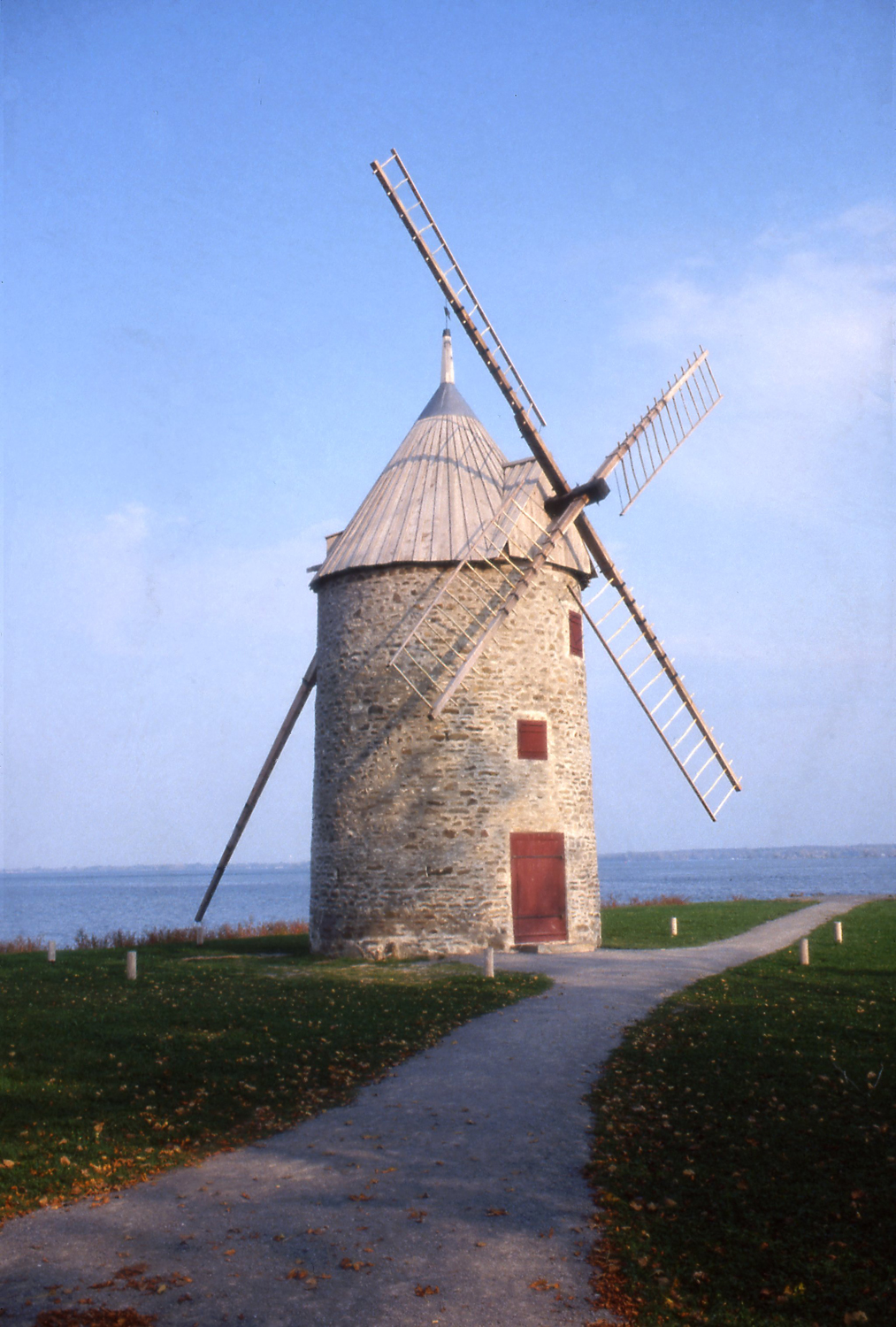
-
Article
Lillooet
Lillooet, BC, incorporated as a district municipality in 1996, population 2322 (2011c), 2324 (2006c). The District of Lillooet is located in the southern interior of British Columbia, 252 km northeast of Vancouver.
"https://thecanadianencyclopedia.ca/images/tce_placeholder.jpg?v=e9dca980c9bdb3aa11e832e7ea94f5d9" // resources/views/front/categories/view.blade.php
https://thecanadianencyclopedia.ca/images/tce_placeholder.jpg?v=e9dca980c9bdb3aa11e832e7ea94f5d9
-
Article
Lincoln
Lincoln, Ont, incorporated as a town in 1970, population 22 487 (2011c), 21 722 (2006c). The Town of Lincoln is situated in the Niagara Peninsula, immediately west of ST CATHARINES.
"https://thecanadianencyclopedia.ca/images/tce_placeholder.jpg?v=e9dca980c9bdb3aa11e832e7ea94f5d9" // resources/views/front/categories/view.blade.php
https://thecanadianencyclopedia.ca/images/tce_placeholder.jpg?v=e9dca980c9bdb3aa11e832e7ea94f5d9
-
Article
L'Islet
L'Islet L'Islet, Qué, Municipality, pop 3866 (2001c), 3878 A (1996c), area 120.02 km2, on the South Shore of the ST LAWRENCE RIVER, 100 km east of Québec City, within the former seigneuries of L'Islet-St-Jean and Bonsecours (granted 1677). Before the arrival of the first resident parish priest in 1745, L'Islet was served by missionary priests, and the parish of Notre-Dame-de-Bon-Secours-de-L'Islet was founded in 1721. Until the end of the 19th century, agriculture was the principal...
"https://thecanadianencyclopedia.ca/images/tce_placeholder.jpg?v=e9dca980c9bdb3aa11e832e7ea94f5d9" // resources/views/front/categories/view.blade.php
https://thecanadianencyclopedia.ca/images/tce_placeholder.jpg?v=e9dca980c9bdb3aa11e832e7ea94f5d9
-
Article
Listowel
Listowel, ON, incorporated in 1867 as a village and in 1875 as a town, population 9,539 (2021 census), 7,530 (2016 census). Listowel is now part of the town of North Perth (incorporated in 1998). It is located 66 km northwest of Kitchener - Waterloo.
"https://d3d0lqu00lnqvz.cloudfront.net/media/media/1490e962-ca51-42d8-8293-de7ed1462d21.jpg" // resources/views/front/categories/view.blade.php
https://d3d0lqu00lnqvz.cloudfront.net/media/media/1490e962-ca51-42d8-8293-de7ed1462d21.jpg
-
Article
Listuguj
Listuguj, Quebec, is the common name for both a reserve and a Mi'kmaq First Nation. Listuguj is located on the Gaspé Peninsula at the mouth of Restigouche River. A bridge links it to Campbellton, New Brunswick. As of 2014, the Listuguj First Nation has 4,058 members, with 2,108 members living on the Listuguj reserve. The community was also previously known as Restigouche.
"https://thecanadianencyclopedia.ca/images/tce_placeholder.jpg?v=e9dca980c9bdb3aa11e832e7ea94f5d9" // resources/views/front/categories/view.blade.php
https://thecanadianencyclopedia.ca/images/tce_placeholder.jpg?v=e9dca980c9bdb3aa11e832e7ea94f5d9
-
Article
Lloydminster
Lloydminster, Alberta and Saskatchewan, incorporated as a city in 1958, population 19,739 in Alberta and 11,843 in Saskatchewan (2021 census); 19,645 in Alberta and 11,765 in Saskatchewan (2016 census). The city of Lloydminster is known as the “Border City” since it is located on the Saskatchewan-Alberta border, about 275 km west of Saskatoon and 250 km east of Edmonton. It is one of two communities in Canada split by a provincial boundary, the other being Flin Flon, Manitoba.
"https://d3d0lqu00lnqvz.cloudfront.net/media/media/94afb778-e678-4eb6-999e-e723944f1edd.jpg" // resources/views/front/categories/view.blade.php
https://d3d0lqu00lnqvz.cloudfront.net/media/media/94afb778-e678-4eb6-999e-e723944f1edd.jpg
-
Article
Logan Lake
Logan Lake, BC, incorporated as a district municipality in 1970, population 2073 (2011c), 2162 (2006c). The District of Logan Lake is in the heart of the Highland Valley, 17 km west of the COQUIHALLA HIGHWAY between Kamloops and Merritt.
"https://d3d0lqu00lnqvz.cloudfront.net/media/media/2f2cb1bd-d005-4483-b518-ed31a3f4608e.jpg" // resources/views/front/categories/view.blade.php
https://d3d0lqu00lnqvz.cloudfront.net/media/media/2f2cb1bd-d005-4483-b518-ed31a3f4608e.jpg
-
Article
Logy Bay-Middle Cove-Outer Cove
Logy Bay-Middle Cove-Outer Cove, NL, incorporated as a town in 1986, population 2098 (2011c), 1978 (2006c). The Town of Logy Bay-Middle Cove-Outer Cove is the result of the joining of three former communities on the outskirts of ST JOHN'S.
"https://thecanadianencyclopedia.ca/images/tce_placeholder.jpg?v=e9dca980c9bdb3aa11e832e7ea94f5d9" // resources/views/front/categories/view.blade.php
https://thecanadianencyclopedia.ca/images/tce_placeholder.jpg?v=e9dca980c9bdb3aa11e832e7ea94f5d9